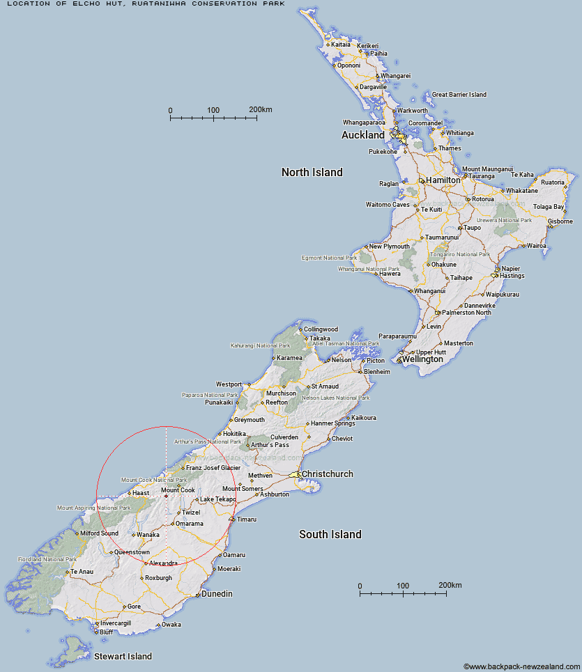
Topo Map showing location of Elcho Hut
This information is sourced from DoC, LINZ and Openstreetmap. Some of the hut photos are mine and the rest are from DoC. I will be adding an upload feature soon so people can photos of .Elcho Hut.
Basic info: standard 12-bunk hut in the Mackenzie Country and Waitaki area.
Latitude: -43.9313277455
Longitude: 169.830281585
Location: Ruataniwha Conservation Park
Area: Canterbury
Type of Hut: Standard
Tracks: Hopkins valley tracks
Map: BY14 Topo Map | Road Map
Does this hut still exist? Have any more information? Contact
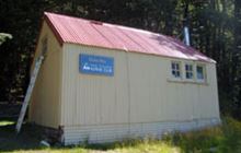
Image: DoC
Scroll down to see a topographical map and road map showing the location of Elcho Hut
[ A ] [ B ] [ C ] [ D ] [ E ] [ F ] [ G ] [ H ] [ I ] [ J ] [ K ] [ L ] [ M ] [ N ] [ O ] [ P ] [ Q ] [ R ] [ S ] [ T ] [ U ] [ V ] [ W ] [ Y ] [ Z ]
Closest 20 Huts to Elcho Hut
These are as the crow fliesCullers Hut 1.14km Dasler Bivouac 3.05km Dodger Hut 5.54km Red Hut 7.5km Grough Hut 9.33km Brodrick Hut 9.46km Monument Hut 10.41km Main Huxley Forks Hut 10.94km Station Hut 11.17km Creswicke Flat Hut 11.36km Erceg Hut 11.61km Le Crens Hut 11.85km Kennedy Hut 12.11km Richardson Rock Bivouac 13.68km South Huxley Bivouac 14.64km Stony Stream Bivouac 15.17km Waterfall Hut 16.75km Reardon Hut 19.68km Whale Stream Hut 20.67km Forbes Hut 21.33km South Temple Hut 23.32km Barron Saddle Hut 23.53km Christmas Flat Hut 24.52km Top Hut 24.99km Lame Duck Hut 25.14km Tunnel Creek Hut 26.65km Baikie Hut 27.15km Harpers Rock Bivouac 27.72km Horace Walker Hut 27.97km Hagens Hut 29.21km Mueller Hut 30.04km Cassel Flat Hut 30.34km Ferguson Hut 30.63km Jollie Hut 30.78km Wills Hut 31.81km Middle Head Hut 32.37km Maitland Hut 32.48km Sefton Bivvy 33.48km Stocking Stream Shelter 33.6km Maryburn Hut 34.23km