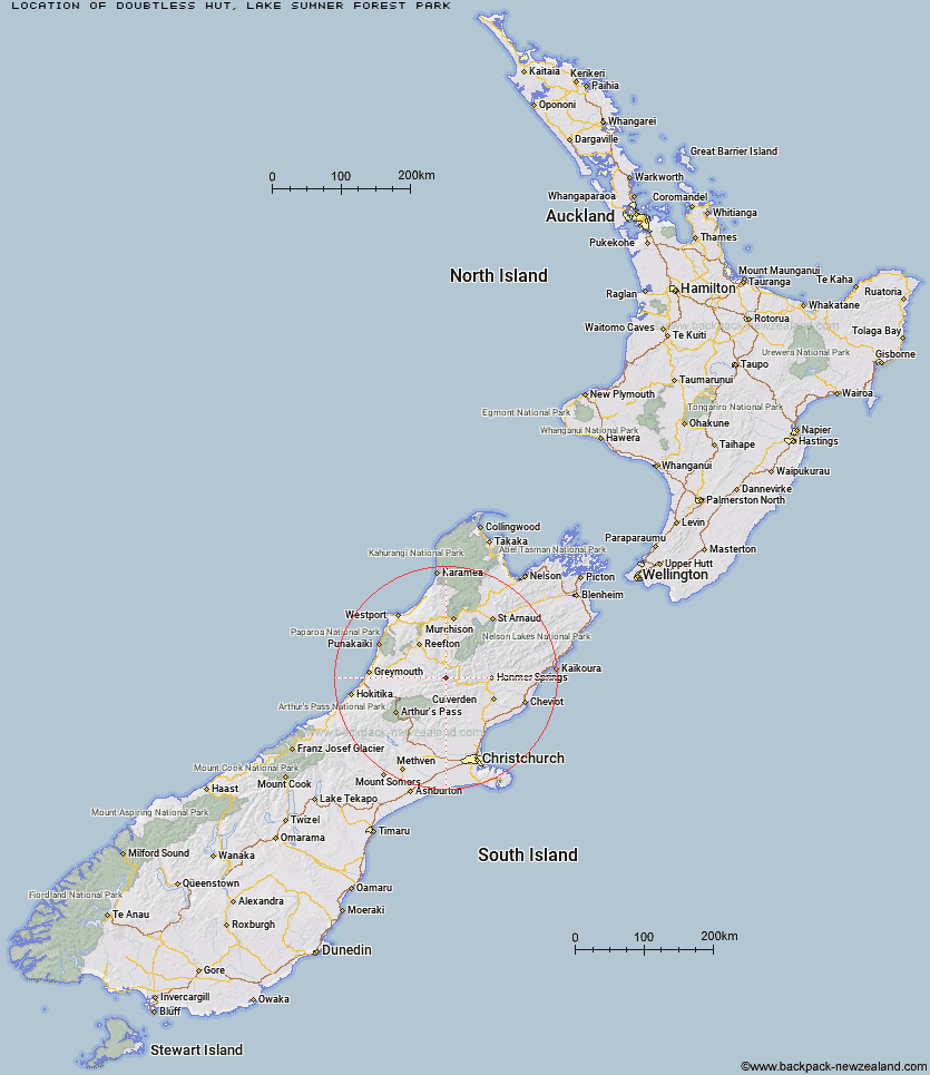
Topo Map showing location of Doubtless Hut
This information is sourced from DoC, LINZ and Openstreetmap. Some of the hut photos are mine and the rest are from DoC. I will be adding an upload feature soon so people can photos of .Doubtless Hut.
Basic info: standard six-bunk hut in the North Canterbury and Arthur's Pass area.
Latitude: -42.5220508649
Longitude: 172.226076913
Location: Lake Sumner Forest Park
Area: Canterbury
Type of Hut: Standard
Tracks: Doubtful valley track & routes
Map: BU22 Topo Map | Road Map
Does this hut still exist? Have any more information? Contact
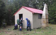
Image: DoC
Scroll down to see a topographical map and road map showing the location of Doubtless Hut
[ A ] [ B ] [ C ] [ D ] [ E ] [ F ] [ G ] [ H ] [ I ] [ J ] [ K ] [ L ] [ M ] [ N ] [ O ] [ P ] [ Q ] [ R ] [ S ] [ T ] [ U ] [ V ] [ W ] [ Y ] [ Z ]
Closest 20 Huts to Doubtless Hut
These are as the crow fliesLake Man Bivouac 3.01km Doubtful Hut 4.79km Top Robinson Hut 6.21km Devils Den Bivouac 6.77km Upper Nina Bivouac 6.95km Top Hope Hut 8.59km Saint Jacob's Hut 9.25km Lake Christabel Hut 9.74km Nina Hut 10.06km Slaty Creek Hut 11.86km Mid Robinson Hut 11.9km Hope Halfway Hut 11.97km Museum Hut 12.32km Brass Monkey Bivouac 13.59km Bus Shelter 14.25km Lucretia Hut 14.57km Three Mile Stream Hut 16.08km Evangeline Bivouac 18.35km Mackenzie Bivouac 19.23km Boyle Flat Hut 20.23km Magdalen Hut 20.58km Lake Sumner Hut 21.62km Rokeby Hut 21.81km Mackenzie Hut 22.05km Carlyle Hut 22.32km Gabriel Hut 22.75km Hurunui Hut 22.83km Tutaekuri Hut 23.21km Jollie Brook Hut 23.71km Pell Stream Hut 23.77km Lake Mason Hut 24.61km Manson-Nicholls Memorial Hut 24.7km Glenrae Bivouac 26.13km Cannibal Gorge Hut 27.43km South Branch Research Hut 27.6km Cold Stream Hut 27.78km Hurunui No 3 Hut 27.83km Steyning Hut 27.84km Stony Stream Hut 28km Tin Jug Hut 29.22km