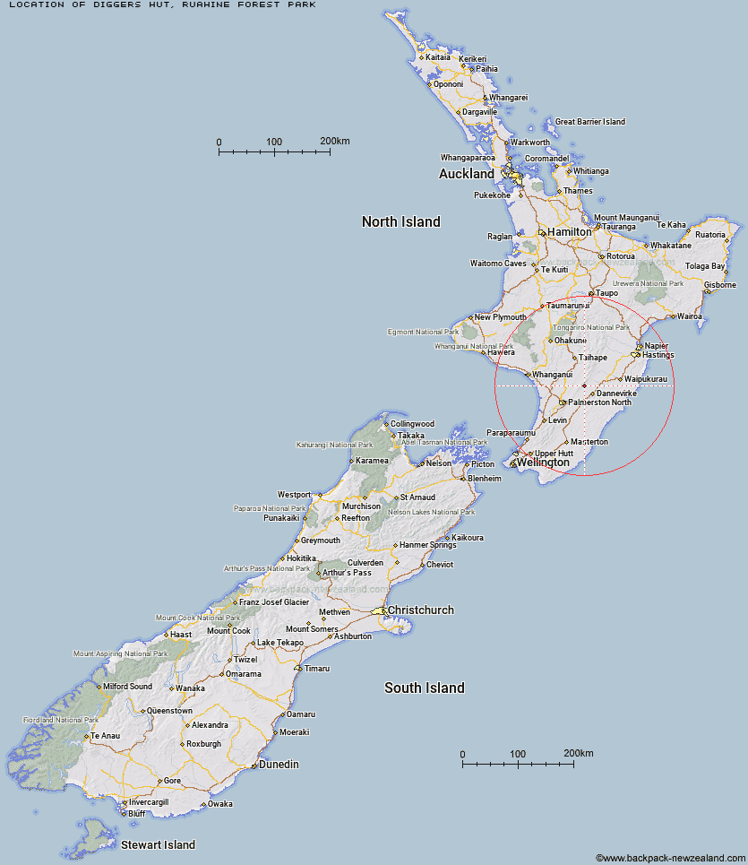
Topo Map showing location of Diggers Hut
This information is sourced from DoC, LINZ and Openstreetmap. Some of the hut photos are mine and the rest are from DoC. I will be adding an upload feature soon so people can photos of .Diggers Hut.
Basic info: standard four-bunk hut in the Manawatu.
Latitude: -40.1009463545
Longitude: 175.955949256
Location: Ruahine Forest Park
Area: Manawatu/Whanganui
Type of Hut: Standard
Map: BK36 Topo Map | Road Map
Does this hut still exist? Have any more information? Contact
Basic info: standard four-bunk hut in the Manawatu.
Latitude: -40.1009463545
Longitude: 175.955949256
Location: Ruahine Forest Park
Area: Manawatu/Whanganui
Type of Hut: Standard
Map: BK36 Topo Map | Road Map
Does this hut still exist? Have any more information? Contact
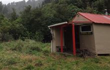
Image: DoC
Scroll down to see a topographical map and road map showing the location of Diggers Hut
[ A ] [ B ] [ C ] [ D ] [ E ] [ F ] [ G ] [ H ] [ I ] [ J ] [ K ] [ L ] [ M ] [ N ] [ O ] [ P ] [ Q ] [ R ] [ S ] [ T ] [ U ] [ V ] [ W ] [ Y ] [ Z ]
Closest 20 Huts to Diggers Hut
These are as the crow fliesForks Hut 1.98km Te Ekaou Hut 2.69km Traverse (A Frame) Hut 4.99km Stanfield Hut 7.99km Mid Pohangina Hut 8.57km Piripiri Hut 8.61km Cattle Creek Hut 9.96km Kiritaki Hut 10.22km Ngamoko Hut 11.01km Leon Kinvig Hut 14.85km Toka Bivouac 16.42km Alice Nash Memorial Heritage Lodge 17.08km Makaretu Hut 17.46km Top Gorge Hut 19.52km Happy Daze Hut 19.56km Iron Gate Hut 21.18km Awatere Hut 21.25km Longview Hut 21.85km Rangiwahia Hut 23.96km Triangle Hut 24.11km Howletts Hut 26.24km Daphne Hut 26.33km Pourangaki Hut 28.97km Tarn Bivouac 29km Kelly Knight Hut 29.09km Hinerua Hut 32.23km Purity Hut 32.36km Waterfall Hut 33.11km Smiths Stream Hut 33.43km Waikamaka Hut 35.57km McKinnon Hut 37.43km Waipawa Forks Hut 38.45km Kawhatau Base 38.61km Crow Hut 38.74km Sunrise Hut 39.27km Triplex Hut 39.95km Top Maropea Hut 40.19km Wakelings Hut 41.26km Gold Creek Hut 42.95km Norris Hut 44.1km