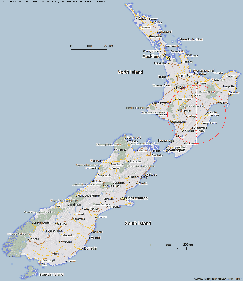
Topo Map showing location of Dead Dog Hut
This information is sourced from DoC, LINZ and Openstreetmap. Some of the hut photos are mine and the rest are from DoC. I will be adding an upload feature soon so people can photos of .Dead Dog Hut.
Basic info: standard six-bunk hut in the Hawke's Bay region.
Latitude: -39.5781180965
Longitude: 176.297682672
Location: Ruahine Forest Park
Area: Hawke's Bay
Type of Hut: Standard
Tracks: No Man's Road area tramping tracks
Map: BK37 Topo Map | Road Map
Does this hut still exist? Have any more information? Contact
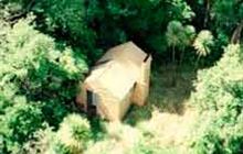
Image: DoC
Scroll down to see a topographical map and road map showing the location of Dead Dog Hut
[ A ] [ B ] [ C ] [ D ] [ E ] [ F ] [ G ] [ H ] [ I ] [ J ] [ K ] [ L ] [ M ] [ N ] [ O ] [ P ] [ Q ] [ R ] [ S ] [ T ] [ U ] [ V ] [ W ] [ Y ] [ Z ]
Closest 20 Huts to Dead Dog Hut
These are as the crow fliesNo Mans Hut 3.24km Ruahine Hut 3.31km Herricks Hut 3.39km Dianes Hut 4.17km Taruarau Bivouac 4.78km Mistake Bivouac 5.47km Masters Shelter 5.98km Aranga Hut 7.31km Shutes Hut 7.39km Rockslide Hut 7.42km Ikawetea Forks Hut 8.71km Makirikiri Hut 9.89km Sentry Box Hut 10.17km Briens Hut 10.47km Parks Peak Hut 11.77km Comet Hut 12.22km Ruahine Corner Hut 12.29km Upper Makaroro Hut 12.8km Tin Hut 12.86km Kylie Bivouac 14.08km Cedars Hut (Blowfly) 14.49km Ellis Hut 15.16km Poutaki Hut 16.71km Barlow Hut 16.83km Colenso Hut 16.99km Sparrowhawk Bivouac 20.47km Iron Bark Hut 21km Lowry Shelter 21.29km Maropea Forks Hut 21.68km Norris Hut 21.8km Gold Creek Hut 22.16km Otukota Hut 22.87km Cameron Hut 24.06km Wakelings Hut 24.33km Top Maropea Hut 24.89km Triplex Hut 25.41km Sunrise Hut 25.79km Waipawa Forks Hut 26.68km Rock Camp Bivouac 27.18km Kiwi Saddle Hut 27.33km