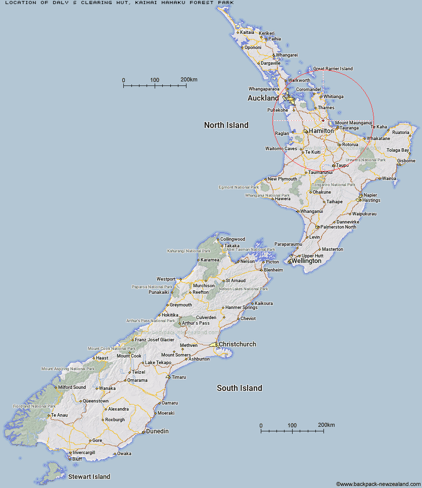
Topo Map showing location of Daly's Clearing Hut
This information is sourced from DoC, LINZ and Openstreetmap. Some of the hut photos are mine and the rest are from DoC. I will be adding an upload feature soon so people can photos of .Daly's Clearing Hut.
Basic info: standard 16-bunk hut in the Tauranga area.
Latitude: -37.4845695689
Longitude: 175.762906881
Location: Kaimai Mamaku Forest Park
Area: Bay of Plenty
Type of Hut: Standard
Tracks: Waitawheta Tramway|Daly's Clearing Loop Track|North-South Track
Map: BC35 Topo Map | Road Map
Does this hut still exist? Have any more information? Contact
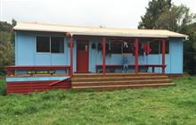
Image: DoC
Scroll down to see a topographical map and road map showing the location of Daly's Clearing Hut
[ A ] [ B ] [ C ] [ D ] [ E ] [ F ] [ G ] [ H ] [ I ] [ J ] [ K ] [ L ] [ M ] [ N ] [ O ] [ P ] [ Q ] [ R ] [ S ] [ T ] [ U ] [ V ] [ W ] [ Y ] [ Z ]
Closest 20 Huts to Daly's Clearing Hut
These are as the crow fliesDaly's Clearing Hut 0km Mangakino Shelter 3.54km Waitawheta Hut 6.01km Wairoa Shelter 9.67km Te Rereatukahia Hut 12.77km Motutapere Hut 16.75km Kauritatahi Hut 21.86km Ngamuwahine Shelter 35.21km Mangamuka Hut 35.71km Hurunui Hut 39.78km Pinnacles Hut 49.41km Crosbies Hut 50.81km Piggotts Hut 68.87km Pahautea Hut 81.75km Wairua Hut 102.04km Wildlife Hut 102.91km Hamilton Tomo Group Hut 103.93km Bog Inn Hut 122.72km Ongaruanuku Hut 127.53km Waihua Hut 132.39km Mangamako Hut 134.2km Twain (Waipotiki) Hut 134.47km Waihaha Hut 135.34km Saddle (Mangaawai) Hut 135.61km Leitchs Hut 136.2km Casino Hut 136.44km Apiti Hut 137.75km Duckville Hut 138.26km Horomanga Base Camp 138.96km Wharekahika Hut 140.34km Hauhungaroa Hut 142.26km Ohora Hut 143.65km Manaohou Right Branch Hut 144.61km Okui Hut 146.61km Mt Heale Hut 146.91km Onepu Hut 147.41km Waikare Junction Hut 148.27km Hanamahihi Hut 148.48km Kaiaraara Hut 148.68km Mangapouri Hut 149.82km