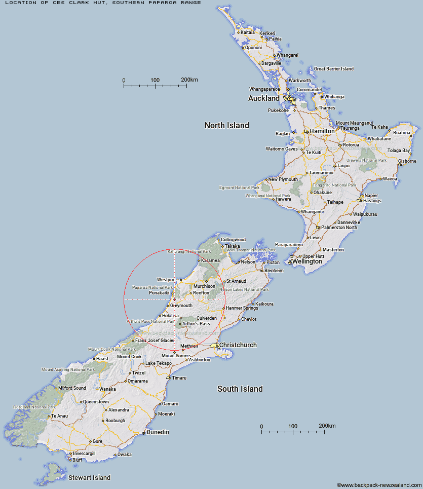
Topo Map showing location of Ces Clark Hut
This information is sourced from DoC, LINZ and Openstreetmap. Some of the hut photos are mine and the rest are from DoC. I will be adding an upload feature soon so people can photos of .Ces Clark Hut.
Basic info: serviced 16-bunk hut in the Greymouth area.
Latitude: -42.2939767147
Longitude: 171.392080717
Location: Southern Paparoa Range
Area: West Coast
Type of Hut: Serviced
Tracks: Croesus Track|Moonlight/Croesus Route
Map: BT20 Topo Map | Road Map
Does this hut still exist? Have any more information? Contact
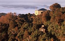
Image: DoC
Scroll down to see a topographical map and road map showing the location of Ces Clark Hut
[ A ] [ B ] [ C ] [ D ] [ E ] [ F ] [ G ] [ H ] [ I ] [ J ] [ K ] [ L ] [ M ] [ N ] [ O ] [ P ] [ Q ] [ R ] [ S ] [ T ] [ U ] [ V ] [ W ] [ Y ] [ Z ]
Closest 20 Huts to Ces Clark Hut
These are as the crow fliesCroesus Top Hut 0.1km Garden Gully Hut 1.29km Meikles Hut 5.03km Jim's Flat Hut 31.89km Big River Hut 41.57km Camp Creek Hut 47.87km Lake Morgan Hut 48.62km Jacko Flat Hut 50.02km Buckland Peaks Hut 50.58km Cone Creek Hut 51.45km Top Crooked Hut 51.8km Waikiti Hut 52.02km Montgomerie Hut 52.37km Elizabeth Hut 54.35km Rocky Creek Bivouac 54.78km Dillons Homestead Hut 54.96km Kirwans Hut 55.15km Dillon Hut 55.27km Griffin Creek Hut 56.03km Carroll Hut 56.75km Scottys Bivouac 57.08km Top Trent / Lagoon Hut 57.81km Top Olderog Bivouac 58.88km Kiwi Hut 58.98km Tutaekuri Hut 59.41km Top Waitahu Bivouac 59.77km Dunns Creek Hut 60.2km Mid Trent Hut 60.26km Newton Creek Hut 60.87km Pfeifer Bivouac 60.89km Lower Olderog Bivouac 60.91km Lake Stream Hut 61.11km Locke Stream Hut 61.22km Mid Robinson Hut 61.25km Hunts Creek Hut 61.46km Mid Taipo Hut 61.98km Townsend Hut 62.05km Lower Arahura Hut 62.96km Harper Pass Bivouac 63.31km Slaty Creek Hut 63.34km