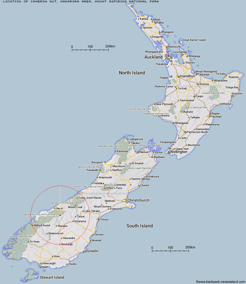
Topo Map showing location of Cameron Hut
This information is sourced from DoC, LINZ and Openstreetmap. Some of the hut photos are mine and the rest are from DoC. I will be adding an upload feature soon so people can photos of .Cameron Hut.
Latitude: -44.1991047372
Longitude: 169.31586409
Location: Makarora area, Mount Aspiring National Park
MAKARORA AREA, MOUNT ASPIRING NATIONAL PARK Type of Hut: Standard
Map: Topo Map | Road Map
Does this hut still exist? Have any more information? Contact
Latitude: -44.1991047372
Longitude: 169.31586409
Location: Makarora area, Mount Aspiring National Park
MAKARORA AREA, MOUNT ASPIRING NATIONAL PARK Type of Hut: Standard
Map: Topo Map | Road Map
Does this hut still exist? Have any more information? Contact
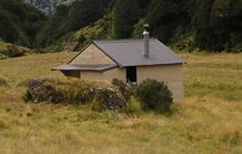
Image: DoC
Scroll down to see a topographical map and road map showing the location of Cameron Hut
[ A ] [ B ] [ C ] [ D ] [ E ] [ F ] [ G ] [ H ] [ I ] [ J ] [ K ] [ L ] [ M ] [ N ] [ O ] [ P ] [ Q ] [ R ] [ S ] [ T ] [ U ] [ V ] [ W ] [ Y ] [ Z ]
Closest 20 Huts to Cameron Hut
These are as the crow fliesBig Hopwood Burn Hut 11.54km Makarora Hut 12.61km Little Boundary Hut 12.78km Boundary Hut 12.87km Green Bush Hut 14.02km High Burn Hut 14.19km Brewster Hut 14.57km Scrubby Hut 15.84km Young Hut 18.22km Bull Flat Hut 18.3km Craigie Burn Hut 18.35km Siberia Hut 20.27km Ferguson Hut 20.7km Top Dingle Hut 21.18km Wills Hut 21.32km Kerin Forks Hut 22.74km Ben Avon Hut 23.16km Ahuriri Base Hut 23.99km Cotters Hut 24.22km Shamrock Hut 24.49km Sawyer Burn Hut 24.54km Franklin Hut 25.88km Bush Hut 26.06km Hagens Hut 26.27km Albert Burn Hut 27.42km Top Hut 29.14km Forbes Hut 29.44km Mae West Bivouac 30.75km Snowy Gorge Hut 31.81km Hideaway Hut 33.34km Moonlight & Roses Hut 33.45km Top Timaru Hut 33.59km Roaring Billy Hut 33.78km Maitland Hut 34.09km Top Forks Hut 34.86km Thomas River Hut 35.3km South Temple Hut 35.48km Junction Hut 36.67km South Huxley Bivouac 37.98km Burnt Bush Hut 38.17km