var addressPoints = [
[-41.5481804298, 172.178591729, "
Mokihinui Forks Hut
Latitude: -41.5481804298 Longitude: 172.178591729
"],
[-41.60585513, 172.198666552, "
Goat Creek Hut
Image: DoC Department of Conservation Hut Type: Basic/bivvies Location: Mokihinui River area Latitude: -41.60585513 Longitude: 172.198666552
"],
[-41.7000258299, 172.158958489, "
Ghost Lake Hut
Latitude: -41.7000258299 Longitude: 172.158958489
"],
[-41.7238632334, 172.099249765, "
Lyell Saddle Hut
Latitude: -41.7238632334 Longitude: 172.099249765
"],
[-41.5447171984, 172.152230457, "
Specimen Point Hut
Latitude: -41.5447171984 Longitude: 172.152230457
"],
[-42.8556459953, 171.896445875, "
Ranger Bivouac
Latitude: -42.8556459953 Longitude: 171.896445875
"],
[-42.9111361952, 171.732715652, "
Hawdon Hut
Image: DoC Department of Conservation Hut Type: Serviced Location: Arthur's Pass National Park Latitude: -42.9111361952 Longitude: 171.732715652
"],
[-42.9496629805, 171.704610759, "
Sudden Valley Bivouac
Latitude: -42.9496629805 Longitude: 171.704610759
"],
[-42.987606289, 171.747287102, "
Hawdon Shelter
Latitude: -42.987606289 Longitude: 171.747287102
"],
[-42.8561660107, 171.300592599, "
Lower Arahura Hut
Image: DoC Department of Conservation Hut Type: Standard Location: Kelly Range - Styx River area Latitude: -42.8561660107 Longitude: 171.300592599
"],
[-42.9195759913, 171.321630032, "
Harman Hut
Image: DoC Department of Conservation Hut Type: Standard Location: Kelly Range - Styx River area Latitude: -42.9195759913 Longitude: 171.321630032
"],
[-43.0340876736, 171.31706108, "
Urquhart's Hut
Image: DoC Department of Conservation Hut Type: Basic/bivvies Location: Craigieburn Forest Park Latitude: -43.0340876736 Longitude: 171.31706108
"],
[-42.8380812218, 171.306063618, "
Lower Olderog Bivouac
Latitude: -42.8380812218 Longitude: 171.306063618
"],
[-42.895521441, 171.245052059, "
Mid Styx Hut
Department of Conservation Hut Type: Basic/bivvies Location: Kelly Range - Styx River area Latitude: -42.895521441 Longitude: 171.245052059
"],
[-42.9353308574, 171.278800089, "
Top Crawford Hut
Image: DoC Department of Conservation Hut Type: Basic/bivvies Location: Kokatahi River - Whitcombe River area Latitude: -42.9353308574 Longitude: 171.278800089
"],
[-42.9604579932, 171.234401938, "
Crawford Junction Hut
Department of Conservation Hut Type: Basic/bivvies Location: Kokatahi River - Whitcombe River area Latitude: -42.9604579932 Longitude: 171.234401938
"],
[-43.0530845169, 171.338105585, "
Weka Burnet Bivouac
Latitude: -43.0530845169 Longitude: 171.338105585
"],
[-43.0658719062, 171.273622898, "
Unknown Stream Hut
Image: DoC Department of Conservation Hut Type: Basic/bivvies Location: Craigieburn Forest Park Latitude: -43.0658719062 Longitude: 171.273622898
"],
[-42.9378671844, 171.17836635, "
Pinnacle Bivouac
Latitude: -42.9378671844 Longitude: 171.17836635
"],
[-42.9967012224, 171.123410529, "
Mullins Hut
Image: DoC Department of Conservation Hut Type: Basic/bivvies Location: Kokatahi River - Whitcombe River area Latitude: -42.9967012224 Longitude: 171.123410529
"],
[-43.0133657562, 171.153897435, "
Top Toaroha Hut
Image: DoC Department of Conservation Hut Type: Standard Location: Kokatahi River - Whitcombe River area Latitude: -43.0133657562 Longitude: 171.153897435
"],
[-42.8690544622, 171.200098471, "
Mt Brown Hut
Image: DoC Department of Conservation Hut Type: Basic/bivvies Location: Lake Kaniere Scenic Reserve Latitude: -42.8690544622 Longitude: 171.200098471
"],
[-42.9831106368, 171.188957803, "
Top Kokatahi Hut
Image: DoC Department of Conservation Hut Type: Basic/bivvies Location: Kokatahi River - Whitcombe River area Latitude: -42.9831106368 Longitude: 171.188957803
"],
[-42.9843388204, 171.148871083, "
Yeats Ridge Hut
Image: DoC Department of Conservation Hut Type: Basic/bivvies Location: Kokatahi River - Whitcombe River area Latitude: -42.9843388204 Longitude: 171.148871083
"],
[-42.9629759899, 171.144175359, "
Cedar Flat Hut
Image: DoC Department of Conservation Hut Type: Standard Location: Kokatahi River - Whitcombe River area Latitude: -42.9629759899 Longitude: 171.144175359
"],
[-43.7590037312, 170.00047498, "
Barron Saddle Hut
Image: DoC Department of Conservation Hut Type: Serviced Alpine Location: Aoraki/Mount Cook National Park Latitude: -43.7590037312 Longitude: 170.00047498
"],
[-43.9458309592, 170.087690137, "
Whale Stream Hut
Latitude: -43.9458309592 Longitude: 170.087690137
"],
[-43.8334218396, 169.989104754, "
Waterfall Hut
Image: DoC Department of Conservation Hut Type: Standard Location: Ruahine Forest Park Latitude: -43.8334218396 Longitude: 169.989104754
"],
[-43.8471249218, 169.915921848, "
Erceg Hut
Image: DoC Department of Conservation Hut Type: Basic/bivvies Location: Ruataniwha Conservation Park Latitude: -43.8471249218 Longitude: 169.915921848
"],
[-45.7923571493, 167.331388201, "
Clark Hut - A Frame
Image: DoC Department of Conservation Hut Type: Basic/bivvies Location: Fiordland National Park, Lake Monowai/Borland Road area Latitude: -45.7923571493 Longitude: 167.331388201
"],
[-45.7845414137, 167.318597273, "
Historic Clark Hut
Latitude: -45.7845414137 Longitude: 167.318597273
"],
[-38.4797085314, 177.276879674, "
Kahunui Hut
Image: DoC Department of Conservation Hut Type: Standard Location: Waioeka Conservation Area Latitude: -38.4797085314 Longitude: 177.276879674
"],
[-45.0504482288, 168.222459271, "
Taipo Hut
Department of Conservation Hut Type: Standard Location: Mavora Lakes Conservation Park Latitude: -45.0504482288 Longitude: 168.222459271
"],
[-37.5860680057, 175.830614554, "
Te Rereatukahia Hut
Image: DoC Department of Conservation Hut Type: Standard Location: Kaimai Mamaku Forest Park Latitude: -37.5860680057 Longitude: 175.830614554
"],
[-44.8884676873, 170.264863701, "
Brown Hut
Department of Conservation Hut Type: Basic/bivvies Location: Oteake Conservation Park Latitude: -44.8884676873 Longitude: 170.264863701
"],
[-44.6028691201, 170.429095378, "
Pearson Hut
Image: DoC Department of Conservation Hut Type: Basic/bivvies Location: Kirkliston Range Conservation Area Latitude: -44.6028691201 Longitude: 170.429095378
"],
[-43.6247421661, 170.19084065, "
Ball Hut
Image: DoC Department of Conservation Hut Type: Standard Location: Aoraki/Mount Cook National Park Latitude: -43.6247421661 Longitude: 170.19084065
"],
[-44.0239920298, 169.811924902, "
Monument Hut
Image: DoC Department of Conservation Hut Type: Standard Location: Ruataniwha Conservation Park Latitude: -44.0239920298 Longitude: 169.811924902
"],
[-43.1077981503, 171.154713015, "
Canyon Creek Bivouac
Latitude: -43.1077981503 Longitude: 171.154713015
"],
[-43.0502150678, 170.911118965, "
Healey Creek Hut
Department of Conservation Hut Type: Basic/bivvies Location: Mikonui River - Kakapotahi River area Latitude: -43.0502150678 Longitude: 170.911118965
"],
[-42.9717605724, 171.165485345, "
Adventure Bivouac
Latitude: -42.9717605724 Longitude: 171.165485345
"],
[-43.2272619117, 171.956632827, "
Kinnebrooks Hut
Latitude: -43.2272619117 Longitude: 171.956632827
"],
[-43.1941097555, 171.951591481, "
Walker Hut
Latitude: -43.1941097555 Longitude: 171.951591481
"],
[-42.5853769912, 172.377385187, "
Bus Shelter
Latitude: -42.5853769912 Longitude: 172.377385187
"],
[-42.5310979958, 172.283262713, "
Doubtful Hut
Image: DoC Department of Conservation Hut Type: Basic/bivvies Location: Lake Sumner Forest Park Latitude: -42.5310979958 Longitude: 172.283262713
"],
[-42.1495503417, 171.997440525, "
Montgomerie Hut
Image: DoC Department of Conservation Hut Type: Standard Location: Victoria Forest Park Latitude: -42.1495503417 Longitude: 171.997440525
"],
[-42.1031466011, 172.010001101, "
Kirwans Hut
Image: DoC Department of Conservation Hut Type: Serviced Location: Victoria Forest Park Latitude: -42.1031466011 Longitude: 172.010001101
"],
[-41.5874901883, 172.364305696, "
McConchies Hut
Image: DoC Department of Conservation Hut Type: Standard Location: Kahurangi National Park Latitude: -41.5874901883 Longitude: 172.364305696
"],
[-41.1977360611, 172.715691374, "
Mt Arthur Hut
Image: DoC Department of Conservation Hut Type: Serviced Location: Kahurangi National Park, Mount Arthur area Latitude: -41.1977360611 Longitude: 172.715691374
"],
[-41.4364931099, 175.33130487, "
Sutherlands Hut
Image: DoC Department of Conservation Hut Type: Standard Location: Aorangi Forest Park Latitude: -41.4364931099 Longitude: 175.33130487
"],
[-41.0076414452, 175.391124039, "
Waiohine Shelter
Latitude: -41.0076414452 Longitude: 175.391124039
"],
[-39.828969965, 176.114065403, "
Waterfall Hut
Image: DoC Department of Conservation Hut Type: Standard Location: Ruahine Forest Park Latitude: -39.828969965 Longitude: 176.114065403
"],
[-39.7874969335, 176.168061783, "
Sunrise Hut
Image: DoC Department of Conservation Hut Type: Serviced Location: Ruahine Forest Park Latitude: -39.7874969335 Longitude: 176.168061783
"],
[-39.7933814617, 176.198153589, "
Triplex Hut
Image: DoC Department of Conservation Hut Type: Standard Location: Ruahine Forest Park Latitude: -39.7933814617 Longitude: 176.198153589
"],
[-39.7546130487, 176.129718829, "
Wakelings Hut
Image: DoC Department of Conservation Hut Type: Standard Location: Ruahine Forest Park Latitude: -39.7546130487 Longitude: 176.129718829
"],
[-39.7380261931, 176.17927007, "
Sparrowhawk Bivouac
Latitude: -39.7380261931 Longitude: 176.17927007
"],
[-39.6661876674, 176.340840843, "
Briens Hut
Latitude: -39.6661876674 Longitude: 176.340840843
"],
[-39.6715629627, 176.140701686, "
Colenso Hut
Image: DoC Department of Conservation Hut Type: Standard Location: Ruahine Forest Park Latitude: -39.6715629627 Longitude: 176.140701686
"],
[-39.6920805772, 176.323210782, "
Tin Hut
Latitude: -39.6920805772 Longitude: 176.323210782
"],
[-39.745809672, 176.804909118, "
Drovers Memorial Hut
Latitude: -39.745809672 Longitude: 176.804909118
"],
[-39.6312552522, 176.171856245, "
Ruahine Corner Hut
Image: DoC Department of Conservation Hut Type: Standard Location: Ruahine Forest Park Latitude: -39.6312552522 Longitude: 176.171856245
"],
[-39.5117923257, 176.292540197, "
Shutes Hut
Latitude: -39.5117923257 Longitude: 176.292540197
"],
[-39.4684161994, 176.289740034, "
Comet Hut
Image: DoC Department of Conservation Hut Type: Basic/bivvies Location: Kaweka Forest Park Latitude: -39.4684161994 Longitude: 176.289740034
"],
[-39.3638564875, 175.983319206, "
Bob's Hut
Latitude: -39.3638564875 Longitude: 175.983319206
"],
[-39.2755738045, 176.296687929, "
Rocks Ahead Hut
Image: DoC Department of Conservation Hut Type: Standard Location: Kaweka Forest Park Latitude: -39.2755738045 Longitude: 176.296687929
"],
[-39.2805094864, 176.393943782, "
Dominie Hut
Image: DoC Department of Conservation Hut Type: Basic/bivvies Location: Kaweka Forest Park Latitude: -39.2805094864 Longitude: 176.393943782
"],
[-39.3018036546, 176.438282404, "
Black Birch Bivouac
Latitude: -39.3018036546 Longitude: 176.438282404
"],
[-39.2380244004, 176.369749283, "
Ballard Hut
Image: DoC Department of Conservation Hut Type: Standard Location: Kaweka Forest Park Latitude: -39.2380244004 Longitude: 176.369749283
"],
[-39.2621519539, 176.416680166, "
Kaweka Flats Bivouac
Latitude: -39.2621519539 Longitude: 176.416680166
"],
[-39.2562405077, 176.430609157, "
Iron Whare
Latitude: -39.2562405077 Longitude: 176.430609157
"],
[-39.2273062003, 176.426520733, "
Middle Hill Hut
Image: DoC Department of Conservation Hut Type: Standard Location: Kaweka Forest Park Latitude: -39.2273062003 Longitude: 176.426520733
"],
[-39.1896100034, 176.407589913, "
Makino Hut
Image: DoC Department of Conservation Hut Type: Standard Location: Kaweka Forest Park Latitude: -39.1896100034 Longitude: 176.407589913
"],
[-37.0708082093, 175.183693648, "
Piggotts Hut
Latitude: -37.0708082093 Longitude: 175.183693648
"],
[-46.2265919873, 166.958550979, "
Westies Hut
Image: DoC Department of Conservation Hut Type: Basic/bivvies Location: Fiordland National Park, Tuatapere area Latitude: -46.2265919873 Longitude: 166.958550979
"],
[-38.4337933854, 177.262646513, "
Tawa Hut
Image: DoC Department of Conservation Hut Type: Standard Location: Waioeka Conservation Area Latitude: -38.4337933854 Longitude: 177.262646513
"],
[-38.39726875, 177.287565163, "
Koranga Forks Hut
Image: DoC Department of Conservation Hut Type: Standard Location: Waioeka Conservation Area Latitude: -38.39726875 Longitude: 177.287565163
"],
[-38.3554419041, 177.290403887, "
Nikau Flat Hut
Image: DoC Department of Conservation Hut Type: Standard Location: Waioeka Conservation Area Latitude: -38.3554419041 Longitude: 177.290403887
"],
[-38.3338963956, 177.327570697, "
Kotepato Hut
Image: DoC Department of Conservation Hut Type: Standard Location: Waioeka Conservation Area Latitude: -38.3338963956 Longitude: 177.327570697
"],
[-38.2318807534, 177.385993684, "
Tokenui Hut
Latitude: -38.2318807534 Longitude: 177.385993684
"],
[-38.2051126073, 177.366513919, "
Savlon Hut
Latitude: -38.2051126073 Longitude: 177.366513919
"],
[-38.2718324019, 177.43544643, "
Manganuku Hut
Department of Conservation Hut Type: Basic/bivvies Location: Urutawa Conservation Area Latitude: -38.2718324019 Longitude: 177.43544643
"],
[-38.213230607, 177.44746231, "
Wahaatua Hut
Latitude: -38.213230607 Longitude: 177.44746231
"],
[-38.2273937313, 177.49288264, "
Pakihi Heads Hut
Latitude: -38.2273937313 Longitude: 177.49288264
"],
[-38.1701716805, 177.467583371, "
Pakihi Hut
Image: DoC Department of Conservation Hut Type: Standard Location: Opotiki area, Urutawa Conservation Area Latitude: -38.1701716805 Longitude: 177.467583371
"],
[-43.6545166336, 170.474675331, "
Angus Hut
Latitude: -43.6545166336 Longitude: 170.474675331
"],
[-41.4070522381, 172.494574573, "
Kiwi Saddle Hut
Image: DoC Department of Conservation Hut Type: Standard Location: Kahurangi National Park Latitude: -41.4070522381 Longitude: 172.494574573
"],
[-41.9113971987, 173.049592246, "
Bottom Misery Hut
Image: DoC Department of Conservation Hut Type: Standard Location: Leatham Conservation Area Latitude: -41.9113971987 Longitude: 173.049592246
"],
[-41.172418941, 172.200821533, "
Sunshine Flat Shelter
Latitude: -41.172418941 Longitude: 172.200821533
"],
[-46.122301923, 166.672497295, "
Te Oneroa Hut
Latitude: -46.122301923 Longitude: 166.672497295
"],
[-46.2371354291, 167.063196359, "
Waitutu Hut
Image: DoC Department of Conservation Hut Type: Standard Location: Fiordland National Park, Tuatapere area Latitude: -46.2371354291 Longitude: 167.063196359
"],
[-46.2539103949, 167.217329053, "
Wairaurahiri Hut
Image: DoC Department of Conservation Hut Type: Standard Location: Fiordland National Park, Tuatapere area Latitude: -46.2539103949 Longitude: 167.217329053
"],
[-46.1922144951, 167.066213545, "
Slaughterburn Hut
Image: DoC Department of Conservation Hut Type: Basic/bivvies Location: Fiordland National Park, Tuatapere area Latitude: -46.1922144951 Longitude: 167.066213545
"],
[-46.1108584126, 167.153292914, "
Lake Poteriteri Hut
Image: DoC Department of Conservation Hut Type: Standard Location: Fiordland National Park, Tuatapere area Latitude: -46.1108584126 Longitude: 167.153292914
"],
[-46.1590890984, 167.310366462, "
Okaka Lodge
Latitude: -46.1590890984 Longitude: 167.310366462
"],
[-46.066570592, 167.294813917, "
Teal Bay Hut
Image: DoC Department of Conservation Hut Type: Standard Location: Fiordland National Park, Tuatapere area Latitude: -46.066570592 Longitude: 167.294813917
"],
[-45.9413230454, 167.283304824, "
Caroline Hut
Image: DoC Department of Conservation Hut Type: Basic/bivvies Location: Fiordland National Park Latitude: -45.9413230454 Longitude: 167.283304824
"],
[-45.8822111539, 167.361611598, "
Eel Creek Hut
Image: DoC Department of Conservation Hut Type: Basic/bivvies Location: Fiordland National Park Latitude: -45.8822111539 Longitude: 167.361611598
"],
[-45.702230373, 166.944579854, "
Supper Cove Hut
Image: DoC Department of Conservation Hut Type: Standard Location: Fiordland National Park, Southern fiords area Latitude: -45.702230373 Longitude: 166.944579854
"],
[-45.8343144455, 167.349332163, "
Monowai Hut
Image: DoC Department of Conservation Hut Type: Standard Location: Fiordland National Park, Lake Monowai/Borland Road area Latitude: -45.8343144455 Longitude: 167.349332163
"],
[-45.7855470676, 167.400054446, "
Green Lake Hut
Image: DoC Department of Conservation Hut Type: Standard Location: Fiordland National Park, Lake Monowai/Borland Road area Latitude: -45.7855470676 Longitude: 167.400054446
"],
[-45.7597928598, 167.143020327, "
Halfway Hut
Image: DoC Department of Conservation Hut Type: Standard Location: Fiordland National Park Latitude: -45.7597928598 Longitude: 167.143020327
"],
[-45.7399179434, 167.371384153, "
Borland Bivouac
Latitude: -45.7399179434 Longitude: 167.371384153
"],
[-45.6146578148, 167.115836885, "
Kintail Hut
Image: DoC Department of Conservation Hut Type: Standard Location: Fiordland National Park Latitude: -45.6146578148 Longitude: 167.115836885
"],
[-45.5802866578, 167.163273403, "
Upper Spey Hut
Image: DoC Department of Conservation Hut Type: Standard Location: Fiordland National Park Latitude: -45.5802866578 Longitude: 167.163273403
"],
[-45.5891695904, 167.323626074, "
Percy Shelter
Latitude: -45.5891695904 Longitude: 167.323626074
"],
[-45.5255505274, 167.263200961, "
West Arm Hut
Image: DoC Department of Conservation Hut Type: Standard Location: Doubtful Sound/Patea area, Fiordland National Park Latitude: -45.5255505274 Longitude: 167.263200961
"],
[-45.2955906134, 166.956298313, "
The Gut Hut
Image: DoC Department of Conservation Hut Type: Basic/bivvies Location: Fiordland National Park Latitude: -45.2955906134 Longitude: 166.956298313
"],
[-45.220919405, 166.884762368, "
Stantley Burn Hut
Latitude: -45.220919405 Longitude: 166.884762368
"],
[-45.440449268, 167.381172073, "
Freeman Burn Hut
Image: DoC Department of Conservation Hut Type: Standard Location: Fiordland National Park, Lake Manapouri area Latitude: -45.440449268 Longitude: 167.381172073
"],
[-45.191678159, 166.908100541, "
Rocky Point Hut
Latitude: -45.191678159 Longitude: 166.908100541
"],
[-45.193091015, 166.9747001, "
Deas Cove Hut
Image: DoC Department of Conservation Hut Type: Standard Location: Southern fiords area Latitude: -45.193091015 Longitude: 166.9747001
"],
[-45.1958627211, 167.352285587, "
Robin Saddle Hut
Latitude: -45.1958627211 Longitude: 167.352285587
"],
[-45.0479860241, 167.308840658, "
Caswell Sound Hut
Image: DoC Department of Conservation Hut Type: Basic/bivvies Location: Fiordland National Park Latitude: -45.0479860241 Longitude: 167.308840658
"],
[-47.1996690153, 167.638065854, "
South Pegasus Hunters Hut
Image: DoC Department of Conservation Hut Type: Basic/bivvies Location: Rakiura National Park, Stewart Island/Rakiura Latitude: -47.1996690153 Longitude: 167.638065854
"],
[-47.1983003407, 167.666289799, "
North Pegasus Hunters Hut
Image: DoC Department of Conservation Hut Type: Basic/bivvies Location: Rakiura National Park, Stewart Island/Rakiura Latitude: -47.1983003407 Longitude: 167.666289799
"],
[-47.0329093173, 167.706208124, "
Doughboy Bay Hut
Image: DoC Department of Conservation Hut Type: Standard Location: Rakiura National Park, Stewart Island/Rakiura Latitude: -47.0329093173 Longitude: 167.706208124
"],
[-47.0750107444, 168.049903091, "
Lords River Hunters Hut
Latitude: -47.0750107444 Longitude: 168.049903091
"],
[-47.0848111106, 168.152267387, "
North Tikotatahi Hunters Hut
Image: DoC Department of Conservation Hut Type: Basic/bivvies Location: Rakiura National Park, Stewart Island/Rakiura Latitude: -47.0848111106 Longitude: 168.152267387
"],
[-47.0738803445, 168.171544139, "
Kellys Hunters Hut
Image: DoC Department of Conservation Hut Type: Basic/bivvies Location: Rakiura National Park, Stewart Island/Rakiura Latitude: -47.0738803445 Longitude: 168.171544139
"],
[-47.0494692976, 168.176654121, "
Port Adventure Hunters Hut
Image: DoC Department of Conservation Hut Type: Basic/bivvies Location: Rakiura National Park, Stewart Island/Rakiura Latitude: -47.0494692976 Longitude: 168.176654121
"],
[-47.0178448017, 168.21480355, "
Chew Tobacco Hunters Hut
Latitude: -47.0178448017 Longitude: 168.21480355
"],
[-46.9632230022, 167.722498195, "
Cavalier Hunters Hut
Image: DoC Department of Conservation Hut Type: Basic/bivvies Location: Rakiura National Park, Stewart Island/Rakiura Latitude: -46.9632230022 Longitude: 167.722498195
"],
[-46.9391343828, 167.760786829, "
Martins Creek Hunters Hut
Image: DoC Department of Conservation Hut Type: Basic/bivvies Location: Rakiura National Park, Stewart Island/Rakiura Latitude: -46.9391343828 Longitude: 167.760786829
"],
[-46.9821313462, 167.880873591, "
Rakeahua Hut
Image: DoC Department of Conservation Hut Type: Standard Location: Rakiura National Park, Stewart Island/Rakiura Latitude: -46.9821313462 Longitude: 167.880873591
"],
[-46.9265503099, 167.780173831, "
Mason Bay Hut
Image: DoC Department of Conservation Hut Type: Standard Location: Rakiura National Park, Stewart Island/Rakiura Latitude: -46.9265503099 Longitude: 167.780173831
"],
[-46.9208232875, 167.79684267, "
Homestead Hunters Hut
Image: DoC Department of Conservation Hut Type: Basic/bivvies Location: Rakiura National Park, Stewart Island/Rakiura Latitude: -46.9208232875 Longitude: 167.79684267
"],
[-46.8144398957, 167.738184393, "
Big Hellfire Hut
Image: DoC Department of Conservation Hut Type: Standard Location: Rakiura National Park, Stewart Island/Rakiura Latitude: -46.8144398957 Longitude: 167.738184393
"],
[-46.8682726783, 167.920056996, "
Freshwater Hut
Image: DoC Department of Conservation Hut Type: Standard Location: Rakiura National Park, Stewart Island/Rakiura Latitude: -46.8682726783 Longitude: 167.920056996
"],
[-46.7235175806, 167.746191064, "
East Ruggedy Hut
Image: DoC Department of Conservation Hut Type: Standard Location: Rakiura National Park, Stewart Island/Rakiura Latitude: -46.7235175806 Longitude: 167.746191064
"],
[-46.6943126136, 167.807644141, "
Long Harry Hut
Image: DoC Department of Conservation Hut Type: Standard Location: Rakiura National Park, Stewart Island/Rakiura Latitude: -46.6943126136 Longitude: 167.807644141
"],
[-46.6947478363, 167.888165955, "
Yankee River Hut
Image: DoC Department of Conservation Hut Type: Standard Location: Rakiura National Park, Stewart Island/Rakiura Latitude: -46.6947478363 Longitude: 167.888165955
"],
[-46.9479786413, 168.023373271, "
Abrahams Bay Hunters Hut
Image: DoC Department of Conservation Hut Type: Basic/bivvies Location: Rakiura National Park, Stewart Island/Rakiura Latitude: -46.9479786413 Longitude: 168.023373271
"],
[-46.9546880883, 168.071446592, "
Hapuatuna Hunters Hut
Image: DoC Department of Conservation Hut Type: Basic/bivvies Location: Rakiura National Park, Stewart Island/Rakiura Latitude: -46.9546880883 Longitude: 168.071446592
"],
[-46.9284343154, 167.977761752, "
Freds Camp Hut
Image: DoC Department of Conservation Hut Type: Standard Location: Rakiura National Park, Stewart Island/Rakiura Latitude: -46.9284343154 Longitude: 167.977761752
"],
[-46.9742999949, 168.154035462, "
Little Glory Hunters Hut
Image: DoC Department of Conservation Hut Type: Basic/bivvies Location: Glory Cove Scenic Reserve, Stewart Island/Rakiura Latitude: -46.9742999949 Longitude: 168.154035462
"],
[-46.9591111373, 168.125777318, "
North Big Glory Hunters Hut
Image: DoC Department of Conservation Hut Type: Basic/bivvies Location: Rakiura National Park, Stewart Island/Rakiura Latitude: -46.9591111373 Longitude: 168.125777318
"],
[-46.8357824854, 168.087142175, "
Port William Hut
Image: DoC Department of Conservation Hut Type: Great Walk Location: Rakiura National Park, Stewart Island/Rakiura Latitude: -46.8357824854 Longitude: 168.087142175
"],
[-46.8090446308, 168.033550157, "
Bungaree Hut
Image: DoC Department of Conservation Hut Type: Standard Location: Rakiura National Park, Stewart Island/Rakiura Latitude: -46.8090446308 Longitude: 168.033550157
"],
[-46.7507497857, 167.980813176, "
Christmas Village Hunters Hut
Image: DoC Department of Conservation Hut Type: Basic/bivvies Location: Rakiura National Park, Stewart Island/Rakiura Latitude: -46.7507497857 Longitude: 167.980813176
"],
[-46.7438314458, 167.979480615, "
Christmas Village Hut
Image: DoC Department of Conservation Hut Type: Standard Location: Rakiura National Park, Stewart Island/Rakiura Latitude: -46.7438314458 Longitude: 167.979480615
"],
[-46.2225754911, 167.361440117, "
Port Craig School Hut
Image: DoC Department of Conservation Hut Type: Serviced Location: Fiordland National Park, Tuatapere area Latitude: -46.2225754911 Longitude: 167.361440117
"],
[-46.2218740471, 167.36170365, "
Port Craig Lodge
Latitude: -46.2218740471 Longitude: 167.36170365
"],
[-46.2916406894, 167.852373795, "
Turnbull's (Big Dam) Hut
Image: DoC Department of Conservation Hut Type: Basic/bivvies Location: Longwood Forest Conservation Area Latitude: -46.2916406894 Longitude: 167.852373795
"],
[-46.5538006453, 169.325003254, "
Tautuku Hut
Image: DoC Department of Conservation Hut Type: Basic/bivvies Location: Catlins Conservation Park Latitude: -46.5538006453 Longitude: 169.325003254
"],
[-46.4321791202, 169.361626221, "
McLennan Hut
Latitude: -46.4321791202 Longitude: 169.361626221
"],
[-45.8574876267, 167.443189682, "
Rodger Inlet Huts
Latitude: -45.8574876267 Longitude: 167.443189682
"],
[-45.6858883174, 167.486107604, "
North Borland Hut
Image: DoC Department of Conservation Hut Type: Basic/bivvies Location: Fiordland National Park Latitude: -45.6858883174 Longitude: 167.486107604
"],
[-45.8585366463, 167.857781225, "
Barcoo Hut
Latitude: -45.8585366463 Longitude: 167.857781225
"],
[-45.8372088824, 167.886947772, "
Rock Hut
Latitude: -45.8372088824 Longitude: 167.886947772
"],
[-45.7208351391, 167.827020172, "
Redcliff Hut
Image: DoC Department of Conservation Hut Type: Basic/bivvies Location: Takitimu Conservation Area Latitude: -45.7208351391 Longitude: 167.827020172
"],
[-45.7795149343, 167.940675533, "
Lower Wairaki Hut
Image: DoC Department of Conservation Hut Type: Basic/bivvies Location: Takitimu Conservation Area Latitude: -45.7795149343 Longitude: 167.940675533
"],
[-45.7055129421, 167.878868977, "
Spence Hut
Image: DoC Department of Conservation Hut Type: Basic/bivvies Location: Takitimu Conservation Area Latitude: -45.7055129421 Longitude: 167.878868977
"],
[-45.7071997957, 167.999215478, "
Aparima Huts
Latitude: -45.7071997957 Longitude: 167.999215478
"],
[-45.5899053558, 167.541398919, "
Hope Arm Hut
Image: DoC Department of Conservation Hut Type: Standard Location: Fiordland National Park, Lake Manapouri area Latitude: -45.5899053558 Longitude: 167.541398919
"],
[-45.6004594675, 167.581525816, "
Back Valley Hut
Image: DoC Department of Conservation Hut Type: Basic/bivvies Location: Fiordland National Park, Lake Manapouri area Latitude: -45.6004594675 Longitude: 167.581525816
"],
[-45.4933980679, 167.612515822, "
Shallow Bay Hut
Image: DoC Department of Conservation Hut Type: Standard Location: Fiordland National Park, Lake Manapouri area Latitude: -45.4933980679 Longitude: 167.612515822
"],
[-45.4817325607, 167.610635984, "
Moturau Hut
Image: DoC Department of Conservation Hut Type: Great Walk Location: Fiordland National Park, Lake Manapouri area, Lake Te Anau area Latitude: -45.4817325607 Longitude: 167.610635984
"],
[-45.6320918801, 167.78558806, "
Cheviot Downs Hut
Image: DoC Department of Conservation Hut Type: Standard Location: Takitimu Conservation Area Latitude: -45.6320918801 Longitude: 167.78558806
"],
[-45.6680363318, 167.826229712, "
Whare Creek Hut
Image: DoC Department of Conservation Hut Type: Basic/bivvies Location: Takitimu Conservation Area Latitude: -45.6680363318 Longitude: 167.826229712
"],
[-45.6713112031, 167.929958432, "
Aparima Forks Hut
Image: DoC Department of Conservation Hut Type: Basic/bivvies Location: Takitimu Conservation Area Latitude: -45.6713112031 Longitude: 167.929958432
"],
[-45.6552358271, 168.00292672, "
Becketts Hut
Image: DoC Department of Conservation Hut Type: Basic/bivvies Location: Takitimu Conservation Area Latitude: -45.6552358271 Longitude: 168.00292672
"],
[-45.6222850311, 167.913877302, "
Upper Princhester Hut
Department of Conservation Hut Type: Basic/bivvies Location: Takitimu Conservation Area Latitude: -45.6222850311 Longitude: 167.913877302
"],
[-45.593597515, 167.95145852, "
Lower Princhester Hut
Image: DoC Department of Conservation Hut Type: Standard Location: Takitimu Conservation Area Latitude: -45.593597515 Longitude: 167.95145852
"],
[-45.3990326199, 167.509462812, "
Iris Burn Hut
Image: DoC Department of Conservation Hut Type: Great Walk Location: Fiordland National Park Latitude: -45.3990326199 Longitude: 167.509462812
"],
[-45.3828284225, 167.536178638, "
Hanging Valley Shelter
Latitude: -45.3828284225 Longitude: 167.536178638
"],
[-45.3894937998, 167.5718408, "
Forest Burn Shelter
Latitude: -45.3894937998 Longitude: 167.5718408
"],
[-45.3852747424, 167.619212075, "
Luxmore Hut
Image: DoC Department of Conservation Hut Type: Great Walk Location: Fiordland National Park, Lake Te Anau area Latitude: -45.3852747424 Longitude: 167.619212075
"],
[-45.4047079254, 167.674515214, "
Brod Bay Shelter and Campsite
Latitude: -45.4047079254 Longitude: 167.674515214
"],
[-45.4817309643, 168.12675247, "
Oreti Hut
Department of Conservation Hut Type: Basic/bivvies Location: Eyre Mountains/Taka Rā Haka Conservation Park Latitude: -45.4817309643 Longitude: 168.12675247
"],
[-45.5067568228, 168.195974099, "
Lower Windley Hut
Department of Conservation Hut Type: Basic/bivvies Location: Eyre Mountains/Taka Rā Haka Conservation Park Latitude: -45.5067568228 Longitude: 168.195974099
"],
[-45.5252765157, 168.372457154, "
Mt Bee Bunkrooms
Image: DoC Department of Conservation Hut Type: Basic/bivvies Location: Eyre Mountains/Taka Rā Haka Conservation Park Latitude: -45.5252765157 Longitude: 168.372457154
"],
[-45.4998053238, 168.424223905, "
Mansion Hut
Department of Conservation Hut Type: Basic/bivvies Location: Eyre Mountains/Taka Rā Haka Conservation Park Latitude: -45.4998053238 Longitude: 168.424223905
"],
[-45.3915525993, 168.199495347, "
Lincoln Hut
Department of Conservation Hut Type: Basic/bivvies Location: Eyre Mountains/Taka Rā Haka Conservation Park Latitude: -45.3915525993 Longitude: 168.199495347
"],
[-45.4733827433, 168.360070466, "
Cromel Branch Hut
Department of Conservation Hut Type: Basic/bivvies Location: Eyre Mountains/Taka Rā Haka Conservation Park Latitude: -45.4733827433 Longitude: 168.360070466
"],
[-45.3550861018, 168.090878177, "
Kiwi Burn Hut
Image: DoC Department of Conservation Hut Type: Standard Location: Snowdon Forest Conservation Area Latitude: -45.3550861018 Longitude: 168.090878177
"],
[-45.4042229566, 168.431963769, "
Shepherd Creek Hut
Image: DoC Department of Conservation Hut Type: Basic/bivvies Location: Eyre Mountains/Taka Rā Haka Conservation Park Latitude: -45.4042229566 Longitude: 168.431963769
"],
[-45.291713641, 168.600128129, "
Ross Hut
Latitude: -45.291713641 Longitude: 168.600128129
"],
[-45.7873148704, 169.09185932, "
Beaumont Hut
Latitude: -45.7873148704 Longitude: 169.09185932
"],
[-45.7585421017, 169.055914027, "
Leithen Hut
Latitude: -45.7585421017 Longitude: 169.055914027
"],
[-45.6408067829, 168.788278908, "
Sullivan Hut
Latitude: -45.6408067829 Longitude: 168.788278908
"],
[-45.6305507948, 168.815502592, "
Hyde Home Hut
Latitude: -45.6305507948 Longitude: 168.815502592
"],
[-45.5701466671, 168.887887494, "
Flaxy Hut
Latitude: -45.5701466671 Longitude: 168.887887494
"],
[-45.5599092321, 168.897115022, "
Junction Hut
Image: DoC Department of Conservation Hut Type: Standard Location: Old Woman and Old Man/Kopuwai Ranges Latitude: -45.5599092321 Longitude: 168.897115022
"],
[-45.5447344102, 168.973557055, "
Titan Huts
Latitude: -45.5447344102 Longitude: 168.973557055
"],
[-45.6134004329, 169.025922332, "
Black Hut
Latitude: -45.6134004329 Longitude: 169.025922332
"],
[-45.4539763941, 168.748091015, "
Garston Ski Hut
Latitude: -45.4539763941 Longitude: 168.748091015
"],
[-45.4797487606, 168.938383163, "
Blue Lake Huts
Latitude: -45.4797487606 Longitude: 168.938383163
"],
[-45.3039281794, 168.90398148, "
Baileys Hut
Latitude: -45.3039281794 Longitude: 168.90398148
"],
[-45.4862748143, 169.052259309, "
Bush Huts
Latitude: -45.4862748143 Longitude: 169.052259309
"],
[-45.3930281426, 169.083582091, "
McCrimmons Hut
Latitude: -45.3930281426 Longitude: 169.083582091
"],
[-45.383331836, 169.110079397, "
Diggers Hut
Image: DoC Department of Conservation Hut Type: Standard Location: Ruahine Forest Park Latitude: -45.383331836 Longitude: 169.110079397
"],
[-45.150980299, 167.498085005, "
Junction Burn Hut
Image: DoC Department of Conservation Hut Type: Standard Location: Fiordland National Park Latitude: -45.150980299 Longitude: 167.498085005
"],
[-44.9981567226, 167.696731942, "
Glaisnock Hut
Image: DoC Department of Conservation Hut Type: Standard Location: Fiordland National Park Latitude: -44.9981567226 Longitude: 167.696731942
"],
[-44.8376037673, 167.800975252, "
Pompolona Lodge
Latitude: -44.8376037673 Longitude: 167.800975252
"],
[-44.9426301454, 167.833462991, "
Worsley Hut
Image: DoC Department of Conservation Hut Type: Standard Location: Fiordland National Park Latitude: -44.9426301454 Longitude: 167.833462991
"],
[-44.9058581047, 167.908332979, "
Clinton Hut
Image: DoC Department of Conservation Hut Type: Great Walk Location: Fiordland National Park Latitude: -44.9058581047 Longitude: 167.908332979
"],
[-44.9213135643, 167.928714344, "
Glade House
Latitude: -44.9213135643 Longitude: 167.928714344
"],
[-44.8404503514, 167.803817293, "
Bus Stop Shelter
Latitude: -44.8404503514 Longitude: 167.803817293
"],
[-44.8538456486, 168.446008358, "
Jean Hut
Latitude: -44.8538456486 Longitude: 168.446008358
"],
[-44.7913931687, 167.753388804, "
Quintin Lodge
Latitude: -44.7913931687 Longitude: 167.753388804
"],
[-44.8097341693, 167.781538234, "
Mintaro Hut
Image: DoC Department of Conservation Hut Type: Great Walk Location: Fiordland National Park Latitude: -44.8097341693 Longitude: 167.781538234
"],
[-44.8024251308, 167.775393884, "
Mackinnon Pass Shelter
Latitude: -44.8024251308 Longitude: 167.775393884
"],
[-44.7682274104, 167.764852279, "
Dumpling Hut
Image: DoC Department of Conservation Hut Type: Great Walk Location: Fiordland National Park Latitude: -44.7682274104 Longitude: 167.764852279
"],
[-44.7064619032, 167.851068993, "
Giant Gate Shelter
Latitude: -44.7064619032 Longitude: 167.851068993
"],
[-44.4885821291, 167.943745787, "
Kaipo Hut
Image: DoC Department of Conservation Hut Type: Basic/bivvies Location: Fiordland National Park Latitude: -44.4885821291 Longitude: 167.943745787
"],
[-46.241393984, 167.305094277, "
Percy Burn Hut
Latitude: -46.241393984 Longitude: 167.305094277
"],
[-46.9226622038, 167.79685856, "
Island Hill Run Deer Pen
Latitude: -46.9226622038 Longitude: 167.79685856
"],
[-45.845115992, 169.780144187, "
Iron Hut
Latitude: -45.845115992 Longitude: 169.780144187
"],
[-45.4256500639, 169.139065179, "
Andrew Rees Hut
Latitude: -45.4256500639 Longitude: 169.139065179
"],
[-45.5106629961, 169.184034162, "
Junction Hut
Image: DoC Department of Conservation Hut Type: Standard Location: Old Woman and Old Man/Kopuwai Ranges Latitude: -45.5106629961 Longitude: 169.184034162
"],
[-45.4269121096, 169.144381024, "
Potters Huts
Latitude: -45.4269121096 Longitude: 169.144381024
"],
[-45.3298979841, 169.145175896, "
Boundary Hut
Image: DoC Department of Conservation Hut Type: Basic/bivvies Location: Old Woman and Old Man/Kopuwai Ranges Latitude: -45.3298979841 Longitude: 169.145175896
"],
[-45.3529478456, 169.18617186, "
Nicholsons Hut
Image: DoC Department of Conservation Hut Type: Basic/bivvies Location: Old Woman and Old Man/Kopuwai Ranges Latitude: -45.3529478456 Longitude: 169.18617186
"],
[-45.674045997, 169.872887185, "
Tent Hut
Latitude: -45.674045997 Longitude: 169.872887185
"],
[-45.5747594736, 169.839788333, "
The Swamp Hut
Latitude: -45.5747594736 Longitude: 169.839788333
"],
[-45.5100212734, 169.784831309, "
Canadian Hut
Latitude: -45.5100212734 Longitude: 169.784831309
"],
[-45.258360111, 168.02859462, "
Army Hut
Image: DoC Department of Conservation Hut Type: Basic/bivvies Location: Snowdon Forest Conservation Area Latitude: -45.258360111 Longitude: 168.02859462
"],
[-45.2062250819, 168.154150979, "
West Burn Hut
Image: DoC Department of Conservation Hut Type: Basic/bivvies Location: Mavora Lakes Conservation Park Latitude: -45.2062250819 Longitude: 168.154150979
"],
[-45.1882689595, 168.164543832, "
Careys Hut
Image: DoC Department of Conservation Hut Type: Standard Location: Mavora Lakes Conservation Park Latitude: -45.1882689595 Longitude: 168.164543832
"],
[-45.1138688492, 168.127450955, "
Forks Hut
Image: DoC Department of Conservation Hut Type: Basic/bivvies Location: Mavora Lakes Conservation Park Latitude: -45.1138688492 Longitude: 168.127450955
"],
[-45.1397205324, 168.179583165, "
Boundary Hut
Image: DoC Department of Conservation Hut Type: Standard Location: Mavora Lakes Conservation Park Latitude: -45.1397205324 Longitude: 168.179583165
"],
[-45.2659941175, 168.499097674, "
Billy Hut
Latitude: -45.2659941175 Longitude: 168.499097674
"],
[-45.2378882241, 168.494659922, "
Saint Marys Hut
Latitude: -45.2378882241 Longitude: 168.494659922
"],
[-45.2505493711, 168.604946142, "
Siberia Hut
Latitude: -45.2505493711 Longitude: 168.604946142
"],
[-45.1794860624, 168.638159602, "
Long Burn Hut
Latitude: -45.1794860624 Longitude: 168.638159602
"],
[-44.9618071713, 168.213508391, "
Steele Creek Lodge
Latitude: -44.9618071713 Longitude: 168.213508391
"],
[-44.9792927293, 168.262570949, "
Greenstone Hut
Image: DoC Department of Conservation Hut Type: Serviced Location: Greenstone and Caples Conservation Areas Latitude: -44.9792927293 Longitude: 168.262570949
"],
[-44.9563869793, 168.274205211, "
Slip Flat Hut
Image: DoC Department of Conservation Hut Type: Basic/bivvies Location: Greenstone and Caples Conservation Areas Latitude: -44.9563869793 Longitude: 168.274205211
"],
[-44.9270113558, 168.213523112, "
Steele Creek Hut
Image: DoC Department of Conservation Hut Type: Basic/bivvies Location: Greenstone and Caples Conservation Areas Latitude: -44.9270113558 Longitude: 168.213523112
"],
[-44.8697580975, 168.144190781, "
McKellar Lodge
Latitude: -44.8697580975 Longitude: 168.144190781
"],
[-44.843950458, 168.222192948, "
Upper Caples Hut
Latitude: -44.843950458 Longitude: 168.222192948
"],
[-44.9161903413, 168.279222525, "
Home Hill Hut
Image: DoC Department of Conservation Hut Type: Basic/bivvies Location: Greenstone and Caples Conservation Areas Latitude: -44.9161903413 Longitude: 168.279222525
"],
[-44.8919200733, 168.27313235, "
Mid Caples Hut
Image: DoC Department of Conservation Hut Type: Serviced Location: Greenstone and Caples Conservation Areas Latitude: -44.8919200733 Longitude: 168.27313235
"],
[-45.0476272413, 168.531444045, "
Sam Summers Hut
Image: DoC Department of Conservation Hut Type: Basic/bivvies Location: Queenstown area Latitude: -45.0476272413 Longitude: 168.531444045
"],
[-44.8703099883, 168.484681487, "
Kelly's Hut
Latitude: -44.8703099883 Longitude: 168.484681487
"],
[-44.8591739216, 168.449242412, "
Bonnie Jean Hut
Latitude: -44.8591739216 Longitude: 168.449242412
"],
[-44.8542914266, 168.455696654, "
Heather Jock Hut
Image: DoC Department of Conservation Hut Type: Basic/bivvies Location: Whakaari Conservation Area Latitude: -44.8542914266 Longitude: 168.455696654
"],
[-44.8525700203, 168.483881343, "
Wallers Hut
Latitude: -44.8525700203 Longitude: 168.483881343
"],
[-44.9270257823, 168.619627892, "
Butchers Hut
Latitude: -44.9270257823 Longitude: 168.619627892
"],
[-44.8486309243, 168.587539451, "
Stoney Creek Hut
Image: DoC Department of Conservation Hut Type: Basic/bivvies Location: Skippers area Latitude: -44.8486309243 Longitude: 168.587539451
"],
[-44.8988214456, 168.691531062, "
Green Gate Huts
Latitude: -44.8988214456 Longitude: 168.691531062
"],
[-44.850488847, 168.675838097, "
Sainsburys Huts
Latitude: -44.850488847 Longitude: 168.675838097
"],
[-44.6203512289, 168.020831259, "
Turners Bivouac
Latitude: -44.6203512289 Longitude: 168.020831259
"],
[-44.6235792993, 168.114513177, "
Hidden Falls Hut
Image: DoC Department of Conservation Hut Type: Serviced Location: Fiordland National Park, Hollyford Valley area Latitude: -44.6235792993 Longitude: 168.114513177
"],
[-44.6293020662, 168.117851085, "
Sunshine Hut
Latitude: -44.6293020662 Longitude: 168.117851085
"],
[-44.5898752697, 167.98583912, "
Pawnbroker Rock
Latitude: -44.5898752697 Longitude: 167.98583912
"],
[-44.5179441104, 168.063516313, "
McKerrow Island Hut
Image: DoC Department of Conservation Hut Type: Standard Location: Fiordland National Park, Hollyford Valley area Latitude: -44.5179441104 Longitude: 168.063516313
"],
[-44.4941973125, 168.073357087, "
Demon Trail Hut
Image: DoC Department of Conservation Hut Type: Serviced Location: Fiordland National Park Latitude: -44.4941973125 Longitude: 168.073357087
"],
[-44.421062249, 168.056496173, "
Hokuri Hut
Image: DoC Department of Conservation Hut Type: Serviced Location: Fiordland National Park, Hollyford Valley area Latitude: -44.421062249 Longitude: 168.056496173
"],
[-44.7991364576, 168.246396641, "
Kay Creek Hut
Image: DoC Department of Conservation Hut Type: Basic/bivvies Location: Greenstone and Caples Conservation Areas Latitude: -44.7991364576 Longitude: 168.246396641
"],
[-44.7262186561, 168.198930798, "
Routeburn Falls Lodge
Latitude: -44.7262186561 Longitude: 168.198930798
"],
[-44.7258718452, 168.199447869, "
Routeburn Falls Hut
Image: DoC Department of Conservation Hut Type: Great Walk Location: Mount Aspiring National Park Latitude: -44.7258718452 Longitude: 168.199447869
"],
[-44.7189293112, 168.278324558, "
Routeburn Shelter
Latitude: -44.7189293112 Longitude: 168.278324558
"],
[-44.8375650391, 168.444362301, "
McIntyre's Hut
Latitude: -44.8375650391 Longitude: 168.444362301
"],
[-44.8316851275, 168.456421929, "
McIntosh Hut
Image: DoC Department of Conservation Hut Type: Basic/bivvies Location: Whakaari Conservation Area Latitude: -44.8316851275 Longitude: 168.456421929
"],
[-44.8307067291, 168.667540592, "
Crystal Hut
Image: DoC Department of Conservation Hut Type: Basic/bivvies Location: Skippers area Latitude: -44.8307067291 Longitude: 168.667540592
"],
[-44.8298906295, 168.720532882, "
Peats Hut
Latitude: -44.8298906295 Longitude: 168.720532882
"],
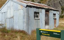
[-44.8012877219, 168.662480785, "
Dynamo Hut
Image: DoC Department of Conservation Hut Type: Standard Location: Skippers area Latitude: -44.8012877219 Longitude: 168.662480785
"],
[-44.787579301, 168.673524276, "
Bullendale Hut
Image: DoC Department of Conservation Hut Type: Standard Location: Skippers area Latitude: -44.787579301 Longitude: 168.673524276
"],
[-44.750994245, 168.656941747, "
Ballarat Hut - Flood Burn
Image: DoC Department of Conservation Hut Type: Basic/bivvies Location: Skippers area Latitude: -44.750994245 Longitude: 168.656941747
"],
[-44.6406211983, 168.470432839, "
Twenty Five Mile Hut
Latitude: -44.6406211983 Longitude: 168.470432839
"],
[-44.6726028333, 168.65042608, "
Sixteen Mile Huts
Latitude: -44.6726028333 Longitude: 168.65042608
"],
[-44.5458975593, 168.144141217, "
Lake Alabaster Hut
Image: DoC Department of Conservation Hut Type: Serviced Location: Fiordland National Park, Hollyford Valley area Latitude: -44.5458975593 Longitude: 168.144141217
"],
[-44.6153984436, 168.407036791, "
Esquilant Bivvy Hut
Image: DoC Department of Conservation Hut Type: Basic/bivvies Location: Mount Aspiring National Park Latitude: -44.6153984436 Longitude: 168.407036791
"],
[-44.5482198843, 168.374413601, "
Daleys Flat Hut
Image: DoC Department of Conservation Hut Type: Serviced Location: Mount Aspiring National Park Latitude: -44.5482198843 Longitude: 168.374413601
"],
[-44.4437179801, 168.213813061, "
Olivine Hut
Image: DoC Department of Conservation Hut Type: Standard Location: Fiordland National Park, Hollyford Valley area Latitude: -44.4437179801 Longitude: 168.213813061
"],
[-44.6217621543, 168.447538477, "
Earnslaw Hut
Image: DoC Department of Conservation Hut Type: Basic/bivvies Location: Mount Aspiring National Park Latitude: -44.6217621543 Longitude: 168.447538477
"],
[-44.5587366889, 168.508899507, "
Shelter Rock Hut
Image: DoC Department of Conservation Hut Type: Serviced Location: Mount Aspiring National Park Latitude: -44.5587366889 Longitude: 168.508899507
"],
[-44.5216317904, 168.55449195, "
Dart Hut
Image: DoC Department of Conservation Hut Type: Serviced Location: Mount Aspiring National Park Latitude: -44.5216317904 Longitude: 168.55449195
"],
[-44.4136212696, 168.608068148, "
Arawhata Rock Bivouac
Latitude: -44.4136212696 Longitude: 168.608068148
"],
[-45.1745589548, 168.802642967, "
Two Mile Hut
Image: DoC Department of Conservation Hut Type: Basic/bivvies Location: Remarkables Conservation Area Latitude: -45.1745589548 Longitude: 168.802642967
"],
[-45.0864495667, 168.876106147, "
Glen Roy Raceman's Hut
Latitude: -45.0864495667 Longitude: 168.876106147
"],
[-45.2641948669, 169.134525284, "
Whites Hut
Latitude: -45.2641948669 Longitude: 169.134525284
"],
[-45.2081207749, 169.070402287, "
Old Woman Hut
Image: DoC Department of Conservation Hut Type: Standard Location: Old Woman and Old Man/Kopuwai Ranges Latitude: -45.2081207749 Longitude: 169.070402287
"],
[-45.1103692477, 169.240594784, "
Cairnmuir Musterer's Hut
Latitude: -45.1103692477 Longitude: 169.240594784
"],
[-44.8878628135, 168.840545374, "
Eight Mile Hut
Latitude: -44.8878628135 Longitude: 168.840545374
"],
[-44.9571355963, 169.120690474, "
Deep Creek Hut
Image: DoC Department of Conservation Hut Type: Basic/bivvies Location: Pisa Conservation Area Latitude: -44.9571355963 Longitude: 169.120690474
"],
[-44.916061829, 169.056359985, "
Meg Hut
Image: DoC Department of Conservation Hut Type: Standard Location: Pisa Conservation Area Latitude: -44.916061829 Longitude: 169.056359985
"],
[-44.8710202277, 169.160676477, "
Kirtle Burn Hut
Image: DoC Department of Conservation Hut Type: Standard Location: Pisa Conservation Area Latitude: -44.8710202277 Longitude: 169.160676477
"],
[-44.8044688692, 168.862701251, "
Roses Hut
Image: DoC Department of Conservation Hut Type: Standard Location: Wanaka area Latitude: -44.8044688692 Longitude: 168.862701251
"],
[-44.7741674216, 168.941782732, "
Highland Creek Hut
Image: DoC Department of Conservation Hut Type: Standard Location: Wanaka area Latitude: -44.7741674216 Longitude: 168.941782732
"],
[-44.6955766358, 168.779334832, "
Cabin Hut
Latitude: -44.6955766358 Longitude: 168.779334832
"],
[-44.6809327919, 168.73567564, "
Shiel Burn Hut
Latitude: -44.6809327919 Longitude: 168.73567564
"],
[-44.7398254685, 168.984421805, "
Fern Burn Hut
Image: DoC Department of Conservation Hut Type: Standard Location: Wanaka area Latitude: -44.7398254685 Longitude: 168.984421805
"],
[-44.6931595013, 169.605140325, "
Polson's Hut
Latitude: -44.6931595013 Longitude: 169.605140325
"],
[-44.8454339237, 169.65993808, "
Lauder Basin Hut
Image: DoC Department of Conservation Hut Type: Basic/bivvies Location: Lauder Basin Conservation Area Latitude: -44.8454339237 Longitude: 169.65993808
"],
[-44.7713037641, 169.680642278, "
Richmond Hut
Latitude: -44.7713037641 Longitude: 169.680642278
"],
[-45.751963143, 170.37856154, "
Poplar Hut
Latitude: -45.751963143 Longitude: 170.37856154
"],
[-45.7190340077, 170.440252952, "
Jubilee Hut
Image: DoC Department of Conservation Hut Type: Standard Location: Silver Peaks Scenic Reserve Latitude: -45.7190340077 Longitude: 170.440252952
"],
[-45.7115487559, 170.497233971, "
Philip J Cox Memorial Hut
Image: DoC Department of Conservation Hut Type: Standard Location: Silver Peaks Scenic Reserve Latitude: -45.7115487559 Longitude: 170.497233971
"],
[-45.6661939843, 170.455759371, "
Bendoran Hut
Latitude: -45.6661939843 Longitude: 170.455759371
"],
[-45.5332006988, 169.939094189, "
Howells Hut
Latitude: -45.5332006988 Longitude: 169.939094189
"],
[-45.4358250174, 170.075327716, "
Big Hut
Image: DoC Department of Conservation Hut Location: Rock and Pillar Conservation Area Latitude: -45.4358250174 Longitude: 170.075327716
"],
[-45.419290491, 170.087089739, "
Leaning Lodge
Latitude: -45.419290491 Longitude: 170.087089739
"],
[-45.2174299382, 170.538931617, "
Gentle Annie Hut
Latitude: -45.2174299382 Longitude: 170.538931617
"],
[-45.1973641019, 170.540071395, "
Cayenne Hut
Latitude: -45.1973641019 Longitude: 170.540071395
"],
[-45.1600250911, 170.542675123, "
Mitchells Hut
Latitude: -45.1600250911 Longitude: 170.542675123
"],
[-45.1396206612, 170.503143981, "
Half Moon Hut
Latitude: -45.1396206612 Longitude: 170.503143981
"],
[-45.1001912304, 170.444711861, "
Crumb Hut
Latitude: -45.1001912304 Longitude: 170.444711861
"],
[-45.0763965955, 170.53278794, "
Middle Hut
Latitude: -45.0763965955 Longitude: 170.53278794
"],
[-44.9219380837, 170.263589045, "
Buster Hut
Image: DoC Department of Conservation Hut Type: Basic/bivvies Location: Oteake Conservation Park Latitude: -44.9219380837 Longitude: 170.263589045
"],
[-45.2932901967, 170.68015622, "
Staircase Hut
Image: DoC Department of Conservation Hut Type: Basic/bivvies Location: Moeraki area Latitude: -45.2932901967 Longitude: 170.68015622
"],
[-45.2541207623, 170.659527936, "
Red Hut
Image: DoC Department of Conservation Hut Type: Standard Location: Ruataniwha Conservation Park Latitude: -45.2541207623 Longitude: 170.659527936
"],
[-45.2121580424, 170.633551094, "
Bog Hut
Latitude: -45.2121580424 Longitude: 170.633551094
"],
[-45.1678214968, 170.545658596, "
Grays Hut
Latitude: -45.1678214968 Longitude: 170.545658596
"],
[-45.1510213407, 170.612793246, "
Mount Hut
Latitude: -45.1510213407 Longitude: 170.612793246
"],
[-44.9320008261, 171.144458721, "
Waitaki Huts
Latitude: -44.9320008261 Longitude: 171.144458721
"],
[-44.8480443916, 170.157791143, "
Ida Railway Hut
Image: DoC Department of Conservation Hut Type: Standard Location: Oteake Conservation Park Latitude: -44.8480443916 Longitude: 170.157791143
"],
[-44.855927321, 170.241459568, "
Tailings Hut
Image: DoC Department of Conservation Hut Type: Standard Location: Oteake Conservation Park Latitude: -44.855927321 Longitude: 170.241459568
"],
[-44.8333058183, 170.279595849, "
Hut Creek Hut
Image: DoC Department of Conservation Hut Type: Basic/bivvies Location: Oteake Conservation Park Latitude: -44.8333058183 Longitude: 170.279595849
"],
[-44.6080510261, 168.659574349, "
Hundred Mile Hut
Latitude: -44.6080510261 Longitude: 168.659574349
"],
[-44.5957289564, 168.619773933, "
Lochnagar Hut
Latitude: -44.5957289564 Longitude: 168.619773933
"],
[-44.5685806545, 168.669704469, "
Tummel Burn Hut
Latitude: -44.5685806545 Longitude: 168.669704469
"],
[-44.4928742119, 168.668260259, "
Cascade Hut
Image: DoC Department of Conservation Hut Type: Standard Location: Kaimanawa Forest Park Latitude: -44.4928742119 Longitude: 168.668260259
"],
[-44.4771358521, 168.660154162, "
Aspiring Hut
Image: DoC Department of Conservation Hut Type: Serviced Alpine Location: Matukituki Valley area, Mount Aspiring National Park Latitude: -44.4771358521 Longitude: 168.660154162
"],
[-44.4312074519, 168.66528582, "
Liverpool Hut
Image: DoC Department of Conservation Hut Type: Serviced Alpine Location: Matukituki Valley area, Mount Aspiring National Park Latitude: -44.4312074519 Longitude: 168.66528582
"],
[-44.4286605403, 168.693911261, "
French Ridge Hut
Image: DoC Department of Conservation Hut Type: Serviced Alpine Location: Matukituki Valley area, Mount Aspiring National Park Latitude: -44.4286605403 Longitude: 168.693911261
"],
[-44.4192092284, 168.680290995, "
Scotts Rock Bivouac
Latitude: -44.4192092284 Longitude: 168.680290995
"],
[-44.6580606235, 168.775528509, "
Polnoon Hut
Latitude: -44.6580606235 Longitude: 168.775528509
"],
[-44.6352935994, 168.884439306, "
Saddle Hut
Latitude: -44.6352935994 Longitude: 168.884439306
"],
[-44.5980990905, 168.827138165, "
Black Peak Hut
Latitude: -44.5980990905 Longitude: 168.827138165
"],
[-44.4704718259, 169.50136702, "
Top Timaru Hut
Image: DoC Department of Conservation Hut Type: Standard Location: Hāwea Conservation Park Latitude: -44.4704718259 Longitude: 169.50136702
"],
[-44.5268731819, 169.366465359, "
Junction Hut
Image: DoC Department of Conservation Hut Type: Standard Location: Old Woman and Old Man/Kopuwai Ranges Latitude: -44.5268731819 Longitude: 169.366465359
"],
[-44.5441382153, 169.435609547, "
Stodys Hut
Image: DoC Department of Conservation Hut Type: Basic/bivvies Location: Hāwea Conservation Park Latitude: -44.5441382153 Longitude: 169.435609547
"],
[-44.4938694996, 169.400169108, "
Moonlight & Roses Hut
Latitude: -44.4938694996 Longitude: 169.400169108
"],
[-44.4537322526, 169.466829707, "
Mae West Bivouac
Latitude: -44.4537322526 Longitude: 169.466829707
"],
[-44.4977891051, 169.552431673, "
Burnt Bush Hut
Latitude: -44.4977891051 Longitude: 169.552431673
"],
[-44.6730903138, 169.989552467, "
Otamatapaio Hut
Image: DoC Department of Conservation Hut Type: Standard Location: Oteake Conservation Park Latitude: -44.6730903138 Longitude: 169.989552467
"],
[-44.3346983226, 168.002222624, "
Martins Bay Hut
Image: DoC Department of Conservation Hut Type: Serviced Location: Fiordland National Park, Hollyford Valley area Latitude: -44.3346983226 Longitude: 168.002222624
"],
[-44.2989862313, 168.11539177, "
Big Bay Hut
Image: DoC Department of Conservation Hut Type: Standard Location: Fiordland National Park Latitude: -44.2989862313 Longitude: 168.11539177
"],
[-44.1841541445, 168.193819134, "
Gorge River Hut
Image: DoC Department of Conservation Hut Type: Standard Location: Jackson Bay - Gorge River area Latitude: -44.1841541445 Longitude: 168.193819134
"],
[-44.1655575775, 168.311202591, "
Spoon Hut
Image: DoC Department of Conservation Hut Type: Basic/bivvies Location: Jackson Bay - Gorge River area Latitude: -44.1655575775 Longitude: 168.311202591
"],
[-43.9961683415, 168.54510128, "
Stafford Hut
Image: DoC Department of Conservation Hut Type: Standard Location: Jackson Bay - Gorge River area Latitude: -43.9961683415 Longitude: 168.54510128
"],
[-43.609453228, 170.306890582, "
Onslow Hut (Steffan Memorial Hut)
Department of Conservation Hut Type: Basic/bivvies Location: Aoraki/Mount Cook National Park Latitude: -43.609453228 Longitude: 170.306890582
"],
[-43.7649805278, 170.462155244, "
Middle Gorge Hut
Image: DoC Department of Conservation Hut Type: Standard Location: Godley Peaks Conservation Area Latitude: -43.7649805278 Longitude: 170.462155244
"],
[-43.6777481636, 170.384284602, "
Memorial Hut
Latitude: -43.6777481636 Longitude: 170.384284602
"],
[-43.6816827927, 170.389337493, "
Birdcage Hut
Latitude: -43.6816827927 Longitude: 170.389337493
"],
[-43.6287941896, 170.310622501, "
Liebig Hut
Department of Conservation Hut Type: Standard Location: Aoraki/Mount Cook National Park Latitude: -43.6287941896 Longitude: 170.310622501
"],
[-43.7068443594, 170.508430418, "
Ribbonwood Hut
Latitude: -43.7068443594 Longitude: 170.508430418
"],
[-43.8917048731, 170.72745832, "
South Opuha Hut
Image: DoC Department of Conservation Hut Type: Standard Location: Te Kahui Kaupeka Conservation Park Latitude: -43.8917048731 Longitude: 170.72745832
"],
[-43.8267132821, 170.871852912, "
Spurs Hut
Image: DoC Department of Conservation Hut Type: Basic/bivvies Location: Te Kahui Kaupeka Conservation Park Latitude: -43.8267132821 Longitude: 170.871852912
"],
[-43.7938397509, 170.649136683, "
Camp Stream Hut
Image: DoC Department of Conservation Hut Type: Basic/bivvies Location: Te Kahui Kaupeka Conservation Park Latitude: -43.7938397509 Longitude: 170.649136683
"],
[-43.7684400394, 170.631691475, "
Rex Simpson Hut
Latitude: -43.7684400394 Longitude: 170.631691475
"],
[-43.686374, 170.7711602, "
Stone Hut
Image: DoC Department of Conservation Hut Type: Basic/bivvies Location: Te Kahui Kaupeka Conservation Park Latitude: -43.686374 Longitude: 170.7711602
"],
[-43.7258846794, 170.734246623, "
Royal Hut
Image: DoC Department of Conservation Hut Type: Basic/bivvies Location: Te Kahui Kaupeka Conservation Park Latitude: -43.7258846794 Longitude: 170.734246623
"],
[-43.5836498402, 170.184025768, "
Plateau Hut
Image: DoC Department of Conservation Hut Type: Serviced Alpine Location: Aoraki/Mount Cook National Park Latitude: -43.5836498402 Longitude: 170.184025768
"],
[-43.5827890934, 170.196658091, "
Haast Hut
Department of Conservation Hut Type: Basic/bivvies Location: Aoraki/Mount Cook National Park Latitude: -43.5827890934 Longitude: 170.196658091
"],
[-43.5314385968, 170.183103505, "
Pioneer Hut
Image: DoC Department of Conservation Hut Type: Serviced Alpine Location: Westland Tai Poutini National Park Latitude: -43.5314385968 Longitude: 170.183103505
"],
[-43.5081304506, 170.233938866, "
Centennial Hut
Image: DoC Department of Conservation Hut Type: Serviced Alpine Location: Westland Tai Poutini National Park Latitude: -43.5081304506 Longitude: 170.233938866
"],
[-43.4745052622, 170.208501138, "
Almer Hut
Image: DoC Department of Conservation Hut Type: Serviced Alpine Location: Franz Josef Glacier/Kā Roimata o Hine Hukatere, Westland Tai Poutini National Park Latitude: -43.4745052622 Longitude: 170.208501138
"],
[-43.4367384714, 170.269839462, "
Spencer Rock Bivouac
Latitude: -43.4367384714 Longitude: 170.269839462
"],
[-43.5138016446, 170.341889832, "
Tasman Saddle Hut
Image: DoC Department of Conservation Hut Type: Serviced Alpine Location: Aoraki/Mount Cook National Park Latitude: -43.5138016446 Longitude: 170.341889832
"],
[-43.5192300125, 170.361006936, "
Kelman Hut
Department of Conservation Hut Type: Serviced Alpine Location: Aoraki/Mount Cook National Park Latitude: -43.5192300125 Longitude: 170.361006936
"],
[-43.5185270898, 170.394352891, "
Murchison Hut
Department of Conservation Hut Location: Aoraki/Mount Cook National Park Latitude: -43.5185270898 Longitude: 170.394352891
"],
[-43.4420239178, 170.371543245, "
Whymper Hut
Image: DoC Department of Conservation Hut Type: Standard Location: Whataroa area Latitude: -43.4420239178 Longitude: 170.371543245
"],
[-43.4077149239, 170.414345086, "
Butler Junction Hut
Image: DoC Department of Conservation Hut Type: Standard Location: Whataroa area Latitude: -43.4077149239 Longitude: 170.414345086
"],
[-43.4203968969, 170.440404006, "
Top Butler Hut
Image: DoC Department of Conservation Hut Type: Standard Location: Whataroa area Latitude: -43.4203968969 Longitude: 170.440404006
"],
[-43.3554073822, 170.402686294, "
Stan's Hut
Image: DoC Department of Conservation Hut Type: Standard Location: Whataroa area Latitude: -43.3554073822 Longitude: 170.402686294
"],
[-44.3720655514, 168.694593689, "
Colin Todd Hut
Image: DoC Department of Conservation Hut Type: Serviced Alpine Location: Mount Aspiring National Park Latitude: -44.3720655514 Longitude: 168.694593689
"],
[-44.4115371004, 168.794787646, "
Rock of Ages Bivouac
Latitude: -44.4115371004 Longitude: 168.794787646
"],
[-44.3418636774, 169.035026242, "
Albert Burn Hut
Image: DoC Department of Conservation Hut Type: Standard Location: Albert Burn Conservation Area Latitude: -44.3418636774 Longitude: 169.035026242
"],
[-44.2743075871, 168.891132431, "
Top Forks Hut
Image: DoC Department of Conservation Hut Type: Serviced Location: Mount Aspiring National Park Latitude: -44.2743075871 Longitude: 168.891132431
"],
[-44.2392314529, 169.036027776, "
Kerin Forks Hut
Image: DoC Department of Conservation Hut Type: Serviced Location: Mount Aspiring National Park Latitude: -44.2392314529 Longitude: 169.036027776
"],
[-44.4157700202, 169.257022517, "
Sawyer Burn Hut
Latitude: -44.4157700202 Longitude: 169.257022517
"],
[-44.3224378569, 169.162843538, "
Craigie Burn Hut
Latitude: -44.3224378569 Longitude: 169.162843538
"],
[-44.3027146222, 169.3241879, "
Big Hopwood Burn Hut
Image: DoC Department of Conservation Hut Type: Basic/bivvies Location: Hāwea Conservation Park Latitude: -44.3027146222 Longitude: 169.3241879
"],
[-44.2047411606, 169.061640267, "
Siberia Hut
Image: DoC Department of Conservation Hut Type: Serviced Location: Mount Aspiring National Park Latitude: -44.2047411606 Longitude: 169.061640267
"],
[-44.1746229383, 169.089929228, "
Young Hut
Image: DoC Department of Conservation Hut Type: Serviced Location: Mount Aspiring National Park Latitude: -44.1746229383 Longitude: 169.089929228
"],
[-44.1991047372, 169.31586409, "
Cameron Hut
Image: DoC Department of Conservation Hut Type: Standard Location: Makarora area, Mount Aspiring National Park Latitude: -44.1991047372 Longitude: 169.31586409
"],
[-44.028916966, 169.094797405, "
Franklin Hut
Latitude: -44.028916966 Longitude: 169.094797405
"],
[-44.4087991918, 169.46201453, "
Bush Hut
Image: DoC Department of Conservation Hut Type: Standard Location: Hāwea Conservation Park Latitude: -44.4087991918 Longitude: 169.46201453
"],
[-44.3621393213, 169.51754518, "
Cotters Hut
Image: DoC Department of Conservation Hut Type: Standard Location: Hāwea Conservation Park Latitude: -44.3621393213 Longitude: 169.51754518
"],
[-44.3373530021, 169.533465752, "
Ben Avon Hut
Latitude: -44.3373530021 Longitude: 169.533465752
"],
[-44.2829654025, 169.697688273, "
Snowy Gorge Hut
Image: DoC Department of Conservation Hut Type: Basic/bivvies Location: Ahuriri Conservation Park Latitude: -44.2829654025 Longitude: 169.697688273
"],
[-44.1293235734, 169.440480177, "
Makarora Hut
Image: DoC Department of Conservation Hut Type: Standard Location: Makarora area, Mount Aspiring National Park Latitude: -44.1293235734 Longitude: 169.440480177
"],
[-44.1579939039, 169.538009153, "
Bull Flat Hut
Image: DoC Department of Conservation Hut Type: Basic/bivvies Location: Hāwea Conservation Park Latitude: -44.1579939039 Longitude: 169.538009153
"],
[-44.1194695505, 169.55042479, "
Ferguson Hut
Image: DoC Department of Conservation Hut Type: Standard Location: Hāwea Conservation Park Latitude: -44.1194695505 Longitude: 169.55042479
"],
[-44.1221028884, 169.665050234, "
Top Hut
Department of Conservation Hut Type: Basic/bivvies Location: Ahuriri Conservation Park Latitude: -44.1221028884 Longitude: 169.665050234
"],
[-44.0878171212, 169.412269362, "
Brewster Hut
Image: DoC Department of Conservation Hut Type: Serviced Alpine Location: Makarora area, Mount Aspiring National Park Latitude: -44.0878171212 Longitude: 169.412269362
"],
[-44.0385437536, 169.461734438, "
Wills Hut
Image: DoC Department of Conservation Hut Type: Standard Location: Makarora area, Mount Aspiring National Park Latitude: -44.0385437536 Longitude: 169.461734438
"],
[-44.0489049427, 169.619649234, "
Forbes Hut
Image: DoC Department of Conservation Hut Type: Standard Location: Hāwea Conservation Park Latitude: -44.0489049427 Longitude: 169.619649234
"],
[-44.0464939168, 169.741541692, "
South Huxley Bivouac
Latitude: -44.0464939168 Longitude: 169.741541692
"],
[-43.9435265047, 168.987362268, "
Red Hut
Image: DoC Department of Conservation Hut Type: Standard Location: Ruataniwha Conservation Park Latitude: -43.9435265047 Longitude: 168.987362268
"],
[-43.8937191074, 169.195077087, "
Thomas River Hut
Image: DoC Department of Conservation Hut Type: Standard Location: Haast, Paringa and Moeraki rivers area Latitude: -43.8937191074 Longitude: 169.195077087
"],
[-43.8953240663, 169.322988124, "
Roaring Billy Hut
Image: DoC Department of Conservation Hut Type: Basic/bivvies Location: Haast, Paringa and Moeraki rivers area Latitude: -43.8953240663 Longitude: 169.322988124
"],
[-43.8223618346, 169.167557188, "
Coppermine Creek Hut
Image: DoC Department of Conservation Hut Type: Standard Location: Haast, Paringa and Moeraki rivers area Latitude: -43.8223618346 Longitude: 169.167557188
"],
[-43.8142358922, 169.274034373, "
Maori Saddle Hut
Image: DoC Department of Conservation Hut Type: Standard Location: Haast, Paringa and Moeraki rivers area Latitude: -43.8142358922 Longitude: 169.274034373
"],
[-43.7926665567, 169.345854605, "
Blue River (Blowfly) Hut
Image: DoC Department of Conservation Hut Type: Standard Location: Haast, Paringa and Moeraki rivers area Latitude: -43.7926665567 Longitude: 169.345854605
"],
[-43.8094553128, 169.413977324, "
Horseshoe Flat Hut
Image: DoC Department of Conservation Hut Type: Standard Location: Haast, Paringa and Moeraki rivers area Latitude: -43.8094553128 Longitude: 169.413977324
"],
[-43.8237867867, 169.45503024, "
Middle Head Hut
Department of Conservation Hut Type: Basic/bivvies Location: Haast, Paringa and Moeraki rivers area Latitude: -43.8237867867 Longitude: 169.45503024
"],
[-43.8184452708, 169.536974809, "
Tunnel Creek Hut
Image: DoC Department of Conservation Hut Type: Basic/bivvies Location: Haast, Paringa and Moeraki rivers area Latitude: -43.8184452708 Longitude: 169.536974809
"],
[-43.9221009111, 169.836473022, "
Cullers Hut
Department of Conservation Hut Type: Standard Location: Ruataniwha Conservation Park Latitude: -43.9221009111 Longitude: 169.836473022
"],
[-43.9987150402, 169.833795694, "
Red Hut
Image: DoC Department of Conservation Hut Type: Standard Location: Ruataniwha Conservation Park Latitude: -43.9987150402 Longitude: 169.833795694
"],
[-43.9313277455, 169.830281585, "
Elcho Hut
Image: DoC Department of Conservation Hut Type: Standard Location: Ruataniwha Conservation Park Latitude: -43.9313277455 Longitude: 169.830281585
"],
[-44.0145154074, 169.922837047, "
Le Crens Hut
Latitude: -44.0145154074 Longitude: 169.922837047
"],
[-43.9563052666, 169.845965697, "
Dasler Bivouac
Latitude: -43.9563052666 Longitude: 169.845965697
"],
[-43.9690756279, 169.959557815, "
Station Hut
Latitude: -43.9690756279 Longitude: 169.959557815
"],
[-43.9334148438, 169.946747169, "
Grough Hut
Department of Conservation Hut Type: Basic/bivvies Location: Ruataniwha Conservation Park Latitude: -43.9334148438 Longitude: 169.946747169
"],
[-43.8266593218, 169.919881642, "
Richardson Rock Bivouac
Latitude: -43.8266593218 Longitude: 169.919881642
"],
[-43.8960311045, 169.87907078, "
Dodger Hut
Image: DoC Department of Conservation Hut Type: Standard Location: Ruataniwha Conservation Park Latitude: -43.8960311045 Longitude: 169.87907078
"],
[-43.8800583288, 169.963598935, "
Kennedy Hut
Latitude: -43.8800583288 Longitude: 169.963598935
"],
[-43.7181803273, 169.908511952, "
Christmas Flat Hut
Image: DoC Department of Conservation Hut Type: Standard Location: Westland Tai Poutini National Park Latitude: -43.7181803273 Longitude: 169.908511952
"],
[-43.7062136038, 169.978768042, "
Harpers Rock Bivouac
Latitude: -43.7062136038 Longitude: 169.978768042
"],
[-43.6585063539, 169.826831341, "
Cassel Flat Hut
Image: DoC Department of Conservation Hut Type: Standard Location: Westland Tai Poutini National Park Latitude: -43.6585063539 Longitude: 169.826831341
"],
[-43.688708254, 169.922200201, "
Horace Walker Hut
Image: DoC Department of Conservation Hut Type: Standard Location: Westland Tai Poutini National Park Latitude: -43.688708254 Longitude: 169.922200201
"],
[-43.6111767405, 169.886390265, "
Architect Creek Hut
Image: DoC Department of Conservation Hut Type: Standard Location: Westland Tai Poutini National Park Latitude: -43.6111767405 Longitude: 169.886390265
"],
[-43.6303890972, 169.946281046, "
Welcome Flat Hut
Image: DoC Department of Conservation Hut Type: Serviced Location: Westland Tai Poutini National Park Latitude: -43.6303890972 Longitude: 169.946281046
"],
[-43.6304720003, 169.94660098, "
Welcome Flat Campsite
Latitude: -43.6304720003 Longitude: 169.94660098
"],
[-44.1079524687, 170.064792014, "
Baikie Hut
Image: DoC Department of Conservation Hut Type: Basic/bivvies Location: Ruataniwha Conservation Park Latitude: -44.1079524687 Longitude: 170.064792014
"],
[-44.006804239, 169.988203566, "
Stony Stream Bivouac
Latitude: -44.006804239 Longitude: 169.988203566
"],
[-43.6984594969, 170.097231907, "
Stocking Stream Shelter
Latitude: -43.6984594969 Longitude: 170.097231907
"],
[-43.72091834, 170.065166961, "
Mueller Hut
Image: DoC Department of Conservation Hut Type: Serviced Alpine Location: Aoraki/Mount Cook National Park Latitude: -43.72091834 Longitude: 170.065166961
"],
[-43.8029881445, 169.999238829, "
Reardon Hut
Image: DoC Department of Conservation Hut Type: Basic/bivvies Location: Ruataniwha Conservation Park Latitude: -43.8029881445 Longitude: 169.999238829
"],
[-43.6531122576, 170.018717507, "
Douglas Rock Hut
Image: DoC Department of Conservation Hut Type: Standard Location: Westland Tai Poutini National Park Latitude: -43.6531122576 Longitude: 170.018717507
"],
[-43.6550710471, 170.098577377, "
Copland Shelter
Image: DoC Department of Conservation Hut Type: Basic/bivvies Location: Aoraki/Mount Cook National Park Latitude: -43.6550710471 Longitude: 170.098577377
"],
[-43.5946400285, 170.121731573, "
Empress Hut
Department of Conservation Hut Type: Serviced Alpine Location: Aoraki/Mount Cook National Park Latitude: -43.5946400285 Longitude: 170.121731573
"],
[-43.6357772438, 170.170895417, "
Caroline Hut
Image: DoC Department of Conservation Hut Type: Basic/bivvies Location: Fiordland National Park Latitude: -43.6357772438 Longitude: 170.170895417
"],
[-43.4530689174, 170.166968629, "
Castle Rocks Hut
Image: DoC Department of Conservation Hut Type: Standard Location: Franz Josef Glacier/Kā Roimata o Hine Hukatere, Westland Tai Poutini National Park Latitude: -43.4530689174 Longitude: 170.166968629
"],
[-43.4329755263, 170.177710315, "
Hende's Hut
Latitude: -43.4329755263 Longitude: 170.177710315
"],
[-43.0388481947, 172.149240258, "
Tarn Hut
Department of Conservation Hut Type: Basic/bivvies Location: Puketeraki Forest Conservation Area Latitude: -43.0388481947 Longitude: 172.149240258
"],
[-43.6023231666, 170.47575161, "
Rankin Hut
Latitude: -43.6023231666 Longitude: 170.47575161
"],
[-43.8484265554, 171.118831812, "
Bottom Mount Peel Hut
Latitude: -43.8484265554 Longitude: 171.118831812
"],
[-43.7284488181, 170.820052362, "
Felt Hut
Latitude: -43.7284488181 Longitude: 170.820052362
"],
[-43.6672743862, 170.614980315, "
Stony Stream Hut
Latitude: -43.6672743862 Longitude: 170.614980315
"],
[-43.623888119, 170.789607284, "
Crooked Spur Hut
Image: DoC Department of Conservation Hut Type: Basic/bivvies Location: Te Kahui Kaupeka Conservation Park Latitude: -43.623888119 Longitude: 170.789607284
"],
[-43.7534687016, 170.996154522, "
Taffy Hut
Latitude: -43.7534687016 Longitude: 170.996154522
"],
[-43.8104158821, 171.118080562, "
Top Mount Peel Huts
Latitude: -43.8104158821 Longitude: 171.118080562
"],
[-43.5804724345, 170.603430903, "
Macaulay Hut
Image: DoC Department of Conservation Hut Type: Serviced Location: Te Kahui Kaupeka Conservation Park Latitude: -43.5804724345 Longitude: 170.603430903
"],
[-43.519371959, 170.481904751, "
Eade Memorial Hut
Latitude: -43.519371959 Longitude: 170.481904751
"],
[-43.5401459528, 170.502478728, "
Red Stag Hut
Image: DoC Department of Conservation Hut Type: Basic/bivvies Location: Te Kahui Kaupeka Conservation Park Latitude: -43.5401459528 Longitude: 170.502478728
"],
[-43.4803617603, 170.510417015, "
Godley Hut
Department of Conservation Hut Type: Standard Location: Aoraki/Mount Cook National Park Latitude: -43.4803617603 Longitude: 170.510417015
"],
[-43.3484491388, 170.482050004, "
Nolans Hut
Image: DoC Department of Conservation Hut Type: Basic/bivvies Location: Whataroa area Latitude: -43.3484491388 Longitude: 170.482050004
"],
[-43.3757753247, 170.569213965, "
Scone Hut
Image: DoC Department of Conservation Hut Type: Standard Location: Whataroa area Latitude: -43.3757753247 Longitude: 170.569213965
"],
[-43.4962183178, 170.662436573, "
Carneys Bivvy's
Latitude: -43.4962183178 Longitude: 170.662436573
"],
[-43.5109110205, 170.738764854, "
Growler Hut
Image: DoC Department of Conservation Hut Type: Standard Location: Rangitata and Rakaia Rivers area, Te Kahui Kaupeka Conservation Park Latitude: -43.5109110205 Longitude: 170.738764854
"],
[-43.5839114004, 170.8101877, "
Dog Kennel Bivouac
Latitude: -43.5839114004 Longitude: 170.8101877
"],
[-43.540109765, 170.82117679, "
Black Mountain Hut
Latitude: -43.540109765 Longitude: 170.82117679
"],
[-43.4677629038, 170.6773422, "
Murphys Bivvy
Latitude: -43.4677629038 Longitude: 170.6773422
"],
[-43.4648712218, 170.648070844, "
Forbes Bivouac
Latitude: -43.4648712218 Longitude: 170.648070844
"],
[-43.4483113288, 170.693690949, "
Mistake Flats Hut
Latitude: -43.4483113288 Longitude: 170.693690949
"],
[-43.4523630939, 170.712415509, "
Curtis Memorial Hut
Image: DoC Department of Conservation Hut Type: Standard Location: Rangitata and Rakaia Rivers area Latitude: -43.4523630939 Longitude: 170.712415509
"],
[-43.4170570075, 170.683107226, "
Saint Winifreds Hut
Latitude: -43.4170570075 Longitude: 170.683107226
"],
[-43.4472934415, 170.848652024, "
Erewhon Station Hut
Latitude: -43.4472934415 Longitude: 170.848652024
"],
[-43.4081907597, 170.78840863, "
Watchdog Hut
Image: DoC Department of Conservation Hut Type: Standard Location: Rangitata and Rakaia Rivers area Latitude: -43.4081907597 Longitude: 170.78840863
"],
[-43.4212121369, 170.884963055, "
Lawrence Hut
Image: DoC Department of Conservation Hut Type: Standard Location: Rangitata and Rakaia Rivers area Latitude: -43.4212121369 Longitude: 170.884963055
"],
[-43.4015995412, 170.908112892, "
Hermitage Hut
Latitude: -43.4015995412 Longitude: 170.908112892
"],
[-43.4910066385, 170.970692429, "
Potts Hut
Image: DoC Department of Conservation Hut Type: Basic/bivvies Location: Hakatere Conservation Park Latitude: -43.4910066385 Longitude: 170.970692429
"],
[-43.4207638179, 171.028852625, "
Top Hut
Department of Conservation Hut Type: Basic/bivvies Location: Hakatere Conservation Park Latitude: -43.4207638179 Longitude: 171.028852625
"],
[-43.4152049417, 171.072810153, "
Highland Home
Latitude: -43.4152049417 Longitude: 171.072810153
"],
[-43.3783226092, 170.77559038, "
McCoy Hut
Image: DoC Department of Conservation Hut Type: Standard Location: Rangitata and Rakaia Rivers area Latitude: -43.3783226092 Longitude: 170.77559038
"],
[-43.2991152342, 170.909683446, "
Lyell Hut
Image: DoC Department of Conservation Hut Type: Basic/bivvies Location: Rangitata and Rakaia Rivers area Latitude: -43.2991152342 Longitude: 170.909683446
"],
[-43.2266616852, 170.75211479, "
Hunters Hut
Image: DoC Department of Conservation Hut Type: Standard Location: Harihari area Latitude: -43.2266616852 Longitude: 170.75211479
"],
[-43.2089822214, 170.848797934, "
Smyth Hut
Image: DoC Department of Conservation Hut Type: Standard Location: Harihari area Latitude: -43.2089822214 Longitude: 170.848797934
"],
[-43.3493376475, 170.919599826, "
Lawrence Bivouac
Latitude: -43.3493376475 Longitude: 170.919599826
"],
[-43.3670981204, 171.018051513, "
Cameron Hut
Department of Conservation Hut Type: Basic/bivvies Location: Hakatere Conservation Park Latitude: -43.3670981204 Longitude: 171.018051513
"],
[-43.2984512287, 171.055982798, "
Banfield Hut
Latitude: -43.2984512287 Longitude: 171.055982798
"],
[-43.3814964897, 171.176517068, "
Charlies Hut
Latitude: -43.3814964897 Longitude: 171.176517068
"],
[-43.332753326, 171.124409955, "
Downs Hut
Latitude: -43.332753326 Longitude: 171.124409955
"],
[-43.3092711056, 171.087341157, "
Thompsons Hut
Latitude: -43.3092711056 Longitude: 171.087341157
"],
[-43.279812528, 170.964063832, "
Reischek Hut
Image: DoC Department of Conservation Hut Type: Basic/bivvies Location: Rangitata and Rakaia Rivers area Latitude: -43.279812528 Longitude: 170.964063832
"],
[-43.2685406067, 170.965178307, "
Lauper Bivouac
Latitude: -43.2685406067 Longitude: 170.965178307
"],
[-43.2759840859, 171.020157321, "
Washbourne Hut
Latitude: -43.2759840859 Longitude: 171.020157321
"],
[-43.2596780319, 171.03089152, "
Evans Hut
Image: DoC Department of Conservation Hut Type: Basic/bivvies Location: Rangitata and Rakaia Rivers area Latitude: -43.2596780319 Longitude: 171.03089152
"],
[-43.1805545276, 170.982517785, "
Neave Hut
Department of Conservation Hut Type: Standard Location: Kokatahi River - Whitcombe River area Latitude: -43.1805545276 Longitude: 170.982517785
"],
[-43.2810048153, 171.114920252, "
Jellicoe Hut
Latitude: -43.2810048153 Longitude: 171.114920252
"],
[-43.1814980442, 171.124722472, "
Centennial Cabin
Latitude: -43.1814980442 Longitude: 171.124722472
"],
[-43.187123614, 171.131371504, "
Mathias Hut
Image: DoC Department of Conservation Hut Type: Basic/bivvies Location: Rangitata and Rakaia Rivers area Latitude: -43.187123614 Longitude: 171.131371504
"],
[-43.1798714409, 171.142048538, "
Moraine Hut
Latitude: -43.1798714409 Longitude: 171.142048538
"],
[-43.1537295309, 170.737485136, "
Scamper Torrent Hut
Image: DoC Department of Conservation Hut Type: Basic/bivvies Location: Waitaha River area Latitude: -43.1537295309 Longitude: 170.737485136
"],
[-43.1354666326, 170.746460843, "
Kiwi Flat Hut
Image: DoC Department of Conservation Hut Type: Basic/bivvies Location: Waitaha River area Latitude: -43.1354666326 Longitude: 170.746460843
"],
[-43.1403647351, 170.807806465, "
Moonbeam Hut
Image: DoC Department of Conservation Hut Type: Basic/bivvies Location: Waitaha River area Latitude: -43.1403647351 Longitude: 170.807806465
"],
[-43.1581716179, 170.849863684, "
County Stream Hut
Image: DoC Department of Conservation Hut Type: Basic/bivvies Location: Waitaha River area Latitude: -43.1581716179 Longitude: 170.849863684
"],
[-43.1313943047, 170.876499814, "
Top Waitaha Hut
Image: DoC Department of Conservation Hut Type: Basic/bivvies Location: Waitaha River area Latitude: -43.1313943047 Longitude: 170.876499814
"],
[-43.1353572315, 170.913269698, "
Ivory Lake Hut
Image: DoC Department of Conservation Hut Type: Basic/bivvies Location: Waitaha River area Latitude: -43.1353572315 Longitude: 170.913269698
"],
[-43.1567401864, 170.98985443, "
Wilkinson Hut
Image: DoC Department of Conservation Hut Type: Basic/bivvies Location: Kokatahi River - Whitcombe River area Latitude: -43.1567401864 Longitude: 170.98985443
"],
[-43.1309644193, 170.963649604, "
Price Basin Hut
Image: DoC Department of Conservation Hut Type: Basic/bivvies Location: Kokatahi River - Whitcombe River area Latitude: -43.1309644193 Longitude: 170.963649604
"],
[-43.1084282494, 171.005890916, "
Price Flat Hut
Image: DoC Department of Conservation Hut Type: Standard Location: Kokatahi River - Whitcombe River area Latitude: -43.1084282494 Longitude: 171.005890916
"],
[-43.110128619, 171.007357077, "
Price Flat Hut
Image: DoC Department of Conservation Hut Type: Standard Location: Kokatahi River - Whitcombe River area Latitude: -43.110128619 Longitude: 171.007357077
"],
[-43.6099404977, 171.38249021, "
Pinnacles Hut
Image: DoC Department of Conservation Hut Type: Serviced Location: Hakatere Conservation Park, Mount Somers area Latitude: -43.6099404977 Longitude: 171.38249021
"],
[-43.4854456056, 171.442336462, "
Cookies Hut
Image: DoC Department of Conservation Hut Type: Basic/bivvies Location: Hakatere Conservation Park Latitude: -43.4854456056 Longitude: 171.442336462
"],
[-43.455396432, 171.45917194, "
Tribulation Hut
Image: DoC Department of Conservation Hut Type: Basic/bivvies Location: Hakatere Conservation Park Latitude: -43.455396432 Longitude: 171.45917194
"],
[-43.4287949074, 171.367135957, "
Comyns Hut
Image: DoC Department of Conservation Hut Type: Basic/bivvies Location: Hakatere Conservation Park Latitude: -43.4287949074 Longitude: 171.367135957
"],
[-43.3829070235, 171.370342618, "
A Frame Hut
Image: DoC Department of Conservation Hut Type: Basic/bivvies Location: Hakatere Conservation Park Latitude: -43.3829070235 Longitude: 171.370342618
"],
[-43.1291461794, 171.26065428, "
Moa Stream Hut
Department of Conservation Hut Type: Basic/bivvies Location: Craigieburn Forest Park Latitude: -43.1291461794 Longitude: 171.26065428
"],
[-43.1748081055, 171.364027372, "
Manuels Hut
Latitude: -43.1748081055 Longitude: 171.364027372
"],
[-43.1087007899, 171.322132269, "
Moa Hut
Latitude: -43.1087007899 Longitude: 171.322132269
"],
[-43.1014886449, 171.478714144, "
Basins Hut
Department of Conservation Hut Type: Standard Location: Craigieburn Forest Park Latitude: -43.1014886449 Longitude: 171.478714144
"],
[-43.0998727255, 171.480259804, "
Old Basins Hut
Department of Conservation Hut Type: Basic/bivvies Location: Craigieburn Forest Park Latitude: -43.0998727255 Longitude: 171.480259804
"],
[-43.0532205504, 171.430194361, "
Avoca Hut
Image: DoC Department of Conservation Hut Type: Basic/bivvies Location: Craigieburn Forest Park Latitude: -43.0532205504 Longitude: 171.430194361
"],
[-42.9889497863, 171.397644989, "
Barker Hut
Image: DoC Department of Conservation Hut Type: Serviced Alpine Location: Arthur's Pass National Park Latitude: -42.9889497863 Longitude: 171.397644989
"],
[-42.9996531427, 171.511388676, "
Anti Crow Hut
Image: DoC Department of Conservation Hut Type: Standard Location: Arthur's Pass National Park Latitude: -42.9996531427 Longitude: 171.511388676
"],
[-43.1293860847, 171.62991543, "
Hamilton Hut
Image: DoC Department of Conservation Hut Type: Serviced Location: Craigieburn Forest Park Latitude: -43.1293860847 Longitude: 171.62991543
"],
[-43.0997890198, 171.606996403, "
West Harper Hut
Image: DoC Department of Conservation Hut Type: Basic/bivvies Location: Craigieburn Forest Park Latitude: -43.0997890198 Longitude: 171.606996403
"],
[-43.0330353564, 171.569893363, "
Bealey Spur Hut
Image: DoC Department of Conservation Hut Type: Basic/bivvies Location: Arthur's Pass National Park Latitude: -43.0330353564 Longitude: 171.569893363
"],
[-43.0547807241, 171.601059128, "
Lagoon Saddle Hut
Department of Conservation Hut Type: Basic/bivvies Location: Craigieburn Forest Park Latitude: -43.0547807241 Longitude: 171.601059128
"],
[-42.9842855007, 171.590241335, "
Greyneys Shelter
Latitude: -42.9842855007 Longitude: 171.590241335
"],
[-42.9598888307, 171.44839097, "
Carrington Hut
Image: DoC Department of Conservation Hut Type: Serviced Location: Arthur's Pass National Park Latitude: -42.9598888307 Longitude: 171.44839097
"],
[-42.9434561704, 171.517050611, "
Crow Hut
Image: DoC Department of Conservation Hut Type: Standard Location: Arthur's Pass National Park Latitude: -42.9434561704 Longitude: 171.517050611
"],
[-42.9176104249, 171.487700837, "
Waimakariri Falls Hut
Image: DoC Department of Conservation Hut Type: Basic/bivvies Location: Arthur's Pass National Park Latitude: -42.9176104249 Longitude: 171.487700837
"],
[-42.8976404611, 171.424564903, "
Julia Hut
Image: DoC Department of Conservation Hut Type: Standard Location: Kelly Range - Styx River area Latitude: -42.8976404611 Longitude: 171.424564903
"],
[-42.8979143586, 171.425384479, "
Old Julia Hut
Latitude: -42.8979143586 Longitude: 171.425384479
"],
[-42.8500992265, 171.443393263, "
Mid Taipo Hut
Image: DoC Department of Conservation Hut Type: Standard Location: Kelly Range - Styx River area Latitude: -42.8500992265 Longitude: 171.443393263
"],
[-42.8347149128, 171.428518731, "
Dunns Creek Hut
Image: DoC Department of Conservation Hut Type: Basic/bivvies Location: Kelly Range - Styx River area Latitude: -42.8347149128 Longitude: 171.428518731
"],
[-42.8071155258, 171.412148872, "
Scottys Bivouac
Latitude: -42.8071155258 Longitude: 171.412148872
"],
[-42.8407621004, 171.501642301, "
Hunts Creek Hut
Department of Conservation Hut Type: Standard Location: Arthur's Pass National Park Latitude: -42.8407621004 Longitude: 171.501642301
"],
[-42.7834727137, 171.485048818, "
Dillons Homestead Hut
Image: DoC Department of Conservation Hut Type: Basic/bivvies Location: Kelly Range - Styx River area Latitude: -42.7834727137 Longitude: 171.485048818
"],
[-42.9418353253, 171.648015504, "
Edwards Hut
Image: DoC Department of Conservation Hut Type: Serviced Location: Arthur's Pass National Park Latitude: -42.9418353253 Longitude: 171.648015504
"],
[-42.9227794543, 171.629960553, "
Mingha Bivouac
Latitude: -42.9227794543 Longitude: 171.629960553
"],
[-42.9015556069, 171.624853953, "
Goat Pass Hut
Image: DoC Department of Conservation Hut Type: Standard Location: Arthur's Pass National Park Latitude: -42.9015556069 Longitude: 171.624853953
"],
[-42.8841403355, 171.617031807, "
Upper Deception Hut
Image: DoC Department of Conservation Hut Type: Basic/bivvies Location: Arthur's Pass National Park Latitude: -42.8841403355 Longitude: 171.617031807
"],
[-42.8032741134, 171.665316402, "
Pfeifer Bivouac
Latitude: -42.8032741134 Longitude: 171.665316402
"],
[-42.7905074156, 171.552148339, "
Carroll Hut
Image: DoC Department of Conservation Hut Type: Standard Location: Arthur's Pass National Park Latitude: -42.7905074156 Longitude: 171.552148339
"],
[-43.0293947103, 170.936755735, "
Mikonui Spur Bivouac
Latitude: -43.0293947103 Longitude: 170.936755735
"],
[-43.0114013959, 171.0109919, "
Rapid Creek Hut
Image: DoC Department of Conservation Hut Type: Standard Location: Kokatahi River - Whitcombe River area Latitude: -43.0114013959 Longitude: 171.0109919
"],
[-43.0586336175, 171.155227861, "
Sir Robert Hut
Image: DoC Department of Conservation Hut Type: Basic/bivvies Location: Kokatahi River - Whitcombe River area Latitude: -43.0586336175 Longitude: 171.155227861
"],
[-43.0135024778, 171.079377716, "
Serpentine Hut
Image: DoC Department of Conservation Hut Type: Basic/bivvies Location: Kokatahi River - Whitcombe River area Latitude: -43.0135024778 Longitude: 171.079377716
"],
[-43.0240082456, 171.16473107, "
Toaroha Saddle Bivouac
Latitude: -43.0240082456 Longitude: 171.16473107
"],
[-42.972997367, 171.096282924, "
Gerhardt Spur Bivouac
Latitude: -42.972997367 Longitude: 171.096282924
"],
[-43.0633862224, 170.82180213, "
Polluck Creek Hut
Department of Conservation Hut Type: Basic/bivvies Location: Mikonui River - Kakapotahi River area Latitude: -43.0633862224 Longitude: 170.82180213
"],
[-43.0897101464, 170.889314213, "
Top Tuke Hut
Image: DoC Department of Conservation Hut Type: Basic/bivvies Location: Mikonui River - Kakapotahi River area Latitude: -43.0897101464 Longitude: 170.889314213
"],
[-43.0589071278, 170.869601065, "
Dickie Spur Hut
Image: DoC Department of Conservation Hut Type: Basic/bivvies Location: Mikonui River - Kakapotahi River area Latitude: -43.0589071278 Longitude: 170.869601065
"],
[-43.0768892503, 171.091708049, "
Frew Saddle Bivouac
Latitude: -43.0768892503 Longitude: 171.091708049
"],
[-43.0316835953, 171.110904809, "
Frisco Hut
Image: DoC Department of Conservation Hut Type: Basic/bivvies Location: Kokatahi River - Whitcombe River area Latitude: -43.0316835953 Longitude: 171.110904809
"],
[-43.0467818695, 171.126903716, "
Bluff Hut
Image: DoC Department of Conservation Hut Type: Standard Location: Kokatahi River - Whitcombe River area Latitude: -43.0467818695 Longitude: 171.126903716
"],
[-43.0359849233, 171.152375925, "
Poet Hut
Image: DoC Department of Conservation Hut Type: Standard Location: Kokatahi River - Whitcombe River area Latitude: -43.0359849233 Longitude: 171.152375925
"],
[-42.9964363247, 171.152712115, "
Crystal Bivouac
Latitude: -42.9964363247 Longitude: 171.152712115
"],
[-42.9282897037, 171.198445362, "
Boo Boo Hut
Image: DoC Department of Conservation Hut Type: Basic/bivvies Location: Kokatahi River - Whitcombe River area Latitude: -42.9282897037 Longitude: 171.198445362
"],
[-43.049539191, 171.043453629, "
Frew Hut
Image: DoC Department of Conservation Hut Type: Standard Location: Kokatahi River - Whitcombe River area Latitude: -43.049539191 Longitude: 171.043453629
"],
[-43.0260917507, 171.197317162, "
Mungo Hut
Image: DoC Department of Conservation Hut Type: Basic/bivvies Location: Kokatahi River - Whitcombe River area Latitude: -43.0260917507 Longitude: 171.197317162
"],
[-43.3689914748, 171.756471996, "
Benmore Hut
Image: DoC Department of Conservation Hut Type: Basic/bivvies Location: Korowai/Torlesse Tussocklands Park Latitude: -43.3689914748 Longitude: 171.756471996
"],
[-43.1977387966, 172.040457158, "
Wharfedale Hut
Image: DoC Department of Conservation Hut Type: Standard Location: Oxford Forest Conservation Area Latitude: -43.1977387966 Longitude: 172.040457158
"],
[-43.1897609545, 171.836163078, "
Broken River Hut
Image: DoC Department of Conservation Hut Type: Basic/bivvies Location: Korowai/Torlesse Tussocklands Park Latitude: -43.1897609545 Longitude: 171.836163078
"],
[-42.9053696307, 171.274927983, "
Browning Range Bivouac
Latitude: -42.9053696307 Longitude: 171.274927983
"],
[-42.8221458826, 171.340215908, "
Top Olderog Bivouac
Latitude: -42.8221458826 Longitude: 171.340215908
"],
[-42.8746233201, 171.368500429, "
Mudflats Hut
Department of Conservation Hut Type: Standard Location: Kelly Range - Styx River area Latitude: -42.8746233201 Longitude: 171.368500429
"],
[-42.797824448, 171.382778375, "
Griffin Creek Hut
Image: DoC Department of Conservation Hut Type: Basic/bivvies Location: Kelly Range - Styx River area Latitude: -42.797824448 Longitude: 171.382778375
"],
[-42.9718024603, 171.341905262, "
Park Morpeth Hut
Image: DoC Department of Conservation Hut Type: Serviced Alpine Location: Arthur's Pass National Park Latitude: -42.9718024603 Longitude: 171.341905262
"],
[-42.8792105319, 171.271939015, "
Newton Range Bivouac
Latitude: -42.8792105319 Longitude: 171.271939015
"],
[-42.8922373756, 171.292057631, "
Grassy Flat Hut
Image: DoC Department of Conservation Hut Type: Standard Location: Kelly Range - Styx River area Latitude: -42.8922373756 Longitude: 171.292057631
"],
[-42.8412691823, 171.377713222, "
Newton Creek Hut
Department of Conservation Hut Type: Basic/bivvies Location: Kelly Range - Styx River area Latitude: -42.8412691823 Longitude: 171.377713222
"],
[-42.8984353643, 171.355914934, "
Campbell Bivouac
Latitude: -42.8984353643 Longitude: 171.355914934
"],
[-43.6304298148, 172.699437876, "
Quail Shelter
Latitude: -43.6304298148 Longitude: 172.699437876
"],
[-42.7059911323, 171.561311306, "
Camp Creek Hut
Image: DoC Department of Conservation Hut Type: Basic/bivvies Location: Ahaura River and Lake Brunner catchments area Latitude: -42.7059911323 Longitude: 171.561311306
"],
[-42.7079383783, 171.630804667, "
Jacko Flat Hut
Image: DoC Department of Conservation Hut Type: Basic/bivvies Location: Ahaura River and Lake Brunner catchments area Latitude: -42.7079383783 Longitude: 171.630804667
"],
[-42.2902869714, 171.406940027, "
Garden Gully Hut
Latitude: -42.2902869714 Longitude: 171.406940027
"],
[-42.2522582144, 171.415574267, "
Meikles Hut
Latitude: -42.2522582144 Longitude: 171.415574267
"],
[-41.4674021371, 172.276131222, "
Johnson Hut
Image: DoC Department of Conservation Hut Type: Basic/bivvies Location: Mokihinui River area Latitude: -41.4674021371 Longitude: 172.276131222
"],
[-41.3797906411, 172.276918849, "
Wangapeka Bivouac
Latitude: -41.3797906411 Longitude: 172.276918849
"],
[-41.3497894641, 172.236955825, "
Belltown Manunui Hut
Image: DoC Department of Conservation Hut Type: Standard Location: Kahurangi National Park Latitude: -41.3497894641 Longitude: 172.236955825
"],
[-41.3964267802, 172.295561846, "
Stag Flat Shelter
Department of Conservation Hut Type: Basic/bivvies Location: Kahurangi National Park Latitude: -41.3964267802 Longitude: 172.295561846
"],
[-41.397944808, 172.313698468, "
Taipo Hut
Image: DoC Department of Conservation Hut Type: Standard Location: Kahurangi National Park Latitude: -41.397944808 Longitude: 172.313698468
"],
[-41.4160394161, 172.361042698, "
Helicopter Flat Hut
Image: DoC Department of Conservation Hut Type: Standard Location: Kahurangi National Park Latitude: -41.4160394161 Longitude: 172.361042698
"],
[-41.3980827256, 172.390297148, "
Trevor Carter Hut
Image: DoC Department of Conservation Hut Type: Standard Location: Kahurangi National Park Latitude: -41.3980827256 Longitude: 172.390297148
"],
[-41.1090672995, 172.103044727, "
Kohaihai Shelter
Latitude: -41.1090672995 Longitude: 172.103044727
"],
[-41.0442595402, 172.106894192, "
Katipo Creek Shelter
Latitude: -41.0442595402 Longitude: 172.106894192
"],
[-43.096963346, 171.692102681, "
Cass Saddle Hut
Image: DoC Department of Conservation Hut Type: Basic/bivvies Location: Craigieburn Forest Park Latitude: -43.096963346 Longitude: 171.692102681
"],
[-42.9940284016, 171.792975209, "
Andrews Shelter
Latitude: -42.9940284016 Longitude: 171.792975209
"],
[-43.0001632615, 171.779066165, "
Riversdale Hut
Latitude: -43.0001632615 Longitude: 171.779066165
"],
[-42.8999569249, 171.776165257, "
East Hawdon Bivouac
Latitude: -42.8999569249 Longitude: 171.776165257
"],
[-42.8575807341, 171.71069037, "
Otehake Hut
Image: DoC Department of Conservation Hut Type: Standard Location: Arthur's Pass National Park Latitude: -42.8575807341 Longitude: 171.71069037
"],
[-42.811975268, 171.734603269, "
Koropuku Hut
Image: DoC Department of Conservation Hut Type: Basic/bivvies Location: Arthur's Pass National Park Latitude: -42.811975268 Longitude: 171.734603269
"],
[-42.8514819569, 171.783075901, "
Worsley Bivouac
Latitude: -42.8514819569 Longitude: 171.783075901
"],
[-42.8152240334, 171.770894383, "
Poulter Bivouac
Latitude: -42.8152240334 Longitude: 171.770894383
"],
[-42.8494204798, 171.809903136, "
Poulter Hut
Image: DoC Department of Conservation Hut Type: Standard Location: Arthur's Pass National Park Latitude: -42.8494204798 Longitude: 171.809903136
"],
[-42.7742731722, 171.777537557, "
Townsend Hut
Image: DoC Department of Conservation Hut Type: Basic/bivvies Location: Arthur's Pass National Park Latitude: -42.7742731722 Longitude: 171.777537557
"],
[-42.794741698, 171.81018206, "
Minchin Bivouac
Latitude: -42.794741698 Longitude: 171.81018206
"],
[-42.7569456461, 171.743316854, "
Kiwi Hut
Image: DoC Department of Conservation Hut Type: Standard Location: Arthur's Pass National Park Latitude: -42.7569456461 Longitude: 171.743316854
"],
[-43.1120898331, 171.973283812, "
Puketeraki Bivouac
Latitude: -43.1120898331 Longitude: 171.973283812
"],
[-43.0253223866, 172.182993546, "
Youngman Stream Hut
Image: DoC Department of Conservation Hut Type: Standard Location: Puketeraki Forest Conservation Area Latitude: -43.0253223866 Longitude: 172.182993546
"],
[-43.0754223684, 172.14586508, "
Lilburne Hut
Latitude: -43.0754223684 Longitude: 172.14586508
"],
[-42.9560635715, 171.908502651, "
Turnbull Bivouac
Latitude: -42.9560635715 Longitude: 171.908502651
"],
[-42.9344225983, 172.007369467, "
Lochinvar Hut
Image: DoC Department of Conservation Hut Type: Standard Location: Lochinvar Forest Conservation Area Latitude: -42.9344225983 Longitude: 172.007369467
"],
[-42.9368260211, 172.106847284, "
Anna Hut
Latitude: -42.9368260211 Longitude: 172.106847284
"],
[-42.893126052, 171.968329474, "
Bull Creek Hut
Image: DoC Department of Conservation Hut Type: Basic/bivvies Location: Arthur's Pass National Park Latitude: -42.893126052 Longitude: 171.968329474
"],
[-42.8969357577, 172.088955535, "
Ant Stream Hut
Image: DoC Department of Conservation Hut Type: Basic/bivvies Location: Lochinvar Forest Conservation Area Latitude: -42.8969357577 Longitude: 172.088955535
"],
[-42.867402955, 172.096150678, "
Ant Stream Bivouac
Latitude: -42.867402955 Longitude: 172.096150678
"],
[-42.8547138631, 171.842774385, "
Trust/Poulter Hut
Image: DoC Department of Conservation Hut Type: Standard Location: Arthur's Pass National Park Latitude: -42.8547138631 Longitude: 171.842774385
"],
[-42.7639010215, 171.987143995, "
Upper South Branch Hurunui Hut
Image: DoC Department of Conservation Hut Type: Basic/bivvies Location: Lake Sumner Forest Park Latitude: -42.7639010215 Longitude: 171.987143995
"],
[-42.8004030115, 172.069694311, "
North Esk Hut
Latitude: -42.8004030115 Longitude: 172.069694311
"],
[-42.8290193811, 172.02364207, "
Candlesticks Bivouac
Latitude: -42.8290193811 Longitude: 172.02364207
"],
[-42.7582370354, 172.107367808, "
Stony Stream Hut
Latitude: -42.7582370354 Longitude: 172.107367808
"],
[-42.9392650138, 172.20193104, "
Cattle Creek Hut
Image: DoC Department of Conservation Hut Type: Standard Location: Ruahine Forest Park Latitude: -42.9392650138 Longitude: 172.20193104
"],
[-42.9015058551, 172.156628587, "
Anderson's Hut
Department of Conservation Hut Type: Basic/bivvies Location: Lochinvar Forest Conservation Area Latitude: -42.9015058551 Longitude: 172.156628587
"],
[-42.8954661909, 172.222428845, "
Esk Bivouac
Latitude: -42.8954661909 Longitude: 172.222428845
"],
[-42.9077145498, 172.296325645, "
Seldom Inn Hut
Latitude: -42.9077145498 Longitude: 172.296325645
"],
[-42.8267140884, 172.20564491, "
Deep Creek Hut
Image: DoC Department of Conservation Hut Type: Basic/bivvies Location: Pisa Conservation Area Latitude: -42.8267140884 Longitude: 172.20564491
"],
[-42.8088767859, 172.158988195, "
Bush Camp Hut
Latitude: -42.8088767859 Longitude: 172.158988195
"],
[-42.7043709228, 171.69106677, "
Top Crooked Hut
Image: DoC Department of Conservation Hut Type: Basic/bivvies Location: Ahaura River and Lake Brunner catchments area Latitude: -42.7043709228 Longitude: 171.69106677
"],
[-42.6633857688, 171.709302137, "
Lake Morgan Hut
Image: DoC Department of Conservation Hut Type: Basic/bivvies Location: Ahaura River and Lake Brunner catchments area Latitude: -42.6633857688 Longitude: 171.709302137
"],
[-42.6823730517, 171.733197597, "
Cone Creek Hut
Image: DoC Department of Conservation Hut Type: Basic/bivvies Location: Ahaura River and Lake Brunner catchments area Latitude: -42.6823730517 Longitude: 171.733197597
"],
[-42.6884419433, 171.783519352, "
Elizabeth Hut
Image: DoC Department of Conservation Hut Type: Standard Location: Ahaura River and Lake Brunner catchments area Latitude: -42.6884419433 Longitude: 171.783519352
"],
[-42.4345454667, 171.730474275, "
Jim's Flat Hut
Image: DoC Department of Conservation Hut Type: Basic/bivvies Location: Ahaura River and Lake Brunner catchments area Latitude: -42.4345454667 Longitude: 171.730474275
"],
[-42.7398612604, 171.830200679, "
Locke Stream Hut
Image: DoC Department of Conservation Hut Type: Standard Location: Arthur's Pass National Park Latitude: -42.7398612604 Longitude: 171.830200679
"],
[-42.6997641353, 171.832927984, "
Top Trent / Lagoon Hut
Latitude: -42.6997641353 Longitude: 171.832927984
"],
[-42.6895941171, 171.894371295, "
Mid Trent Hut
Image: DoC Department of Conservation Hut Type: Basic/bivvies Location: Ahaura River and Lake Brunner catchments area Latitude: -42.6895941171 Longitude: 171.894371295
"],
[-42.7250106463, 171.896635614, "
Harper Pass Bivouac
Latitude: -42.7250106463 Longitude: 171.896635614
"],
[-42.7107811385, 171.952127546, "
Camerons Hut
Image: DoC Department of Conservation Hut Type: Basic/bivvies Location: Lake Sumner Forest Park Latitude: -42.7107811385 Longitude: 171.952127546
"],
[-42.6483133402, 172.018476589, "
Mackenzie Hut
Image: DoC Department of Conservation Hut Type: Basic/bivvies Location: Lake Sumner Forest Park Latitude: -42.6483133402 Longitude: 172.018476589
"],
[-42.6483583308, 172.065617248, "
Mackenzie Bivouac
Latitude: -42.6483583308 Longitude: 172.065617248
"],
[-42.7008002712, 171.988027338, "
Hurunui No 3 Hut
Latitude: -42.7008002712 Longitude: 171.988027338
"],
[-42.7037381891, 172.09608225, "
Hurunui Hut
Image: DoC Department of Conservation Hut Type: Standard Location: Lake Sumner Forest Park Latitude: -42.7037381891 Longitude: 172.09608225
"],
[-42.614454735, 171.853962351, "
Waikiti Hut
Image: DoC Department of Conservation Hut Type: Basic/bivvies Location: Ahaura River and Lake Brunner catchments area Latitude: -42.614454735 Longitude: 171.853962351
"],
[-42.6142092208, 171.971786024, "
Tutaekuri Hut
Image: DoC Department of Conservation Hut Type: Standard Location: Ahaura River and Lake Brunner catchments area Latitude: -42.6142092208 Longitude: 171.971786024
"],
[-42.5451093508, 172.084696979, "
Slaty Creek Hut
Image: DoC Department of Conservation Hut Type: Basic/bivvies Location: Ahaura River and Lake Brunner catchments area Latitude: -42.5451093508 Longitude: 172.084696979
"],
[-42.7388873642, 172.165642366, "
Lake Mason Hut
Latitude: -42.7388873642 Longitude: 172.165642366
"],
[-42.7075924473, 172.147143129, "
Lake Sumner Hut
Latitude: -42.7075924473 Longitude: 172.147143129
"],
[-42.7212315289, 172.289833589, "
Gabriel Hut
Image: DoC Department of Conservation Hut Type: Basic/bivvies Location: Lake Sumner Forest Park Latitude: -42.7212315289 Longitude: 172.289833589
"],
[-42.7199439154, 172.333821195, "
Jollie Brook Hut
Latitude: -42.7199439154 Longitude: 172.333821195
"],
[-42.7439615607, 172.382102507, "
Cold Stream Hut
Department of Conservation Hut Type: Standard Location: Lake Sumner Forest Park Latitude: -42.7439615607 Longitude: 172.382102507
"],
[-42.6824422489, 172.278743114, "
Evangeline Bivouac
Latitude: -42.6824422489 Longitude: 172.278743114
"],
[-42.5897567374, 172.175499345, "
Top Hope Hut
Image: DoC Department of Conservation Hut Type: Basic/bivvies Location: Lake Sumner Forest Park Latitude: -42.5897567374 Longitude: 172.175499345
"],
[-42.6049275796, 172.236302611, "
Saint Jacob's Hut
Latitude: -42.6049275796 Longitude: 172.236302611
"],
[-42.5490727303, 172.22501832, "
Lake Man Bivouac
Latitude: -42.5490727303 Longitude: 172.22501832
"],
[-42.6157649295, 172.297922756, "
Hope Halfway Hut
Image: DoC Department of Conservation Hut Type: Basic/bivvies Location: Lake Sumner Forest Park Latitude: -42.6157649295 Longitude: 172.297922756
"],
[-42.499449262, 172.084180931, "
Mid Robinson Hut
Image: DoC Department of Conservation Hut Type: Standard Location: Victoria Forest Park Latitude: -42.499449262 Longitude: 172.084180931
"],
[-42.5220508649, 172.226076913, "
Doubtless Hut
Image: DoC Department of Conservation Hut Type: Standard Location: Lake Sumner Forest Park Latitude: -42.5220508649 Longitude: 172.226076913
"],
[-42.4781612874, 172.179309292, "
Top Robinson Hut
Image: DoC Department of Conservation Hut Type: Standard Location: Victoria Forest Park Latitude: -42.4781612874 Longitude: 172.179309292
"],
[-42.4371423717, 172.255256799, "
Lake Christabel Hut
Image: DoC Department of Conservation Hut Type: Standard Location: Victoria Forest Park Latitude: -42.4371423717 Longitude: 172.255256799
"],
[-42.4695880192, 172.272123407, "
Upper Nina Bivouac
Latitude: -42.4695880192 Longitude: 172.272123407
"],
[-42.4878064101, 172.294330234, "
Devils Den Bivouac
Latitude: -42.4878064101 Longitude: 172.294330234
"],
[-42.4658237055, 172.322156574, "
Nina Hut
Image: DoC Department of Conservation Hut Type: Standard Location: Lake Sumner Forest Park Latitude: -42.4658237055 Longitude: 172.322156574
"],
[-42.427146148, 172.34860062, "
Lucretia Hut
Image: DoC Department of Conservation Hut Type: Basic/bivvies Location: Lake Sumner Forest Park Latitude: -42.427146148 Longitude: 172.34860062
"],
[-42.2445604322, 171.892816474, "
Big River Hut
Image: DoC Department of Conservation Hut Type: Serviced Location: Victoria Forest Park Latitude: -42.2445604322 Longitude: 171.892816474
"],
[-42.3049322872, 172.289575797, "
Manson-Nicholls Memorial Hut
Latitude: -42.3049322872 Longitude: 172.289575797
"],
[-42.0708736422, 172.131845678, "
Wheel Creek Hut
Image: DoC Department of Conservation Hut Type: Basic/bivvies Location: Victoria Forest Park Latitude: -42.0708736422 Longitude: 172.131845678
"],
[-41.559918632, 172.31610804, "
Larrikin Creek Hut
Image: DoC Department of Conservation Hut Type: Standard Location: Kahurangi National Park Latitude: -41.559918632 Longitude: 172.31610804
"],
[-41.6560213935, 172.330227432, "
Lake Matiri Hut
Image: DoC Department of Conservation Hut Type: Standard Location: Kahurangi National Park Latitude: -41.6560213935 Longitude: 172.330227432
"],
[-41.6140554273, 172.322186552, "
Poor Pete's Hut
Image: DoC Department of Conservation Hut Type: Basic/bivvies Location: Kahurangi National Park Latitude: -41.6140554273 Longitude: 172.322186552
"],
[-41.5067709257, 172.382627365, "
Hurricane Hut
Image: DoC Department of Conservation Hut Type: Standard Location: Kahurangi National Park Latitude: -41.5067709257 Longitude: 172.382627365
"],
[-43.1616975233, 171.980458727, "
Lower Salmon Creek Bivouac
Latitude: -43.1616975233 Longitude: 171.980458727
"],
[-43.179308608, 172.006183303, "
Black Hill Hut
Image: DoC Department of Conservation Hut Type: Standard Location: Oxford Forest Conservation Area Latitude: -43.179308608 Longitude: 172.006183303
"],
[-43.168448445, 171.900003311, "
Rosa Hut
Latitude: -43.168448445 Longitude: 171.900003311
"],
[-43.118438838, 171.966607593, "
Hamilton Hut
Image: DoC Department of Conservation Hut Type: Serviced Location: Craigieburn Forest Park Latitude: -43.118438838 Longitude: 171.966607593
"],
[-43.1294275276, 172.337447458, "
Pinchgut Hut
Image: DoC Department of Conservation Hut Type: Standard Location: Mount Thomas Forest Conservation Area Latitude: -43.1294275276 Longitude: 172.337447458
"],
[-41.8744587083, 171.629030489, "
Buckland Peaks Hut
Latitude: -41.8744587083 Longitude: 171.629030489
"],
[-41.4669771236, 172.479362462, "
Cecil Kings Hut
Latitude: -41.4669771236 Longitude: 172.479362462
"],
[-41.4654615403, 172.481268507, "
Kings Creek Hut
Image: DoC Department of Conservation Hut Type: Standard Location: Kahurangi National Park Latitude: -41.4654615403 Longitude: 172.481268507
"],
[-41.4206210631, 172.43938529, "
Stone Hut
Image: DoC Department of Conservation Hut Type: Standard Location: Kahurangi National Park Latitude: -41.4206210631 Longitude: 172.43938529
"],
[-41.4021779622, 172.549597429, "
John Reid Hut
Image: DoC Department of Conservation Hut Type: Standard Location: Kahurangi National Park Latitude: -41.4021779622 Longitude: 172.549597429
"],
[-41.3529521324, 172.437812177, "
Thor Hut
Image: DoC Department of Conservation Hut Type: Basic/bivvies Location: Kahurangi National Park Latitude: -41.3529521324 Longitude: 172.437812177
"],
[-41.3168841895, 172.439500234, "
Venus Hut
Image: DoC Department of Conservation Hut Type: Standard Location: Kahurangi National Park Latitude: -41.3168841895 Longitude: 172.439500234
"],
[-41.2934499196, 172.468715593, "
Crow Hut
Image: DoC Department of Conservation Hut Type: Standard Location: Kahurangi National Park Latitude: -41.2934499196 Longitude: 172.468715593
"],
[-41.2330838203, 172.511003275, "
Karamea Bend Hut
Image: DoC Department of Conservation Hut Type: Standard Location: Kahurangi National Park Latitude: -41.2330838203 Longitude: 172.511003275
"],
[-41.271779719, 172.591157879, "
Flanagans Hut
Image: DoC Department of Conservation Hut Type: Standard Location: Kahurangi National Park Latitude: -41.271779719 Longitude: 172.591157879
"],
[-41.2377450331, 172.685743902, "
Ellis Hut
Image: DoC Department of Conservation Hut Type: Standard Location: Kahurangi National Park, Mount Arthur area Latitude: -41.2377450331 Longitude: 172.685743902
"],
[-42.9565414522, 172.48135281, "
Tommys Cabin
Latitude: -42.9565414522 Longitude: 172.48135281
"],
[-42.7645363826, 172.433891777, "
Glenrae Hut
Department of Conservation Hut Type: Basic/bivvies Location: Lake Sumner Forest Park Latitude: -42.7645363826 Longitude: 172.433891777
"],
[-42.6947344431, 172.442640062, "
Glenrae Bivouac
Latitude: -42.6947344431 Longitude: 172.442640062
"],
[-42.5503119922, 172.495772475, "
Carlyle Hut
Image: DoC Department of Conservation Hut Type: Basic/bivvies Location: Lake Sumner Forest Park Latitude: -42.5503119922 Longitude: 172.495772475
"],
[-42.5504081332, 172.606418697, "
Tutu Hut
Image: DoC Department of Conservation Hut Type: Basic/bivvies Location: Hanmer Forest Park Latitude: -42.5504081332 Longitude: 172.606418697
"],
[-42.4972559211, 172.474872913, "
Magdalen Hut
Image: DoC Department of Conservation Hut Type: Standard Location: St James Conservation Area Latitude: -42.4972559211 Longitude: 172.474872913
"],
[-42.4693126769, 172.558001028, "
Steyning Hut
Image: DoC Department of Conservation Hut Type: Basic/bivvies Location: Lake Sumner Forest Park Latitude: -42.4693126769 Longitude: 172.558001028
"],
[-42.4336809515, 172.463542108, "
Rokeby Hut
Image: DoC Department of Conservation Hut Type: Basic/bivvies Location: St James Conservation Area Latitude: -42.4336809515 Longitude: 172.463542108
"],
[-42.4658315876, 172.574262889, "
Tin Jug Hut
Latitude: -42.4658315876 Longitude: 172.574262889
"],
[-42.4635283773, 172.628504798, "
Stony Stream Bivouac
Latitude: -42.4635283773 Longitude: 172.628504798
"],
[-42.4297608697, 172.639972997, "
Scotties Hut
Image: DoC Department of Conservation Hut Type: Basic/bivvies Location: St James Conservation Area Latitude: -42.4297608697 Longitude: 172.639972997
"],
[-42.3266541803, 172.42999844, "
Cannibal Gorge Hut
Image: DoC Department of Conservation Hut Type: Serviced Location: Lewis Pass Scenic Reserve Latitude: -42.3266541803 Longitude: 172.42999844
"],
[-42.3511301522, 172.528943688, "
Anne Hut
Image: DoC Department of Conservation Hut Type: Serviced Location: St James Conservation Area Latitude: -42.3511301522 Longitude: 172.528943688
"],
[-42.4154934248, 172.578122905, "
Jervois Hut
Department of Conservation Hut Type: Basic/bivvies Location: St James Conservation Area Latitude: -42.4154934248 Longitude: 172.578122905
"],
[-42.3987750493, 172.618401592, "
Old Bridge Hut
Latitude: -42.3987750493 Longitude: 172.618401592
"],
[-42.3958758577, 172.615582854, "
Pool Hut
Image: DoC Department of Conservation Hut Type: Basic/bivvies Location: St James Conservation Area Latitude: -42.3958758577 Longitude: 172.615582854
"],
[-42.316097462, 172.660313208, "
Stanley Vale Hut
Image: DoC Department of Conservation Hut Type: Basic/bivvies Location: St James Conservation Area Latitude: -42.316097462 Longitude: 172.660313208
"],
[-42.2884623474, 172.565025098, "
Christopher Hut
Image: DoC Department of Conservation Hut Type: Serviced Location: St James Conservation Area Latitude: -42.2884623474 Longitude: 172.565025098
"],
[-42.2870859752, 172.648511523, "
Lake Guyon Hut
Image: DoC Department of Conservation Hut Type: Standard Location: St James Conservation Area Latitude: -42.2870859752 Longitude: 172.648511523
"],
[-42.1332493983, 172.524732926, "
Downie Hut
Latitude: -42.1332493983 Longitude: 172.524732926
"],
[-42.1082826672, 172.605604011, "
Upper D'Urville Hut
Image: DoC Department of Conservation Hut Type: Basic/bivvies Location: Nelson Lakes National Park Latitude: -42.1082826672 Longitude: 172.605604011
"],
[-42.153581532, 172.660057078, "
Caroline Creek Bivouac
Latitude: -42.153581532 Longitude: 172.660057078
"],
[-42.3133793833, 172.764910755, "
Fowlers Hut
Latitude: -42.3133793833 Longitude: 172.764910755
"],
[-42.1115701515, 172.754409016, "
Paske Hut
Image: DoC Department of Conservation Hut Type: Standard Location: Upper Wairau River area Latitude: -42.1115701515 Longitude: 172.754409016
"],
[-42.1463290576, 172.826067174, "
Island Gully Hut
Image: DoC Department of Conservation Hut Type: Standard Location: Molesworth Station Latitude: -42.1463290576 Longitude: 172.826067174
"],
[-42.0156687724, 172.519553422, "
Matakitaki Base Hut
Latitude: -42.0156687724 Longitude: 172.519553422
"],
[-42.0969057757, 172.430278357, "
Nardoo Hut
Image: DoC Department of Conservation Hut Type: Basic/bivvies Location: Nelson Lakes National Park Latitude: -42.0969057757 Longitude: 172.430278357
"],
[-42.0474639681, 172.605117971, "
George Lyon Hut
Image: DoC Department of Conservation Hut Type: Standard Location: Nelson Lakes National Park Latitude: -42.0474639681 Longitude: 172.605117971
"],
[-42.0582649991, 172.655120243, "
Blue Lake Hut
Image: DoC Department of Conservation Hut Type: Serviced Location: Nelson Lakes National Park Latitude: -42.0582649991 Longitude: 172.655120243
"],
[-42.0079482551, 172.684059844, "
West Sabine Hut
Image: DoC Department of Conservation Hut Type: Serviced Location: Nelson Lakes National Park Latitude: -42.0079482551 Longitude: 172.684059844
"],
[-41.9613277533, 172.572078039, "
Mole Hut
Image: DoC Department of Conservation Hut Type: Standard Location: Nelson Lakes National Park Latitude: -41.9613277533 Longitude: 172.572078039
"],
[-41.9827251352, 172.630828441, "
Morgan Hut
Image: DoC Department of Conservation Hut Type: Standard Location: Nelson Lakes National Park Latitude: -41.9827251352 Longitude: 172.630828441
"],
[-41.9078676627, 172.581798832, "
Tiraumea Hut
Image: DoC Department of Conservation Hut Type: Standard Location: Nelson Lakes National Park Latitude: -41.9078676627 Longitude: 172.581798832
"],
[-41.9341682112, 172.670590178, "
Mount Misery Hut
Image: DoC Department of Conservation Hut Type: Basic/bivvies Location: Nelson Lakes National Park Latitude: -41.9341682112 Longitude: 172.670590178
"],
[-41.9055916345, 172.646243212, "
D'Urville Hut
Image: DoC Department of Conservation Hut Type: Standard Location: Nelson Lakes National Park Latitude: -41.9055916345 Longitude: 172.646243212
"],
[-41.9010982267, 172.681312247, "
Sabine Hut
Image: DoC Department of Conservation Hut Type: Serviced Location: Nelson Lakes National Park Latitude: -41.9010982267 Longitude: 172.681312247
"],
[-42.0203521254, 172.749893353, "
Upper Travers Hut
Image: DoC Department of Conservation Hut Type: Serviced Location: Nelson Lakes National Park Latitude: -42.0203521254 Longitude: 172.749893353
"],
[-42.0340823728, 172.799049304, "
Begley Hut
Image: DoC Department of Conservation Hut Type: Standard Location: Upper Wairau River area Latitude: -42.0340823728 Longitude: 172.799049304
"],
[-41.9304330684, 172.756604262, "
Hopeless Hut
Image: DoC Department of Conservation Hut Type: Standard Location: Nelson Lakes National Park Latitude: -41.9304330684 Longitude: 172.756604262
"],
[-41.9718925963, 172.732843094, "
Cupola Hut
Image: DoC Department of Conservation Hut Type: Standard Location: Nelson Lakes National Park Latitude: -41.9718925963 Longitude: 172.732843094
"],
[-41.9747641317, 172.768641115, "
John Tait Hut
Image: DoC Department of Conservation Hut Type: Serviced Location: Nelson Lakes National Park Latitude: -41.9747641317 Longitude: 172.768641115
"],
[-41.8884051355, 172.748675032, "
Angelus Hut
Image: DoC Department of Conservation Hut Type: Serviced Location: Nelson Lakes National Park Latitude: -41.8884051355 Longitude: 172.748675032
"],
[-42.721848707, 172.542621267, "
Bush Hut
Image: DoC Department of Conservation Hut Type: Standard Location: Hāwea Conservation Park Latitude: -42.721848707 Longitude: 172.542621267
"],
[-42.6767405231, 172.554004618, "
Valley Camp Hut
Latitude: -42.6767405231 Longitude: 172.554004618
"],
[-41.852021494, 172.752384569, "
Speargrass Hut
Image: DoC Department of Conservation Hut Type: Serviced Location: Nelson Lakes National Park Latitude: -41.852021494 Longitude: 172.752384569
"],
[-41.8350039378, 172.809169243, "
Relax Shelter
Latitude: -41.8350039378 Longitude: 172.809169243
"],
[-41.8315200277, 172.810747547, "
Bushedge Shelter
Latitude: -41.8315200277 Longitude: 172.810747547
"],
[-41.8756426378, 172.822074559, "
Lakehead Hut
Image: DoC Department of Conservation Hut Type: Serviced Location: Nelson Lakes National Park Latitude: -41.8756426378 Longitude: 172.822074559
"],
[-41.8367640586, 172.823226192, "
Bushline Hut
Image: DoC Department of Conservation Hut Type: Serviced Location: Nelson Lakes National Park Latitude: -41.8367640586 Longitude: 172.823226192
"],
[-41.8704230631, 172.817062362, "
Coldwater Hut
Image: DoC Department of Conservation Hut Type: Standard Location: Nelson Lakes National Park Latitude: -41.8704230631 Longitude: 172.817062362
"],
[-41.5238601305, 172.510872269, "
Branch Creek Hut
Image: DoC Department of Conservation Hut Type: Standard Location: Kahurangi National Park Latitude: -41.5238601305 Longitude: 172.510872269
"],
[-41.5230178894, 172.561150248, "
Granity Pass Hut
Image: DoC Department of Conservation Hut Type: Standard Location: Kahurangi National Park Latitude: -41.5230178894 Longitude: 172.561150248
"],
[-42.2939767147, 171.392080717, "
Ces Clark Hut
Image: DoC Department of Conservation Hut Type: Serviced Location: Southern Paparoa Range Latitude: -42.2939767147 Longitude: 171.392080717
"],
[-42.2931070603, 171.392191166, "
Croesus Top Hut
Image: DoC Department of Conservation Hut Type: Basic/bivvies Location: Southern Paparoa Range Latitude: -42.2931070603 Longitude: 171.392191166
"],
[-42.376538441, 173.167061474, "
Cloudy Hut
Latitude: -42.376538441 Longitude: 173.167061474
"],
[-42.3366492768, 173.256586011, "
Palmer Bivouac
Latitude: -42.3366492768 Longitude: 173.256586011
"],
[-42.4149143916, 173.335262049, "
Stone Jug Hut
Latitude: -42.4149143916 Longitude: 173.335262049
"],
[-42.3249706883, 173.348650237, "
Alfred Hut
Image: DoC Department of Conservation Hut Type: Standard Location: Ka Whata Tu o Rakihouia Clarence Latitude: -42.3249706883 Longitude: 173.348650237
"],
[-42.3216951718, 173.406655446, "
Kahutara Bivouac
Latitude: -42.3216951718 Longitude: 173.406655446
"],
[-42.2904298392, 173.260548219, "
Palmer Hut
Image: DoC Department of Conservation Hut Type: Standard Location: Ka Whata Tu o Rakihouia Clarence Latitude: -42.2904298392 Longitude: 173.260548219
"],
[-42.2762118305, 173.426447955, "
Black Spur Historic Hut
Latitude: -42.2762118305 Longitude: 173.426447955
"],
[-42.2219823392, 173.398658807, "
Seymour Hut
Latitude: -42.2219823392 Longitude: 173.398658807
"],
[-42.2449819508, 173.514678796, "
Limestone Hut
Image: DoC Department of Conservation Hut Type: Standard Location: Ka Whata Tu o Rakihouia Clarence Latitude: -42.2449819508 Longitude: 173.514678796
"],
[-42.2169299664, 173.56261722, "
Dubious Bivouac
Latitude: -42.2169299664 Longitude: 173.56261722
"],
[-42.1875872478, 173.313596808, "
Lake McRae Hut
Image: DoC Department of Conservation Hut Type: Standard Location: Molesworth Station Latitude: -42.1875872478 Longitude: 173.313596808
"],
[-42.1511618905, 173.550988114, "
Goose Flat Hut
Image: DoC Department of Conservation Hut Type: Standard Location: Ka Whata Tu o Rakihouia Clarence Latitude: -42.1511618905 Longitude: 173.550988114
"],
[-42.0554802261, 173.152283761, "
Saxton Hut
Image: DoC Department of Conservation Hut Type: Standard Location: Molesworth Station Latitude: -42.0554802261 Longitude: 173.152283761
"],
[-42.0679987561, 173.192679768, "
Carters Yards Hut
Latitude: -42.0679987561 Longitude: 173.192679768
"],
[-42.0208732088, 173.168675059, "
Team Hut
Latitude: -42.0208732088 Longitude: 173.168675059
"],
[-42.0340091293, 173.204431137, "
Junction Hut
Image: DoC Department of Conservation Hut Type: Standard Location: Old Woman and Old Man/Kopuwai Ranges Latitude: -42.0340091293 Longitude: 173.204431137
"],
[-42.0185913451, 173.251772002, "
Munroe Hut
Latitude: -42.0185913451 Longitude: 173.251772002
"],
[-41.9644124394, 173.299921235, "
Burnt Yards Hut
Latitude: -41.9644124394 Longitude: 173.299921235
"],
[-42.3240266527, 173.593432345, "
Mt Fyffe Hut
Image: DoC Department of Conservation Hut Type: Standard Location: Ka Whata Tu o Rakihouia Clarence Latitude: -42.3240266527 Longitude: 173.593432345
"],
[-42.2983945022, 173.595066124, "
Kowhai Hut
Image: DoC Department of Conservation Hut Type: Standard Location: Ka Whata Tu o Rakihouia Clarence Latitude: -42.2983945022 Longitude: 173.595066124
"],
[-42.2445924964, 173.671888239, "
Barratts Hut
Latitude: -42.2445924964 Longitude: 173.671888239
"],
[-42.2435823886, 173.672036732, "
Barratts Bivouac
Latitude: -42.2435823886 Longitude: 173.672036732
"],
[-42.1218058456, 173.700004393, "
Haycocks Bivouac
Latitude: -42.1218058456 Longitude: 173.700004393
"],
[-42.067307675, 173.747329481, "
Hornby Bivvy
Image: DoC Department of Conservation Hut Type: Basic/bivvies Location: Ka Whata Tu o Rakihouia Clarence Latitude: -42.067307675 Longitude: 173.747329481
"],
[-42.0517453143, 173.739039846, "
Snowgrass Hut
Image: DoC Department of Conservation Hut Type: Standard Location: Ka Whata Tu o Rakihouia Clarence Latitude: -42.0517453143 Longitude: 173.739039846
"],
[-41.9993613437, 173.749111554, "
Dee Hut
Latitude: -41.9993613437 Longitude: 173.749111554
"],
[-42.007537424, 173.812871413, "
Gibson Hut
Latitude: -42.007537424 Longitude: 173.812871413
"],
[-41.9927940331, 173.847163229, "
Cabbage Tree Hut
Latitude: -41.9927940331 Longitude: 173.847163229
"],
[-41.9718061101, 173.806723551, "
Mead Hut
Latitude: -41.9718061101 Longitude: 173.806723551
"],
[-41.8984485133, 173.779484091, "
Flynns
Latitude: -41.8984485133 Longitude: 173.779484091
"],
[-41.9158629002, 173.846534045, "
Swale Hut
Latitude: -41.9158629002 Longitude: 173.846534045
"],
[-41.9134617851, 173.857967008, "
Beechs Hut
Latitude: -41.9134617851 Longitude: 173.857967008
"],
[-41.9451586837, 173.924879932, "
Whernside Hut
Latitude: -41.9451586837 Longitude: 173.924879932
"],
[-41.9232311104, 173.927283862, "
Zoo Hut
Image: DoC Department of Conservation Hut Type: Standard Location: Isolated Hill Scenic Reserve Latitude: -41.9232311104 Longitude: 173.927283862
"],
[-41.8993893283, 173.985022133, "
Isolation Hut
Image: DoC Department of Conservation Hut Type: Standard Location: Isolated Hill Scenic Reserve Latitude: -41.8993893283 Longitude: 173.985022133
"],
[-41.8635248898, 173.169036999, "
Barbers Hut
Image: DoC Department of Conservation Hut Type: Standard Location: Leatham Conservation Area Latitude: -41.8635248898 Longitude: 173.169036999
"],
[-41.8064139578, 173.190045291, "
Caves Hut
Image: DoC Department of Conservation Hut Type: Standard Location: Leatham Conservation Area Latitude: -41.8064139578 Longitude: 173.190045291
"],
[-41.8627128678, 173.324024231, "
Blue Mountain Hut
Image: DoC Department of Conservation Hut Type: Standard Location: Glazebrook Conservation Area Latitude: -41.8627128678 Longitude: 173.324024231
"],
[-41.8439841174, 173.428562914, "
Top Whare
Latitude: -41.8439841174 Longitude: 173.428562914
"],
[-41.747123107, 173.321868125, "
Turkeys Nest Bivouac
Latitude: -41.747123107 Longitude: 173.321868125
"],
[-41.7686771339, 173.342425911, "
Gosling Hut
Image: DoC Department of Conservation Hut Type: Basic/bivvies Location: Glazebrook Conservation Area Latitude: -41.7686771339 Longitude: 173.342425911
"],
[-41.5192865643, 173.220639812, "
Mt Rintoul Hut
Image: DoC Department of Conservation Hut Type: Standard Location: Mount Richmond Forest Park Latitude: -41.5192865643 Longitude: 173.220639812
"],
[-41.5246616387, 173.271025411, "
Old Man Hut
Image: DoC Department of Conservation Hut Type: Standard Location: Mount Richmond Forest Park Latitude: -41.5246616387 Longitude: 173.271025411
"],
[-41.4854904221, 173.278412857, "
Slaty Hut
Image: DoC Department of Conservation Hut Type: Standard Location: Mount Richmond Forest Park Latitude: -41.4854904221 Longitude: 173.278412857
"],
[-41.4578364418, 173.24159093, "
Starveall Hut
Image: DoC Department of Conservation Hut Type: Standard Location: Mount Richmond Forest Park Latitude: -41.4578364418 Longitude: 173.24159093
"],
[-41.4739408645, 173.383334342, "
Richmond Saddle Hut
Image: DoC Department of Conservation Hut Type: Standard Location: Mount Richmond Forest Park Latitude: -41.4739408645 Longitude: 173.383334342
"],
[-41.4576476089, 173.414746036, "
Mt Fell Hut
Image: DoC Department of Conservation Hut Type: Standard Location: Mount Richmond Forest Park Latitude: -41.4576476089 Longitude: 173.414746036
"],
[-41.4461290235, 173.489445056, "
Fishtail Hut
Image: DoC Department of Conservation Hut Type: Standard Location: Mount Richmond Forest Park Latitude: -41.4461290235 Longitude: 173.489445056
"],
[-41.1979217272, 172.433646408, "
Roaring Lion Hut
Image: DoC Department of Conservation Hut Type: Basic/bivvies Location: Kahurangi National Park Latitude: -41.1979217272 Longitude: 172.433646408
"],
[-41.2053299179, 172.608601773, "
Splugeons Rock Shelter
Image: DoC Department of Conservation Hut Type: Basic/bivvies Location: Kahurangi National Park Latitude: -41.2053299179 Longitude: 172.608601773
"],
[-41.1777092631, 172.660198863, "
Dry Rock Shelter
Latitude: -41.1777092631 Longitude: 172.660198863
"],
[-41.16910341, 172.622455382, "
Balloon Hut
Image: DoC Department of Conservation Hut Type: Serviced Location: Kahurangi National Park, Mount Arthur area Latitude: -41.16910341 Longitude: 172.622455382
"],
[-41.1357842705, 172.621662185, "
Myttons Hut
Image: DoC Department of Conservation Hut Type: Basic/bivvies Location: Cobb Valley, Kahurangi National Park Latitude: -41.1357842705 Longitude: 172.621662185
"],
[-41.1302467455, 172.609165071, "
Trilobite Hut
Image: DoC Department of Conservation Hut Type: Standard Location: Cobb Valley, Kahurangi National Park Latitude: -41.1302467455 Longitude: 172.609165071
"],
[-41.1669515024, 172.674841127, "
Growler Rock Shelter
Latitude: -41.1669515024 Longitude: 172.674841127
"],
[-41.1296887494, 172.691920333, "
Asbestos Cottage
Image: DoC Department of Conservation Hut Type: Basic/bivvies Location: Cobb Valley, Kahurangi National Park Latitude: -41.1296887494 Longitude: 172.691920333
"],
[-41.0948150201, 172.570744979, "
Chaffey Hut
Image: DoC Department of Conservation Hut Type: Basic/bivvies Location: Cobb Valley, Kahurangi National Park Latitude: -41.0948150201 Longitude: 172.570744979
"],
[-41.0661226758, 172.536400934, "
Tent Camp
Image: DoC Department of Conservation Hut Type: Basic/bivvies Location: Cobb Valley, Kahurangi National Park Latitude: -41.0661226758 Longitude: 172.536400934
"],
[-42.2888976454, 172.996703053, "
Yarra Hut
Latitude: -42.2888976454 Longitude: 172.996703053
"],
[-42.0053911398, 172.885170443, "
Connors Creek Hut
Image: DoC Department of Conservation Hut Type: Standard Location: Upper Wairau River area Latitude: -42.0053911398 Longitude: 172.885170443
"],
[-41.9432528951, 172.974759928, "
Lees Creek Hut
Image: DoC Department of Conservation Hut Type: Standard Location: Upper Wairau River area Latitude: -41.9432528951 Longitude: 172.974759928
"],
[-42.2780464801, 173.139231088, "
Half Moon Hut
Latitude: -42.2780464801 Longitude: 173.139231088
"],
[-42.2637410923, 173.072438476, "
Guide Hut
Latitude: -42.2637410923 Longitude: 173.072438476
"],
[-41.9270265641, 173.13932471, "
Bottom Gordons Hut
Latitude: -41.9270265641 Longitude: 173.13932471
"],
[-41.8325507253, 172.99614261, "
Bull Paddock Creek Hut
Latitude: -41.8325507253 Longitude: 172.99614261
"],
[-41.7192791771, 172.931122177, "
Beebys Hut
Image: DoC Department of Conservation Hut Type: Standard Location: Mount Richmond Forest Park Latitude: -41.7192791771 Longitude: 172.931122177
"],
[-41.7311702327, 172.991554833, "
Red Hills Hut
Image: DoC Department of Conservation Hut Type: Standard Location: Mount Richmond Forest Park Latitude: -41.7311702327 Longitude: 172.991554833
"],
[-41.6536191675, 172.997301659, "
Porters Creek Hut
Image: DoC Department of Conservation Hut Type: Standard Location: Mount Richmond Forest Park Latitude: -41.6536191675 Longitude: 172.997301659
"],
[-41.5995409508, 173.002989144, "
Hunters Hut
Image: DoC Department of Conservation Hut Type: Standard Location: Mount Richmond Forest Park Latitude: -41.5995409508 Longitude: 173.002989144
"],
[-41.865529703, 173.024675559, "
Lost Stream Bivouac
Latitude: -41.865529703 Longitude: 173.024675559
"],
[-41.7938986603, 173.042065123, "
Silverstream Bivouac
Latitude: -41.7938986603 Longitude: 173.042065123
"],
[-41.5708232669, 173.121438957, "
Mid Wairoa Hut
Image: DoC Department of Conservation Hut Type: Standard Location: Mount Richmond Forest Park Latitude: -41.5708232669 Longitude: 173.121438957
"],
[-41.6108071947, 173.075408228, "
Top Wairoa Hut
Image: DoC Department of Conservation Hut Type: Standard Location: Mount Richmond Forest Park Latitude: -41.6108071947 Longitude: 173.075408228
"],
[-41.0559273986, 172.525058248, "
Cobb Hut
Image: DoC Department of Conservation Hut Type: Basic/bivvies Location: Cobb Valley, Kahurangi National Park Latitude: -41.0559273986 Longitude: 172.525058248
"],
[-41.0496025591, 172.525196898, "
Fenella Hut
Image: DoC Department of Conservation Hut Type: Serviced Location: Cobb Valley, Kahurangi National Park Latitude: -41.0496025591 Longitude: 172.525196898
"],
[-41.1060503477, 172.644287863, "
Sylvester Hut
Image: DoC Department of Conservation Hut Type: Serviced Location: Kahurangi National Park Latitude: -41.1060503477 Longitude: 172.644287863
"],
[-41.0455377189, 172.674191434, "
Waingaro Forks Hut
Image: DoC Department of Conservation Hut Type: Basic/bivvies Location: Kahurangi National Park Latitude: -41.0455377189 Longitude: 172.674191434
"],
[-41.1826395607, 172.730003563, "
Flora Hut
Image: DoC Department of Conservation Hut Type: Basic/bivvies Location: Kahurangi National Park, Mount Arthur area Latitude: -41.1826395607 Longitude: 172.730003563
"],
[-41.5700451202, 175.271688603, "
Mangatoetoe Hut
Image: DoC Department of Conservation Hut Type: Standard Location: Aorangi Forest Park Latitude: -41.5700451202 Longitude: 175.271688603
"],
[-41.5307459302, 175.293438037, "
Kawakawa Hut
Image: DoC Department of Conservation Hut Type: Standard Location: Aorangi Forest Park Latitude: -41.5307459302 Longitude: 175.293438037
"],
[-41.5027347074, 175.303681217, "
Pararaki Hut
Image: DoC Department of Conservation Hut Type: Standard Location: Aorangi Forest Park Latitude: -41.5027347074 Longitude: 175.303681217
"],
[-41.477177905, 175.292393819, "
Washpool Hut
Image: DoC Department of Conservation Hut Type: Standard Location: Aorangi Forest Park Latitude: -41.477177905 Longitude: 175.292393819
"],
[-41.4181512973, 174.943824384, "
Barneys Whare
Latitude: -41.4181512973 Longitude: 174.943824384
"],
[-41.3456315882, 174.969409728, "
Boar Inn
Image: DoC Department of Conservation Hut Type: Serviced Location: Catchpool Valley & Orongorongo Valley, Remutaka Forest Park Latitude: -41.3456315882 Longitude: 174.969409728
"],
[-41.3427242233, 174.976775826, "
Waerenga Hut
Latitude: -41.3427242233 Longitude: 174.976775826
"],
[-41.3414754165, 174.98222508, "
Jans Hut
Image: DoC Department of Conservation Hut Type: Serviced Location: Catchpool Valley & Orongorongo Valley, Remutaka Forest Park Latitude: -41.3414754165 Longitude: 174.98222508
"],
[-41.3284506338, 174.997205875, "
Haurangi Hut
Image: DoC Department of Conservation Hut Type: Serviced Location: Catchpool Valley & Orongorongo Valley, Remutaka Forest Park Latitude: -41.3284506338 Longitude: 174.997205875
"],
[-41.3238365939, 175.019810274, "
Papatahi Hut
Image: DoC Department of Conservation Hut Type: Serviced Location: Catchpool Valley & Orongorongo Valley, Remutaka Forest Park Latitude: -41.3238365939 Longitude: 175.019810274
"],
[-41.0454814985, 172.742778725, "
Riordans Hut
Image: DoC Department of Conservation Hut Type: Basic/bivvies Location: Kahurangi National Park Latitude: -41.0454814985 Longitude: 172.742778725
"],
[-41.3247212834, 175.075433165, "
Wharepapa Hut
Image: DoC Department of Conservation Hut Type: Basic/bivvies Location: Remutaka Forest Park Latitude: -41.3247212834 Longitude: 175.075433165
"],
[-41.3877661912, 175.305047219, "
Tauanui Hut
Image: DoC Department of Conservation Hut Type: Standard Location: Aorangi Forest Park Latitude: -41.3877661912 Longitude: 175.305047219
"],
[-41.2565939991, 175.106571146, "
Waiorongomai Hut
Image: DoC Department of Conservation Hut Type: Basic/bivvies Location: Remutaka Forest Park Latitude: -41.2565939991 Longitude: 175.106571146
"],
[-41.0149838235, 172.759704496, "
Tin Hut Shelter
Latitude: -41.0149838235 Longitude: 172.759704496
"],
[-41.4158809563, 173.245780341, "
Hacket Hut
Image: DoC Department of Conservation Hut Type: Standard Location: Mount Richmond Forest Park Latitude: -41.4158809563 Longitude: 173.245780341
"],
[-41.4137700944, 173.276772502, "
Browning Hut
Image: DoC Department of Conservation Hut Type: Standard Location: Mount Richmond Forest Park Latitude: -41.4137700944 Longitude: 173.276772502
"],
[-41.4120248936, 173.35733275, "
Roebuck Hut
Image: DoC Department of Conservation Hut Type: Standard Location: Mount Richmond Forest Park Latitude: -41.4120248936 Longitude: 173.35733275
"],
[-41.3672500154, 173.355232994, "
Rocks Hut
Image: DoC Department of Conservation Hut Type: Standard Location: Mount Richmond Forest Park Latitude: -41.3672500154 Longitude: 173.355232994
"],
[-41.3842496467, 173.392660858, "
Middy Creek Hut
Image: DoC Department of Conservation Hut Type: Standard Location: Mount Richmond Forest Park Latitude: -41.3842496467 Longitude: 173.392660858
"],
[-41.3740434695, 173.435095006, "
Captain Creek Hut
Latitude: -41.3740434695 Longitude: 173.435095006
"],
[-41.4160423637, 173.57711036, "
Devils Creek Hut
Image: DoC Department of Conservation Hut Type: Standard Location: Mount Richmond Forest Park Latitude: -41.4160423637 Longitude: 173.57711036
"],
[-41.3253213295, 173.324654757, "
Third House Shelter
Latitude: -41.3253213295 Longitude: 173.324654757
"],
[-41.4708638898, 173.660596633, "
Chimney
Latitude: -41.4708638898 Longitude: 173.660596633
"],
[-41.430947513, 173.640670889, "
Fosters Hut
Image: DoC Department of Conservation Hut Type: Standard Location: Mount Richmond Forest Park Latitude: -41.430947513 Longitude: 173.640670889
"],
[-41.409141939, 173.678869529, "
Mt Sunday Bivouac
Latitude: -41.409141939 Longitude: 173.678869529
"],
[-41.0541976273, 175.277925624, "
Smith Creek Shelter
Latitude: -41.0541976273 Longitude: 175.277925624
"],
[-41.0101435092, 175.325065567, "
Tutuwai Hut
Image: DoC Department of Conservation Hut Type: Serviced Location: Tararua Forest Park Latitude: -41.0101435092 Longitude: 175.325065567
"],
[-40.9866787631, 172.110673068, "
Heaphy Hut
Image: DoC Department of Conservation Hut Type: Great Walk Location: Kahurangi National Park Latitude: -40.9866787631 Longitude: 172.110673068
"],
[-40.9400199421, 172.147937515, "
Lewis Hut
Image: DoC Department of Conservation Hut Type: Great Walk Location: Kahurangi National Park Latitude: -40.9400199421 Longitude: 172.147937515
"],
[-40.9011510032, 172.402904281, "
Perry Saddle Hut
Image: DoC Department of Conservation Hut Type: Great Walk Location: Kahurangi National Park Latitude: -40.9011510032 Longitude: 172.402904281
"],
[-40.886074139, 172.216915388, "
James Mackay Hut
Department of Conservation Hut Type: Great Walk Location: Kahurangi National Park Latitude: -40.886074139 Longitude: 172.216915388
"],
[-40.8429851766, 172.241505515, "
Ministry of Works Historic Hut
Image: DoC Department of Conservation Hut Type: Basic/bivvies Location: Kahurangi National Park Latitude: -40.8429851766 Longitude: 172.241505515
"],
[-40.886311026, 172.308189427, "
Saxon Hut
Image: DoC Department of Conservation Hut Type: Great Walk Location: Kahurangi National Park Latitude: -40.886311026 Longitude: 172.308189427
"],
[-40.8905558187, 172.353288039, "
Gouland Downs Hut
Image: DoC Department of Conservation Hut Type: Great Walk Location: Kahurangi National Park Latitude: -40.8905558187 Longitude: 172.353288039
"],
[-40.9826266919, 172.557969542, "
Lonely Lake Hut
Image: DoC Department of Conservation Hut Type: Basic/bivvies Location: Kahurangi National Park Latitude: -40.9826266919 Longitude: 172.557969542
"],
[-40.9426345077, 172.54343664, "
Adelaide Tarn Hut
Image: DoC Department of Conservation Hut Type: Basic/bivvies Location: Kahurangi National Park Latitude: -40.9426345077 Longitude: 172.54343664
"],
[-39.310134853, 173.951320996, "
Waiweranui Trust Hut
Latitude: -39.310134853 Longitude: 173.951320996
"],
[-39.3252172741, 174.003720383, "
Waiaua Gorge Hut
Image: DoC Department of Conservation Hut Type: Serviced Location: Egmont National Park Latitude: -39.3252172741 Longitude: 174.003720383
"],
[-39.318736794, 174.110449048, "
Waingongoro Hut
Image: DoC Department of Conservation Hut Type: Serviced Location: Dawson Falls area, Egmont National Park Latitude: -39.318736794 Longitude: 174.110449048
"],
[-39.336110716, 174.060734507, "
Lake Dive Hut
Image: DoC Department of Conservation Hut Type: Serviced Location: Dawson Falls area, Egmont National Park Latitude: -39.336110716 Longitude: 174.060734507
"],
[-39.3175914995, 174.087750125, "
Hooker Shelter
Latitude: -39.3175914995 Longitude: 174.087750125
"],
[-39.2941543276, 174.014561928, "
Kahui Hut
Image: DoC Department of Conservation Hut Type: Standard Location: Egmont National Park Latitude: -39.2941543276 Longitude: 174.014561928
"],
[-39.2816320322, 174.099033193, "
Maketawa Hut
Image: DoC Department of Conservation Hut Type: Serviced Location: Egmont National Park, North Egmont area Latitude: -39.2816320322 Longitude: 174.099033193
"],
[-39.3093857228, 174.065981948, "
Syme Hut
Image: DoC Department of Conservation Hut Type: Standard Location: Dawson Falls area, Egmont National Park Latitude: -39.3093857228 Longitude: 174.065981948
"],
[-40.9392374958, 172.608287561, "
Anatoki Forks Hut
Image: DoC Department of Conservation Hut Type: Standard Location: Kahurangi National Park Latitude: -40.9392374958 Longitude: 172.608287561
"],
[-40.8503933464, 172.447283414, "
Brown Hut
Image: DoC Department of Conservation Hut Type: Great Walk Location: Kahurangi National Park Latitude: -40.8503933464 Longitude: 172.447283414
"],
[-40.8999619516, 172.578854005, "
Boulder Lake Hut
Image: DoC Department of Conservation Hut Type: Standard Location: Kahurangi National Park Latitude: -40.8999619516 Longitude: 172.578854005
"],
[-40.9169149248, 175.155465761, "
Kapakapanui Hut
Image: DoC Department of Conservation Hut Type: Standard Location: Tararua Forest Park Latitude: -40.9169149248 Longitude: 175.155465761
"],
[-40.9683156252, 175.172608579, "
Renata Hut
Image: DoC Department of Conservation Hut Type: Basic/bivvies Location: Tararua Forest Park Latitude: -40.9683156252 Longitude: 175.172608579
"],
[-40.9390500094, 175.185247224, "
Waiotauru Hut
Department of Conservation Hut Type: Basic/bivvies Location: Tararua Forest Park Latitude: -40.9390500094 Longitude: 175.185247224
"],
[-40.9718567689, 175.232411111, "
Elder Hut
Image: DoC Department of Conservation Hut Type: Standard Location: Tararua Forest Park Latitude: -40.9718567689 Longitude: 175.232411111
"],
[-40.9857506326, 175.281915239, "
Alpha Hut
Image: DoC Department of Conservation Hut Type: Standard Location: Tararua Forest Park Latitude: -40.9857506326 Longitude: 175.281915239
"],
[-40.9428443653, 175.271727981, "
Kime Hut
Image: DoC Department of Conservation Hut Type: Standard Location: Otaki Forks area, Tararua Forest Park Latitude: -40.9428443653 Longitude: 175.271727981
"],
[-40.9078123657, 175.256223074, "
Field Hut
Latitude: -40.9078123657 Longitude: 175.256223074
"],
[-40.9015556346, 175.286381551, "
Penn Creek Hut
Image: DoC Department of Conservation Hut Type: Standard Location: Tararua Forest Park Latitude: -40.9015556346 Longitude: 175.286381551
"],
[-40.7208671628, 175.246987102, "
Waikawa Shelter
Latitude: -40.7208671628 Longitude: 175.246987102
"],
[-40.9872595001, 175.344842565, "
Cone Hut
Latitude: -40.9872595001 Longitude: 175.344842565
"],
[-40.9327375065, 175.356044888, "
Neill Forks Hut
Image: DoC Department of Conservation Hut Type: Standard Location: Tararua Forest Park Latitude: -40.9327375065 Longitude: 175.356044888
"],
[-40.932686146, 175.403151037, "
Totara Flats Hut
Image: DoC Department of Conservation Hut Type: Serviced Location: Tararua Forest Park Latitude: -40.932686146 Longitude: 175.403151037
"],
[-40.9464743098, 175.394187428, "
Sayer Hut
Latitude: -40.9464743098 Longitude: 175.394187428
"],
[-40.9122668594, 175.333965039, "
Maungahuka Hut
Image: DoC Department of Conservation Hut Type: Standard Location: Tararua Forest Park Latitude: -40.9122668594 Longitude: 175.333965039
"],
[-40.8918543556, 175.360343312, "
Aokaparangi Hut
Image: DoC Department of Conservation Hut Type: Basic/bivvies Location: Tararua Forest Park Latitude: -40.8918543556 Longitude: 175.360343312
"],
[-40.8945881054, 175.431654241, "
Mountain House Shelter
Latitude: -40.8945881054 Longitude: 175.431654241
"],
[-40.8848324926, 175.42417732, "
Powell Hut
Image: DoC Department of Conservation Hut Type: Serviced Location: Holdsworth area, Tararua Forest Park Latitude: -40.8848324926 Longitude: 175.42417732
"],
[-40.8309742495, 175.306236647, "
Waitewaewae Hut
Image: DoC Department of Conservation Hut Type: Standard Location: Otaki Forks area, Tararua Forest Park Latitude: -40.8309742495 Longitude: 175.306236647
"],
[-40.8464741742, 175.356033553, "
Anderson Memorial Hut
Image: DoC Department of Conservation Hut Type: Standard Location: Tararua Forest Park Latitude: -40.8464741742 Longitude: 175.356033553
"],
[-40.8740295233, 175.38161695, "
Mid Waiohine Hut
Image: DoC Department of Conservation Hut Type: Standard Location: Tararua Forest Park Latitude: -40.8740295233 Longitude: 175.38161695
"],
[-40.854342332, 175.439786577, "
Jumbo Hut
Image: DoC Department of Conservation Hut Type: Serviced Location: Holdsworth area, Tararua Forest Park Latitude: -40.854342332 Longitude: 175.439786577
"],
[-40.8327089306, 175.410906171, "
McGregor Bivouac
Latitude: -40.8327089306 Longitude: 175.410906171
"],
[-40.8102354175, 175.375921367, "
Nichols Hut
Image: DoC Department of Conservation Hut Type: Standard Location: Tararua Forest Park Latitude: -40.8102354175 Longitude: 175.375921367
"],
[-40.8075548746, 175.422412184, "
Dorset Ridge Hut
Image: DoC Department of Conservation Hut Type: Standard Location: Tararua Forest Park Latitude: -40.8075548746 Longitude: 175.422412184
"],
[-40.769648088, 175.389420968, "
Dracophyllum Hut
Image: DoC Department of Conservation Hut Type: Basic/bivvies Location: Tararua Forest Park Latitude: -40.769648088 Longitude: 175.389420968
"],
[-40.7902271872, 175.396313147, "
Carkeek Hut
Image: DoC Department of Conservation Hut Type: Standard Location: Tararua Forest Park Latitude: -40.7902271872 Longitude: 175.396313147
"],
[-40.7907677716, 175.435944831, "
Tarn Ridge Hut
Image: DoC Department of Conservation Hut Type: Standard Location: Tararua Forest Park Latitude: -40.7907677716 Longitude: 175.435944831
"],
[-40.8681769784, 175.454064814, "
Atiwhakatu Hut
Image: DoC Department of Conservation Hut Type: Standard Location: Holdsworth area, Tararua Forest Park Latitude: -40.8681769784 Longitude: 175.454064814
"],
[-40.827437531, 175.448419392, "
Mid King Bivouac
Latitude: -40.827437531 Longitude: 175.448419392
"],
[-40.830573804, 175.478767124, "
Mitre Flats Hut
Image: DoC Department of Conservation Hut Type: Serviced Location: Tararua Forest Park Latitude: -40.830573804 Longitude: 175.478767124
"],
[-40.7767776371, 175.491025331, "
Cow Creek Hut
Image: DoC Department of Conservation Hut Type: Standard Location: Tararua Forest Park Latitude: -40.7767776371 Longitude: 175.491025331
"],
[-40.7933266504, 175.518679884, "
Blue Range Hut
Image: DoC Department of Conservation Hut Type: Standard Location: Tararua Forest Park Latitude: -40.7933266504 Longitude: 175.518679884
"],
[-40.7263510426, 175.356969995, "
Waiopehu Hut
Image: DoC Department of Conservation Hut Type: Standard Location: Tararua Forest Park Latitude: -40.7263510426 Longitude: 175.356969995
"],
[-40.7485464629, 175.437014816, "
Arete Hut
Image: DoC Department of Conservation Hut Type: Basic/bivvies Location: Tararua Forest Park Latitude: -40.7485464629 Longitude: 175.437014816
"],
[-40.7375359806, 175.398665908, "
Te Matawai Hut
Image: DoC Department of Conservation Hut Type: Standard Location: Tararua Forest Park Latitude: -40.7375359806 Longitude: 175.398665908
"],
[-40.7180074044, 175.389868603, "
South Ohau Hut
Image: DoC Department of Conservation Hut Type: Standard Location: Tararua Forest Park Latitude: -40.7180074044 Longitude: 175.389868603
"],
[-40.6918285054, 175.435970407, "
Mangahao Flats Hut
Image: DoC Department of Conservation Hut Type: Standard Location: Tararua Forest Park Latitude: -40.6918285054 Longitude: 175.435970407
"],
[-40.6969530097, 175.402601594, "
North Ohau Hut
Image: DoC Department of Conservation Hut Type: Basic/bivvies Location: Tararua Forest Park Latitude: -40.6969530097 Longitude: 175.402601594
"],
[-40.7651605378, 175.455501512, "
Arete Forks Hut
Image: DoC Department of Conservation Hut Type: Standard Location: Tararua Forest Park Latitude: -40.7651605378 Longitude: 175.455501512
"],
[-40.7165178447, 175.466028336, "
Dundas Hut
Image: DoC Department of Conservation Hut Type: Standard Location: Tararua Forest Park Latitude: -40.7165178447 Longitude: 175.466028336
"],
[-40.7299242528, 175.503457397, "
Cattle Ridge Hut
Image: DoC Department of Conservation Hut Type: Standard Location: Tararua Forest Park Latitude: -40.7299242528 Longitude: 175.503457397
"],
[-40.73066374, 175.524586769, "
Roaring Stag Hut
Image: DoC Department of Conservation Hut Type: Standard Location: Tararua Forest Park Latitude: -40.73066374 Longitude: 175.524586769
"],
[-40.6921519722, 175.523179906, "
Herepai Hut
Image: DoC Department of Conservation Hut Type: Standard Location: Tararua Forest Park Latitude: -40.6921519722 Longitude: 175.523179906
"],
[-40.6203319107, 175.528603443, "
Burn Hut
Image: DoC Department of Conservation Hut Type: Basic/bivvies Location: Tararua Forest Park Latitude: -40.6203319107 Longitude: 175.528603443
"],
[-40.7490333864, 176.135067056, "
Tanawa Hut
Latitude: -40.7490333864 Longitude: 176.135067056
"],
[-40.9616692735, 172.953804884, "
Castle Rock Hut
Image: DoC Department of Conservation Hut Type: Standard Location: Abel Tasman National Park Latitude: -40.9616692735 Longitude: 172.953804884
"],
[-40.9641155613, 173.00171642, "
Holyoake Clearing Shelter
Latitude: -40.9641155613 Longitude: 173.00171642
"],
[-40.1886098198, 175.919735309, "
Kiritaki Hut
Image: DoC Department of Conservation Hut Type: Standard Location: Ruahine Forest Park Latitude: -40.1886098198 Longitude: 175.919735309
"],
[-40.1096365596, 175.926419141, "
Te Ekaou Hut
Image: DoC Department of Conservation Hut Type: Standard Location: Ruahine Forest Park Latitude: -40.1096365596 Longitude: 175.926419141
"],
[-40.1139088435, 175.940019333, "
Forks Hut
Department of Conservation Hut Type: Standard Location: Ruahine Forest Park Latitude: -40.1139088435 Longitude: 175.940019333
"],
[-40.9143300891, 172.920315017, "
Wainui Hut
Image: DoC Department of Conservation Hut Type: Standard Location: Abel Tasman National Park Latitude: -40.9143300891 Longitude: 172.920315017
"],
[-40.9382533814, 172.936094287, "
Moa Park Shelter
Latitude: -40.9382533814 Longitude: 172.936094287
"],
[-40.8628093161, 172.938801317, "
Awapoto Hut
Image: DoC Department of Conservation Hut Type: Standard Location: Abel Tasman National Park Latitude: -40.8628093161 Longitude: 172.938801317
"],
[-40.7890144048, 172.974351686, "
Whariwharangi Hut
Image: DoC Department of Conservation Hut Type: Great Walk Location: Abel Tasman National Park Latitude: -40.7890144048 Longitude: 172.974351686
"],
[-40.9568700326, 173.05767467, "
Anchorage Hut
Image: DoC Department of Conservation Hut Type: Great Walk Location: Abel Tasman National Park Latitude: -40.9568700326 Longitude: 173.05767467
"],
[-40.9161209208, 173.048610182, "
Bark Bay Hut
Image: DoC Department of Conservation Hut Type: Great Walk Location: Abel Tasman National Park Latitude: -40.9161209208 Longitude: 173.048610182
"],
[-40.8652709757, 173.017573286, "
Awaroa Hut
Image: DoC Department of Conservation Hut Type: Great Walk Location: Abel Tasman National Park Latitude: -40.8652709757 Longitude: 173.017573286
"],
[-39.479574201, 174.730124611, "
Trains Hut
Image: DoC Department of Conservation Hut Type: Standard Location: WaitÅtara Conservation Area Latitude: -39.479574201 Longitude: 174.730124611
"],
[-39.433058524, 174.774420449, "
Tahupo Hut
Image: DoC Department of Conservation Hut Type: Standard Location: WaitÅtara Conservation Area Latitude: -39.433058524 Longitude: 174.774420449
"],
[-39.3694239074, 174.789687243, "
Puteore Hut
Image: DoC Department of Conservation Hut Type: Standard Location: WaitÅtara Conservation Area Latitude: -39.3694239074 Longitude: 174.789687243
"],
[-39.3708739791, 174.908399051, "
Ngapurua Hut
Image: DoC Department of Conservation Hut Type: Serviced Location: Whanganui National Park Latitude: -39.3708739791 Longitude: 174.908399051
"],
[-39.2853341347, 174.777672162, "
Omaru Hut
Image: DoC Department of Conservation Hut Type: Serviced Location: Whanganui National Park Latitude: -39.2853341347 Longitude: 174.777672162
"],
[-39.3374381723, 174.851223038, "
Pouri Hut
Image: DoC Department of Conservation Hut Type: Serviced Location: Whanganui National Park Latitude: -39.3374381723 Longitude: 174.851223038
"],
[-39.3496082998, 174.97655514, "
Puketotara Hut
Image: DoC Department of Conservation Hut Type: Serviced Location: Whanganui National Park Latitude: -39.3496082998 Longitude: 174.97655514
"],
[-39.3375472265, 174.993147561, "
Tieke Kainga
Image: DoC Department of Conservation Hut Type: Great Walk Location: Whanganui National Park Latitude: -39.3375472265 Longitude: 174.993147561
"],
[-39.7601792777, 176.04274657, "
Kawhatau Base
Latitude: -39.7601792777 Longitude: 176.04274657
"],
[-39.7816388854, 176.094747841, "
McKinnon Hut
Image: DoC Department of Conservation Hut Type: Standard Location: Ruahine Forest Park Latitude: -39.7816388854 Longitude: 176.094747841
"],
[-39.7669667381, 176.085164119, "
Crow Hut
Department of Conservation Hut Type: Standard Location: Ruahine Forest Park Latitude: -39.7669667381 Longitude: 176.085164119
"],
[-39.7036610415, 176.086166085, "
Otukota Hut
Image: DoC Department of Conservation Hut Type: Standard Location: Ruahine Forest Park Latitude: -39.7036610415 Longitude: 176.086166085
"],
[-39.6817070417, 176.092599865, "
Iron Bark Hut
Image: DoC Department of Conservation Hut Type: Standard Location: Ruahine Forest Park Latitude: -39.6817070417 Longitude: 176.092599865
"],
[-39.820290368, 176.056315448, "
Purity Hut
Image: DoC Department of Conservation Hut Type: Standard Location: Ruahine Forest Park Latitude: -39.820290368 Longitude: 176.056315448
"],
[-39.811579521, 176.133767842, "
Waikamaka Hut
Image: DoC Department of Conservation Hut Type: Standard Location: Ruahine Forest Park Latitude: -39.811579521 Longitude: 176.133767842
"],
[-39.7987481649, 176.175204852, "
Waipawa Forks Hut
Image: DoC Department of Conservation Hut Type: Standard Location: Ruahine Forest Park Latitude: -39.7987481649 Longitude: 176.175204852
"],
[-39.7744596577, 176.158128345, "
Top Maropea Hut
Image: DoC Department of Conservation Hut Type: Basic/bivvies Location: Ruahine Forest Park Latitude: -39.7744596577 Longitude: 176.158128345
"],
[-39.7618260572, 176.197173883, "
Gold Creek Hut
Image: DoC Department of Conservation Hut Type: Basic/bivvies Location: Ruahine Forest Park Latitude: -39.7618260572 Longitude: 176.197173883
"],
[-39.7144537573, 176.212184829, "
Barlow Hut
Image: DoC Department of Conservation Hut Type: Standard Location: Ruahine Forest Park Latitude: -39.7144537573 Longitude: 176.212184829
"],
[-39.6797464729, 176.199532135, "
Kylie Bivouac
Latitude: -39.6797464729 Longitude: 176.199532135
"],
[-39.6801200109, 176.228404375, "
Upper Makaroro Hut
Image: DoC Department of Conservation Hut Type: Standard Location: Ruahine Forest Park Latitude: -39.6801200109 Longitude: 176.228404375
"],
[-39.7139215341, 176.281589873, "
Ellis Hut
Image: DoC Department of Conservation Hut Type: Basic/bivvies Location: Ruahine Forest Park Latitude: -39.7139215341 Longitude: 176.281589873
"],
[-39.6687255609, 176.281110564, "
Sentry Box Hut
Latitude: -39.6687255609 Longitude: 176.281110564
"],
[-39.5902507466, 176.19730987, "
Ikawetea Forks Hut
Latitude: -39.5902507466 Longitude: 176.19730987
"],
[-39.5415063963, 176.268441752, "
Taruarau Bivouac
Latitude: -39.5415063963 Longitude: 176.268441752
"],
[-39.6343374503, 176.253544688, "
Aranga Hut
Latitude: -39.6343374503 Longitude: 176.253544688
"],
[-39.6286336488, 176.321496651, "
Masters Shelter
Latitude: -39.6286336488 Longitude: 176.321496651
"],
[-39.569215085, 176.182920549, "
Makirikiri Hut
Latitude: -39.569215085 Longitude: 176.182920549
"],
[-39.5781180965, 176.297682672, "
Dead Dog Hut
Image: DoC Department of Conservation Hut Type: Standard Location: Ruahine Forest Park Latitude: -39.5781180965 Longitude: 176.297682672
"],
[-39.5887838494, 176.334767544, "
Herricks Hut
Image: DoC Department of Conservation Hut Type: Basic/bivvies Location: Ruahine Forest Park Latitude: -39.5887838494 Longitude: 176.334767544
"],
[-39.5422988066, 176.283272691, "
Dianes Hut
Image: DoC Department of Conservation Hut Type: Basic/bivvies Location: Ruahine Forest Park Latitude: -39.5422988066 Longitude: 176.283272691
"],
[-39.5570130386, 176.324956984, "
Ruahine Hut
Image: DoC Department of Conservation Hut Type: Standard Location: Ruahine Forest Park Latitude: -39.5570130386 Longitude: 176.324956984
"],
[-39.4892204983, 176.17407128, "
Cedars Hut (Blowfly)
Latitude: -39.4892204983 Longitude: 176.17407128
"],
[-39.2343046521, 176.081217652, "
Te Apunga Hut
Latitude: -39.2343046521 Longitude: 176.081217652
"],
[-39.3329628071, 176.320998469, "
Kiwi Saddle Hut
Image: DoC Department of Conservation Hut Type: Standard Location: Kaweka Forest Park Latitude: -39.3329628071 Longitude: 176.320998469
"],
[-39.2892507088, 176.331354875, "
Back Ridge Bivouac
Image: DoC Department of Conservation Hut Type: Basic/bivvies Location: Kaweka Forest Park Latitude: -39.2892507088 Longitude: 176.331354875
"],
[-39.2341682946, 176.249043622, "
Ngaawapurua Hut
Image: DoC Department of Conservation Hut Type: Standard Location: Kaweka Forest Park Latitude: -39.2341682946 Longitude: 176.249043622
"],
[-39.247165418, 176.321706429, "
Venison Tops Hut (Tira Lodge)
Image: DoC Department of Conservation Hut Type: Standard Location: Kaweka Forest Park Latitude: -39.247165418 Longitude: 176.321706429
"],
[-39.3055320914, 176.363674452, "
Studholme Saddle Bivouac
Latitude: -39.3055320914 Longitude: 176.363674452
"],
[-39.361746016, 176.292077683, "
Cameron Hut
Department of Conservation Hut Type: Standard Location: Kaweka Forest Park Latitude: -39.361746016 Longitude: 176.292077683
"],
[-39.3387102817, 176.2340409, "
Rock Camp Bivouac
Latitude: -39.3387102817 Longitude: 176.2340409
"],
[-39.3255295848, 176.279504147, "
Kiwi Mouth Hut
Image: DoC Department of Conservation Hut Type: Standard Location: Kaweka Forest Park Latitude: -39.3255295848 Longitude: 176.279504147
"],
[-39.269873954, 176.213858982, "
Otutu Island Hut
Latitude: -39.269873954 Longitude: 176.213858982
"],
[-39.2962061447, 176.259935899, "
Manson Hut
Image: DoC Department of Conservation Hut Type: Standard Location: Kaweka Forest Park Latitude: -39.2962061447 Longitude: 176.259935899
"],
[-39.2735867257, 176.232987785, "
Otutu Hut
Image: DoC Department of Conservation Hut Type: Standard Location: Kaweka Forest Park Latitude: -39.2735867257 Longitude: 176.232987785
"],
[-39.2500276625, 176.291874326, "
Omarukokere Bivouac
Latitude: -39.2500276625 Longitude: 176.291874326
"],
[-39.301066412, 176.364316362, "
Studholme Saddle Hut
Image: DoC Department of Conservation Hut Type: Standard Location: Kaweka Forest Park Latitude: -39.301066412 Longitude: 176.364316362
"],
[-39.2768412898, 176.35645242, "
Back Ridge Hut
Image: DoC Department of Conservation Hut Type: Standard Location: Kaweka Forest Park Latitude: -39.2768412898 Longitude: 176.35645242
"],
[-39.2868986762, 176.407730915, "
Makahu Saddle Hut
Image: DoC Department of Conservation Hut Type: Standard Location: Kaweka Forest Park Latitude: -39.2868986762 Longitude: 176.407730915
"],
[-39.4087158327, 176.413229583, "
Lowry Shelter
Latitude: -39.4087158327 Longitude: 176.413229583
"],
[-39.329143439, 176.399346456, "
Mackintosh Hut
Image: DoC Department of Conservation Hut Type: Standard Location: Kaweka Forest Park Latitude: -39.329143439 Longitude: 176.399346456
"],
[-39.6428721557, 177.084364307, "
Rest Hut
Latitude: -39.6428721557 Longitude: 177.084364307
"],
[-39.2351633999, 174.037477564, "
Pouakai Hut
Image: DoC Department of Conservation Hut Type: Serviced Location: Egmont National Park Latitude: -39.2351633999 Longitude: 174.037477564
"],
[-40.1071625806, 176.014031289, "
Traverse (A Frame) Hut
Latitude: -40.1071625806 Longitude: 176.014031289
"],
[-40.1009463545, 175.955949256, "
Diggers Hut
Image: DoC Department of Conservation Hut Type: Standard Location: Ruahine Forest Park Latitude: -40.1009463545 Longitude: 175.955949256
"],
[-40.0880477607, 176.04836643, "
Stanfield Hut
Image: DoC Department of Conservation Hut Type: Standard Location: Ruahine Forest Park Latitude: -40.0880477607 Longitude: 176.04836643
"],
[-40.0546624304, 176.036531565, "
Mid Pohangina Hut
Image: DoC Department of Conservation Hut Type: Standard Location: Ruahine Forest Park Latitude: -40.0546624304 Longitude: 176.036531565
"],
[-40.0659487228, 176.063679344, "
Cattle Creek Hut
Image: DoC Department of Conservation Hut Type: Standard Location: Ruahine Forest Park Latitude: -40.0659487228 Longitude: 176.063679344
"],
[-40.0391567902, 176.016914808, "
Piripiri Hut
Image: DoC Department of Conservation Hut Type: Basic/bivvies Location: Ruahine Forest Park Latitude: -40.0391567902 Longitude: 176.016914808
"],
[-40.0353890891, 176.052953608, "
Ngamoko Hut
Image: DoC Department of Conservation Hut Type: Standard Location: Ruahine Forest Park Latitude: -40.0353890891 Longitude: 176.052953608
"],
[-40.0041129415, 176.076088828, "
Leon Kinvig Hut
Image: DoC Department of Conservation Hut Type: Standard Location: Ruahine Forest Park Latitude: -40.0041129415 Longitude: 176.076088828
"],
[-40.0031239563, 176.116477348, "
Makaretu Hut
Image: DoC Department of Conservation Hut Type: Standard Location: Ruahine Forest Park Latitude: -40.0031239563 Longitude: 176.116477348
"],
[-39.9548026779, 176.017599348, "
Alice Nash Memorial Heritage Lodge
Image: DoC Department of Conservation Hut Type: Standard Location: Ruahine Forest Park Latitude: -39.9548026779 Longitude: 176.017599348
"],
[-39.9831840619, 176.072394493, "
Toka Bivouac
Latitude: -39.9831840619 Longitude: 176.072394493
"],
[-39.9674032421, 176.104723049, "
Top Gorge Hut
Image: DoC Department of Conservation Hut Type: Basic/bivvies Location: Ruahine Forest Park Latitude: -39.9674032421 Longitude: 176.104723049
"],
[-39.8908170612, 176.018377076, "
Rangiwahia Hut
Image: DoC Department of Conservation Hut Type: Serviced Location: Ruahine Forest Park Latitude: -39.8908170612 Longitude: 176.018377076
"],
[-39.9269477259, 176.057060051, "
Iron Gate Hut
Image: DoC Department of Conservation Hut Type: Standard Location: Ruahine Forest Park Latitude: -39.9269477259 Longitude: 176.057060051
"],
[-39.9044057389, 176.075567707, "
Triangle Hut
Image: DoC Department of Conservation Hut Type: Standard Location: Ruahine Forest Park Latitude: -39.9044057389 Longitude: 176.075567707
"],
[-39.9971386371, 176.141522498, "
Happy Daze Hut
Image: DoC Department of Conservation Hut Type: Basic/bivvies Location: Ruahine Forest Park Latitude: -39.9971386371 Longitude: 176.141522498
"],
[-39.9708456829, 176.138712454, "
Awatere Hut
Image: DoC Department of Conservation Hut Type: Basic/bivvies Location: Ruahine Forest Park Latitude: -39.9708456829 Longitude: 176.138712454
"],
[-39.9513706853, 176.122330237, "
Longview Hut
Image: DoC Department of Conservation Hut Type: Serviced Location: Ruahine Forest Park Latitude: -39.9513706853 Longitude: 176.122330237
"],
[-39.9131794863, 176.144304151, "
Daphne Hut
Image: DoC Department of Conservation Hut Type: Standard Location: Ruahine Forest Park Latitude: -39.9131794863 Longitude: 176.144304151
"],
[-39.9043660827, 176.126346851, "
Howletts Hut
Image: DoC Department of Conservation Hut Type: Standard Location: Ruahine Forest Park Latitude: -39.9043660827 Longitude: 176.126346851
"],
[-39.8835867245, 176.144128573, "
Tarn Bivouac
Latitude: -39.8835867245 Longitude: 176.144128573
"],
[-39.858638982, 176.080783918, "
Pourangaki Hut
Image: DoC Department of Conservation Hut Type: Standard Location: Ruahine Forest Park Latitude: -39.858638982 Longitude: 176.080783918
"],
[-39.8501463213, 176.053111966, "
Kelly Knight Hut
Image: DoC Department of Conservation Hut Type: Standard Location: Ruahine Forest Park Latitude: -39.8501463213 Longitude: 176.053111966
"],
[-39.8617726534, 176.169613565, "
Hinerua Hut
Image: DoC Department of Conservation Hut Type: Standard Location: Ruahine Forest Park Latitude: -39.8617726534 Longitude: 176.169613565
"],
[-39.8491632854, 176.17042102, "
Smiths Stream Hut
Image: DoC Department of Conservation Hut Type: Standard Location: Ruahine Forest Park Latitude: -39.8491632854 Longitude: 176.17042102
"],
[-39.7263320942, 175.131447497, "
Downes hut
Image: DoC Department of Conservation Hut Type: Serviced Location: Whanganui National Park Latitude: -39.7263320942 Longitude: 175.131447497
"],
[-39.5407258697, 175.746968653, "
Zekes Hut
Image: DoC Department of Conservation Hut Type: Standard Location: Hihitahi Forest Sanctuary Latitude: -39.5407258697 Longitude: 175.746968653
"],
[-39.3327865422, 175.522177696, "
Lupton Hut
Department of Conservation Hut Type: Basic/bivvies Location: Tongariro National Park Latitude: -39.3327865422 Longitude: 175.522177696
"],
[-39.3317959083, 175.525054793, "
Blyth Hut
Image: DoC Department of Conservation Hut Type: Serviced Location: Tongariro National Park Latitude: -39.3317959083 Longitude: 175.525054793
"],
[-39.2969410331, 175.501805675, "
Mangaturuturu Hut
Image: DoC Department of Conservation Hut Type: Serviced Location: Tongariro National Park Latitude: -39.2969410331 Longitude: 175.501805675
"],
[-39.3431177038, 175.550044641, "
Mangaehuehu Hut
Image: DoC Department of Conservation Hut Type: Serviced Location: Tongariro National Park Latitude: -39.3431177038 Longitude: 175.550044641
"],
[-39.3000923541, 175.623844678, "
Rangipo Hut
Image: DoC Department of Conservation Hut Type: Serviced Location: Tongariro National Park Latitude: -39.3000923541 Longitude: 175.623844678
"],
[-39.2825000727, 175.588623148, "
Whangaehu Hut
Latitude: -39.2825000727 Longitude: 175.588623148
"],
[-39.2333906677, 174.913496687, "
John Coull Hut
Image: DoC Department of Conservation Hut Type: Great Walk Location: Whanganui National Park Latitude: -39.2333906677 Longitude: 174.913496687
"],
[-39.0560057514, 175.037753441, "
Ohuraiti Hut
Latitude: -39.0560057514 Longitude: 175.037753441
"],
[-38.93430902, 174.721049861, "
Rerekapa Hut
Latitude: -38.93430902 Longitude: 174.721049861
"],
[-38.2565787449, 175.095444168, "
Hamilton Tomo Group Hut
Latitude: -38.2565787449 Longitude: 175.095444168
"],
[-39.1239298032, 175.958282941, "
Waipakihi Hut
Image: DoC Department of Conservation Hut Type: Standard Location: Kaimanawa Forest Park Latitude: -39.1239298032 Longitude: 175.958282941
"],
[-39.2198529824, 176.156584936, "
Golden Hills Hut
Latitude: -39.2198529824 Longitude: 176.156584936
"],
[-39.1935101874, 176.27658411, "
Te Puke (Te Pukeohikarua) Hut
Latitude: -39.1935101874 Longitude: 176.27658411
"],
[-39.1448521969, 176.293248243, "
Mangatainoka Hut
Image: DoC Department of Conservation Hut Type: Standard Location: Kaweka Forest Park Latitude: -39.1448521969 Longitude: 176.293248243
"],
[-39.0573677298, 176.112591841, "
Cascade Hut
Image: DoC Department of Conservation Hut Type: Standard Location: Kaimanawa Forest Park Latitude: -39.0573677298 Longitude: 176.112591841
"],
[-39.0721670198, 176.27872021, "
Poronui Hut
Latitude: -39.0721670198 Longitude: 176.27872021
"],
[-39.1278405821, 176.128611919, "
WTFRW Hut
Latitude: -39.1278405821 Longitude: 176.128611919
"],
[-39.1656086036, 176.215336964, "
Tussock Hut
Image: DoC Department of Conservation Hut Type: Standard Location: Kaweka Forest Park Latitude: -39.1656086036 Longitude: 176.215336964
"],
[-39.1954521824, 176.23916404, "
Harkness Hut
Image: DoC Department of Conservation Hut Type: Standard Location: Kaweka Forest Park Latitude: -39.1954521824 Longitude: 176.23916404
"],
[-39.219209782, 176.329841956, "
Mangaturutu Hut
Image: DoC Department of Conservation Hut Type: Standard Location: Kaweka Forest Park Latitude: -39.219209782 Longitude: 176.329841956
"],
[-39.0754641925, 176.26478499, "
Oamaru Hut
Image: DoC Department of Conservation Hut Type: Standard Location: Kaimanawa Forest Park Latitude: -39.0754641925 Longitude: 176.26478499
"],
[-39.0889368753, 176.292041567, "
East Creek Hut
Latitude: -39.0889368753 Longitude: 176.292041567
"],
[-39.0739796919, 176.302234372, "
Red Hut
Image: DoC Department of Conservation Hut Type: Standard Location: Ruataniwha Conservation Park Latitude: -39.0739796919 Longitude: 176.302234372
"],
[-39.0769442666, 176.488043124, "
Upper Toropapa Hut
Latitude: -39.0769442666 Longitude: 176.488043124
"],
[-39.0257837502, 176.529788341, "
Lower Ohane Hut
Latitude: -39.0257837502 Longitude: 176.529788341
"],
[-39.1184199009, 176.412952498, "
Te Matai Hut
Latitude: -39.1184199009 Longitude: 176.412952498
"],
[-39.1296303884, 176.464926337, "
Lower Ripia Hut
Latitude: -39.1296303884 Longitude: 176.464926337
"],
[-39.1076677608, 176.403794221, "
Tevers Hut
Latitude: -39.1076677608 Longitude: 176.403794221
"],
[-39.1115930068, 176.444000671, "
Upper Ripia Hut
Latitude: -39.1115930068 Longitude: 176.444000671
"],
[-39.1023769501, 176.413135037, "
Ernie's Creek Hut
Latitude: -39.1023769501 Longitude: 176.413135037
"],
[-39.1496010871, 176.716627497, "
Galbraith Hut
Latitude: -39.1496010871 Longitude: 176.716627497
"],
[-38.8941811335, 176.595505859, "
Upper Matakuhia Hut
Image: DoC Department of Conservation Hut Type: Basic/bivvies Location: Waipunga Forest Latitude: -38.8941811335 Longitude: 176.595505859
"],
[-38.9341116848, 176.598827869, "
Lower Matakuhia Hut
Image: DoC Department of Conservation Hut Type: Basic/bivvies Location: Waipunga Forest Latitude: -38.9341116848 Longitude: 176.598827869
"],
[-38.8125311036, 176.672955508, "
Upper Whirinaki Hut
Image: DoC Department of Conservation Hut Type: Standard Location: Whirinaki Te Pua-a-Tāne Conservation Park Latitude: -38.8125311036 Longitude: 176.672955508
"],
[-38.8397507415, 176.720050433, "
Upper Te Hoe Hut
Image: DoC Department of Conservation Hut Type: Standard Location: Whirinaki Te Pua-a-Tāne Conservation Park Latitude: -38.8397507415 Longitude: 176.720050433
"],
[-38.8065561819, 176.7726869, "
Mangakahika Hut
Image: DoC Department of Conservation Hut Type: Standard Location: Whirinaki Te Pua-a-Tāne Conservation Park Latitude: -38.8065561819 Longitude: 176.7726869
"],
[-38.8102837838, 176.85609582, "
Te Waiotukapiti Hut
Image: DoC Department of Conservation Hut Type: Standard Location: Te Urewera Latitude: -38.8102837838 Longitude: 176.85609582
"],
[-38.7707347661, 176.652874627, "
Central Whirinaki Hut
Image: DoC Department of Conservation Hut Type: Serviced Location: Whirinaki Te Pua-a-Tāne Conservation Park Latitude: -38.7707347661 Longitude: 176.652874627
"],
[-38.755764143, 176.689020537, "
Mangamate Hut
Image: DoC Department of Conservation Hut Type: Standard Location: Whirinaki Te Pua-a-Tāne Conservation Park Latitude: -38.755764143 Longitude: 176.689020537
"],
[-38.7206001266, 176.80009548, "
Skips Hut (Whangatawhia)
Image: DoC Department of Conservation Hut Type: Standard Location: Whirinaki Te Pua-a-Tāne Conservation Park Latitude: -38.7206001266 Longitude: 176.80009548
"],
[-38.7219426977, 176.680442772, "
Vern's Camp Shelter
Latitude: -38.7219426977 Longitude: 176.680442772
"],
[-38.7528001562, 176.789317139, "
Rogers Hut (Te Wairoa)
Image: DoC Department of Conservation Hut Type: Standard Location: Whirinaki Te Pua-a-Tāne Conservation Park Latitude: -38.7528001562 Longitude: 176.789317139
"],
[-38.7681023906, 176.846944711, "
Central Waiau Hut
Image: DoC Department of Conservation Hut Type: Standard Location: Te Urewera Latitude: -38.7681023906 Longitude: 176.846944711
"],
[-38.7478868927, 176.723607963, "
Moerangi Hut
Image: DoC Department of Conservation Hut Type: Standard Location: Whirinaki Te Pua-a-Tāne Conservation Park Latitude: -38.7478868927 Longitude: 176.723607963
"],
[-38.7312565457, 176.873815458, "
Te Totara Hut
Image: DoC Department of Conservation Hut Type: Standard Location: Te Urewera Latitude: -38.7312565457 Longitude: 176.873815458
"],
[-38.4104757385, 176.827322629, "
Horomanga Base Camp
Latitude: -38.4104757385 Longitude: 176.827322629
"],
[-38.5363617566, 176.831684706, "
Mangapouri Hut
Department of Conservation Hut Type: Standard Location: Te Urewera Latitude: -38.5363617566 Longitude: 176.831684706
"],
[-38.5263739607, 176.788520673, "
Okui Hut
Department of Conservation Hut Type: Standard Location: Te Urewera Latitude: -38.5263739607 Longitude: 176.788520673
"],
[-38.8089681662, 176.993979397, "
Waiopaoa Hut
Image: DoC Department of Conservation Hut Type: Great Walk Location: Te Urewera Latitude: -38.8089681662 Longitude: 176.993979397
"],
[-38.8125057376, 177.051754279, "
Panekire Hut
Image: DoC Department of Conservation Hut Type: Great Walk Location: Te Urewera Latitude: -38.8125057376 Longitude: 177.051754279
"],
[-38.7675714662, 176.995826771, "
Marauiti Hut
Image: DoC Department of Conservation Hut Type: Great Walk Location: Te Urewera Latitude: -38.7675714662 Longitude: 176.995826771
"],
[-38.7207950398, 177.040131827, "
Whanganui Hut
Image: DoC Department of Conservation Hut Type: Great Walk Location: Te Urewera Latitude: -38.7207950398 Longitude: 177.040131827
"],
[-38.743603608, 177.032582096, "
Waiharuru Hut
Image: DoC Department of Conservation Hut Type: Great Walk Location: Te Urewera Latitude: -38.743603608 Longitude: 177.032582096
"],
[-38.6924591678, 177.001454198, "
Whakatakaa Hut
Image: DoC Department of Conservation Hut Type: Standard Location: Te Urewera Latitude: -38.6924591678 Longitude: 177.001454198
"],
[-38.6023725293, 177.023768732, "
Kanohirua Hut
Department of Conservation Hut Type: Basic/bivvies Location: Te Urewera Latitude: -38.6023725293 Longitude: 177.023768732
"],
[-38.6560813173, 177.120771033, "
Manuoha Hut
Image: DoC Department of Conservation Hut Type: Standard Location: Te Urewera Latitude: -38.6560813173 Longitude: 177.120771033
"],
[-38.5650802769, 177.047347843, "
Waiawa Hut
Image: DoC Department of Conservation Hut Type: Standard Location: Te Urewera Latitude: -38.5650802769 Longitude: 177.047347843
"],
[-38.7007944987, 177.188795738, "
Sandy Bay Hut
Image: DoC Department of Conservation Hut Type: Serviced Location: Te Urewera Latitude: -38.7007944987 Longitude: 177.188795738
"],
[-38.4130009674, 176.917733998, "
Manaohou Right Branch Hut
Department of Conservation Hut Type: Standard Location: Te Urewera Latitude: -38.4130009674 Longitude: 176.917733998
"],
[-38.3910667356, 177.002898807, "
Waikare Junction Hut
Image: DoC Department of Conservation Hut Type: Standard Location: Te Urewera Latitude: -38.3910667356 Longitude: 177.002898807
"],
[-38.536290499, 177.12867675, "
Makomako Hut
Image: DoC Department of Conservation Hut Type: Standard Location: Te Urewera Latitude: -38.536290499 Longitude: 177.12867675
"],
[-38.4598551418, 177.100194088, "
Te Panaa Hut
Image: DoC Department of Conservation Hut Type: Standard Location: Te Urewera Latitude: -38.4598551418 Longitude: 177.100194088
"],
[-38.5122970946, 176.989467992, "
Tawhiwhi Hut
Image: DoC Department of Conservation Hut Type: Standard Location: Te Urewera Latitude: -38.5122970946 Longitude: 176.989467992
"],
[-38.4923505691, 176.977702126, "
Ngahiramai Hut
Image: DoC Department of Conservation Hut Type: Standard Location: Te Urewera Latitude: -38.4923505691 Longitude: 176.977702126
"],
[-38.5152100393, 177.090376491, "
Taurawharona Hut
Image: DoC Department of Conservation Hut Type: Standard Location: Te Urewera Latitude: -38.5152100393 Longitude: 177.090376491
"],
[-38.4905721858, 177.053505774, "
Otanetea Hut
Department of Conservation Hut Type: Basic/bivvies Location: Te Urewera Latitude: -38.4905721858 Longitude: 177.053505774
"],
[-38.4298871456, 176.958998616, "
Hanamahihi Hut
Image: DoC Department of Conservation Hut Type: Standard Location: Te Urewera Latitude: -38.4298871456 Longitude: 176.958998616
"],
[-38.4804577112, 177.006911695, "
Takurua Hut
Latitude: -38.4804577112 Longitude: 177.006911695
"],
[-38.3993689006, 177.033556095, "
Ohane Hut
Department of Conservation Hut Type: Standard Location: Te Urewera Latitude: -38.3993689006 Longitude: 177.033556095
"],
[-38.4207420127, 177.108615081, "
Te Pourewa Hut
Image: DoC Department of Conservation Hut Type: Standard Location: Te Urewera Latitude: -38.4207420127 Longitude: 177.108615081
"],
[-38.3924330618, 177.148986597, "
Otapukawa Hut
Department of Conservation Hut Type: Standard Location: Te Urewera Latitude: -38.3924330618 Longitude: 177.148986597
"],
[-38.4676047917, 177.135171743, "
Te Pua Hut
Image: DoC Department of Conservation Hut Type: Standard Location: Te Urewera Latitude: -38.4676047917 Longitude: 177.135171743
"],
[-38.4577342692, 177.218712348, "
Tataweka Hut
Image: DoC Department of Conservation Hut Type: Standard Location: Te Urewera Latitude: -38.4577342692 Longitude: 177.218712348
"],
[-38.5278456336, 177.167362497, "
Mangatoatoa Hut
Image: DoC Department of Conservation Hut Type: Standard Location: Te Urewera Latitude: -38.5278456336 Longitude: 177.167362497
"],
[-38.4436498222, 177.171747257, "
Otane Hut
Department of Conservation Hut Type: Basic/bivvies Location: Te Urewera Latitude: -38.4436498222 Longitude: 177.171747257
"],
[-38.4782049601, 177.248746159, "
Makakoere Hut
Department of Conservation Hut Type: Standard Location: Te Urewera Latitude: -38.4782049601 Longitude: 177.248746159
"],
[-38.3425663646, 177.179674041, "
Koaunui Hut
Department of Conservation Hut Type: Standard Location: Te Urewera Latitude: -38.3425663646 Longitude: 177.179674041
"],
[-39.2376780071, 175.517645743, "
Whakapapaiti Hut
Image: DoC Department of Conservation Hut Type: Serviced Location: Tongariro National Park Latitude: -39.2376780071 Longitude: 175.517645743
"],
[-39.1446582898, 175.59668935, "
Mangatepopo Hut
Image: DoC Department of Conservation Hut Type: Great Walk Location: Tongariro National Park Latitude: -39.1446582898 Longitude: 175.59668935
"],
[-39.2094850369, 175.679836465, "
Waihohonu Hut
Image: DoC Department of Conservation Hut Type: Great Walk Location: Tongariro National Park Latitude: -39.2094850369 Longitude: 175.679836465
"],
[-39.158677704, 175.689221972, "
Oturere Hut
Image: DoC Department of Conservation Hut Type: Great Walk Location: Tongariro National Park Latitude: -39.158677704 Longitude: 175.689221972
"],
[-39.0166871073, 175.447722303, "
Ten Man Hut
Image: DoC Department of Conservation Hut Type: Basic/bivvies Location: Tongariro Forest Conservation Area Latitude: -39.0166871073 Longitude: 175.447722303
"],
[-38.6950451726, 175.600750113, "
Waihaha Hut
Image: DoC Department of Conservation Hut Type: Standard Location: Pureora Forest Park Latitude: -38.6950451726 Longitude: 175.600750113
"],
[-38.5831653578, 175.628806549, "
Bog Inn Hut
Image: DoC Department of Conservation Hut Type: Standard Location: Pureora Forest Park Latitude: -38.5831653578 Longitude: 175.628806549
"],
[-37.9934843243, 175.091945804, "
Pahautea Hut
Image: DoC Department of Conservation Hut Type: Standard Location: Pirongia Forest Park Latitude: -37.9934843243 Longitude: 175.091945804
"],
[-38.0991326464, 177.774510238, "
Mangaotane Hut (McMillans)
Image: DoC Department of Conservation Hut Type: Basic/bivvies Location: Raukumara Conservation Park Latitude: -38.0991326464 Longitude: 177.774510238
"],
[-38.1627854734, 177.363207179, "
Lagoon Hut
Latitude: -38.1627854734 Longitude: 177.363207179
"],
[-38.1677353417, 177.403006905, "
Te Waiti Hut
Image: DoC Department of Conservation Hut Type: Standard Location: Opotiki area, Urutawa Conservation Area Latitude: -38.1677353417 Longitude: 177.403006905
"],
[-38.136747602, 177.366592742, "
Hastings Hut
Latitude: -38.136747602 Longitude: 177.366592742
"],
[-38.0131991875, 177.67809119, "
Mangakirikiri Hut
Image: DoC Department of Conservation Hut Type: Basic/bivvies Location: Raukumara Conservation Park Latitude: -38.0131991875 Longitude: 177.67809119
"],
[-37.8048914095, 177.946425323, "
Green Hut
Latitude: -37.8048914095 Longitude: 177.946425323
"],
[-37.9058655053, 178.058557419, "
Hikurangi Hut
Latitude: -37.9058655053 Longitude: 178.058557419
"],
[-37.8826569321, 177.994425009, "
Oronui Hut
Image: DoC Department of Conservation Hut Type: Standard Location: Raukumara Conservation Park Latitude: -37.8826569321 Longitude: 177.994425009
"],
[-38.2397462716, 176.423385291, "
Wairua Hut
Latitude: -38.2397462716 Longitude: 176.423385291
"],
[-38.3130851667, 176.875042186, "
Mangamako Hut
Image: DoC Department of Conservation Hut Type: Standard Location: Te Urewera Latitude: -38.3130851667 Longitude: 176.875042186
"],
[-38.3141547215, 176.908755154, "
Casino Hut
Image: DoC Department of Conservation Hut Type: Basic/bivvies Location: Te Urewera Latitude: -38.3141547215 Longitude: 176.908755154
"],
[-38.3141797483, 177.017962551, "
Ohora Hut
Image: DoC Department of Conservation Hut Type: Standard Location: Te Urewera Latitude: -38.3141797483 Longitude: 177.017962551
"],
[-38.2773758599, 176.888356383, "
Waihua Hut
Image: DoC Department of Conservation Hut Type: Basic/bivvies Location: Te Urewera Latitude: -38.2773758599 Longitude: 176.888356383
"],
[-38.2492865421, 177.034734838, "
Wharekahika Hut
Image: DoC Department of Conservation Hut Type: Basic/bivvies Location: Te Urewera Latitude: -38.2492865421 Longitude: 177.034734838
"],
[-38.3224231918, 177.064924291, "
Onepu Hut
Department of Conservation Hut Type: Standard Location: Te Urewera Latitude: -38.3224231918 Longitude: 177.064924291
"],
[-38.2811530657, 176.965016773, "
Apiti Hut
Image: DoC Department of Conservation Hut Type: Basic/bivvies Location: Te Urewera Latitude: -38.2811530657 Longitude: 176.965016773
"],
[-37.8175186122, 175.928312836, "
Hurunui Hut
Department of Conservation Hut Type: Basic/bivvies Location: Kaimai Mamaku Forest Park Latitude: -37.8175186122 Longitude: 175.928312836
"],
[-37.7880521052, 175.895568996, "
Mangamuka Hut
Image: DoC Department of Conservation Hut Type: Basic/bivvies Location: Kaimai Mamaku Forest Park Latitude: -37.7880521052 Longitude: 175.895568996
"],
[-37.6650393271, 175.861218468, "
Kauritatahi Hut
Image: DoC Department of Conservation Hut Type: Basic/bivvies Location: Kaimai Mamaku Forest Park Latitude: -37.6650393271 Longitude: 175.861218468
"],
[-37.6220242101, 175.840759801, "
Motutapere Hut
Image: DoC Department of Conservation Hut Type: Basic/bivvies Location: Kaimai Mamaku Forest Park Latitude: -37.6220242101 Longitude: 175.840759801
"],
[-37.5444609552, 175.842331813, "
Wairoa Shelter
Latitude: -37.5444609552 Longitude: 175.842331813
"],
[-37.5262775206, 175.806301842, "
Waitawheta Hut
Image: DoC Department of Conservation Hut Type: Serviced Location: Kaimai Mamaku Forest Park Latitude: -37.5262775206 Longitude: 175.806301842
"],
[-37.5146658818, 175.749964885, "
Mangakino Shelter
Latitude: -37.5146658818 Longitude: 175.749964885
"],
[-38.1918373222, 177.332133398, "
Brills Bivouac
Latitude: -38.1918373222 Longitude: 177.332133398
"],
[-36.9161177266, 174.512345134, "
Ongaruanuku Hut
Latitude: -36.9161177266 Longitude: 174.512345134
"],
[-35.8910541108, 174.129973308, "
Tangihua Lodge
Latitude: -35.8910541108 Longitude: 174.129973308
"],
[-35.8504526217, 174.110459173, "
Tangihua Hut
Image: DoC Department of Conservation Hut Type: Standard Location: Tangihua Forest Latitude: -35.8504526217 Longitude: 174.110459173
"],
[-35.8570234787, 174.566038704, "
Peach Cove Hut
Image: DoC Department of Conservation Hut Type: Serviced Location: Bream Head Scenic Reserve, Whangarei Heads area Latitude: -35.8570234787 Longitude: 174.566038704
"],
[-37.0460311889, 175.601593344, "
Crosbies Hut
Latitude: -37.0460311889 Longitude: 175.601593344
"],
[-37.0420440778, 175.712576277, "
Pinnacles Hut
Image: DoC Department of Conservation Hut Type: Serviced Location: Coromandel Forest Park, Kauaeranga Valley Latitude: -37.0420440778 Longitude: 175.712576277
"],
[-37.4845695689, 175.762906881, "
Daly's Clearing Hut
Image: DoC Department of Conservation Hut Type: Standard Location: Kaimai Mamaku Forest Park Latitude: -37.4845695689 Longitude: 175.762906881
"],
[-36.1934116502, 175.413018932, "
Mt Heale Hut
Image: DoC Department of Conservation Hut Type: Serviced Location: Great Barrier Island/Aotea Latitude: -36.1934116502 Longitude: 175.413018932
"],
[-36.1834516468, 175.377794225, "
Kaiaraara Hut
Image: DoC Department of Conservation Hut Type: Serviced Location: Great Barrier Island/Aotea Latitude: -36.1834516468 Longitude: 175.377794225
"],
[-35.5120728519, 173.472813932, "
Frampton's Hut
Image: DoC Department of Conservation Hut Type: Standard Location: Waima & Mataraua Forests Latitude: -35.5120728519 Longitude: 173.472813932
"],
[-35.2117119202, 173.793631232, "
Puketi Forest Hut
Image: DoC Department of Conservation Hut Type: Serviced Location: Puketi and Omahuta Forests Latitude: -35.2117119202 Longitude: 173.793631232
"],
[-35.0122981958, 173.730923462, "
Lane Cove Hut
Image: DoC Department of Conservation Hut Type: Serviced Location: Whangaroa area Latitude: -35.0122981958 Longitude: 173.730923462
"],
[-35.0069659455, 173.937289824, "
Motukawanui Hut
Image: DoC Department of Conservation Hut Type: Serviced Location: Motukawanui Island Scenic Reserve Latitude: -35.0069659455 Longitude: 173.937289824
"],
[-40.5423019082, 175.607129352, "
North Mangahao Bivouac
Latitude: -40.5423019082 Longitude: 175.607129352
"],
[-38.749377112, 175.517985085, "
Hauhungaroa Hut
Image: DoC Department of Conservation Hut Type: Standard Location: Pureora Forest Park Latitude: -38.749377112 Longitude: 175.517985085
"],
[-44.7673187466, 168.002604618, "
Homer Hut
Latitude: -44.7673187466 Longitude: 168.002604618
"],
[-44.8248628885, 168.11756609, "
The Divide Shelter
Latitude: -44.8248628885 Longitude: 168.11756609
"],
[-44.8155880152, 168.135338797, "
Lake Howden Hut
Image: DoC Department of Conservation Hut Type: Great Walk Location: Fiordland National Park, Milford Road/Milford Sound area Latitude: -44.8155880152 Longitude: 168.135338797
"],
[-44.7687644826, 168.173425184, "
Lake Mackenzie Lodge
Latitude: -44.7687644826 Longitude: 168.173425184
"],
[-44.7675079811, 168.173681954, "
Lake Mackenzie Hut
Image: DoC Department of Conservation Hut Type: Great Walk Location: Fiordland National Park Latitude: -44.7675079811 Longitude: 168.173681954
"],
[-39.2649277263, 174.047515779, "
Holly Hut
Image: DoC Department of Conservation Hut Type: Serviced Location: Egmont National Park, North Egmont area Latitude: -39.2649277263 Longitude: 174.047515779
"],
[-39.239344939, 174.084834545, "
Kaiauai Shelter
Latitude: -39.239344939 Longitude: 174.084834545
"],
[-44.9838889366, 167.440117279, "
George Sound Hut
Image: DoC Department of Conservation Hut Type: Standard Location: Fiordland National Park Latitude: -44.9838889366 Longitude: 167.440117279
"],
[-45.6349483732, 169.037894514, "
Stronach Hut
Latitude: -45.6349483732 Longitude: 169.037894514
"],
[-45.4942407793, 169.100312516, "
Christies Hut
Latitude: -45.4942407793 Longitude: 169.100312516
"],
[-45.0253180246, 167.536915139, "
Lake Thomson Hut
Image: DoC Department of Conservation Hut Type: Standard Location: Fiordland National Park Latitude: -45.0253180246 Longitude: 167.536915139
"],
[-45.0461116446, 167.565324742, "
Lake Hankinson Hut
Image: DoC Department of Conservation Hut Type: Standard Location: Fiordland National Park Latitude: -45.0461116446 Longitude: 167.565324742
"],
[-45.8265308186, 170.463059179, "
Ben Rudds Hut
Latitude: -45.8265308186 Longitude: 170.463059179
"],
[-45.7479396982, 170.479439102, "
Possum Hut
Latitude: -45.7479396982 Longitude: 170.479439102
"],
[-45.7173073655, 170.409451336, "
Mt John Hut
Latitude: -45.7173073655 Longitude: 170.409451336
"],
[-45.7058744996, 170.433937406, "
Christmas Creek Hut
Latitude: -45.7058744996 Longitude: 170.433937406
"],
[-43.0551305075, 171.601735564, "
Lagoon Saddle A Frame Hut
Image: DoC Department of Conservation Hut Type: Basic/bivvies Location: Craigieburn Forest Park Latitude: -43.0551305075 Longitude: 171.601735564
"],
[-42.7865018384, 171.409263844, "
Rocky Creek Bivouac
Latitude: -42.7865018384 Longitude: 171.409263844
"],
[-42.7861044765, 171.486881258, "
Dillon Hut
Image: DoC Department of Conservation Hut Type: Standard Location: Kelly Range - Styx River area Latitude: -42.7861044765 Longitude: 171.486881258
"],
[-41.3488349964, 174.965332053, "
Paua Hut
Latitude: -41.3488349964 Longitude: 174.965332053
"],
[-38.4314848709, 174.777462851, "
Leitchs Hut
Latitude: -38.4314848709 Longitude: 174.777462851
"],
[-38.376778544, 175.451231623, "
Wildlife Hut
Image: DoC Department of Conservation Hut Type: Basic/bivvies Location: Pureora Forest Park Latitude: -38.376778544 Longitude: 175.451231623
"],
[-35.1726102275, 174.330980926, "
Cape Brett Hut
Image: DoC Department of Conservation Hut Type: Serviced Location: Cape Brett and Whangamumu area Latitude: -35.1726102275 Longitude: 174.330980926
"],
[-43.5295253422, 171.071437104, "
Boundary Creek Hut
Image: DoC Department of Conservation Hut Type: Basic/bivvies Location: Hakatere Conservation Park Latitude: -43.5295253422 Longitude: 171.071437104
"],
[-43.5358235913, 171.254404462, "
Manuka Hut
Image: DoC Department of Conservation Hut Type: Basic/bivvies Location: Hakatere Conservation Park Latitude: -43.5358235913 Longitude: 171.254404462
"],
[-37.777167423, 175.915723379, "
Ngamuwahine Shelter
Latitude: -37.777167423 Longitude: 175.915723379
"],
[-45.6202690214, 168.776680502, "
Jim Baird Hut
Latitude: -45.6202690214 Longitude: 168.776680502
"],
[-45.4844838199, 168.738549093, "
Mud Hut
Latitude: -45.4844838199 Longitude: 168.738549093
"],
[-45.4701879043, 168.750764065, "
Slate Hut
Latitude: -45.4701879043 Longitude: 168.750764065
"],
[-45.6848810574, 167.06564115, "
Loch Maree Hut
Image: DoC Department of Conservation Hut Type: Standard Location: Fiordland National Park Latitude: -45.6848810574 Longitude: 167.06564115
"],
[-45.8306475191, 167.145486764, "
Hauroko Burn Hut
Image: DoC Department of Conservation Hut Type: Standard Location: Fiordland National Park Latitude: -45.8306475191 Longitude: 167.145486764
"],
[-45.7035477323, 167.14362372, "
Lake Roe Hut
Image: DoC Department of Conservation Hut Type: Standard Location: Fiordland National Park Latitude: -45.7035477323 Longitude: 167.14362372
"],
[-45.752277849, 167.845982909, "
Telford Hut
Image: DoC Department of Conservation Hut Type: Basic/bivvies Location: Takitimu Conservation Area Latitude: -45.752277849 Longitude: 167.845982909
"],
[-45.7349500211, 167.889309168, "
Upper Wairaki Hut
Image: DoC Department of Conservation Hut Type: Basic/bivvies Location: Takitimu Conservation Area Latitude: -45.7349500211 Longitude: 167.889309168
"],
[-45.316484742, 168.632003074, "
Mitchells Hut
Latitude: -45.316484742 Longitude: 168.632003074
"],
[-45.5525582322, 168.79948138, "
Dome Hut
Latitude: -45.5525582322 Longitude: 168.79948138
"],
[-44.7960910613, 168.637246953, "
Archie's Hut - Copper Creek
Image: DoC Department of Conservation Hut Type: Basic/bivvies Location: Skippers area Latitude: -44.7960910613 Longitude: 168.637246953
"],
[-42.2932124179, 173.443306926, "
Tent Poles Hut
Latitude: -42.2932124179 Longitude: 173.443306926
"],
[-42.2786233776, 173.438497873, "
Warden Hut
Image: DoC Department of Conservation Hut Type: Standard Location: Ka Whata Tu o Rakihouia Clarence Latitude: -42.2786233776 Longitude: 173.438497873
"],
[-41.9317381833, 173.195262761, "
Top Gordon Hut
Image: DoC Department of Conservation Hut Type: Standard Location: Leatham Conservation Area Latitude: -41.9317381833 Longitude: 173.195262761
"],
[-42.2725415811, 173.651512056, "
Hapuku Hut
Image: DoC Department of Conservation Hut Type: Standard Location: Ka Whata Tu o Rakihouia Clarence Latitude: -42.2725415811 Longitude: 173.651512056
"],
[-42.1767276429, 173.629884256, "
Fidgit Bivouac
Latitude: -42.1767276429 Longitude: 173.629884256
"],
[-41.3438904012, 173.372849562, "
Dun Shelter
Latitude: -41.3438904012 Longitude: 173.372849562
"],
[-44.533636363, 169.144710741, "
Wanaka Faces Hut
Latitude: -44.533636363 Longitude: 169.144710741
"],
[-44.8570607333, 169.188898449, "
Robrosa Hut
Latitude: -44.8570607333 Longitude: 169.188898449
"],
[-45.5381298668, 168.354064991, "
Cromel Base Hut
Department of Conservation Hut Type: Basic/bivvies Location: Eyre Mountains/Taka Rā Haka Conservation Park Latitude: -45.5381298668 Longitude: 168.354064991
"],
[-45.4382667413, 168.245949051, "
Upper Windley Hut
Image: DoC Department of Conservation Hut Type: Basic/bivvies Location: Eyre Mountains/Taka Rā Haka Conservation Park Latitude: -45.4382667413 Longitude: 168.245949051
"],
[-45.4685978251, 168.290104545, "
Islands Hut
Department of Conservation Hut Type: Basic/bivvies Location: Eyre Mountains/Taka Rā Haka Conservation Park Latitude: -45.4685978251 Longitude: 168.290104545
"],
[-45.4457525393, 168.327414991, "
Upper Cromel Hut
Image: DoC Department of Conservation Hut Type: Basic/bivvies Location: Eyre Mountains/Taka Rā Haka Conservation Park Latitude: -45.4457525393 Longitude: 168.327414991
"],
[-45.3842670289, 168.268468161, "
Ashton Hut
Image: DoC Department of Conservation Hut Type: Basic/bivvies Location: Eyre Mountains/Taka Rā Haka Conservation Park Latitude: -45.3842670289 Longitude: 168.268468161
"],
[-45.4366934681, 168.377055068, "
Irthing Hut
Department of Conservation Hut Type: Basic/bivvies Location: Eyre Mountains/Taka Rā Haka Conservation Park Latitude: -45.4366934681 Longitude: 168.377055068
"],
[-45.3646471165, 168.399911288, "
Dog Box Bivouac
Latitude: -45.3646471165 Longitude: 168.399911288
"],
[-45.3716546469, 168.471829985, "
Cowshed Hut
Latitude: -45.3716546469 Longitude: 168.471829985
"],
[-42.7457090328, 172.079888415, "
South Branch Research Hut
Latitude: -42.7457090328 Longitude: 172.079888415
"],
[-42.6570354333, 172.155587536, "
Three Mile Stream Hut
Image: DoC Department of Conservation Hut Type: Standard Location: Lake Sumner Forest Park Latitude: -42.6570354333 Longitude: 172.155587536
"],
[-42.6306584459, 172.256108898, "
Museum Hut
Latitude: -42.6306584459 Longitude: 172.256108898
"],
[-42.4194167631, 172.316038893, "
Brass Monkey Bivouac
Latitude: -42.4194167631 Longitude: 172.316038893
"],
[-42.3249223497, 172.337969161, "
Pell Stream Hut
Image: DoC Department of Conservation Hut Type: Basic/bivvies Location: Lewis Pass Scenic Reserve Latitude: -42.3249223497 Longitude: 172.337969161
"],
[-41.6636952797, 172.198919795, "
Stern Valley Hut
Latitude: -41.6636952797 Longitude: 172.198919795
"],
[-43.1960028229, 171.91076797, "
Petticoat Junction Hut
Latitude: -43.1960028229 Longitude: 171.91076797
"],
[-42.4655339595, 172.460635412, "
Boyle Flat Hut
Image: DoC Department of Conservation Hut Type: Serviced Location: St James Conservation Area Latitude: -42.4655339595 Longitude: 172.460635412
"],
[-42.3553861025, 172.516382731, "
Anne Cullers Hut
Latitude: -42.3553861025 Longitude: 172.516382731
"],
[-42.3045488526, 172.457320788, "
Ada Pass Hut
Image: DoC Department of Conservation Hut Type: Serviced Location: Lewis Pass Scenic Reserve Latitude: -42.3045488526 Longitude: 172.457320788
"],
[-42.2831581915, 172.557781647, "
Christopher Cullers Hut
Latitude: -42.2831581915 Longitude: 172.557781647
"],
[-42.2237440759, 172.486152484, "
Bobs Hut
Image: DoC Department of Conservation Hut Type: Standard Location: Nelson Lakes National Park Latitude: -42.2237440759 Longitude: 172.486152484
"],
[-42.1566545655, 172.449162433, "
Burn Creek Hut
Image: DoC Department of Conservation Hut Type: Basic/bivvies Location: Nelson Lakes National Park Latitude: -42.1566545655 Longitude: 172.449162433
"],
[-42.1935248333, 172.557864307, "
East Matakitaki Hut
Image: DoC Department of Conservation Hut Type: Standard Location: Nelson Lakes National Park Latitude: -42.1935248333 Longitude: 172.557864307
"],
[-38.5212343296, 177.204154951, "
Te Rangaakapua Hut
Image: DoC Department of Conservation Hut Type: Standard Location: Te Urewera Latitude: -38.5212343296 Longitude: 177.204154951
"],
[-39.1079961339, 175.652974197, "
Ketetahi Shelter
Latitude: -39.1079961339 Longitude: 175.652974197
"],
[-43.9428682492, 170.257475449, "
Maryburn Hut
Latitude: -43.9428682492 Longitude: 170.257475449
"],
[-43.976955306, 170.330757592, "
Telegraph Hut
Latitude: -43.976955306 Longitude: 170.330757592
"],
[-46.2629139526, 167.860221598, "
Martin's Hut
Image: DoC Department of Conservation Hut Type: Basic/bivvies Location: Longwood Forest Conservation Area Latitude: -46.2629139526 Longitude: 167.860221598
"],
[-43.852903395, 170.19866848, "
Jollie Hut
Image: DoC Department of Conservation Hut Type: Basic/bivvies Location: Gamack Conservation Area Latitude: -43.852903395 Longitude: 170.19866848
"],
[-43.7901838513, 170.239672726, "
Green Point Hut
Image: DoC Department of Conservation Hut Type: Basic/bivvies Location: Gamack Conservation Area Latitude: -43.7901838513 Longitude: 170.239672726
"],
[-43.7419832666, 170.267598869, "
Littles Hut
Latitude: -43.7419832666 Longitude: 170.267598869
"],
[-43.7954240921, 170.387885679, "
Waterfall Hut
Image: DoC Department of Conservation Hut Type: Standard Location: Ruahine Forest Park Latitude: -43.7954240921 Longitude: 170.387885679
"],
[-43.7644306056, 170.41051462, "
Ryders Hut
Latitude: -43.7644306056 Longitude: 170.41051462
"],
[-43.7387229417, 170.397940833, "
Tin Hut
Latitude: -43.7387229417 Longitude: 170.397940833
"],
[-43.5719073176, 171.436511266, "
Cookshop Hut
Latitude: -43.5719073176 Longitude: 171.436511266
"],
[-43.5059112118, 171.410627432, "
Lagoon Hut
Latitude: -43.5059112118 Longitude: 171.410627432
"],
[-43.5454786627, 171.437009228, "
Alford Hut
Latitude: -43.5454786627 Longitude: 171.437009228
"],
[-43.5529227517, 171.473158807, "
Cutty Grass Hut
Latitude: -43.5529227517 Longitude: 171.473158807
"],
[-43.0234087817, 170.874754898, "
Mikonui Flat Hut
Image: DoC Department of Conservation Hut Type: Standard Location: Mikonui River - Kakapotahi River area Latitude: -43.0234087817 Longitude: 170.874754898
"],
[-42.9746626499, 170.852683354, "
Black Hut
Latitude: -42.9746626499 Longitude: 170.852683354
"],
[-43.0035519825, 170.934722498, "
Explorer Hut
Department of Conservation Hut Type: Basic/bivvies Location: Mikonui River - Kakapotahi River area Latitude: -43.0035519825 Longitude: 170.934722498
"],
[-39.2970274554, 176.262908037, "
Old Manson Hut
Latitude: -39.2970274554 Longitude: 176.262908037
"],
[-39.2757113487, 176.295245971, "
Rocks Ahead Bivouac
Image: DoC Department of Conservation Hut Type: Basic/bivvies Location: Kaweka Forest Park Latitude: -39.2757113487 Longitude: 176.295245971
"],
[-46.9355667043, 167.984370003, "
South West Arm Hunters Hut
Latitude: -46.9355667043 Longitude: 167.984370003
"],
[-45.3755127382, 168.217885073, "
Upper Oreti Hut
Latitude: -45.3755127382 Longitude: 168.217885073
"],
[-44.2998570388, 169.425221621, "
High Burn Hut
Latitude: -44.2998570388 Longitude: 169.425221621
"],
[-44.248222977, 169.460873615, "
Little Boundary Hut
Latitude: -44.248222977 Longitude: 169.460873615
"],
[-44.2568108948, 169.472345377, "
Green Bush Hut
Latitude: -44.2568108948 Longitude: 169.472345377
"],
[-44.2407517918, 169.466610154, "
Boundary Hut
Latitude: -44.2407517918 Longitude: 169.466610154
"],
[-44.1788862344, 169.512471943, "
Scrubby Hut
Latitude: -44.1788862344 Longitude: 169.512471943
"],
[-42.2044091504, 172.108061446, "
Top Waitahu Bivouac
Latitude: -42.2044091504 Longitude: 172.108061446
"],
[-42.2477115961, 172.132137285, "
Lake Stream Hut
Image: DoC Department of Conservation Hut Type: Basic/bivvies Location: Victoria Forest Park Latitude: -42.2477115961 Longitude: 172.132137285
"],
[-39.7298167785, 176.138567387, "
Maropea Forks Hut
Image: DoC Department of Conservation Hut Type: Standard Location: Ruahine Forest Park Latitude: -39.7298167785 Longitude: 176.138567387
"],
[-38.8668960881, 176.766463884, "
Central Te Hoe Hut
Image: DoC Department of Conservation Hut Type: Standard Location: Whirinaki Te Pua-a-Tāne Conservation Park Latitude: -38.8668960881 Longitude: 176.766463884
"],
[-44.8453036689, 167.812809568, "
Prairie Shelter
Latitude: -44.8453036689 Longitude: 167.812809568
"],
[-44.7939580095, 167.773844002, "
Andersons Cascade Shelter
Latitude: -44.7939580095 Longitude: 167.773844002
"],
[-44.7378678573, 167.80212922, "
Boatshed Hut
Latitude: -44.7378678573 Longitude: 167.80212922
"],
[-44.8495324949, 170.116910018, "
Wire Yards Hut
Latitude: -44.8495324949 Longitude: 170.116910018
"],
[-44.8155342001, 170.189195926, "
Chimney Creek Hut
Latitude: -44.8155342001 Longitude: 170.189195926
"],
[-43.7203861751, 172.797603504, "
Rod Donald Hut
Image: DoC Department of Conservation Hut Type: Serviced Location: Banks Peninsula area Latitude: -43.7203861751 Longitude: 172.797603504
"],
[-44.8698435084, 167.840736555, "
Hirere Shelter
Latitude: -44.8698435084 Longitude: 167.840736555
"],
[-44.7378454875, 167.801579976, "
Boatshed Shelter
Latitude: -44.7378454875 Longitude: 167.801579976
"],
[-44.684214235, 167.901412477, "
Sandfly Point Shelter
Latitude: -44.684214235 Longitude: 167.901412477
"],
[-44.7779252433, 170.308809133, "
Awakino Ski Field
Latitude: -44.7779252433 Longitude: 170.308809133
"],
[-43.1665699495, 171.08965702, "
West Mathias Bivouac
Latitude: -43.1665699495 Longitude: 171.08965702
"],
[-43.1277531112, 171.370634721, "
Fanghill Hut
Latitude: -43.1277531112 Longitude: 171.370634721
"],
[-44.5130398126, 168.747462802, "
Raspberry Creek Shelter
Latitude: -44.5130398126 Longitude: 168.747462802
"],
[-43.9230315848, 169.688924758, "
Creswicke Flat Hut
Image: DoC Department of Conservation Hut Type: Basic/bivvies Location: Landsborough River area Latitude: -43.9230315848 Longitude: 169.688924758
"],
[-44.0074702096, 169.74365385, "
Main Huxley Forks Hut
Latitude: -44.0074702096 Longitude: 169.74365385
"],
[-43.9750043667, 169.728846576, "
Brodrick Hut
Image: DoC Department of Conservation Hut Type: Standard Location: Ruataniwha Conservation Park Latitude: -43.9750043667 Longitude: 169.728846576
"],
[-43.7020507185, 172.692432341, "
Packhorse Hut
Image: DoC Department of Conservation Hut Type: Serviced Location: Banks Peninsula area Latitude: -43.7020507185 Longitude: 172.692432341
"],
[-43.6948803066, 172.735168729, "
Mount Herbert Shelter
Latitude: -43.6948803066 Longitude: 172.735168729
"],
[-43.6497030862, 172.831172103, "
Horomaka Island Hut
Latitude: -43.6497030862 Longitude: 172.831172103
"],
[-44.0069645068, 171.000687684, "
Halfway Hut
Image: DoC Department of Conservation Hut Type: Standard Location: Fiordland National Park Latitude: -44.0069645068 Longitude: 171.000687684
"],
[-43.936568873, 171.01107165, "
Sutherland's Hut
Latitude: -43.936568873 Longitude: 171.01107165
"],
[-43.9682224978, 170.97158528, "
Devil's Creek Hut
Latitude: -43.9682224978 Longitude: 170.97158528
"],
[-44.0093434875, 171.049746795, "
Pleasant Gully Hut
Latitude: -44.0093434875 Longitude: 171.049746795
"],
[-39.6099060239, 176.248931997, "
Mistake Bivouac
Latitude: -39.6099060239 Longitude: 176.248931997
"],
[-44.7287304288, 169.85485346, "
Boundary Creek Hut
Image: DoC Department of Conservation Hut Type: Standard Location: Oteake Conservation Park Latitude: -44.7287304288 Longitude: 169.85485346
"],
[-43.8232523448, 171.022827352, "
Ribbonwood Hut
Latitude: -43.8232523448 Longitude: 171.022827352
"],
[-43.0870479791, 171.433404515, "
Back Basin Hide
Latitude: -43.0870479791 Longitude: 171.433404515
"],
[-43.0377481614, 171.641676559, "
Bealey Hut
Image: DoC Department of Conservation Hut Type: Basic/bivvies Location: Craigieburn Forest Park Latitude: -43.0377481614 Longitude: 171.641676559
"],
[-43.0022651375, 171.589179273, "
Klondyke Shelter
Latitude: -43.0022651375 Longitude: 171.589179273
"],
[-42.9195344689, 171.558831502, "
Jacks Hut
Latitude: -42.9195344689 Longitude: 171.558831502
"],
[-44.6744000821, 169.808392312, "
Top Hut
Image: DoC Department of Conservation Hut Type: Standard Location: Oteake Conservation Park Latitude: -44.6744000821 Longitude: 169.808392312
"],
[-44.2805471018, 169.55622418, "
Top Dingle Hut
Image: DoC Department of Conservation Hut Type: Standard Location: Hāwea Conservation Park Latitude: -44.2805471018 Longitude: 169.55622418
"],
[-44.2719999978, 169.599307855, "
Ahuriri Base Hut
Image: DoC Department of Conservation Hut Type: Standard Location: Ahuriri Conservation Park Latitude: -44.2719999978 Longitude: 169.599307855
"],
[-44.3458433992, 169.681056775, "
Hideaway Hut
Image: DoC Department of Conservation Hut Type: Basic/bivvies Location: Ahuriri Conservation Park Latitude: -44.3458433992 Longitude: 169.681056775
"],
[-44.2070431378, 169.622873199, "
Shamrock Hut
Image: DoC Department of Conservation Hut Type: Standard Location: Ahuriri Conservation Park Latitude: -44.2070431378 Longitude: 169.622873199
"],
[-44.1554453041, 169.639606362, "
Hagens Hut
Image: DoC Department of Conservation Hut Type: Standard Location: Ahuriri Conservation Park Latitude: -44.1554453041 Longitude: 169.639606362
"],
[-44.1331217467, 169.751046844, "
South Temple Hut
Image: DoC Department of Conservation Hut Type: Standard Location: Ruataniwha Conservation Park Latitude: -44.1331217467 Longitude: 169.751046844
"],
[-44.2166046217, 169.742914503, "
Maitland Hut
Image: DoC Department of Conservation Hut Type: Standard Location: Ruataniwha Conservation Park Latitude: -44.2166046217 Longitude: 169.742914503
"],
[-39.7688004421, 176.238677684, "
Norris Hut
Latitude: -39.7688004421 Longitude: 176.238677684
"],
[-39.7278199574, 176.314653516, "
Poutaki Hut
Image: DoC Department of Conservation Hut Type: Basic/bivvies Location: Ruahine Forest Park Latitude: -39.7278199574 Longitude: 176.314653516
"],
[-39.6775473473, 176.250557867, "
Parks Peak Hut
Image: DoC Department of Conservation Hut Type: Standard Location: Ruahine Forest Park Latitude: -39.6775473473 Longitude: 176.250557867
"],
[-39.6151689474, 176.225591487, "
Rockslide Hut
Image: DoC Department of Conservation Hut Type: Basic/bivvies Location: Ruahine Forest Park Latitude: -39.6151689474 Longitude: 176.225591487
"],
[-39.5823384713, 176.260316883, "
No Mans Hut
Latitude: -39.5823384713 Longitude: 176.260316883
"],
[-46.7044142946, 167.83143116, "
Smoky Hunters Hut
Image: DoC Department of Conservation Hut Type: Basic/bivvies Location: Rakiura National Park, Stewart Island/Rakiura Latitude: -46.7044142946 Longitude: 167.83143116
"],
[-46.8833170742, 168.018022931, "
North Arm Hut
Image: DoC Department of Conservation Hut Type: Great Walk Location: Rakiura National Park, Stewart Island/Rakiura Latitude: -46.8833170742 Longitude: 168.018022931
"],
[-46.7816943525, 167.998385137, "
Murray River Hunters Hut
Latitude: -46.7816943525 Longitude: 167.998385137
"],
[-41.1974944866, 172.212605768, "
Adams Flat Hut
Latitude: -41.1974944866 Longitude: 172.212605768
"],
[-41.2391177971, 172.275720971, "
Greys Hut
Image: DoC Department of Conservation Hut Type: Basic/bivvies Location: Kahurangi National Park Latitude: -41.2391177971 Longitude: 172.275720971
"],
[-43.2654420396, 172.122656373, "
Adams Hut
Latitude: -43.2654420396 Longitude: 172.122656373
"],
[-44.7419173353, 168.038870115, "
Phil's Bivvy
Latitude: -44.7419173353 Longitude: 168.038870115
"],
[-44.7348212687, 168.03491017, "
Gill's Bivvy
Latitude: -44.7348212687 Longitude: 168.03491017
"],
[-41.0062823375, 172.596832717, "
Soper Shelter
Image: DoC Department of Conservation Hut Type: Basic/bivvies Location: Kahurangi National Park Latitude: -41.0062823375 Longitude: 172.596832717
"],
[-44.9451309353, 168.186057054, "
Rats Nest Hut
Latitude: -44.9451309353 Longitude: 168.186057054
"],
[-44.8717788664, 168.145019073, "
McKellar Hut
Image: DoC Department of Conservation Hut Type: Serviced Location: Greenstone and Caples Conservation Areas Latitude: -44.8717788664 Longitude: 168.145019073
"],
[-44.7256448444, 168.215381667, "
Routeburn Flats Hut
Image: DoC Department of Conservation Hut Type: Great Walk Location: Mount Aspiring National Park Latitude: -44.7256448444 Longitude: 168.215381667
"],
[-43.7068137343, 169.86697467, "
Lame Duck Hut
Image: DoC Department of Conservation Hut Type: Standard Location: Westland Tai Poutini National Park Latitude: -43.7068137343 Longitude: 169.86697467
"],
[-41.7900292751, 173.25437065, "
Boulder Forks Hut
Image: DoC Department of Conservation Hut Type: Standard Location: Leatham Conservation Area Latitude: -41.7900292751 Longitude: 173.25437065
"],
[-41.7397497445, 173.295812988, "
Hidden Hut
Image: DoC Department of Conservation Hut Type: Standard Location: Leatham Conservation Area Latitude: -41.7397497445 Longitude: 173.295812988
"],
[-41.6126030174, 173.176015569, "
Lower Goulter Hut
Image: DoC Department of Conservation Hut Type: Standard Location: Mount Richmond Forest Park Latitude: -41.6126030174 Longitude: 173.176015569
"],
[-41.5805373428, 173.235497417, "
Mid Goulter Hut
Image: DoC Department of Conservation Hut Type: Standard Location: Mount Richmond Forest Park Latitude: -41.5805373428 Longitude: 173.235497417
"],
[-41.5518134714, 173.168092455, "
Tarn Hut
Department of Conservation Hut Type: Standard Location: Mount Richmond Forest Park Latitude: -41.5518134714 Longitude: 173.168092455
"],
[-41.5678140928, 173.320183268, "
Lake Chalice Hut
Image: DoC Department of Conservation Hut Type: Standard Location: Mount Richmond Forest Park Latitude: -41.5678140928 Longitude: 173.320183268
"],
[-41.1706241024, 172.696625614, "
Upper Gridiron Hut and Rock Shelters
Latitude: -41.1706241024 Longitude: 172.696625614
"],
[-39.451933261, 175.857070329, "
Westlawn Hut
Latitude: -39.451933261 Longitude: 175.857070329
"],
[-39.2093102911, 175.672626082, "
Old Waihohonu Hut
Latitude: -39.2093102911 Longitude: 175.672626082
"],
[-41.0159049864, 175.261021341, "
Eastern Hutt Hut
Latitude: -41.0159049864 Longitude: 175.261021341
"],
[-38.9157409434, 176.568080446, "
Halfway Hut
Image: DoC Department of Conservation Hut Type: Standard Location: Fiordland National Park Latitude: -38.9157409434 Longitude: 176.568080446
"],
[-43.1421722312, 172.291501586, "
Bob's Camp Bivouac
Latitude: -43.1421722312 Longitude: 172.291501586
"],
[-39.2971308325, 176.288593119, "
Manson Bivouac
Latitude: -39.2971308325 Longitude: 176.288593119
"],
[-38.3626781691, 176.878866317, "
Duckville Hut
Department of Conservation Hut Type: Basic/bivvies Location: Te Urewera Latitude: -38.3626781691 Longitude: 176.878866317
"],
[-38.2747148503, 176.939905102, "
Saddle (Mangaawai) Hut
Latitude: -38.2747148503 Longitude: 176.939905102
"],
[-38.2489172633, 176.950076481, "
Twain (Waipotiki) Hut
Latitude: -38.2489172633 Longitude: 176.950076481
"],
[-42.1354837073, 172.899854856, "
Sedgemere Sleepout
Image: DoC Department of Conservation Hut Type: Standard Location: Molesworth Station Latitude: -42.1354837073 Longitude: 172.899854856
"],
[-41.8840958887, 172.994215719, "
Top Misery Hut
Image: DoC Department of Conservation Hut Type: Standard Location: Leatham Conservation Area Latitude: -41.8840958887 Longitude: 172.994215719
"],
[-42.132467942, 173.052813496, "
Red Gate Hut
Latitude: -42.132467942 Longitude: 173.052813496
"],
[-42.1187822308, 173.117742848, "
Acheron Hut
Latitude: -42.1187822308 Longitude: 173.117742848
"],
[-42.0618584152, 173.036812958, "
Severn Hut
Image: DoC Department of Conservation Hut Type: Standard Location: Molesworth Station Latitude: -42.0618584152 Longitude: 173.036812958
"],
[-41.9731618366, 173.082059666, "
Top Leatham Hut
Image: DoC Department of Conservation Hut Type: Standard Location: Leatham Conservation Area Latitude: -41.9731618366 Longitude: 173.082059666
"],
[-41.9636323502, 173.037072572, "
Branch Bivouac
Latitude: -41.9636323502 Longitude: 173.037072572
"],
[-41.8251156396, 173.047951165, "
Mid Silverstream Hut
Image: DoC Department of Conservation Hut Type: Standard Location: Leatham Conservation Area Latitude: -41.8251156396 Longitude: 173.047951165
"],
[-41.8793063261, 173.074992127, "
Siberia Hut
Image: DoC Department of Conservation Hut Type: Standard Location: Leatham Conservation Area Latitude: -41.8793063261 Longitude: 173.074992127
"],
[-41.8366282879, 173.105209873, "
Greigs Hut
Image: DoC Department of Conservation Hut Type: Standard Location: Leatham Conservation Area Latitude: -41.8366282879 Longitude: 173.105209873
"],
[-45.0201995334, 170.540151558, "
Balmoral Huts
Latitude: -45.0201995334 Longitude: 170.540151558
"],
[-44.5820322818, 169.356406147, "
Pakituhi Hut
Image: DoC Department of Conservation Hut Type: Standard Location: Hāwea Conservation Park Latitude: -44.5820322818 Longitude: 169.356406147
"],
[-43.6878971463, 170.075809188, "
Sefton Bivvy
Latitude: -43.6878971463 Longitude: 170.075809188
"],
[-43.5103255067, 170.108494905, "
Chancellor Hut
Image: DoC Department of Conservation Hut Type: Serviced Alpine Location: Westland Tai Poutini National Park Latitude: -43.5103255067 Longitude: 170.108494905
"],
[-41.9675478673, 173.523157429, "
Old Middlehurst Hut
Latitude: -41.9675478673 Longitude: 173.523157429
"],
[-42.0803953138, 173.650160036, "
Ravine Hut
Latitude: -42.0803953138 Longitude: 173.650160036
"],
[-42.0955080483, 173.715136364, "
Jam Hut
Image: DoC Department of Conservation Hut Type: Standard Location: Ka Whata Tu o Rakihouia Clarence Latitude: -42.0955080483 Longitude: 173.715136364
"],
[-41.9082733517, 173.699915718, "
Cam Hut
Latitude: -41.9082733517 Longitude: 173.699915718
"],
[-41.7869284057, 173.683736026, "
Penk Hut
Image: DoC Department of Conservation Hut Type: Standard Location: Ferny Gair Conservation Area Latitude: -41.7869284057 Longitude: 173.683736026
"],
[-41.74939922, 173.661901456, "
Lake Alexander Hut
Image: DoC Department of Conservation Hut Type: Standard Location: Ferny Gair Conservation Area Latitude: -41.74939922 Longitude: 173.661901456
"],
[-41.7080655368, 173.725964607, "
Dillon Hut
Image: DoC Department of Conservation Hut Type: Standard Location: Kelly Range - Styx River area Latitude: -41.7080655368 Longitude: 173.725964607
"],
[-41.6812682347, 173.703644422, "
McNaughts Hut
Latitude: -41.6812682347 Longitude: 173.703644422
"],
[-41.7178815459, 173.820579672, "
Black Birch Bivouac
Latitude: -41.7178815459 Longitude: 173.820579672
"],
[-41.7114930779, 173.752364364, "
Omaka Bivouac
Latitude: -41.7114930779 Longitude: 173.752364364
"],
[-41.6733234933, 173.782364506, "
Beehive Hut
Latitude: -41.6733234933 Longitude: 173.782364506
"],
[-41.6578792474, 173.75170114, "
Ramshead Hut
Latitude: -41.6578792474 Longitude: 173.75170114
"],
[-41.6408910929, 173.874626285, "
Tinpot Hut
Latitude: -41.6408910929 Longitude: 173.874626285
"],
[-43.6012375142, 171.32581051, "
Woolshed Creek Hut
Image: DoC Department of Conservation Hut Type: Serviced Location: Hakatere Conservation Park, Mount Somers area Latitude: -43.6012375142 Longitude: 171.32581051
"],
[-43.5546491664, 171.358832786, "
Three Creeks Hut
Latitude: -43.5546491664 Longitude: 171.358832786
"],
[-43.4956447284, 171.260781116, "
Double Hut
Image: DoC Department of Conservation Hut Type: Basic/bivvies Location: Hakatere Conservation Park Latitude: -43.4956447284 Longitude: 171.260781116
"],
[-41.3324724712, 172.303624007, "
Kakapo Hut
Image: DoC Department of Conservation Hut Type: Basic/bivvies Location: Kahurangi National Park Latitude: -41.3324724712 Longitude: 172.303624007