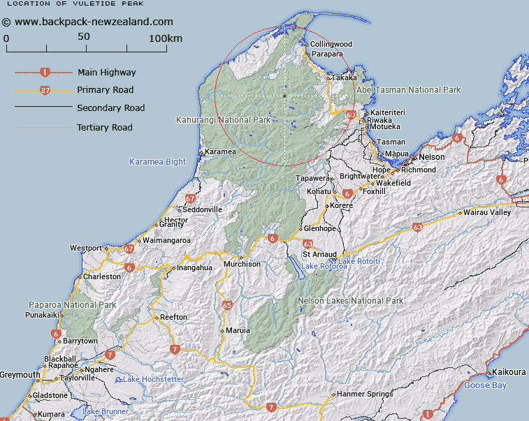
Map showing location of Yuletide Peak


LINZ description: Peak at the head of a double ridge between the forks of the Anatoki River, 2km East of Mount Douglas. Block VII Waingaro Survey District.
Latitude: -40.944524
Longitude: 172.562154
Northing: 5467308.9
Easting: 1563145.5
Land District: Nelson
Feat Type: Hill


Scroll down to see a more detailed road map and below that a topographical map showing the location of Yuletide Peak. The road map has been supplied by openstreetmap and the topographical map of Yuletide Peak has been supplied by Land Information New Zealand (LINZ).

Yes you can use the top static map for you school/university project or personal website with a link back. Contact me for any commercial use.

Yuletide Peak Map New Zealand


New Zealand places in our database
[ A ] [ B ] [ C ] [ D ] [ E ] [ F ] [ G ] [ H ] [ I ] [ J ] [ K ] [ L ] [ M ] [ N ] [ O ] [ P ] [ Q ] [ R ] [ S ] [ T ] [ U ] [ V ] [ W ] [ X ] [ Y ] [ Z ]


Closest 20 Hills to Yuletide Peak

The Needle ( 1.11km )   Mount Douglas ( 1.97km )   Trident ( 2.1km )   Anatoki Peak ( 2.47km )   Gladiator Peak ( 3.08km )   Calphurnia Peak ( 4.23km )   Clark Peak ( 4.91km )   Caesar Knob ( 5.13km )   Lead Hills ( 5.83km )   Slate River Peak ( 6.31km )   Mount Olympus ( 6.64km )   Paradise Peak ( 6.69km )   Brown Cow ( 7.29km )   Devil River Peak ( 7.73km )   The Pulpit ( 8.03km )   K?k?p? Peak ( 8.43km )   Mount Christmas ( 8.45km )   The Minaret ( 8.56km )   Mount Hardy ( 9.04km )   Red Peak ( 9.52km )   Brown Knob ( 9.98km )   Aorere Peak ( 10.53km )   Mount Snowden ( 10.61km )   Mount Snowdon ( 10.61km )   Waingaro Peak ( 10.99km )   Black Cow ( 11.44km )   Burnt Hill ( 11.55km )   Xenicus Peak ( 12.55km )   Mount Gibbs ( 12.6km )   Brown Hill ( 12.61km )   Peter Knob ( 12.89km )   Mount Inaccessible ( 13.63km )   Bushy Cone ( 14.14km )   Lookout Knob ( 14.36km )   Mount Cobb ( 14.45km )   Mount Benson ( 14.68km )   Mount Gouland ( 14.82km )   Mount Perry ( 15.1km )   Parapara Peak ( 15.29km )   Mount Lockett ( 15.3km )