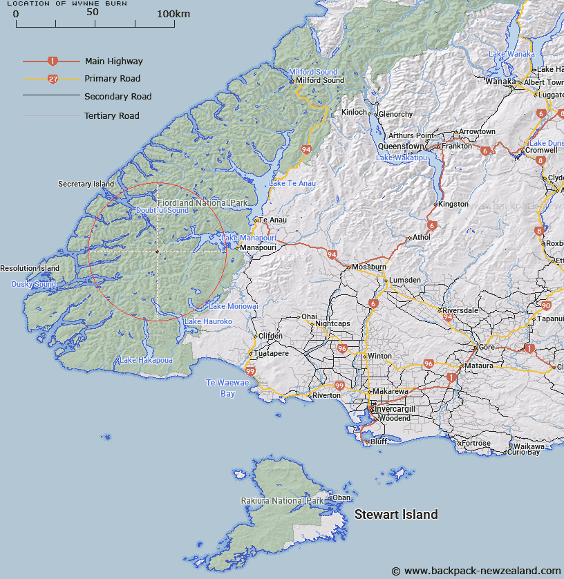
Map showing location of Wynne Burn


LINZ description: Stream flowing between Mount Memphis and Pinnacle into the Spey River
Latitude: -45.581448
Longitude: 167.170079
Northing: 4935900
Easting: 1145200
Land District: Southland
Feat Type: Stream


Scroll down to see a more detailed road map and below that a topographical map showing the location of Wynne Burn. The road map has been supplied by openstreetmap and the topographical map of Wynne Burn has been supplied by Land Information New Zealand (LINZ).

Yes you can use the top static map for you school/university project or personal website with a link back. Contact me for any commercial use.

Wynne Burn Map New Zealand


New Zealand places in our database
[ A ] [ B ] [ C ] [ D ] [ E ] [ F ] [ G ] [ H ] [ I ] [ J ] [ K ] [ L ] [ M ] [ N ] [ O ] [ P ] [ Q ] [ R ] [ S ] [ T ] [ U ] [ V ] [ W ] [ X ] [ Y ] [ Z ]


Closest 20 Streams to Wynne Burn

Cockburn Stream ( 1.04km )   Warren Burn ( 1.32km )   Waterfall Creek ( 2.72km )   Diamond Creek ( 2.83km )   Sholl Stream ( 4.52km )   Shott Stream ( 4.52km )   Seaforth River ( 4.77km )   Bypass Stream ( 4.84km )   Takahe Stream ( 4.84km )   Kintail Stream ( 4.88km )   Spey River ( 4.96km )   Emerald Stream ( 5.41km )   Dashwood Stream ( 6.25km )   Todd Burn ( 6.31km )   Percy Stream ( 8.34km )   Bessie Burn ( 8.62km )   Kenneth Burn ( 8.93km )   Lyvia River ( 8.94km )   Disaster Burn ( 9.59km )   Brae Burn ( 9.68km )   Deadwood Creek ( 10.29km )   Mica Burn ( 10.54km )   Stella Burn ( 10.97km )   Florence Stream North Branch ( 11.5km )   Wolfe Burn ( 11.85km )   Bishop Burn ( 13.62km )   Florence Stream ( 14.36km )   Jane Burn ( 14.84km )   Oonah Burn ( 15.46km )   Hauroko Burn ( 16.46km )   Macfarlane Stream ( 17.62km )   Roa Stream ( 17.74km )   Henry Burn ( 18.11km )   Elizabeth River ( 18.56km )   Herrick Creek ( 18.59km )   Awe Burn ( 19.67km )   Wekawai Stream ( 20.12km )   Jaquiery Stream ( 20.89km )   Gardner Burn ( 22.13km )   Grebe River ( 22.36km )