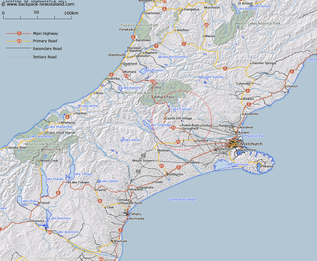
Map showing location of Windwhistle Hill


LINZ description: In Waimakariri Gorge vicinity, north of Waterfall Creek, 1.2km East by North-east of Patterson Hill. Kowai Survey District.
Latitude: -43.232762
Longitude: 171.9379
Northing: 5212789.3
Easting: 1513757.2
Land District: Canterbury
Feat Type: Hill


Scroll down to see a more detailed road map and below that a topographical map showing the location of Windwhistle Hill. The road map has been supplied by openstreetmap and the topographical map of Windwhistle Hill has been supplied by Land Information New Zealand (LINZ).

Yes you can use the top static map for you school/university project or personal website with a link back. Contact me for any commercial use.

Windwhistle Hill Map New Zealand


New Zealand places in our database
[ A ] [ B ] [ C ] [ D ] [ E ] [ F ] [ G ] [ H ] [ I ] [ J ] [ K ] [ L ] [ M ] [ N ] [ O ] [ P ] [ Q ] [ R ] [ S ] [ T ] [ U ] [ V ] [ W ] [ X ] [ Y ] [ Z ]


Closest 20 Hills to Windwhistle Hill

Paterson Hill ( 1.2km )   Patterson Hill ( 1.2km )   Bold Hill ( 3.88km )   Fosters Hill ( 3.9km )   Latter Hill ( 3.97km )   Wilson Hill ( 5km )   Black Hill ( 7.63km )   Otarama Peak ( 8.09km )   Caesars Hill ( 9.08km )   Back Peak ( 9.17km )   Mount Torlesse ( 9.74km )   Junction Peak ( 9.81km )   Nomans Land ( 10.8km )   Red Peak ( 11.32km )   Mount Rosa ( 11.41km )   Mount Oxford ( 12.03km )   Oxford Hill ( 12.78km )   The Puffer ( 13.2km )   View Hill ( 13.28km )   Castle Hill Peak ( 13.9km )   Prebble Hill ( 14.51km )   Broken Hill ( 15.35km )   Russell Peak ( 15.56km )   Gorge Hill ( 15.68km )   Chest Peak ( 15.87km )   Bullock Hill ( 16.11km )   Mount Saint Bernard ( 16.14km )   Foggy Peak ( 16.18km )   Gorge Hill ( 16.38km )   Mount Plenty ( 16.4km )   Mount Storm ( 16.51km )   Flock Hill ( 16.53km )   Purple Hill ( 17.1km )   Whale Hill ( 17.84km )   Castle Hill ( 18.06km )   Magog ( 18.23km )   Lake Hill ( 19.27km )   Ladbrooks Hill ( 19.32km )   Abners Head ( 19.36km )   Sugar Loaf ( 19.75km )