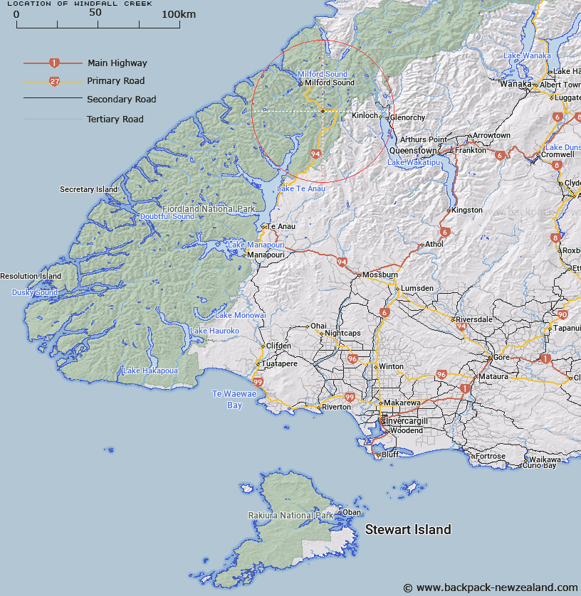
Map showing location of Windfall Creek


LINZ description: Stream rising 2km East of Mount Suter and flowing into the left bank of Hollyford River. Crossed by the Te Anau - Milfrod road, 92.6km from Te Anau. Greenstone Survey District.
Latitude: -44.816096
Longitude: 168.040191
Northing: 5025500
Easting: 1207839.3
Land District: Southland
Feat Type: Stream


Scroll down to see a more detailed road map and below that a topographical map showing the location of Windfall Creek. The road map has been supplied by openstreetmap and the topographical map of Windfall Creek has been supplied by Land Information New Zealand (LINZ).

Yes you can use the top static map for you school/university project or personal website with a link back. Contact me for any commercial use.

Windfall Creek Map New Zealand


New Zealand places in our database
[ A ] [ B ] [ C ] [ D ] [ E ] [ F ] [ G ] [ H ] [ I ] [ J ] [ K ] [ L ] [ M ] [ N ] [ O ] [ P ] [ Q ] [ R ] [ S ] [ T ] [ U ] [ V ] [ W ] [ X ] [ Y ] [ Z ]


Closest 20 Streams to Windfall Creek

Disappointment Creek ( 1.35km )   Falls Creek ( 2.72km )   Monkey Creek ( 3.02km )   Cirque Creek ( 4.25km )   Marian Creek ( 4.59km )   Melita Stream ( 5.3km )   Divide Creek ( 5.78km )   Homers River ( 6.5km )   Neale Burn ( 6.82km )   Mistake Creek ( 7.12km )   Pass Creek ( 7.44km )   Sunny Creek ( 7.89km )   Hut Creek ( 9.33km )   Caples Creek ( 9.43km )   Gifford Crack ( 9.54km )   Gifford Gap ( 9.54km )   Duck Creek ( 9.65km )   Roaring Creek ( 10.17km )   McKellar Branch;Greenstone River ( 10.35km )   Caples River ( 10.7km )   Esperance River ( 10.72km )   Cleddau River South Branch ( 10.8km )   Potters Creek ( 10.92km )   Plato Creek ( 11.03km )   Waterfall Creek ( 11.22km )   Cascade Creek ( 11.29km )   Gulliver River ( 12.02km )   Light-finger Creek ( 12.36km )   Slip Creek ( 12.39km )   Surprise Creek ( 12.46km )   Talbot River ( 12.64km )   Moraine Creek ( 13.01km )   The Chasm ( 13.07km )   Glade Burn ( 13.16km )   Donne River ( 13.25km )   Fraser Creek ( 13.28km )   Clinton River North Branch ( 14.07km )   Epidote Cataract ( 14.09km )   Clinton River ( 14.12km )   Joes River ( 14.15km )