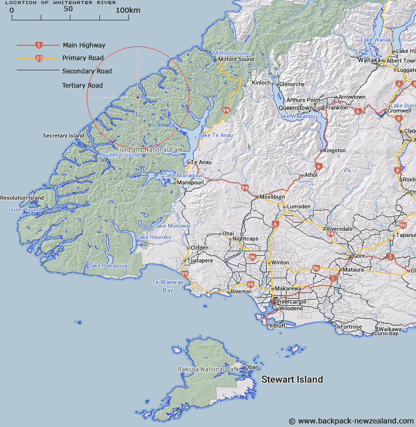
Map showing location of Whitewater River


LINZ description: River flowing into western side of George Sound, 5km North-west of the entrance to South West Arm.
Latitude: -44.94398
Longitude: 167.336946
Northing: 5007650
Easting: 1153228.5
Land District: Southland
Feat Type: Stream


Scroll down to see a more detailed road map and below that a topographical map showing the location of Whitewater River. The road map has been supplied by openstreetmap and the topographical map of Whitewater River has been supplied by Land Information New Zealand (LINZ).

Yes you can use the top static map for you school/university project or personal website with a link back. Contact me for any commercial use.

Whitewater River Map New Zealand


New Zealand places in our database
[ A ] [ B ] [ C ] [ D ] [ E ] [ F ] [ G ] [ H ] [ I ] [ J ] [ K ] [ L ] [ M ] [ N ] [ O ] [ P ] [ Q ] [ R ] [ S ] [ T ] [ U ] [ V ] [ W ] [ X ] [ Y ] [ Z ]


Closest 20 Streams to Whitewater River

Madman Stream ( 6.61km )   Trophy Burn ( 7.55km )   Overlander Stream ( 8.18km )   Expectation Stream ( 8.45km )   Ethne Stream ( 8.77km )   Nita Creek ( 9.48km )   Katherine Creek ( 9.67km )   Feldspar Stream ( 10.48km )   George River ( 12.69km )   McDonald Creek ( 12.92km )   Edith River ( 13.18km )   Stillwater River ( 15.97km )   Large Burn ( 16.55km )   Rugged Burn ( 16.75km )   West Burn ( 16.75km )   Stina Burn ( 17.89km )   Wapiti River ( 18.19km )   Rugged Burn ( 18.19km )   Pitt River ( 18.37km )   Juno River ( 18.57km )   Campbell Creek ( 18.65km )   Wild Natives River ( 19.39km )   Barrier Stream ( 19.57km )   Irene River ( 19.64km )   Midnight Creek ( 20.08km )   Pisgah Creek ( 20.35km )   Canyon Creek ( 21.57km )   Doon River ( 22km )   Bernard Burn ( 22.21km )   Taheke Creek ( 24.41km )   Junction Burn ( 24.89km )   Henderson Burn ( 25.92km )   Jennings Burn ( 26.08km )   Robb Creek ( 26.26km )   Inaccessible Creek ( 26.4km )   Kakapo Creek ( 26.86km )   Austral Creek ( 26.95km )   McIvor Burn ( 27.3km )   Windward River ( 27.43km )   Glaisnock River ( 27.62km )