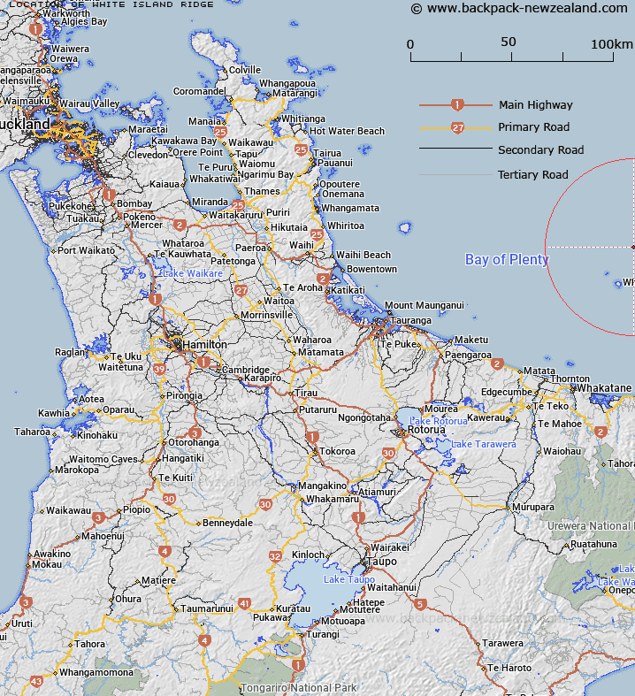
Map showing location of White Island Ridge


LINZ description: 37°30.18′S Latitude, 177°09.70′E Longitude to 37°16.90'S Latitude, 177°23.54′E Longitude. A southwest-northeast trending undersea ridge that extends for 32km northwards from Whakaari / White Island, perpendicular to the regional slope. The crest of the ridge is between 500m and 1500m deep.
Latitude: -37.367257
Longitude: 177.249326
Northing: 5855906.3
Easting: 1976353.7
Land District: South Auckland
Feat Type: Ridge


Scroll down to see a more detailed road map and below that a topographical map showing the location of White Island Ridge. The road map has been supplied by openstreetmap and the topographical map of White Island Ridge has been supplied by Land Information New Zealand (LINZ).

Yes you can use the top static map for you school/university project or personal website with a link back. Contact me for any commercial use.

White Island Ridge Map New Zealand


New Zealand places in our database
[ A ] [ B ] [ C ] [ D ] [ E ] [ F ] [ G ] [ H ] [ I ] [ J ] [ K ] [ L ] [ M ] [ N ] [ O ] [ P ] [ Q ] [ R ] [ S ] [ T ] [ U ] [ V ] [ W ] [ X ] [ Y ] [ Z ]


Closest 20 Ridges to White Island Ridge

Whakaari / White Island Ridge ( 0km )   White Island Ridge ( 0km )   R?rima Ridge ( 31.77km )   Paerata Ridge ( 71.58km )   Lottin Ridge ( 92.25km )   Te Hanga Ridge ( 126.6km )   Rakaiwhaia Ridge ( 127.69km )   Paewhakataratara Ridge ( 130.44km )   Matairangi Ridge ( 131.22km )   Bald Spur ( 135.71km )   Manawaru Ridge ( 137.47km )   Te Kopenga or Rocky Ridge ( 138.27km )   Te Tarata Ridge ( 139.28km )   Te Mapara Ridge ( 139.59km )   The Pinnacles ( 139.88km )   Kahunui Ridge ( 140.14km )   Papatotara Ridge ( 141.22km )   Tahunapiripiri Ridge ( 146.45km )   Ngaheni ( 150.79km )   Ngaheni Ridge ( 150.93km )   Haowhenua Ridge ( 151.23km )   Matanunui Ridge ( 152.79km )   Whakaneke Spur ( 157.15km )   Simon Spur ( 189.21km )   The Hogs Back ( 209.33km )   Raepahu Ridge ( 209.58km )   Darkys Spur ( 212.2km )   Te Waka-o-Ng?rangikataka Ridge ( 212.32km )   Camp Spur ( 220.62km )   Ihaka Spur ( 221.82km )   Dicks Spur ( 223.21km )   Pawerawera Ridge ( 224.16km )   Pinnacle Spur ( 224.31km )   Makahu Spur ( 225.5km )   Dons Spur ( 226.41km )   Taurangatao Spur ( 226.49km )   Coxcomb Spur ( 227.37km )   Back Ridge ( 227.43km )   Spion Kop ( 228.46km )   Matauria Ridge ( 228.93km )