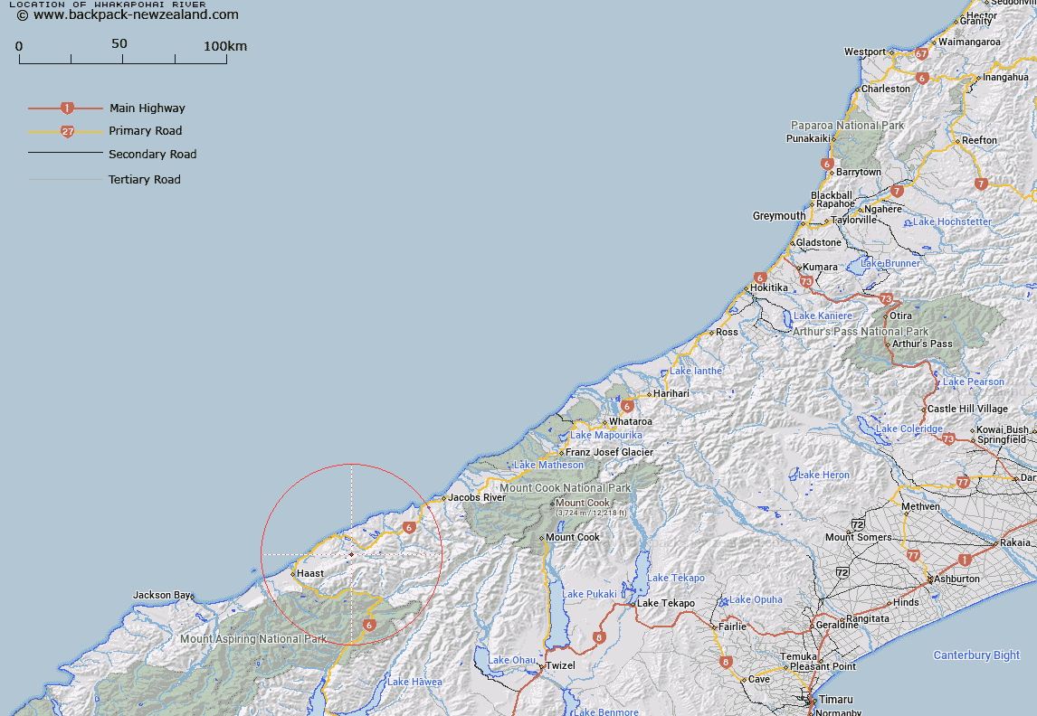
Map showing location of Whakapohai River


LINZ description: River rising under the Mataketake Range and flowing generally north west to the West Coast adjacent to Moerak River (Blue River).
Latitude: -43.802286
Longitude: 169.291751
Northing: 5143400
Easting: 1301700
Land District: Westland
Feat Type: Stream


Scroll down to see a more detailed road map and below that a topographical map showing the location of Whakapohai River. The road map has been supplied by openstreetmap and the topographical map of Whakapohai River has been supplied by Land Information New Zealand (LINZ).

Yes you can use the top static map for you school/university project or personal website with a link back. Contact me for any commercial use.

Whakapohai River Map New Zealand


New Zealand places in our database
[ A ] [ B ] [ C ] [ D ] [ E ] [ F ] [ G ] [ H ] [ I ] [ J ] [ K ] [ L ] [ M ] [ N ] [ O ] [ P ] [ Q ] [ R ] [ S ] [ T ] [ U ] [ V ] [ W ] [ X ] [ Y ] [ Z ]


Closest 20 Streams to Whakapohai River

Wrong Creek ( 1.87km )   Cedar Creek ( 2.14km )   Chasm Creek ( 3.22km )   Granite Creek ( 3.56km )   Docherty Creek ( 3.74km )   Sundown Creek ( 4.28km )   Pepene Creek ( 4.71km )   Summit Creek ( 4.99km )   Arnott Water ( 5.01km )   Access Creek ( 5.14km )   Boulder Creek ( 5.35km )   Monro Mistake ( 5.42km )   Deep Creek ( 5.63km )   Twenty-one Mile Creek ( 5.76km )   Mimi Creek ( 6.1km )   Friends Creek ( 6.47km )   Rocky River ( 6.5km )   Moeraki River ( 6.74km )   Quad Creek ( 6.77km )   Windbag Creek ( 6.82km )   Robinson Creek ( 7km )   Kaka Creek ( 7.56km )   Mathias Creek ( 7.83km )   Matthies Creek ( 7.83km )   Anybody Creek ( 7.9km )   Cole Creek ( 7.94km )   Bullock Creek ( 7.94km )   Hostel Creek ( 8.03km )   Mistake Creek ( 8.21km )   Windrow Creek ( 8.26km )   Waita River ( 8.4km )   Dawn Creek ( 8.87km )   Fox Creek ( 8.91km )   Simon Slew ( 8.92km )   Konini Creek ( 9.14km )   Coal Creek ( 9.27km )   Waterfall Creek ( 9.31km )   Venture Creek ( 9.31km )   Cement Creek ( 9.44km )   Panel Creek ( 9.45km )