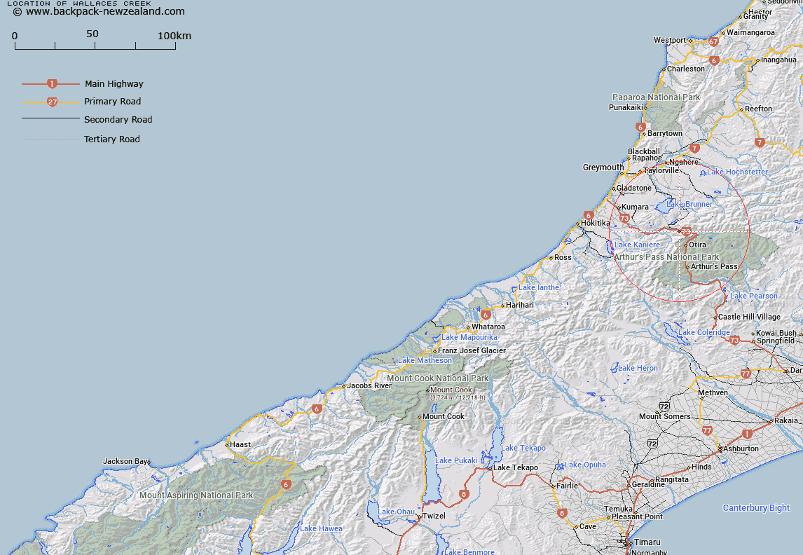
Map showing location of Wallaces Creek


LINZ description: Tributary of Taramakau River between Humphries Creek and Norths Creek
Latitude: -42.757722
Longitude: 171.522447
Northing: 5265030.6
Easting: 1479093.9
Land District: Westland
Feat Type: Stream


Scroll down to see a more detailed road map and below that a topographical map showing the location of Wallaces Creek. The road map has been supplied by openstreetmap and the topographical map of Wallaces Creek has been supplied by Land Information New Zealand (LINZ).

Yes you can use the top static map for you school/university project or personal website with a link back. Contact me for any commercial use.

Wallaces Creek Map New Zealand


New Zealand places in our database
[ A ] [ B ] [ C ] [ D ] [ E ] [ F ] [ G ] [ H ] [ I ] [ J ] [ K ] [ L ] [ M ] [ N ] [ O ] [ P ] [ Q ] [ R ] [ S ] [ T ] [ U ] [ V ] [ W ] [ X ] [ Y ] [ Z ]


Closest 20 Streams to Wallaces Creek

Norths Creek ( 0.98km )   Humphries Creek ( 1.17km )   Second Creek ( 1.63km )   Jacksons Creek ( 2.68km )   McDermotts Creek ( 2.99km )   Main Creek ( 3.08km )   Reef Creek ( 3.41km )   Nellies Creek ( 3.41km )   Debenham Creek ( 3.58km )   Seven Mile Creek ( 3.6km )   One Mile Creek ( 4.74km )   Rocky Creek ( 5.37km )   Homestead Creek ( 5.48km )   Hut Creek ( 5.64km )   Kellys Creek ( 6.01km )   Cheeseman Creek ( 6.09km )   Harley Creek ( 6.16km )   Dry Creek ( 6.22km )   Evans Creek ( 6.83km )   Camp Creek ( 7.45km )   Macs Creek ( 7.62km )   Hunts Creek ( 7.73km )   Freds Creek ( 8.29km )   Poerua River ( 8.45km )   Scottys Creek ( 8.61km )   Goat Creek ( 8.7km )   Paratu Stream ( 9km )   Freitas Creek ( 9.01km )   Lagoon Creek ( 9.03km )   Alexander Creek ( 9.05km )   Brums Creek ( 9.37km )   Brown River ( 9.52km )   Twin Slip Creeks ( 9.69km )   Lows Creek ( 9.69km )   Mosquito Creek ( 10.12km )   Rubieslaw Creek ( 10.23km )   Thirsty Creek ( 10.34km )   Clear Creek ( 10.4km )   Foggy Creek ( 10.41km )   Holts Creek ( 10.6km )