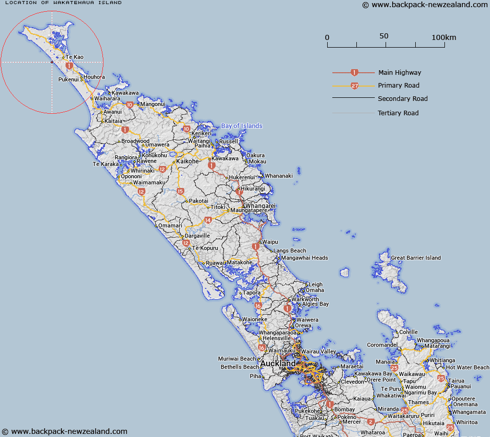
Map showing location of Wakatehāua Island


LINZ description: A small coastal island at height 7m located just north of midway along Te Oneroa-a-Tōhē / Ninety Mile Beach. Feature shown on: NZMS260 N03; NZTopo50-AU25 900617.
Latitude: -34.685889
Longitude: 172.889556
Northing: 6161784.2
Easting: 1589883.4
Land District: North Auckland
Feat Type: Island


Scroll down to see a more detailed road map and below that a topographical map showing the location of Wakatehāua Island. The road map has been supplied by openstreetmap and the topographical map of Wakatehāua Island has been supplied by Land Information New Zealand (LINZ).

Yes you can use the top static map for you school/university project or personal website with a link back. Contact me for any commercial use.

Wakatehāua Island Map New Zealand


New Zealand places in our database
[ A ] [ B ] [ C ] [ D ] [ E ] [ F ] [ G ] [ H ] [ I ] [ J ] [ K ] [ L ] [ M ] [ N ] [ O ] [ P ] [ Q ] [ R ] [ S ] [ T ] [ U ] [ V ] [ W ] [ X ] [ Y ] [ Z ]


Closest 20 Islands to Wakatehāua Island

Motupia Island ( 12.18km )   Matapia ( 12.18km )   Kaipohue Island ( 13.13km )   Dog Island (Motuwhangaikirehe Island) ( 18.94km )   Motu Puruhi Island ( 25.54km )   Simmonds Islands ( 25.57km )   Terakautuhaka Island ( 25.6km )   Motuotuna Island ( 26.62km )   Tokoroa Island ( 28.15km )   Pananahe Island ( 29.64km )   Pananehe Island ( 29.64km )   Taupiri Island ( 31.52km )   Motuopao Island ( 33.5km )   Murimotu Island ( 33.63km )   Motutara Rocks ( 40.78km )   Moturoa Island ( 42.91km )   Scheigis Rock ( 43.43km )   Motutapu Island ( 44.13km )   Green Island ( 44.13km )   Walker Island ( 44.31km )   T?huahua-Paopao-Karoro Island ( 44.31km )   Sugarloaf Island ( 44.48km )   Moturoa Islands ( 44.52km )   Rat Island ( 44.66km )   Tangihana Shell Bank ( 45.04km )   Whale Island ( 46.05km )   Tuputupungahau Island ( 46.05km )   Rocky Island ( 47.14km )   Mangrove Island ( 47.29km )   Omaia Island ( 47.83km )   Okatakata Islands ( 48.6km )   Motukaraka Island ( 49.11km )   Puketu Island ( 59.95km )   Tekura Rocks ( 67.99km )   Motutara Island ( 68.08km )   Paewhenua Island ( 70.04km )   Rahui Rock ( 72.88km )   Wekarua Island (Sugar Loaf) ( 75.45km )   Bird Rock ( 77.69km )   Cone Rock (Horoiwi) ( 78.63km )