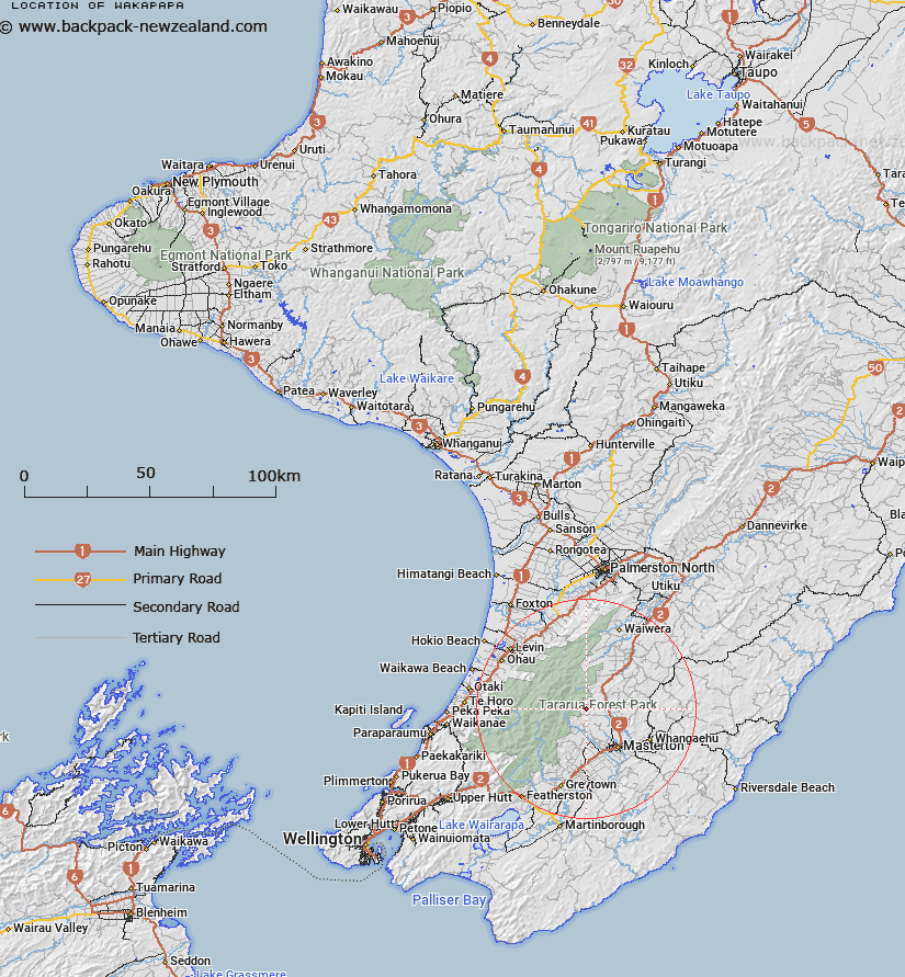
Map showing location of Wakapapa


LINZ description: Approximately 16km north-west of Masterton. East of Blue Range.
Latitude: -40.820868
Longitude: 175.54942
Northing: 5478000
Easting: 1815000
Land District: Wellington
Feat Type: Trig Station


Scroll down to see a more detailed road map and below that a topographical map showing the location of Wakapapa. The road map has been supplied by openstreetmap and the topographical map of Wakapapa has been supplied by Land Information New Zealand (LINZ).

Yes you can use the top static map for you school/university project or personal website with a link back. Contact me for any commercial use.

Wakapapa Map New Zealand


New Zealand places in our database
[ A ] [ B ] [ C ] [ D ] [ E ] [ F ] [ G ] [ H ] [ I ] [ J ] [ K ] [ L ] [ M ] [ N ] [ O ] [ P ] [ Q ] [ R ] [ S ] [ T ] [ U ] [ V ] [ W ] [ X ] [ Y ] [ Z ]


Closest 20 Trig Stations to Wakapapa

Koromakau ( 8.86km )   Koromikau ( 8.86km )   Mount Dundas ( 13.67km )   Pukemoremore ( 14.05km )   Mangatarere ( 14.45km )   Ruapai ( 15.25km )   Ruapae ( 15.25km )   Ngapuketurua ( 18.2km )   Ngapuketarua ( 18.2km )   Taramia ( 22.03km )   Taramea ( 22.03km )   Dennan ( 26.67km )   Tauwharenikau ( 30.68km )   Tauherenikau ( 30.68km )   Pariwhariki ( 34.99km )   Pariwhaririki ( 34.99km )   Pukekowai ( 42.83km )   Pukekowhai ( 42.83km )   Waimanga South ( 43.08km )   Waimangu South ( 43.08km )   Waimanga North ( 43.3km )   Waimangu North ( 43.3km )   Oruarongo ( 43.97km )   Tunnel ( 44.76km )   Kaitoke ( 44.76km )   Mangaroa ( 44.76km )   Mangaroa ( 50km )   Whareroa ( 50.49km )   Wainui (Whareroa) ( 50.49km )   Pukenikau ( 50.86km )   Pukemiki ( 50.86km )   Tuteremoana ( 53.43km )   Pakowai ( 55.15km )   Pakowhai ( 55.15km )   Bawbaw ( 56.39km )   Kaikaikuri ( 56.49km )   Kaikakuri ( 56.49km )   Whakapuni ( 59.2km )   Wakapuni ( 59.2km )   Wairongoma ( 59.29km )