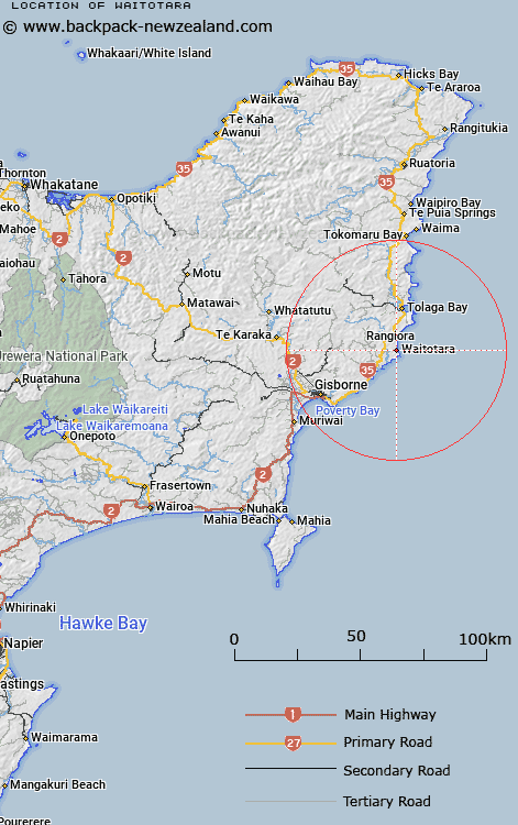
Map showing location of Waitotara
LINZ description: An old locality name depicted on Gisborne ML 538 (1889), used as a boundary reference for the sale of Putai Block. NZTopo50-BG44 608240
Latitude: -38.513223
Longitude: 178.284266
Northing: 5723985.3
Easting: 2060840.2
Land District: Gisborne
Feat Type: Locality
Latitude: -38.513223
Longitude: 178.284266
Northing: 5723985.3
Easting: 2060840.2
Land District: Gisborne
Feat Type: Locality

Scroll down to see a more detailed road map and below that a topographical map showing the location of Waitotara. The road map has been supplied by openstreetmap and the topographical map of Waitotara has been supplied by Land Information New Zealand (LINZ).
Yes you can use the top static map for you school/university project or personal website with a link back. Contact me for any commercial use.
[ A ] [ B ] [ C ] [ D ] [ E ] [ F ] [ G ] [ H ] [ I ] [ J ] [ K ] [ L ] [ M ] [ N ] [ O ] [ P ] [ Q ] [ R ] [ S ] [ T ] [ U ] [ V ] [ W ] [ X ] [ Y ] [ Z ]