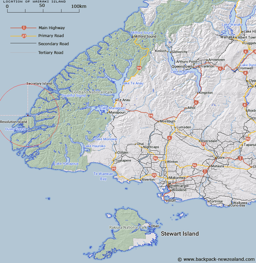
Map showing location of Wairaki Island


LINZ description: One of two islands commonly known as the 'Outer Gilbert Islands' south of Breaksea Island, Fiordland
Latitude: -45.592486
Longitude: 166.636754
Northing: 4931500
Easting: 1103695.9
Land District: Southland
Feat Type: Island


Scroll down to see a more detailed road map and below that a topographical map showing the location of Wairaki Island. The road map has been supplied by openstreetmap and the topographical map of Wairaki Island has been supplied by Land Information New Zealand (LINZ).

Yes you can use the top static map for you school/university project or personal website with a link back. Contact me for any commercial use.

Wairaki Island Map New Zealand


New Zealand places in our database
[ A ] [ B ] [ C ] [ D ] [ E ] [ F ] [ G ] [ H ] [ I ] [ J ] [ K ] [ L ] [ M ] [ N ] [ O ] [ P ] [ Q ] [ R ] [ S ] [ T ] [ U ] [ V ] [ W ] [ X ] [ Y ] [ Z ]


Closest 20 Islands to Wairaki Island

H?wea Island ( 0.54km )   Hawea Island ( 0.54km )   Breaksea Island ( 1.4km )   Gilbert Islands ( 1.74km )   Entry Island ( 5.11km )   Resolution Island ( 9.37km )   Harbour Islands ( 10.48km )   John Islands ( 13.66km )   Pigeon Island ( 14.3km )   Parrot Island ( 15.1km )   Oke Island ( 17.6km )   Front Islands ( 17.74km )   Useless Islands ( 18.06km )   Petrel Islands ( 18.55km )   Shag Islands ( 18.86km )   Seal Rock ( 18.97km )   Station Island ( 19.32km )   Long Island ( 19.36km )   Entry Island ( 19.75km )   Passage Islands ( 19.8km )   Prove Island ( 19.87km )   Two Sisters ( 20.12km )   Garnet Rock ( 20.2km )   Anchor Island ( 20.37km )   Stop Island ( 20.66km )   Indian Island ( 20.7km )   Thrum Cap ( 21.55km )   Cooper Island ( 21.56km )   Curlew Island ( 21.78km )   Nomans Island ( 21.91km )   Many Islands ( 21.96km )   Crayfish Island ( 22.6km )   Heron Island ( 22.63km )   Towing Head Islands ( 23.01km )   Seal Islands ( 24.02km )   Girlies Island ( 27.06km )   Utah Island ( 39.15km )   Hares Ears ( 39.21km )   Bauza Island ( 39.93km )   Station Islet ( 40.62km )