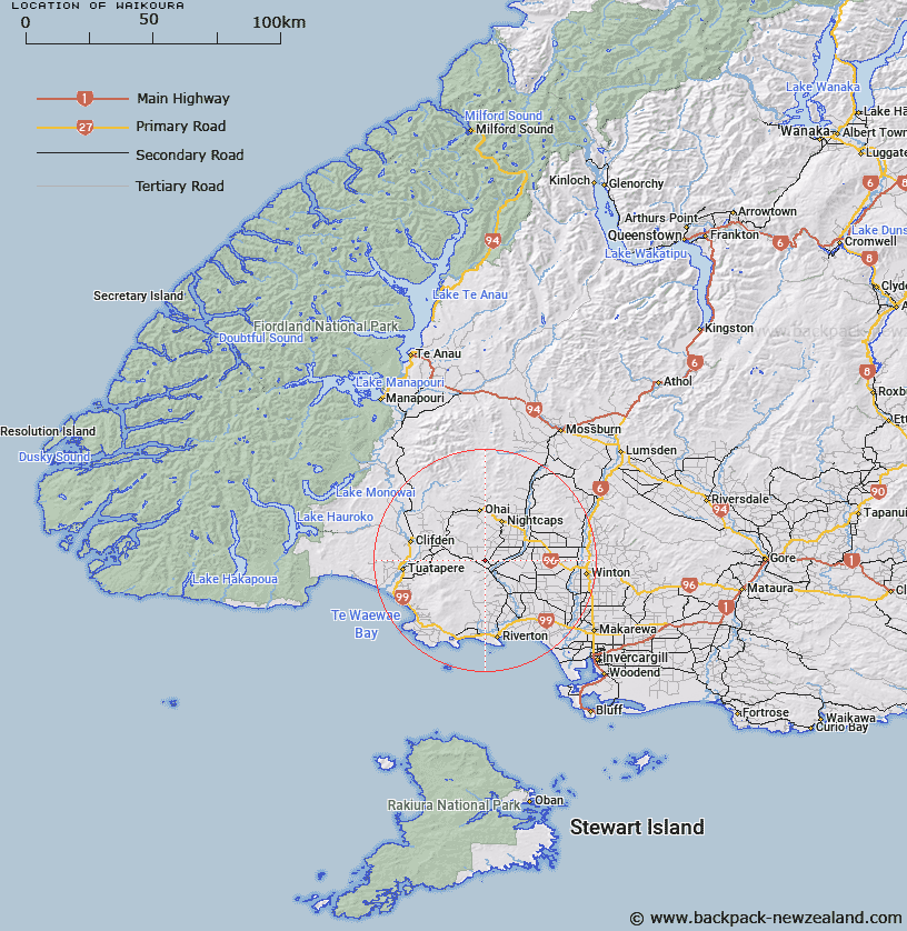
Map showing location of Waikoura
LINZ description: A locality approximately 45km northwest of Invercargill. Feature shown on: NZMS260 D45 Edition 1 1985; NZTopo50-CF09 115827. Alteration from Waikouro (recorded name).
Latitude: -46.098764
Longitude: 167.973584
Northing: 4882685
Easting: 1211505
Land District: Southland
Feat Type: Locality
Latitude: -46.098764
Longitude: 167.973584
Northing: 4882685
Easting: 1211505
Land District: Southland
Feat Type: Locality

Scroll down to see a more detailed road map and below that a topographical map showing the location of Waikoura. The road map has been supplied by openstreetmap and the topographical map of Waikoura has been supplied by Land Information New Zealand (LINZ).
Yes you can use the top static map for you school/university project or personal website with a link back. Contact me for any commercial use.
[ A ] [ B ] [ C ] [ D ] [ E ] [ F ] [ G ] [ H ] [ I ] [ J ] [ K ] [ L ] [ M ] [ N ] [ O ] [ P ] [ Q ] [ R ] [ S ] [ T ] [ U ] [ V ] [ W ] [ X ] [ Y ] [ Z ]