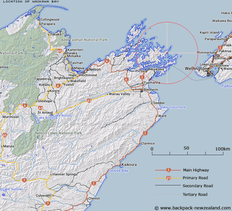
Map showing location of Waikawa Bay


LINZ description: For bay in outer part of Queen Charlotte Sound, lying to north-west of Motuara Island.
Latitude: -41.070723
Longitude: 174.265883
Northing: 5452620
Easting: 1706350
Land District: Marlborough
Feat Type: Bay


Scroll down to see a more detailed road map and below that a topographical map showing the location of Waikawa Bay. The road map has been supplied by openstreetmap and the topographical map of Waikawa Bay has been supplied by Land Information New Zealand (LINZ).

Yes you can use the top static map for you school/university project or personal website with a link back. Contact me for any commercial use.

Waikawa Bay Map New Zealand


New Zealand places in our database
[ A ] [ B ] [ C ] [ D ] [ E ] [ F ] [ G ] [ H ] [ I ] [ J ] [ K ] [ L ] [ M ] [ N ] [ O ] [ P ] [ Q ] [ R ] [ S ] [ T ] [ U ] [ V ] [ W ] [ X ] [ Y ] [ Z ]


Closest 20 Bays to Waikawa Bay

Cannibal Cove ( 1.34km )   Anakakata Bay ( 3.24km )   Meretoto / Ship Cove ( 3.42km )   Meretoto ( 3.42km )   Te Ruatarore ( 4.46km )   Waimatete Bay ( 4.94km )   Te Anam?hanga / Port Gore ( 5.89km )   Port Gore ( 5.89km )   Resolution Bay ( 6.87km )   Tunnel Bay ( 7.13km )   Onehunga Bay ( 8.03km )   Melville Cove ( 8.34km )   Kakaho Bay ( 8.53km )   Anatohia Bay ( 8.54km )   Pig Bay ( 8.73km )   Tawa Bay ( 8.79km )   Umukorora Bay ( 8.83km )   Te Huahua Bay ( 9.12km )   Oamaru Bay ( 9.2km )   East Bay ( 9.62km )   Papakura Bay ( 10.09km )   Endeavour Inlet ( 10.18km )   Ngakuta Bay ( 10.51km )   Wharekupenga Bay ( 10.54km )   Umukuri Bay ( 10.6km )   Haumai Bay ( 10.66km )   Waitui Bay ( 10.66km )   Fitzgerald Bay ( 10.71km )   Ruapara Bay ( 10.75km )   Big Bay ( 10.8km )   Papakaraka Bay ( 11.28km )   Onauku Bay ( 11.37km )   Onepipi Bay ( 11.43km )   Camp Bay ( 11.6km )   Otanerau Bay ( 11.6km )   Mokopeke Bay ( 11.66km )   Wharehunga Bay ( 11.77km )   Bakers Bay ( 11.95km )   Puriri Bay ( 12.26km )   Deep Bay ( 12.32km )