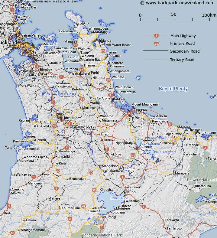
Map showing location of Waerenga/Mission Bay


LINZ description: Located on the northeast shore of Lake Rotorua/Te Rotorua nui ā Kahumatamomoe. NZMS260 U15 005461
Latitude: -38.040719
Longitude: 176.307863
Northing: 5784500
Easting: 1890300
Land District: South Auckland
Feat Type: Bay


Scroll down to see a more detailed road map and below that a topographical map showing the location of Waerenga/Mission Bay. The road map has been supplied by openstreetmap and the topographical map of Waerenga/Mission Bay has been supplied by Land Information New Zealand (LINZ).

Yes you can use the top static map for you school/university project or personal website with a link back. Contact me for any commercial use.

Waerenga/Mission Bay Map New Zealand


New Zealand places in our database
[ A ] [ B ] [ C ] [ D ] [ E ] [ F ] [ G ] [ H ] [ I ] [ J ] [ K ] [ L ] [ M ] [ N ] [ O ] [ P ] [ Q ] [ R ] [ S ] [ T ] [ U ] [ V ] [ W ] [ X ] [ Y ] [ Z ]


Closest 20 Bays to Waerenga/Mission Bay

?kawa Bay ( 2.54km )   Okawa Bay ( 2.54km )   Waipuna Bay ( 2.64km )   Wairau Bay ( 3.43km )   Whangamarino Bay ( 3.58km )   ?kere Inlet ( 3.69km )   Okere Inlet ( 3.69km )   Te P?hue Bay ( 3.7km )   Pohue Bay ( 3.7km )   Te Weta Bay ( 3.7km )   Kaikait?huna Bay ( 4.28km )   T?moana Bay ( 4.5km )   Wharetata Bay ( 5.87km )   Te T? Bay ( 6.17km )   Te Ti Bay ( 6.17km )   Pounamunui Bay ( 6.23km )   ?taramarae Bay ( 6.26km )   Te Karaka Bay ( 6.3km )   Onepoto Bay ( 6.43km )   Te Matawera Bay ( 6.44km )   Manup?rua Bay ( 6.68km )   Te K?ramuramu Bay ( 6.99km )   Puhirua Bay ( 6.99km )   Te Arero Bay ( 7.64km )   Te ?rero Bay ( 7.64km )   Hannahs Bay ( 7.93km )   Waikawau/Hannahs Bay ( 7.93km )   Waimihia Bay ( 8.07km )   ?kahutoroa Bay ( 8.08km )   Tauarau Bay ( 8.4km )   Waitet? Bay ( 8.71km )   Waingaehe/Holdens Bay ( 8.77km )   Holdens Bay ( 8.77km )   Parawai Bay ( 8.98km )   Tapuaekura Bay ( 8.99km )   Paripari te tai Bay ( 9.15km )   Hauparu Bay ( 9.44km )   Tokerau Bay ( 9.71km )   ?whatiura Bay ( 9.74km )   Pour?kau Bay ( 9.96km )