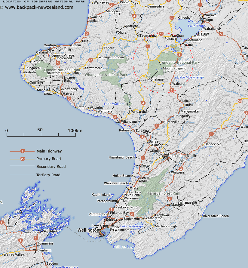
Map showing location of Tongariro National Park
LINZ description: Tongariro National Park is located in the central North Island of New Zealand. It is the closest national park to Auckland, New Zealands largest city, and is easily accessible from State Highway 1. The nearest towns are Turangi, National Park and Ohakune
Latitude: -39.211389
Longitude: 175.583056
Northing: 5656585.6
Easting: 1823019.6
Land District: Wellington
Feat Type: National Park
Latitude: -39.211389
Longitude: 175.583056
Northing: 5656585.6
Easting: 1823019.6
Land District: Wellington
Feat Type: National Park

Scroll down to see a more detailed road map and below that a topographical map showing the location of Tongariro National Park. The road map has been supplied by openstreetmap and the topographical map of Tongariro National Park has been supplied by Land Information New Zealand (LINZ).
Yes you can use the top static map for you school/university project or personal website with a link back. Contact me for any commercial use.
[ A ] [ B ] [ C ] [ D ] [ E ] [ F ] [ G ] [ H ] [ I ] [ J ] [ K ] [ L ] [ M ] [ N ] [ O ] [ P ] [ Q ] [ R ] [ S ] [ T ] [ U ] [ V ] [ W ] [ X ] [ Y ] [ Z ]