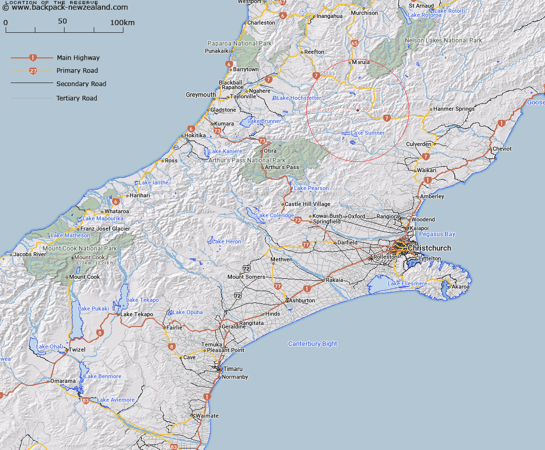
Map showing location of The Reserve


LINZ description: Flat clearing beside the Doubtful River about 5km upstream from the confluence of that river with the Boyle River.
Latitude: -42.534671
Longitude: 172.28153
Northing: 5290607
Easting: 1540998.6
Land District: Canterbury
Feat Type: Flat


Scroll down to see a more detailed road map and below that a topographical map showing the location of The Reserve. The road map has been supplied by openstreetmap and the topographical map of The Reserve has been supplied by Land Information New Zealand (LINZ).

Yes you can use the top static map for you school/university project or personal website with a link back. Contact me for any commercial use.

The Reserve Map New Zealand


New Zealand places in our database
[ A ] [ B ] [ C ] [ D ] [ E ] [ F ] [ G ] [ H ] [ I ] [ J ] [ K ] [ L ] [ M ] [ N ] [ O ] [ P ] [ Q ] [ R ] [ S ] [ T ] [ U ] [ V ] [ W ] [ X ] [ Y ] [ Z ]


Closest 20 Flats to The Reserve

The Reserve ( 0km )   Phantom Flat ( 6.36km )   St Jacobs Flat ( 8.45km )   Speargrass Flat ( 17.16km )   Palmer Flat ( 19.59km )   Lynches Flat ( 21.23km )   Hospital Flat ( 21.49km )   Matagouri Flat ( 26.72km )   The Terraces ( 29.67km )   McIntosh Flat ( 29.67km )   The Racecourse ( 31.46km )   Ada Flat ( 34.76km )   Hanmer Plain ( 38.01km )   Glenrae Flat ( 38.69km )   Flagstaff Flat ( 41.88km )   Hamers Flat ( 45.21km )   Jims Flat ( 46.78km )   Stag Flat ( 46.97km )   Bottom Flat ( 48.46km )   Griffin Flat ( 49.36km )   Mackleys Plain ( 50km )   Emu Plain ( 51.99km )   Commissioners Flat ( 53km )   Rabbit Flat ( 53.7km )   Fox Flat ( 54.35km )   Aeroplane Flat ( 54.36km )   Ikamatua Plain ( 54.92km )   Pig Flat ( 57.07km )   Antonios Flat ( 57.12km )   The Lazyman ( 57.22km )   Soldiers Flat ( 57.7km )   Horse Terrace ( 58.34km )   Murty Flat ( 58.52km )   Mammoth Flat ( 58.84km )   Windfall Flat ( 58.98km )   Hallelujah Flat ( 59.07km )   Neilson Flat ( 59.16km )   McHardy Flat ( 59.48km )   Old Man Flat ( 60.41km )   Ohinetakitaki Plain ( 63.85km )