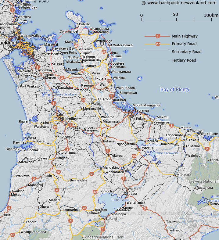
Map showing location of Te Puru
LINZ description: Town and stream in Thames County situated approximately 7 miles north of Thames.
Latitude: -37.045905
Longitude: 175.519851
Northing: 5897065.4
Easting: 1824091.6
Land District: South Auckland
Feat Type: Locality
Latitude: -37.045905
Longitude: 175.519851
Northing: 5897065.4
Easting: 1824091.6
Land District: South Auckland
Feat Type: Locality

Scroll down to see a more detailed road map and below that a topographical map showing the location of Te Puru. The road map has been supplied by openstreetmap and the topographical map of Te Puru has been supplied by Land Information New Zealand (LINZ).
Yes you can use the top static map for you school/university project or personal website with a link back. Contact me for any commercial use.
[ A ] [ B ] [ C ] [ D ] [ E ] [ F ] [ G ] [ H ] [ I ] [ J ] [ K ] [ L ] [ M ] [ N ] [ O ] [ P ] [ Q ] [ R ] [ S ] [ T ] [ U ] [ V ] [ W ] [ X ] [ Y ] [ Z ]