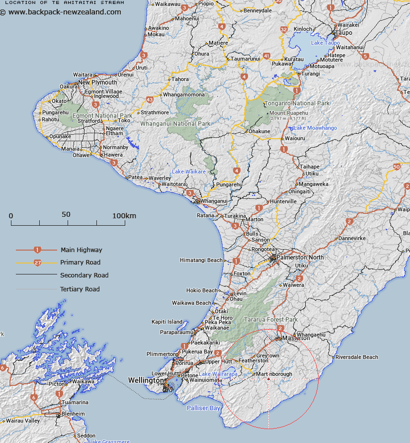
Map showing location of Te Ahitaitai Stream


LINZ description: Feature shown on: NZMS260 S27 Edition 1 1980
Latitude: -41.248889
Longitude: 175.573417
Northing: 5430419.5
Easting: 1815621.7
Land District: Wellington
Feat Type: Stream


Scroll down to see a more detailed road map and below that a topographical map showing the location of Te Ahitaitai Stream. The road map has been supplied by openstreetmap and the topographical map of Te Ahitaitai Stream has been supplied by Land Information New Zealand (LINZ).

Yes you can use the top static map for you school/university project or personal website with a link back. Contact me for any commercial use.
Te Ahitaitai Stream Map New Zealand


New Zealand places in our database
[ A ] [ B ] [ C ] [ D ] [ E ] [ F ] [ G ] [ H ] [ I ] [ J ] [ K ] [ L ] [ M ] [ N ] [ O ] [ P ] [ Q ] [ R ] [ S ] [ T ] [ U ] [ V ] [ W ] [ X ] [ Y ] [ Z ]


Closest 20 Streams to Te Ahitaitai Stream

Ngarara Stream ( 3.32km )   Whakarua Stream ( 4.29km )   Whangaehu Stream ( 4.43km )   Tawhiriwaimanuka Stream ( 4.62km )   Huangarua River ( 6.77km )   Whangaiotekapinga Stream ( 6.9km )   Kaikaikuri Stream ( 7.2km )   Whaitiri Stream ( 7.67km )   Waikoukou Stream ( 8.23km )   Waitawatautau Stream ( 8.62km )   Ngawapurua Stream ( 9.71km )   Ngakonui Stream ( 10.15km )   Mangatoi Creek ( 11.36km )   Waitatuna Stream ( 11.55km )   Waitetuna Stream ( 11.55km )   Taukare Stream ( 12.04km )   Kellys Stream ( 12.04km )   Ririwai Stream ( 12.09km )   Mangapari Stream ( 12.56km )   Pahaua River ( 12.57km )   Pahaoa River ( 12.57km )   Big Swamp Stream ( 13.07km )   Mangahuia Stream ( 13.23km )   Wainuioru River ( 13.3km )   Pohaturiki Stream ( 13.35km )   Willow Tree Stream ( 13.47km )   Rerewhakaaitu River ( 13.62km )   Cherry Tree Creek ( 13.74km )   Whakapuni Stream ( 14.2km )   Wakapuni Stream ( 14.2km )   Makara River ( 14.37km )   Whakangaire Stream ( 14.37km )   Coles Creek ( 14.45km )   Ahiaruhe Stream ( 14.5km )   Oterei River ( 14.62km )   Makahika Stream ( 14.85km )   Ngarara Stream ( 14.94km )   Moy Hill Creek ( 15.2km )   Otukura Stream ( 15.4km )   Dry River ( 15.42km )