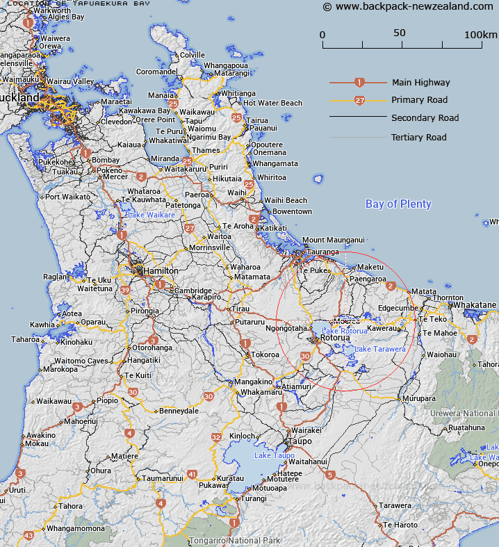
Map showing location of Tapuaekura Bay


LINZ description: Central south of Lake Rotoiti to the west of Hauparu and Ruato
Latitude: -38.042288
Longitude: 176.410458
Northing: 5784000
Easting: 1899300
Land District: South Auckland
Feat Type: Bay


Scroll down to see a more detailed road map and below that a topographical map showing the location of Tapuaekura Bay. The road map has been supplied by openstreetmap and the topographical map of Tapuaekura Bay has been supplied by Land Information New Zealand (LINZ).

Yes you can use the top static map for you school/university project or personal website with a link back. Contact me for any commercial use.

Tapuaekura Bay Map New Zealand


New Zealand places in our database
[ A ] [ B ] [ C ] [ D ] [ E ] [ F ] [ G ] [ H ] [ I ] [ J ] [ K ] [ L ] [ M ] [ N ] [ O ] [ P ] [ Q ] [ R ] [ S ] [ T ] [ U ] [ V ] [ W ] [ X ] [ Y ] [ Z ]


Closest 20 Bays to Tapuaekura Bay

Hauparu Bay ( 0.72km )   ?kahutoroa Bay ( 1.08km )   Tauarau Bay ( 1.34km )   Manup?rua Bay ( 2.35km )   Te Ruato Bay ( 2.4km )   ?tairoa Beach ( 2.47km )   Puketapu Bay ( 2.67km )   Ng?puka Bay ( 2.78km )   Paripari te tai Bay ( 2.9km )   Punawhakareia Bay ( 2.99km )   Tokerau Bay ( 3.07km )   Wharetata Bay ( 3.13km )   Ngongoahi Bay ( 3.14km )   Te ?rero Bay ( 3.58km )   Te Arero Bay ( 3.58km )   Te T? Bay ( 3.8km )   Te Ti Bay ( 3.8km )   Onepoto Bay ( 4.02km )   ?taramarae Bay ( 4.45km )   T?moana Bay ( 4.49km )   Te Karaka Bay ( 4.57km )   Pounamunui Bay ( 4.63km )   Te K?piha Bay ( 4.73km )   Te Weta Bay ( 5.37km )   Okere Inlet ( 5.74km )   ?kere Inlet ( 5.74km )   Wairau Bay ( 5.74km )   Whangamarino Bay ( 5.89km )   T?whakarere Bay ( 6.16km )   Tapuaeharuru Bay ( 6.41km )   Waipuna Bay ( 6.44km )   Korokitewao Bay ( 6.53km )   Okawa Bay ( 6.62km )   ?kawa Bay ( 6.62km )   Tauranganui Bay ( 6.91km )   Tahunapo Bay ( 7.06km )   Tahunap? Bay ( 7.06km )   Log Pool ( 7.11km )   Ng?hau? Bay ( 7.42km )   Pohue Bay ( 8.34km )