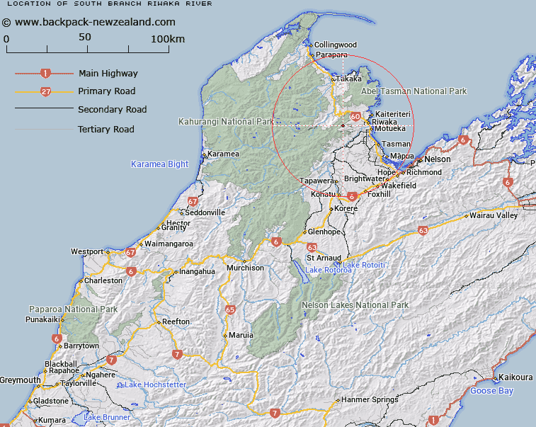
Map showing location of South Branch Riwaka River


LINZ description: A river flowing generally northeast from near Hoary Head in Wharepapa / Arthur Range, into Riuwaka River at the confluence of Riuwaka River and Riuwaka River North Branch. Feature shown on: NZMS260 N26 Edition 1 1986; NZTopo50-BP24 853474 - BP25 936559.
Latitude: -41.094528
Longitude: 172.859972
Northing: 5450739.9
Easting: 1588240.3
Land District: Nelson
Feat Type: Stream


Scroll down to see a more detailed road map and below that a topographical map showing the location of South Branch Riwaka River. The road map has been supplied by openstreetmap and the topographical map of South Branch Riwaka River has been supplied by Land Information New Zealand (LINZ).

Yes you can use the top static map for you school/university project or personal website with a link back. Contact me for any commercial use.

South Branch Riwaka River Map New Zealand


New Zealand places in our database
[ A ] [ B ] [ C ] [ D ] [ E ] [ F ] [ G ] [ H ] [ I ] [ J ] [ K ] [ L ] [ M ] [ N ] [ O ] [ P ] [ Q ] [ R ] [ S ] [ T ] [ U ] [ V ] [ W ] [ X ] [ Y ] [ Z ]


Closest 20 Streams to South Branch Riwaka River

Flat Creek ( 2.35km )   Brooklyn Stream ( 6.45km )   Waitui Stream ( 6.5km )   Herring Stream ( 6.6km )   Aaron Creek ( 6.64km )   Rocky River ( 7.08km )   Alph Stream ( 7.21km )   Whiskey Creek ( 7.22km )   Pokororo River ( 7.36km )   Riuwaka River North Branch ( 7.47km )   North Branch Riwaka River ( 7.47km )   Jordan River ( 8.05km )   Foley Creek ( 8.87km )   Graham River North Branch ( 8.91km )   Sams Creek ( 9.46km )   Riuwaka River ( 9.47km )   Riwaka River ( 9.47km )   Barron Stream ( 9.97km )   Little Pokororo River ( 10.23km )   Grecian Stream ( 10.39km )   Kill Devil Creek ( 10.4km )   Rheumatic Creek ( 10.89km )   Holyoake Stream ( 10.98km )   Atua Stream ( 11.28km )   Sams Creek Middle Branch ( 11.34km )   Takaka River ( 11.58km )   Ferrer Creek ( 11.65km )   Snelling Creek ( 11.85km )   Apahai Creek ( 11.89km )   Magnesite Creek ( 12.08km )   Ironstone Creek ( 12.25km )   Graham River ( 12.39km )   Sam Creek ( 12.41km )   Skeet Creek ( 12.53km )   Ot?whero River ( 12.62km )   Cotton Creek ( 12.76km )   Waiwhero Creek ( 12.78km )   Graham River South Branch ( 13.52km )   Scott Creek ( 13.72km )   Quartz Creek ( 13.81km )