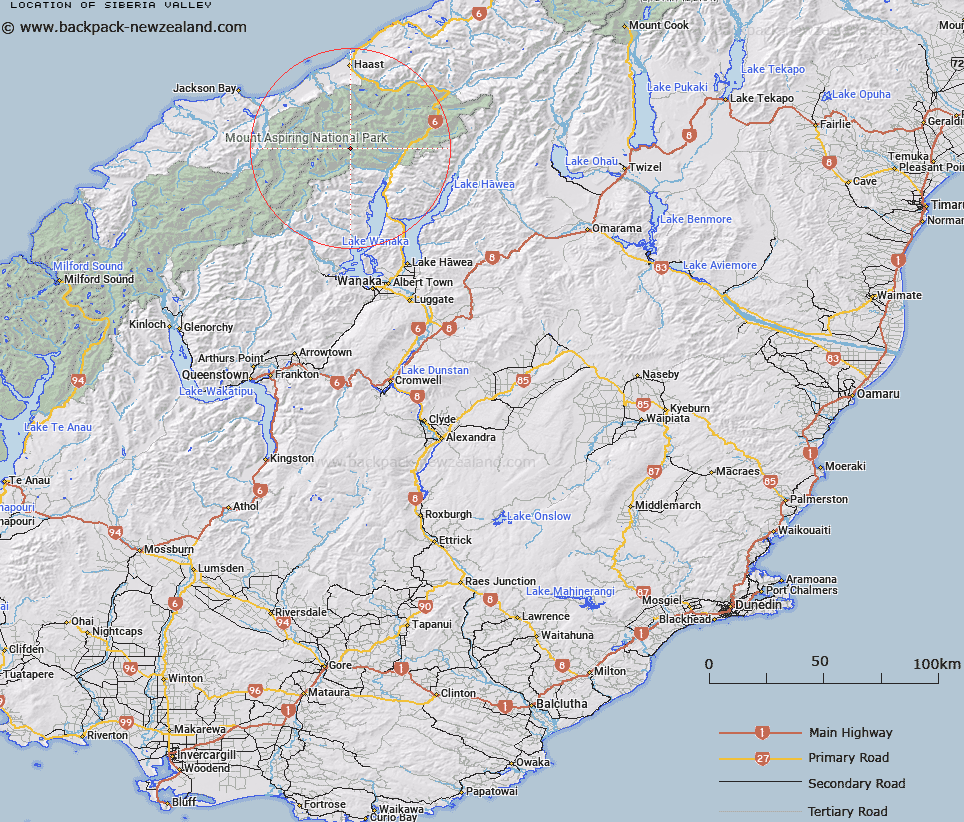
Map showing location of Siberia Valley


LINZ description: Running south from Mt. Doris to the Wilkin River. Young Survey District.
Latitude: -44.186618
Longitude: 169.044906
Northing: 5099789
Easting: 1283892
Land District: Otago
Feat Type: Valley


Scroll down to see a more detailed road map and below that a topographical map showing the location of Siberia Valley. The road map has been supplied by openstreetmap and the topographical map of Siberia Valley has been supplied by Land Information New Zealand (LINZ).

Yes you can use the top static map for you school/university project or personal website with a link back. Contact me for any commercial use.

Siberia Valley Map New Zealand


New Zealand places in our database
[ A ] [ B ] [ C ] [ D ] [ E ] [ F ] [ G ] [ H ] [ I ] [ J ] [ K ] [ L ] [ M ] [ N ] [ O ] [ P ] [ Q ] [ R ] [ S ] [ T ] [ U ] [ V ] [ W ] [ X ] [ Y ] [ Z ]


Closest 20 Valleys to Siberia Valley

Newland Valley ( 5.93km )   Wonderland Valley ( 9.11km )   Shelter Ravine ( 9.83km )   Bosky Gully ( 10.08km )   Hailstorm Gully ( 10.09km )   Chilly Ravine ( 10.64km )   Crevice Gorge ( 11.02km )   Shady Ravine ( 11.22km )   Allup Ravine ( 14.47km )   Greasy Gulch ( 15.74km )   Foggy Ravine ( 15.84km )   Uproar Gorge ( 15.96km )   Quiet Hollow ( 16.42km )   Swelter Ravine ( 16.47km )   Romance Ravine ( 16.87km )   Snow Bridge Gorge ( 17.48km )   Abaft Gully ( 17.68km )   Slippery Gulch ( 18.11km )   Steepside Gully ( 18.23km )   Reecho Ravine ( 18.47km )   Magic Gully ( 18.52km )   Noah Hollow ( 19.21km )   Solitude Ravine ( 19.26km )   Risk Gully ( 19.57km )   Murky Gully ( 19.73km )   Guardian Gorge ( 19.77km )   Sloppy Gulch ( 20.07km )   John Gully ( 20.08km )   Narrow Glen ( 20.22km )   Dizzy Gulch ( 20.36km )   Dark Hollow ( 20.96km )   Murdoch Notch ( 20.99km )   Misty Hollow ( 21.15km )   Setback Ravine ( 21.19km )   Shady Nook ( 21.2km )   Silent Ravine ( 21.21km )   Gloomy Glen ( 21.72km )   Gloomy Gully ( 21.88km )   Seismic Rift ( 21.88km )   Shaky Gully ( 22km )