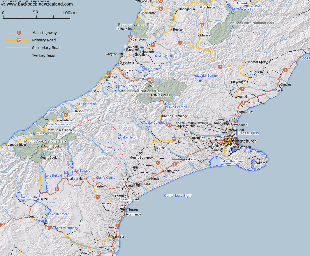
Map showing location of Sawtooth


LINZ description: Portion of Bush Stream 1.8km North-west of Trig. C Sugarloaf (Geodetic Code AAD3). Block X Sinclair Survey District.
Latitude: -43.625074
Longitude: 170.834807
Northing: 5167490.2
Easting: 1425316.1
Land District: Canterbury
Feat Type: Stream


Scroll down to see a more detailed road map and below that a topographical map showing the location of Sawtooth. The road map has been supplied by openstreetmap and the topographical map of Sawtooth has been supplied by Land Information New Zealand (LINZ).

Yes you can use the top static map for you school/university project or personal website with a link back. Contact me for any commercial use.

Sawtooth Map New Zealand


New Zealand places in our database
[ A ] [ B ] [ C ] [ D ] [ E ] [ F ] [ G ] [ H ] [ I ] [ J ] [ K ] [ L ] [ M ] [ N ] [ O ] [ P ] [ Q ] [ R ] [ S ] [ T ] [ U ] [ V ] [ W ] [ X ] [ Y ] [ Z ]


Closest 20 Streams to Sawtooth

Brabazon Stream ( 2.44km )   Scour Stream ( 5.01km )   Black Birch Creek ( 5.45km )   Pack Horse Stream ( 5.63km )   Sweeps Stream ( 6.08km )   Tui Stream ( 8.2km )   Moonlight Stream ( 9.43km )   Alma Stream ( 9.74km )   Bush Stream ( 10.93km )   Two Thumb Stream ( 12.03km )   Blind Spur Stream ( 12.29km )   Trojan Stream ( 12.87km )   Caroline Stream ( 12.96km )   Chevalier Stream ( 13.44km )   North East Gorge Stream ( 13.44km )   Whisky Stream ( 13.52km )   Butlers Creek ( 13.63km )   Ajax Stream ( 13.72km )   Powerhouse Stream ( 13.88km )   The Growler ( 14.22km )   Rawtor Creek ( 15.51km )   Lookup Creek ( 15.66km )   Cradock Stream ( 15.84km )   Craddock Stream ( 15.84km )   Third Waterfall Stream ( 16.21km )   Second Waterfall Stream ( 16.37km )   Neutral Creek ( 16.4km )   Cloudy Stream ( 16.41km )   Balmacaan Stream ( 16.57km )   Kenneth Creek ( 16.88km )   First Waterfall Stream ( 17km )   Camp Creek ( 17.06km )   Clyde River ( 17.73km )   Taffy Creek ( 17.9km )   Toms Stream ( 18.06km )   Carneys Creek ( 18.4km )   Lodge Stream ( 18.46km )   Wildsheep Stream ( 18.5km )   Stone Hut Stream ( 18.55km )   Stony Stream ( 19.23km )