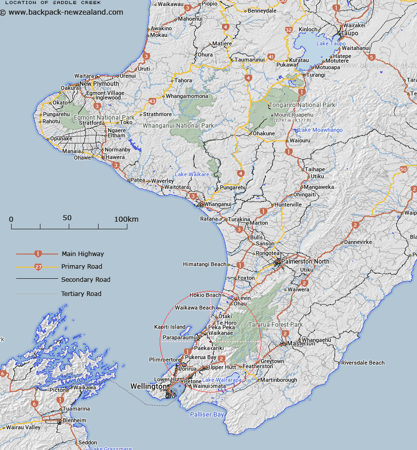
Map showing location of Saddle Creek


LINZ description: Tributary of Kawhatau River. Ruahine Survey District.
Latitude: -40.931379
Longitude: 175.099028
Northing: 5466739.1
Easting: 1776720.1
Land District: Wellington
Feat Type: Stream


Scroll down to see a more detailed road map and below that a topographical map showing the location of Saddle Creek. The road map has been supplied by openstreetmap and the topographical map of Saddle Creek has been supplied by Land Information New Zealand (LINZ).

Yes you can use the top static map for you school/university project or personal website with a link back. Contact me for any commercial use.
Saddle Creek Map New Zealand


New Zealand places in our database
[ A ] [ B ] [ C ] [ D ] [ E ] [ F ] [ G ] [ H ] [ I ] [ J ] [ K ] [ L ] [ M ] [ N ] [ O ] [ P ] [ Q ] [ R ] [ S ] [ T ] [ U ] [ V ] [ W ] [ X ] [ Y ] [ Z ]


Closest 20 Streams to Saddle Creek

Reikorangi Stream ( 1.91km )   Rangiora River ( 2.28km )   Ngatiawa River ( 2.69km )   Bull Stream ( 3.97km )   Akatarawa River ( 4.09km )   Kapakapanui Stream ( 5.83km )   Muaupoko Stream ( 5.96km )   Deadwood Stream ( 6.8km )   Southern Waiotauru River ( 7.32km )   Chilly Stream ( 7.51km )   Renata Stream ( 8.47km )   Pukeatua Stream (Roaring Meg) ( 9.01km )   Wharemauku Stream ( 9.28km )   Frances Stream ( 9.67km )   Waimeha Stream ( 9.68km )   Ngarara Stream ( 9.69km )   Maungakotukutuku Stream ( 10.13km )   Waiotauru River ( 10.59km )   Wedgery Creek ( 10.67km )   Waikanae River ( 10.7km )   Whareroa Stream ( 10.86km )   Titi Stream ( 10.9km )   Tikotu Creek ( 10.92km )   Pukeruru Stream ( 11.06km )   Tregear Creek ( 11.12km )   Sheridan Creek ( 11.33km )   Dopers Creek ( 11.55km )   Eastern Waiotauru (Snowy) River ( 11.89km )   Wainui Stream ( 12.19km )   Kerekere Stream ( 12.32km )   Putaputa Stream ( 12.48km )   Pukehinau Stream ( 12.63km )   Western Hutt River ( 13.03km )   Little Akatarawa River ( 13.54km )   Paraha Stream ( 13.71km )   Paddys Creek ( 14.05km )   Kororipo Stream ( 14.07km )   Akatarawa River West ( 14.8km )   Penn Creek ( 15.37km )   Quoin Stream ( 15.74km )