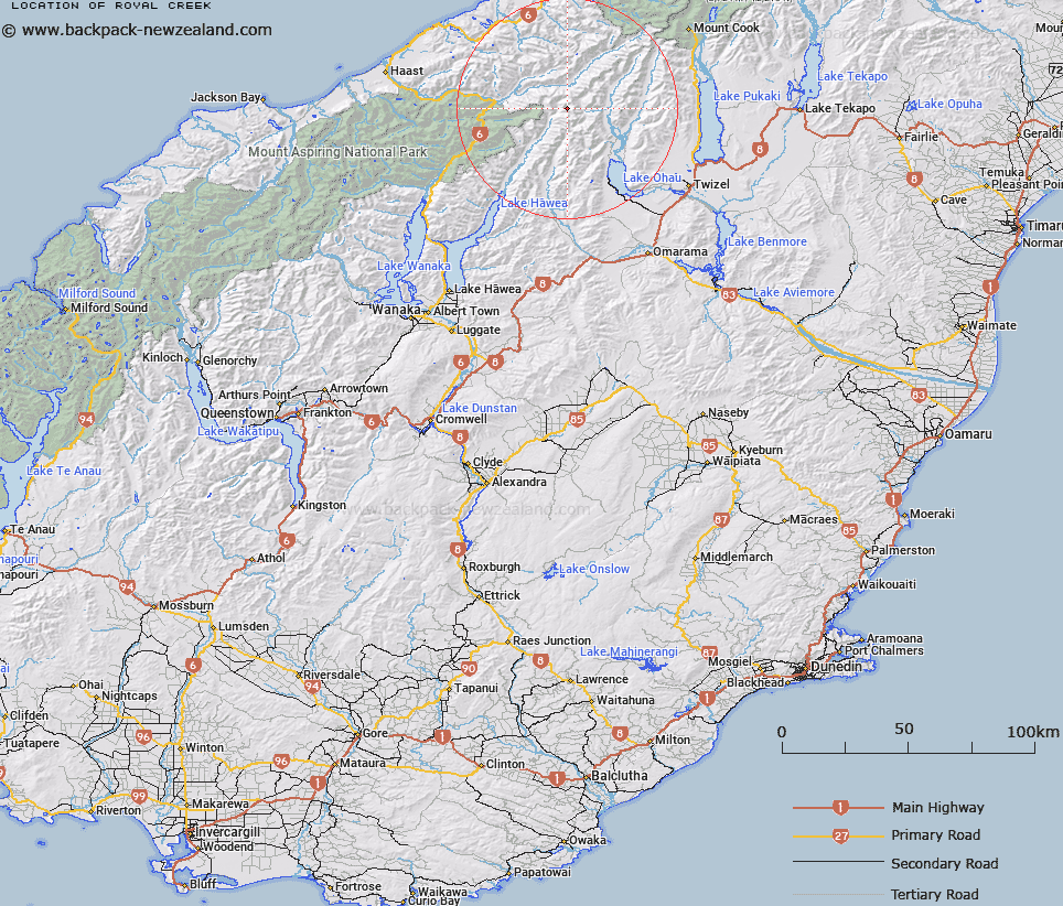
Map showing location of Royal Creek


LINZ description: The biggest tributary of the east branch of the Hunter River from the Huxley Range under the Southern Alps/Kā Tiritiri o te Moana.
Latitude: -44.000343
Longitude: 169.675732
Northing: 5122715
Easting: 1333475.9
Land District: Otago
Feat Type: Stream


Scroll down to see a more detailed road map and below that a topographical map showing the location of Royal Creek. The road map has been supplied by openstreetmap and the topographical map of Royal Creek has been supplied by Land Information New Zealand (LINZ).

Yes you can use the top static map for you school/university project or personal website with a link back. Contact me for any commercial use.

Royal Creek Map New Zealand


New Zealand places in our database
[ A ] [ B ] [ C ] [ D ] [ E ] [ F ] [ G ] [ H ] [ I ] [ J ] [ K ] [ L ] [ M ] [ N ] [ O ] [ P ] [ Q ] [ R ] [ S ] [ T ] [ U ] [ V ] [ W ] [ X ] [ Y ] [ Z ]


Closest 20 Streams to Royal Creek

Hunter River East Branch ( 2.07km )   Huxley River North Branch ( 5.37km )   Hunter River West Branch ( 5.38km )   Huxley River South Branch ( 5.51km )   Cardiac Creek ( 5.78km )   Wilson Creek ( 6.41km )   McKenzie Creek ( 6.47km )   Mackenzie Creek ( 6.47km )   Huxley River ( 7.92km )   Kea Creek ( 8.03km )   Hold Creek ( 8.85km )   Adams Creek ( 9.28km )   Cheap Creek ( 9.63km )   Larson Creek ( 9.68km )   Sweet Nell Creek ( 10.08km )   Clumsy Creek ( 10.49km )   Landslip Creek ( 10.54km )   Paradise Creek ( 10.74km )   Solution Creek ( 10.99km )   Swift Creek ( 11.29km )   Fraser Creek ( 11.36km )   Dobson Creek ( 11.47km )   Safe Creek ( 11.48km )   Crook Creek ( 11.78km )   North Branch Temple Stream ( 11.91km )   Shell Creek ( 11.92km )   Hopkins River ( 12.25km )   Wills River ( 12.37km )   Thar Creek ( 12.51km )   Dredge Creek ( 12.57km )   Lost Creek ( 12.62km )   McLennan Creek ( 12.66km )   South Elcho Stream ( 12.69km )   Dun Creek ( 12.72km )   Dark Creek ( 12.77km )   Border Creek ( 13.1km )   Buffers Creek ( 13.32km )   Barron Creek ( 13.48km )   Ferguson Creek ( 13.55km )   Connors Creek ( 13.71km )