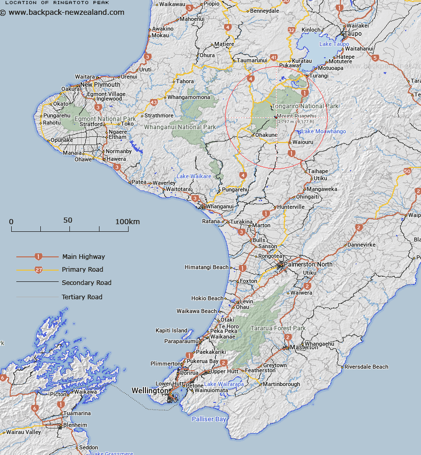
Map showing location of Ringatoto Peak


LINZ description: 2591 m peak on eastern slopes of Mount Ruapehu, above Wahianoa Glacier.
Latitude: -39.28841
Longitude: 175.577345
Northing: 5648050.4
Easting: 1822283
Land District: Wellington
Feat Type: Hill


Scroll down to see a more detailed road map and below that a topographical map showing the location of Ringatoto Peak. The road map has been supplied by openstreetmap and the topographical map of Ringatoto Peak has been supplied by Land Information New Zealand (LINZ).

Yes you can use the top static map for you school/university project or personal website with a link back. Contact me for any commercial use.

Ringatoto Peak Map New Zealand


New Zealand places in our database
[ A ] [ B ] [ C ] [ D ] [ E ] [ F ] [ G ] [ H ] [ I ] [ J ] [ K ] [ L ] [ M ] [ N ] [ O ] [ P ] [ Q ] [ R ] [ S ] [ T ] [ U ] [ V ] [ W ] [ X ] [ Y ] [ Z ]


Closest 20 Hills to Ringatoto Peak

Pyramid Peak ( 1.07km )   Mount Ruapehu ( 1.2km )   Tahurangi ( 1.27km )   Girdlestone Peak ( 1.32km )   Dome ( 1.91km )   Paretetaitonga ( 2.17km )   Glacier Knob ( 2.35km )   Tukino Peak ( 2.38km )   Te Heuheu ( 2.46km )   Te Kohatu ( 5.68km )   Tufa ( 6.43km )   Saddle Cone ( 6.75km )   Hyde ( 10.11km )   Wharepu ( 12.17km )   Tama ( 12.88km )   Hauhungatahi ( 13.22km )   Pukekaikiore ( 15.07km )   Mount Ngauruhoe ( 15.28km )   Makahikatoa ( 15.69km )   Pukeonake ( 16.12km )   Waihohonu ( 17.11km )   Raetihi ( 17.43km )   Mangaio ( 17.95km )   Mount Tongariro ( 18.31km )   Rongokaupo ( 18.85km )   Marie ( 19.74km )   The Needles ( 20.03km )   Rotopaunga ( 20.19km )   Waitangi ( 20.24km )   Oturere ( 20.5km )   Waipahihi ( 20.74km )   Te Mari ( 20.99km )   Manukaiapu ( 21.37km )   Okupata ( 21.48km )   Karewarewa ( 21.52km )   Rata ( 22.1km )   Te Rotete ( 22.23km )   Tunupu ( 22.81km )   Okotinga ( 23.07km )   Patutu ( 23.9km )