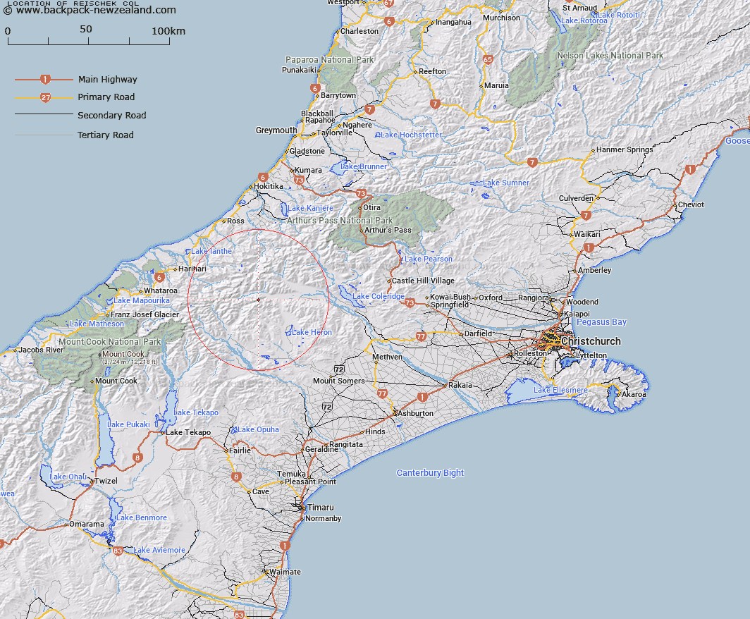
Map showing location of Reischek Col


LINZ description: Crosses the ridge between North and Bastion Peaks
Latitude: -43.306639
Longitude: 171.005002
Northing: 5203200
Easting: 1438200
Land District: Canterbury
Feat Type: Pass


Scroll down to see a more detailed road map and below that a topographical map showing the location of Reischek Col. The road map has been supplied by openstreetmap and the topographical map of Reischek Col has been supplied by Land Information New Zealand (LINZ).

Yes you can use the top static map for you school/university project or personal website with a link back. Contact me for any commercial use.

Reischek Col Map New Zealand


New Zealand places in our database
[ A ] [ B ] [ C ] [ D ] [ E ] [ F ] [ G ] [ H ] [ I ] [ J ] [ K ] [ L ] [ M ] [ N ] [ O ] [ P ] [ Q ] [ R ] [ S ] [ T ] [ U ] [ V ] [ W ] [ X ] [ Y ] [ Z ]


Closest 20 Passs to Reischek Col

Lawrence Col ( 0.94km )   Jagged Col ( 3.16km )   Boulder Col ( 3.9km )   Groove Col ( 3.99km )   Peg Col ( 4.19km )   Cameron Col ( 4.87km )   Chowbok Col ( 5.09km )   Ambrose Saddle ( 8.24km )   Whitcombe Pass ( 9.97km )   Poachers Pass ( 11.79km )   Menace Gap ( 11.92km )   Bandolero Col ( 11.92km )   Musterers Col ( 12.21km )   Strachan Pass ( 12.28km )   Erewhon Col ( 12.7km )   Gladiator Col ( 12.77km )   Crossbow Saddle ( 13.44km )   Full Moon Saddle ( 13.58km )   Toledo Col ( 13.67km )   Battleaxe Col ( 13.96km )   Red Lion Col ( 14.93km )   McCoy Col ( 15.75km )   Camp Saddle ( 16.12km )   McKenzie Col ( 16.22km )   Rangitata Col ( 16.48km )   Malcolm Col ( 16.57km )   Gadarene Col ( 17.37km )   Lambert Col ( 17.57km )   Seddon Col ( 18.5km )   Satan Saddle ( 22.25km )   Kea Pass ( 22.52km )   Fan Col ( 23.5km )   Lucknow Saddle ( 23.69km )   Perth Col ( 23.69km )   Veil Col ( 23.77km )   Disappointment Saddle ( 24.85km )   Mathias Pass ( 25.08km )   Excellent Saddle ( 25.25km )   Adams Col ( 25.63km )   Havelock Col ( 25.86km )