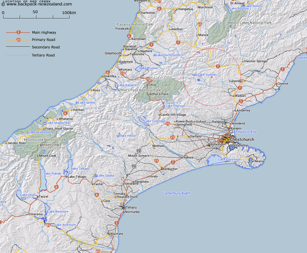
Map showing location of Red Creek


LINZ description: Creek rising on the east side of Jollie Brook peak and flowing into the Glenrae River east of Lake Sumner
Latitude: -42.72423
Longitude: 172.418361
Northing: 5269644.3
Easting: 1552380.1
Land District: Canterbury
Feat Type: Stream


Scroll down to see a more detailed road map and below that a topographical map showing the location of Red Creek. The road map has been supplied by openstreetmap and the topographical map of Red Creek has been supplied by Land Information New Zealand (LINZ).

Yes you can use the top static map for you school/university project or personal website with a link back. Contact me for any commercial use.

Red Creek Map New Zealand


New Zealand places in our database
[ A ] [ B ] [ C ] [ D ] [ E ] [ F ] [ G ] [ H ] [ I ] [ J ] [ K ] [ L ] [ M ] [ N ] [ O ] [ P ] [ Q ] [ R ] [ S ] [ T ] [ U ] [ V ] [ W ] [ X ] [ Y ] [ Z ]


Closest 20 Streams to Red Creek

Glenrae River ( 1.24km )   Devils Creek ( 5.91km )   The Forks ( 6.21km )   Silverton Stream ( 6.55km )   Silver Brook ( 6.55km )   Jollie Brook ( 6.89km )   Robyne Creek ( 7.72km )   Nurse Stream ( 9.12km )   Saddle Brook ( 9.44km )   Blue Rock Stream ( 9.44km )   Shingle Stream ( 9.73km )   Bush Creek ( 9.86km )   Dampier Stream ( 10.03km )   Kakapo Brook ( 10.21km )   Home Brook ( 10.33km )   Gabriel Stream ( 10.4km )   Dozy Stream ( 10.65km )   Coal Creek ( 10.81km )   Organ Stream ( 11.15km )   Mulligan Stream ( 11.62km )   Skiddaw Stream ( 11.68km )   Spring Stream ( 11.95km )   Mandamus River ( 11.97km )   Pig Stream ( 12.07km )   Rough Stream ( 12.52km )   Sisters Stream ( 13.12km )   Glencoe River ( 13.15km )   Bush Stream ( 13.5km )   Woodchopper Stream ( 13.94km )   Surveyors Stream ( 14.1km )   Horseshoe Stream ( 14.21km )   Stokes Stream ( 14.39km )   Jacks Stream ( 14.5km )   Evangeline Stream ( 14.58km )   Glynn Wye Stream ( 14.87km )   Glyn Wye Stream ( 14.87km )   Double End Stream ( 15.51km )   Gorge Stream ( 15.59km )   Boundary Stream ( 15.82km )   Marion Stream ( 16.08km )