Map showing location of Ratty Creek


LINZ description: Taieri County.
Latitude: -45.573291
Longitude: 169.889979
Northing: 4948655.6
Easting: 1357341.7
Land District: Otago
Feat Type: Stream


Scroll down to see a more detailed road map and below that a topographical map showing the location of Ratty Creek. The road map has been supplied by openstreetmap and the topographical map of Ratty Creek has been supplied by Land Information New Zealand (LINZ).

Yes you can use the top static map for you school/university project or personal website with a link back. Contact me for any commercial use.
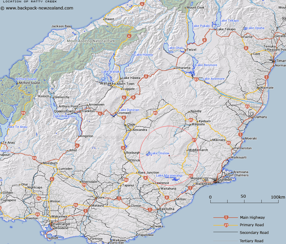
Ratty Creek Map New Zealand


New Zealand places in our database
[ A ] [ B ] [ C ] [ D ] [ E ] [ F ] [ G ] [ H ] [ I ] [ J ] [ K ] [ L ] [ M ] [ N ] [ O ] [ P ] [ Q ] [ R ] [ S ] [ T ] [ U ] [ V ] [ W ] [ X ] [ Y ] [ Z ]


Closest 20 Streams to Ratty Creek

Stony Creek ( 4.03km )   Shepherds Hut Creek ( 4.85km )   Burgan Stream ( 5.88km )   Spillers Creek ( 8.64km )   Deep Creek ( 8.75km )   Flat Creek ( 9.21km )   McPhees Creek ( 10.16km )   Red Swamp Creek ( 10.75km )   Ailsa Creek ( 10.75km )   Logan Burn ( 11.19km )   Sutton Stream ( 13.19km )   Canadian Creek ( 13.25km )   Bullocky Creek ( 13.4km )   Elbow Creek ( 13.77km )   Riddles Creek ( 14.54km )   Pylep Creek ( 14.67km )   Deadbullock Creek ( 15.4km )   Serpentine Creek ( 15.48km )   Bonds Creek ( 16.3km )   Doughboy Creek ( 16.89km )   Kirkland Creek ( 16.92km )   Clarkes Stream ( 16.98km )   Styx Creek ( 16.99km )   MacKays Creek ( 17.25km )   Glengary Stream ( 17.37km )   Fortification Creek ( 17.77km )   Rock Creek ( 17.93km )   Waimonga Creek ( 18.04km )   Shannon Stream ( 18.34km )   Barbours Stream ( 18.45km )   Pegleg Stream ( 18.78km )   Devils Creek ( 18.86km )   March Creek ( 19.07km )   Dewar Stream ( 19.65km )   Canton Stream ( 20.64km )   South Branch Teviot River ( 20.75km )   Fiddlers Creek ( 20.99km )   Deep Stream ( 21.14km )   Rock and Pillar Creek ( 21.62km )   Linn Burn ( 21.7km )