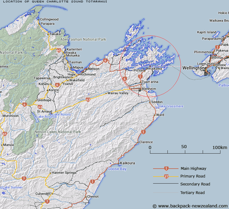
Map showing location of Queen Charlotte Sound / Tōtaranui
LINZ description: A sound extending generally northeast from Okiwa Bay east of Havelock to Cook Strait between Cape Jackson and Cape Koamaru. Feature shown on: NZMS260 P27 Edition 2 1995; NZTopo50-BQ28 764302 to BP30ptBQ30 134549.
Latitude: -41.238056
Longitude: 174.0815
Northing: 5434252.1
Easting: 1690628.5
Land District: Marlborough
Feat Type: Bay
Latitude: -41.238056
Longitude: 174.0815
Northing: 5434252.1
Easting: 1690628.5
Land District: Marlborough
Feat Type: Bay

Scroll down to see a more detailed road map and below that a topographical map showing the location of Queen Charlotte Sound / Tōtaranui. The road map has been supplied by openstreetmap and the topographical map of Queen Charlotte Sound / Tōtaranui has been supplied by Land Information New Zealand (LINZ).
Yes you can use the top static map for you school/university project or personal website with a link back. Contact me for any commercial use.
[ A ] [ B ] [ C ] [ D ] [ E ] [ F ] [ G ] [ H ] [ I ] [ J ] [ K ] [ L ] [ M ] [ N ] [ O ] [ P ] [ Q ] [ R ] [ S ] [ T ] [ U ] [ V ] [ W ] [ X ] [ Y ] [ Z ]