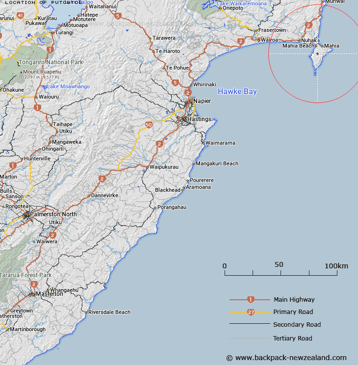
Map showing location of Putoetoe


LINZ description: In center of Mahia Peninsula.
Latitude: -39.141913
Longitude: 177.884317
Northing: 5656100
Easting: 2022200
Land District: Hawke's Bay
Feat Type: Trig Station


Scroll down to see a more detailed road map and below that a topographical map showing the location of Putoetoe. The road map has been supplied by openstreetmap and the topographical map of Putoetoe has been supplied by Land Information New Zealand (LINZ).

Yes you can use the top static map for you school/university project or personal website with a link back. Contact me for any commercial use.

Putoetoe Map New Zealand


New Zealand places in our database
[ A ] [ B ] [ C ] [ D ] [ E ] [ F ] [ G ] [ H ] [ I ] [ J ] [ K ] [ L ] [ M ] [ N ] [ O ] [ P ] [ Q ] [ R ] [ S ] [ T ] [ U ] [ V ] [ W ] [ X ] [ Y ] [ Z ]


Closest 20 Trig Stations to Putoetoe

Taupiri ( 4.02km )   Rahuimokairoa ( 5.12km )   Moumoukai ( 22.71km )   Whakaumuatanetaako ( 28.96km )   Whakaumuataneteko ( 28.96km )   Pukaroronui ( 34.62km )   Rarepe ( 40.87km )   Rerepi ( 40.87km )   Whakapunake ( 44.73km )   Whakapunaki ( 44.73km )   Te Tahi ( 54.82km )   Koherekireki ( 61.07km )   Kohirikiriki ( 61.07km )   Te Itanga Mahaki ( 64.35km )   Te Aitangaamahaki ( 64.35km )   Tapapanui ( 68.91km )   Patuwahine ( 70.2km )   Pukaramea ( 80.67km )   Pukakaramea ( 80.67km )   Patuwahine ( 90km )   Ngapuketurua ( 93.79km )   Ngapukeriki ( 93.79km )   Mangahaumia ( 95.55km )   Maungahaumi ( 95.55km )   Maungahunia ( 95.55km )   Te Iwiroa ( 99.43km )   Te Iwi Roa ( 99.43km )   Parepoupou ( 101.08km )   Paripoupou ( 101.08km )   Tutamoe ( 101.13km )   Tutamoi ( 101.13km )   Waka Atea ( 102.32km )   Wakaateo ( 102.32km )   Motuhora ( 102.5km )   Moutohora ( 102.5km )   Tawhiti ( 103.29km )   Tawhitiapaka ( 103.29km )   Maporiki ( 104.75km )   Mapouriki ( 104.75km )   Pukekiore ( 105.22km )