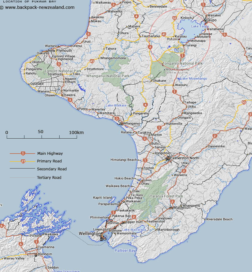
Map showing location of Pukawa Bay


LINZ description: Locality on W shore of Lake Taupo
Latitude: -38.916367
Longitude: 175.75315
Northing: 5688900
Easting: 1838700
Land District: Wellington
Feat Type: Locality


Scroll down to see a more detailed road map and below that a topographical map showing the location of Pukawa Bay. The road map has been supplied by openstreetmap and the topographical map of Pukawa Bay has been supplied by Land Information New Zealand (LINZ).

Yes you can use the top static map for you school/university project or personal website with a link back. Contact me for any commercial use.

Pukawa Bay Map New Zealand


New Zealand places in our database
[ A ] [ B ] [ C ] [ D ] [ E ] [ F ] [ G ] [ H ] [ I ] [ J ] [ K ] [ L ] [ M ] [ N ] [ O ] [ P ] [ Q ] [ R ] [ S ] [ T ] [ U ] [ V ] [ W ] [ X ] [ Y ] [ Z ]


Closest 20 Localitys to Pukawa Bay

Omori ( 1.87km )   Waihi Village ( 3.6km )   Tokaanu ( 5.44km )   Poukura Pa ( 7.44km )   Kuratau ( 7.64km )   Kuratau Junction ( 7.64km )   Hautu Village ( 9.87km )   Mangahouhou ( 10.84km )   Hirata ( 10.91km )   Te Raina ( 11.98km )   Oruatua ( 12.07km )   Moerangi ( 14.43km )   Whanganui ( 14.7km )   Waitetoko ( 15.3km )   Te Aputa ( 15.39km )   Otukou ( 16.03km )   Tongariro ( 16.18km )   Motutere ( 17.72km )   Rangipo ( 18.38km )   Papakai ( 18.84km )   Waihaha ( 21.36km )   Ketetahi ( 22.96km )   Hatepe ( 23.45km )   Taurewa ( 24.76km )   Oruaiwi ( 28.31km )   Meringa ( 29.17km )   Ngapuke ( 30.02km )   Waitahanui ( 31.16km )   Kakahi ( 31.17km )   Kinloch ( 32.11km )   Owhango ( 33.62km )   Tihoi ( 33.79km )   Acacia Bay ( 33.96km )   Mangakahu Valley ( 34.84km )   Taringamotu Valley ( 35.11km )   Oio ( 35.12km )   Echolands ( 35.69km )   Piriaka ( 35.81km )   Hukapapa ( 35.96km )   Whakapapa Village ( 36.68km )