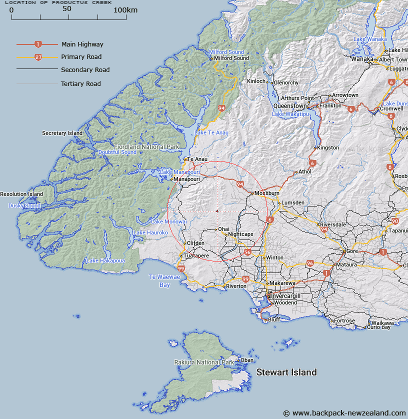
Map showing location of Productus Creek


LINZ description: Joins Elbow Creek about half a mile above its junction with Letham Burn. Wairaki Survey District.
Latitude: -45.795566
Longitude: 167.967869
Northing: 4916339.7
Easting: 1208931.7
Land District: Southland
Feat Type: Stream


Scroll down to see a more detailed road map and below that a topographical map showing the location of Productus Creek. The road map has been supplied by openstreetmap and the topographical map of Productus Creek has been supplied by Land Information New Zealand (LINZ).

Yes you can use the top static map for you school/university project or personal website with a link back. Contact me for any commercial use.

Productus Creek Map New Zealand


New Zealand places in our database
[ A ] [ B ] [ C ] [ D ] [ E ] [ F ] [ G ] [ H ] [ I ] [ J ] [ K ] [ L ] [ M ] [ N ] [ O ] [ P ] [ Q ] [ R ] [ S ] [ T ] [ U ] [ V ] [ W ] [ X ] [ Y ] [ Z ]


Closest 20 Streams to Productus Creek

Elbow Creek ( 1.47km )   Letham Burn ( 2.71km )   Kangaroo Creek ( 4.86km )   North Etal Creek ( 5.29km )   Morley Stream ( 6.85km )   Kowhai Creek ( 7.37km )   Telford Burn ( 7.84km )   Pleasant Creek ( 8.93km )   Etal Stream ( 8.96km )   Back Creek ( 9.17km )   Beaumont Creek ( 9.96km )   Home Creek ( 10.11km )   Coal Creek ( 11.22km )   Spence Burn ( 11.26km )   Sheepwash Creek ( 11.86km )   Sharpridge Creek ( 12.07km )   South Braxton Burn ( 12.1km )   Gibraltar Burn ( 12.15km )   Wairaki River ( 12.6km )   Aparima River ( 12.66km )   Flaxy Creek ( 13.46km )   Aparima River South Branch ( 13.98km )   Waterloo Burn ( 14.03km )   Braxton Burn ( 14.21km )   Linton Creek ( 14.64km )   Sandstone Creek ( 15.19km )   Cessnock ( 15.31km )   Breakdown Creek ( 15.37km )   Coal Creek ( 15.52km )   Chewings Creek ( 16.08km )   Taringatura Creek ( 16.42km )   North Braxton Burn ( 16.56km )   Orauea Stream ( 16.76km )   Fish Creek ( 17.61km )   Heenans Creek ( 17.63km )   Windy Creek ( 17.76km )   Kenny Creek ( 17.83km )   South Drain ( 18.11km )   Hamilton Burn ( 18.86km )   Grassy Creek ( 18.89km )