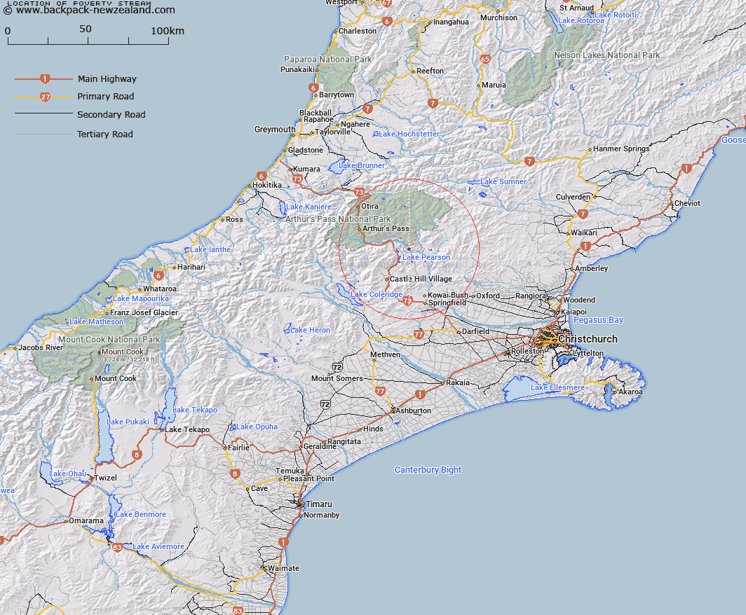
Map showing location of Poverty Stream


LINZ description: Left bank tributary of Waimakariri River 1.6km in length, flowing southward across Poverty Flat and joining Waimakariri River opposite Gog Peak. Block II, Grasmere Survey District.
Latitude: -43.049407
Longitude: 171.837492
Northing: 5233042.9
Easting: 1505321.4
Land District: Canterbury
Feat Type: Stream


Scroll down to see a more detailed road map and below that a topographical map showing the location of Poverty Stream. The road map has been supplied by openstreetmap and the topographical map of Poverty Stream has been supplied by Land Information New Zealand (LINZ).

Yes you can use the top static map for you school/university project or personal website with a link back. Contact me for any commercial use.

Poverty Stream Map New Zealand


New Zealand places in our database
[ A ] [ B ] [ C ] [ D ] [ E ] [ F ] [ G ] [ H ] [ I ] [ J ] [ K ] [ L ] [ M ] [ N ] [ O ] [ P ] [ Q ] [ R ] [ S ] [ T ] [ U ] [ V ] [ W ] [ X ] [ Y ] [ Z ]


Closest 20 Streams to Poverty Stream

Gooseberry Stream ( 2.25km )   Bush Stream ( 2.66km )   Slovens Stream ( 4.88km )   Lower Farm Stream ( 6.04km )   Pete Stream ( 6.84km )   Grasmere Stream ( 6.92km )   Cass River ( 8.52km )   Letitia Stream ( 8.62km )   Andrews Stream ( 8.63km )   Bernard Stream ( 9.09km )   Riversdale Stream ( 9.21km )   Ribbonwood Stream ( 9.45km )   Misery Stream ( 9.45km )   Snowslide Stream ( 9.84km )   Boundary Stream ( 10.51km )   Sailor Stream ( 11.12km )   Mount Brown Creek ( 11.19km )   Manson Creek ( 11.3km )   Winding Creek ( 11.48km )   McLeod Stream ( 11.75km )   Long Valley Stream ( 11.98km )   Broadleaf Stream ( 12.18km )   Turnbull Stream ( 12.26km )   Rata Stream ( 12.54km )   Craigieburn ( 12.59km )   Puffers Stream ( 13.41km )   Sudden Valley Stream ( 13.58km )   Red Beech Stream ( 13.61km )   Poulter River East Branch ( 13.73km )   Trinity Stream ( 14.05km )   Pampas Stream ( 14.53km )   Douglas Stream ( 14.54km )   McKay Stream ( 14.68km )   Nomans Stream ( 14.76km )   Hawdon River ( 14.87km )   Camp Stream ( 14.94km )   Newton Stream ( 15.14km )   Milliken Stream ( 15.28km )   Surprise Stream ( 15.4km )   East Hawdon Stream ( 15.42km )