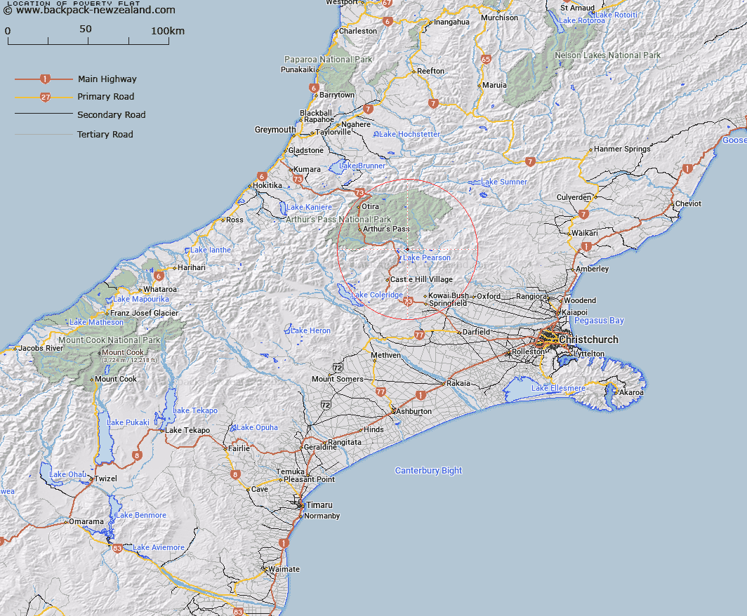
Map showing location of Poverty Flat


LINZ description: A river flat on Waimakariri River on road to Mt White Homestead, approximately 8miles in from Main West Coast Road. Poverty Stream flows across it.
Latitude: -43.050465
Longitude: 171.828594
Northing: 5232915.3
Easting: 1504598.4
Land District: Canterbury
Feat Type: Flat


Scroll down to see a more detailed road map and below that a topographical map showing the location of Poverty Flat. The road map has been supplied by openstreetmap and the topographical map of Poverty Flat has been supplied by Land Information New Zealand (LINZ).

Yes you can use the top static map for you school/university project or personal website with a link back. Contact me for any commercial use.

Poverty Flat Map New Zealand


New Zealand places in our database
[ A ] [ B ] [ C ] [ D ] [ E ] [ F ] [ G ] [ H ] [ I ] [ J ] [ K ] [ L ] [ M ] [ N ] [ O ] [ P ] [ Q ] [ R ] [ S ] [ T ] [ U ] [ V ] [ W ] [ X ] [ Y ] [ Z ]


Closest 20 Flats to Poverty Flat

Hallelujah Flat ( 11.94km )   Aeroplane Flat ( 14.26km )   Rabbit Flat ( 15.3km )   Dracophyllum Flat ( 16.7km )   The Lazyman ( 17.88km )   Turkey Flat ( 23.48km )   Pegleg Flat ( 28.14km )   Moraine Flat ( 33.2km )   Upper Acheron Flat ( 37.13km )   Goat Hill Flat ( 39.88km )   Kiwi Flat ( 40.83km )   Pig Flat ( 42.33km )   Matagouri Flat ( 43.23km )   Acheron Flat ( 44.05km )   Amphitheatre ( 44.13km )   Taylors Flat ( 51.2km )   Cookies Flat ( 52.53km )   Treaceys Flat ( 56.69km )   St Jacobs Flat ( 60.37km )   Revell Terrace ( 62.34km )   Flagstaff Flat ( 64.52km )   Lynches Flat ( 64.94km )   Phantom Flat ( 66.28km )   Blue Bottle Terrace ( 66.99km )   Price Flat ( 67km )   Hamers Flat ( 67.68km )   The Reserve ( 68.23km )   Chairmans Flat ( 68.33km )   Stag Flat ( 69.07km )   Hospital Flat ( 69.41km )   Jims Flat ( 69.55km )   Minchicoff Terrace ( 70.41km )   Bottom Flat ( 71.2km )   Griffin Flat ( 72.2km )   Cockney Terrace ( 72.42km )   Fox Flat ( 74.47km )   Palmer Flat ( 75.29km )   Kaka Terrace ( 78.61km )   Mackleys Plain ( 79.36km )   Cedar Flat ( 79.47km )