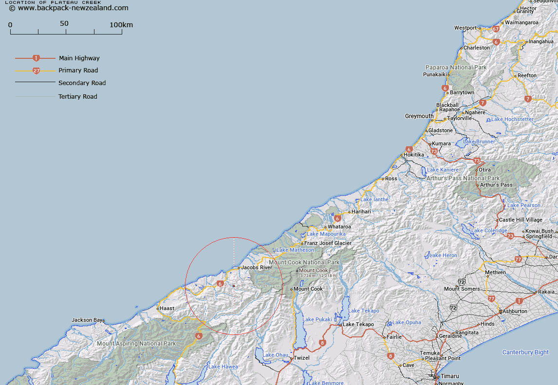
Map showing location of Plateau Creek


LINZ description: Stream flowing into Mahitahi River from Bannock Brae Range
Latitude: -43.708756
Longitude: 169.644226
Northing: 5155000
Easting: 1329634
Land District: Westland
Feat Type: Stream


Scroll down to see a more detailed road map and below that a topographical map showing the location of Plateau Creek. The road map has been supplied by openstreetmap and the topographical map of Plateau Creek has been supplied by Land Information New Zealand (LINZ).

Yes you can use the top static map for you school/university project or personal website with a link back. Contact me for any commercial use.

Plateau Creek Map New Zealand


New Zealand places in our database
[ A ] [ B ] [ C ] [ D ] [ E ] [ F ] [ G ] [ H ] [ I ] [ J ] [ K ] [ L ] [ M ] [ N ] [ O ] [ P ] [ Q ] [ R ] [ S ] [ T ] [ U ] [ V ] [ W ] [ X ] [ Y ] [ Z ]


Closest 20 Streams to Plateau Creek

Plateau Creek ( 0km )   Lennie Creek ( 2.5km )   Morse River ( 3.67km )   Reynolds Creek ( 5.57km )   Greer Creek ( 5.73km )   Flagstaff Creek ( 6.39km )   Two Eye Stream ( 6.59km )   Doughboy Creek ( 7.3km )   Cascade Creek ( 7.47km )   Swindle Creek ( 7.91km )   Gorgy Creek ( 8.28km )   Mahitahi River ( 8.39km )   Maitahi River ( 8.39km )   Galena Creek ( 8.68km )   Millington Creek ( 8.94km )   Kini Creek ( 9.04km )   Otoko River ( 9.19km )   Jack Creek ( 9.21km )   Leo Creek ( 9.23km )   Jumbo Creek ( 9.31km )   Blackwater Creek ( 9.74km )   Edison River ( 9.83km )   Makatata Stream ( 10.67km )   Harker Torrent ( 10.75km )   Uaroa Creek ( 11.53km )   Pavo Creek ( 11.55km )   Waituna Creek ( 11.72km )   Micmac Creek ( 12.2km )   Paringa River ( 12.25km )   Papakeri Creek ( 12.56km )   Power Creek ( 12.88km )   Ohinemaka River ( 13.1km )   Tunnel Creek ( 13.12km )   Hermann Creek ( 13.49km )   Purcell Creek ( 14.09km )   Curly Creek ( 14.1km )   Bunker Creek ( 14.41km )   Filleul Creek ( 14.41km )   Ruera Creek ( 14.42km )   Niblick Creek ( 14.43km )