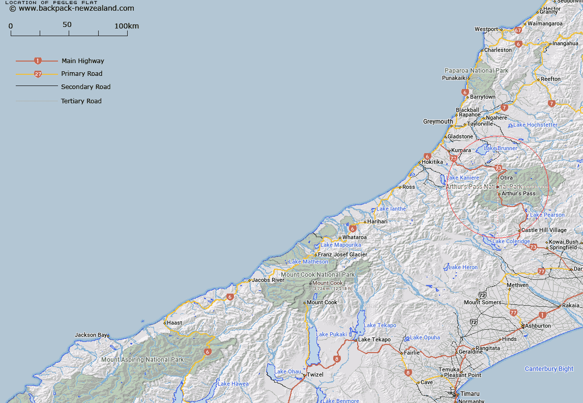
Map showing location of Pegleg Flat


LINZ description: A flat area near Pegleg Creek, east of State Highway 73, 6 km north of Arthurs Pass township off the Otira River.
Latitude: -42.893519
Longitude: 171.55725
Northing: 5250000
Easting: 1482200
Land District: Westland
Feat Type: Flat


Scroll down to see a more detailed road map and below that a topographical map showing the location of Pegleg Flat. The road map has been supplied by openstreetmap and the topographical map of Pegleg Flat has been supplied by Land Information New Zealand (LINZ).

Yes you can use the top static map for you school/university project or personal website with a link back. Contact me for any commercial use.

Pegleg Flat Map New Zealand


New Zealand places in our database
[ A ] [ B ] [ C ] [ D ] [ E ] [ F ] [ G ] [ H ] [ I ] [ J ] [ K ] [ L ] [ M ] [ N ] [ O ] [ P ] [ Q ] [ R ] [ S ] [ T ] [ U ] [ V ] [ W ] [ X ] [ Y ] [ Z ]


Closest 20 Flats to Pegleg Flat

Pegleg Flat ( 0km )   Turkey Flat ( 12.76km )   Moraine Flat ( 19.74km )   Hallelujah Flat ( 22.04km )   Taylors Flat ( 23.13km )   Rabbit Flat ( 26.7km )   Aeroplane Flat ( 27.49km )   Poverty Flat ( 28.14km )   Treaceys Flat ( 28.59km )   Kiwi Flat ( 32.2km )   Dracophyllum Flat ( 32.59km )   Revell Terrace ( 34.62km )   Goat Hill Flat ( 38.04km )   Blue Bottle Terrace ( 40.57km )   The Lazyman ( 42.02km )   Matagouri Flat ( 44.96km )   Amphitheatre ( 45.38km )   Minchicoff Terrace ( 46.45km )   Cockney Terrace ( 48.78km )   Flagstaff Flat ( 50.28km )   Price Flat ( 50.67km )   Upper Acheron Flat ( 51.22km )   Kaka Terrace ( 52km )   Hamers Flat ( 52.15km )   Stag Flat ( 52.92km )   Chairmans Flat ( 53.16km )   Jims Flat ( 53.51km )   Bottom Flat ( 54.63km )   Griffin Flat ( 55.37km )   Fox Flat ( 56.01km )   Cedar Flat ( 57.68km )   Acheron Flat ( 57.76km )   Gribben Flat ( 59.09km )   Lynches Flat ( 59.64km )   Cookies Flat ( 61.27km )   Open Flat ( 61.69km )   Darkies Terrace ( 61.93km )   Ohinetakitaki Plain ( 62.06km )   St Jacobs Flat ( 62.93km )   Mackleys Plain ( 63.16km )