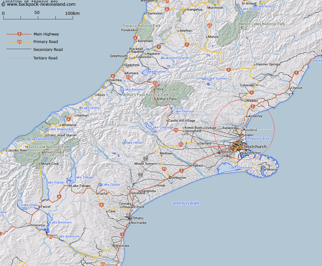
Map showing location of Pegasus Bay


LINZ description: Locality between Woodend and Waikuku Beach, east of State Highway No.1.
Latitude: -43.313733
Longitude: 172.696643
Northing: 5204300
Easting: 1575400
Land District: Canterbury
Feat Type: Locality


Scroll down to see a more detailed road map and below that a topographical map showing the location of Pegasus Bay. The road map has been supplied by openstreetmap and the topographical map of Pegasus Bay has been supplied by Land Information New Zealand (LINZ).

Yes you can use the top static map for you school/university project or personal website with a link back. Contact me for any commercial use.

Pegasus Bay Map New Zealand


New Zealand places in our database
[ A ] [ B ] [ C ] [ D ] [ E ] [ F ] [ G ] [ H ] [ I ] [ J ] [ K ] [ L ] [ M ] [ N ] [ O ] [ P ] [ Q ] [ R ] [ S ] [ T ] [ U ] [ V ] [ W ] [ X ] [ Y ] [ Z ]


Closest 20 Localitys to Pegasus Bay

Pegasus Bay ( 0km )   Waikuku ( 2.31km )   Woodend ( 2.61km )   Woodend Beach ( 2.64km )   Waikuku Beach ( 3.33km )   Tuahiwi ( 4.89km )   Saltwater Creek ( 5.42km )   Coldstream ( 6.65km )   The Pines Beach ( 7.07km )   Flaxton ( 7.29km )   Sefton ( 7.83km )   Southbrook ( 7.9km )   Kairaki ( 7.96km )   Rangiora ( 8.22km )   Kaiapoi ( 8.47km )   Ashley ( 8.97km )   Ohapuku ( 9.29km )   Brooklands ( 9.53km )   Stewarts Gully ( 9.73km )   Stewarts Gully ( 9.98km )   Wetheral ( 10.37km )   Ohoka ( 11.12km )   Balcairn ( 11.64km )   Clarkville ( 11.67km )   Bridgend ( 12.19km )   Leithfield Beach ( 12.26km )   Fernside ( 13.09km )   Spencerville ( 13.23km )   Chaneys ( 13.76km )   Leithfield ( 13.83km )   Coutts Island ( 13.94km )   Loburn ( 14.61km )   Mandeville North ( 14.99km )   Ouruhia ( 15.1km )   Belfast ( 15.66km )   Eyreton ( 16.69km )   Amberley Beach ( 17.14km )   Amberley ( 17.57km )   Loburn North ( 17.78km )   Marshland ( 18.1km )