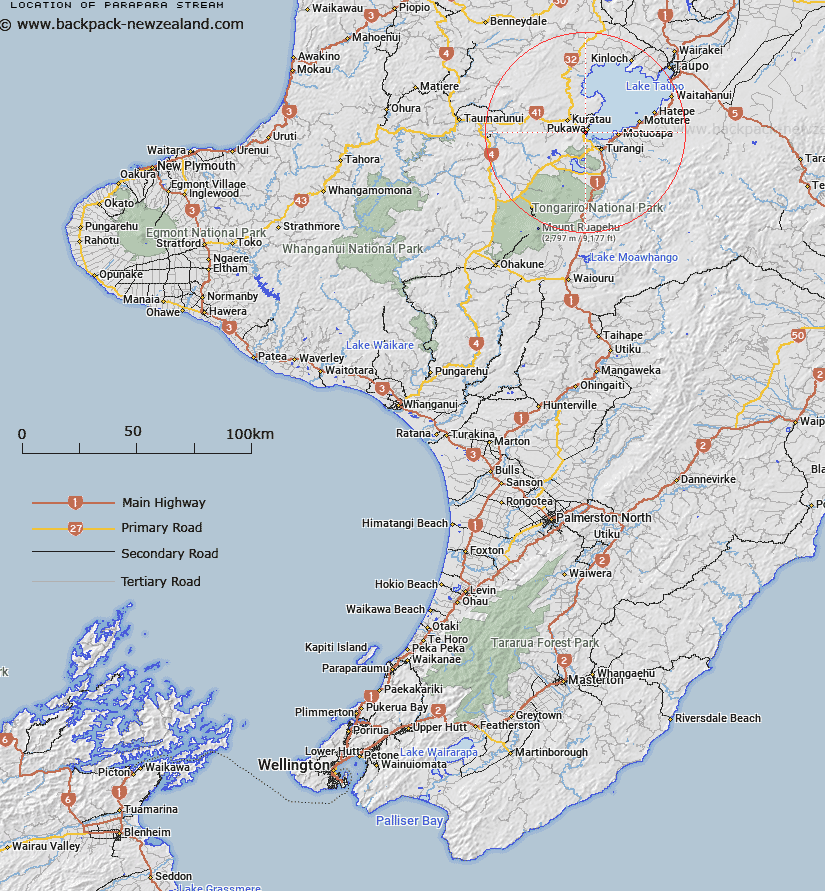
Map showing location of Parapara Stream


LINZ description: Feature shown on: NZMS260 T19 Edition 2 1994
Latitude: -38.927083
Longitude: 175.747972
Northing: 5687724.1
Easting: 1838215.2
Land District: Wellington
Feat Type: Stream


Scroll down to see a more detailed road map and below that a topographical map showing the location of Parapara Stream. The road map has been supplied by openstreetmap and the topographical map of Parapara Stream has been supplied by Land Information New Zealand (LINZ).

Yes you can use the top static map for you school/university project or personal website with a link back. Contact me for any commercial use.
Parapara Stream Map New Zealand


New Zealand places in our database
[ A ] [ B ] [ C ] [ D ] [ E ] [ F ] [ G ] [ H ] [ I ] [ J ] [ K ] [ L ] [ M ] [ N ] [ O ] [ P ] [ Q ] [ R ] [ S ] [ T ] [ U ] [ V ] [ W ] [ X ] [ Y ] [ Z ]


Closest 20 Streams to Parapara Stream

Pungarehu Stream ( 0.51km )   Koporonui Stream ( 1.21km )   Rotomoho Stream ( 1.42km )   Hawai Stream ( 2.58km )   Omori Stream ( 2.6km )   Waihi Stream ( 3.96km )   Tokaanu Stream ( 4.01km )   Tokaanu Tailrace Canal ( 4.91km )   Omoho Stream ( 5.08km )   Waimatai Stream ( 5.51km )   Tupatomatua Stream ( 5.97km )   Pakiraranga Stream ( 7.11km )   Parakaumanga Stream ( 7.25km )   Tangaere Stream ( 7.27km )   Waioparekawa Stream ( 7.3km )   Papanetu Stream ( 7.71km )   Mangawiwi Stream ( 8.15km )   Waimutumutu Stream ( 8.85km )   Horomango Stream ( 8.86km )   Awatapu Stream ( 9.15km )   Boulder Stream ( 9.62km )   Te Hirata Stream ( 9.7km )   Otarua Stream ( 9.98km )   Waipungapunga Stream ( 10.16km )   Matapupuni Stream ( 10.17km )   Waiotaka River ( 10.47km )   Mangamingi Stream ( 10.63km )   Mangamawhitiwhiti Stream ( 11.12km )   Otara Stream ( 11.42km )   Mangamutu Stream ( 11.68km )   Ngatokotoko Stream ( 11.69km )   Kuao Stream ( 11.97km )   Wairehu Canal ( 12.54km )   Mangaongoki Stream ( 12.85km )   Onepoto Stream ( 13.09km )   Maniopotos Pool ( 13.23km )   Waimarino River ( 13.31km )   Mangaharakeke Stream ( 13.34km )   Kuratau River ( 13.45km )   Island Reach ( 13.48km )