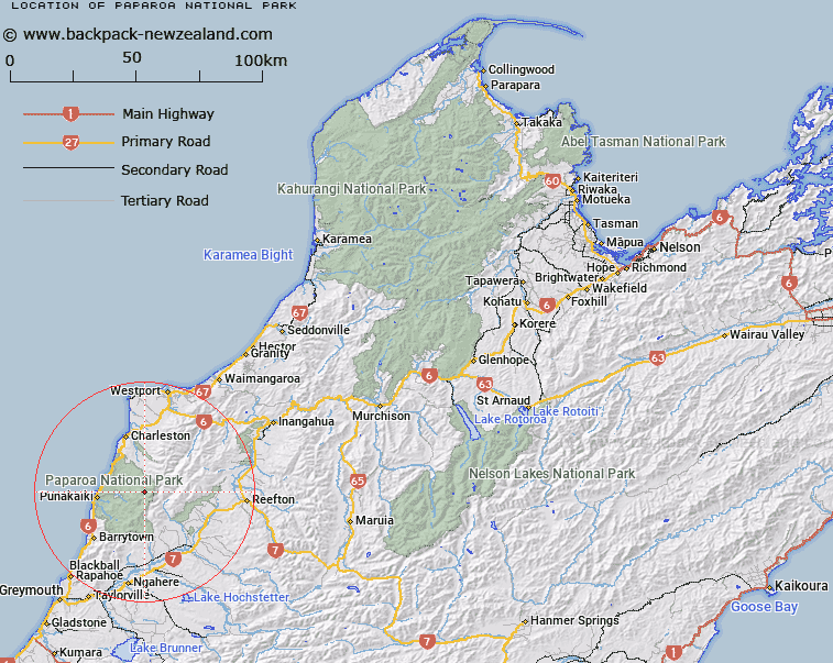
Map showing location of Paparoa National Park
LINZ description: National Park, Sec 30 Blk IX BRIGHTON SURVEY DISTRICT
Latitude: -42.088889
Longitude: 171.501667
Northing: 5339268.3
Easting: 1476083
Land District: Nelson
Feat Type: National Park
Latitude: -42.088889
Longitude: 171.501667
Northing: 5339268.3
Easting: 1476083
Land District: Nelson
Feat Type: National Park

Scroll down to see a more detailed road map and below that a topographical map showing the location of Paparoa National Park. The road map has been supplied by openstreetmap and the topographical map of Paparoa National Park has been supplied by Land Information New Zealand (LINZ).
Yes you can use the top static map for you school/university project or personal website with a link back. Contact me for any commercial use.
[ A ] [ B ] [ C ] [ D ] [ E ] [ F ] [ G ] [ H ] [ I ] [ J ] [ K ] [ L ] [ M ] [ N ] [ O ] [ P ] [ Q ] [ R ] [ S ] [ T ] [ U ] [ V ] [ W ] [ X ] [ Y ] [ Z ]