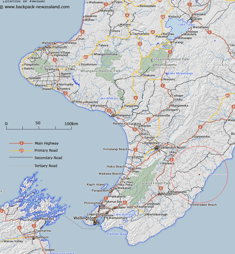
Map showing location of Pakowai


LINZ description: Near Pakowhai River, 2km north-east of MT York
Latitude: -40.697917
Longitude: 176.183774
Northing: 5489900
Easting: 1869000
Land District: Wellington
Feat Type: Trig Station


Scroll down to see a more detailed road map and below that a topographical map showing the location of Pakowai. The road map has been supplied by openstreetmap and the topographical map of Pakowai has been supplied by Land Information New Zealand (LINZ).

Yes you can use the top static map for you school/university project or personal website with a link back. Contact me for any commercial use.

Pakowai Map New Zealand


New Zealand places in our database
[ A ] [ B ] [ C ] [ D ] [ E ] [ F ] [ G ] [ H ] [ I ] [ J ] [ K ] [ L ] [ M ] [ N ] [ O ] [ P ] [ Q ] [ R ] [ S ] [ T ] [ U ] [ V ] [ W ] [ X ] [ Y ] [ Z ]


Closest 20 Trig Stations to Pakowai

Kupukore ( 5.3km )   Kopukore ( 5.3km )   Otuarehua ( 30.82km )   Wahataura ( 33.31km )   Wahatuara ( 33.31km )   Pukenikau ( 41.23km )   Pukemiki ( 41.23km )   Pukekowhai ( 51.78km )   Pukekowai ( 51.78km )   Whakapapa ( 55.15km )   Wakapapa ( 55.15km )   Taramia ( 55.18km )   Taramea ( 55.18km )   Wharite ( 56.4km )   Waimangu North ( 57.26km )   Waimanga North ( 57.26km )   Ruapae ( 57.51km )   Ruapai ( 57.51km )   Ngapuketarua ( 57.84km )   Ngapuketurua ( 57.84km )   Waimanga South ( 58.61km )   Waimangu South ( 58.61km )   Pariwhariki ( 59.49km )   Pariwhaririki ( 59.49km )   Koromikau ( 59.59km )   Koromakau ( 59.59km )   Ross ( 59.96km )   Pukemoremore ( 60.38km )   Matanginui ( 62.03km )   Matanganui ( 62.03km )   Mount Dundas ( 62.12km )   Mangatarere ( 64.08km )   Oruarongo ( 81.39km )   Tauherenikau ( 81.42km )   Tauwharenikau ( 81.42km )   Dennan ( 81.45km )   Wairakai ( 81.84km )   Kaikaikuri ( 83.82km )   Kaikakuri ( 83.82km )   Parawanui ( 89.69km )