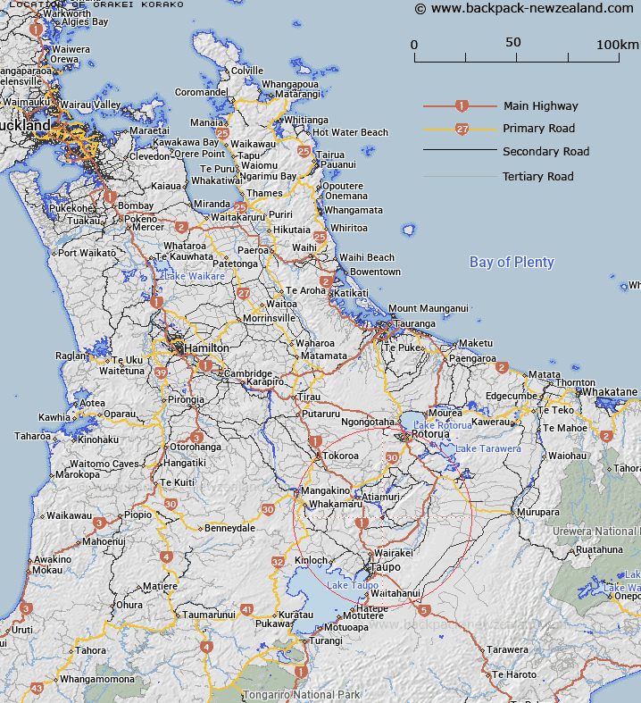
Map showing location of Orakei Korako


LINZ description: Locality on the Waikato River near Lake Ohakuri.
Latitude: -38.474088
Longitude: 176.143087
Northing: 5736900
Easting: 1874200
Land District: South Auckland
Feat Type: Locality


Scroll down to see a more detailed road map and below that a topographical map showing the location of Orakei Korako. The road map has been supplied by openstreetmap and the topographical map of Orakei Korako has been supplied by Land Information New Zealand (LINZ).

Yes you can use the top static map for you school/university project or personal website with a link back. Contact me for any commercial use.

Orakei Korako Map New Zealand


New Zealand places in our database
[ A ] [ B ] [ C ] [ D ] [ E ] [ F ] [ G ] [ H ] [ I ] [ J ] [ K ] [ L ] [ M ] [ N ] [ O ] [ P ] [ Q ] [ R ] [ S ] [ T ] [ U ] [ V ] [ W ] [ X ] [ Y ] [ Z ]


Closest 20 Localitys to Orakei Korako

Orakei Korako ( 0km )   Ohakuri ( 9.79km )   Mihi ( 11.81km )   Te Pouhakatutu ( 12.58km )   Te Pouwhakatutu ( 12.58km )   Tahorakuri ( 12.71km )   Atiamuri ( 12.95km )   Waimahana ( 13.04km )   Mangamingi ( 14km )   Mangaminge ( 14km )   Golden Springs ( 14.32km )   Ohaaki ( 14.79km )   Ohaki ( 14.79km )   Parekarangi ( 15.1km )   Oruanui ( 15.27km )   Aratiatia ( 15.9km )   Wairakei Village ( 16.47km )   Reporoa ( 16.98km )   Broadlands ( 17.05km )   Upper Atiamuri ( 17.28km )   Ngakuru ( 17.4km )   Wairakei ( 17.62km )   Wharepaina ( 17.76km )   Waikite Valley ( 18.21km )   Rotokawa ( 18.41km )   Guthrie ( 21.11km )   Mokai ( 21.85km )   Waireka ( 23.24km )   Waiotapu ( 23.72km )   Wawa ( 25.53km )   Horohoro ( 26.37km )   Kapenga ( 27.02km )   Acacia Bay ( 27.17km )   Earthquake Flats ( 27.65km )   Kinloch ( 28.15km )   Tumunui ( 28.71km )   Waimangu ( 29.22km )   Rotomahana ( 29.57km )   Whakamaru ( 29.74km )   Waiotapu Village ( 30.15km )